Historical Marker Program
Search Results
Your search returned 4 results.
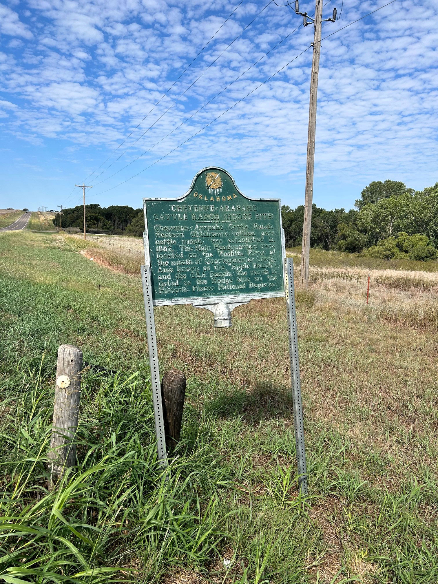
Cheyenne-Arapaho Cattle Ranch (Hodge Site)
Custer CountyLocation: on OK-33, three miles east of Hammon
Coordinates: 35.638807, -99.321835
Material: Aluminum
Sponsor(s): Oklahoma Historical Society and Custer County Historical Society
Topics: American Indians; Ranching; Territorial, 1861–1907
The main headquarters for this million-acre ranch was on the Washita River at the mouth of Quartermaster Creek. The ranch, established in 1882, was also known as the Apple Ranch. Part of the ranch is listed in the National Register of Historic Places as the Hodge Archaeological Site.
Note: This marker is damaged.

Jabbok Orphanage & School
Custer CountyLocation: on OK-33 at west edge of Thomas
Material: Aluminum
Topics: Agriculture; Religion/Philosophy; Social/Cultural
Abe Eisenhower, uncle to President Dwight D. Eisenhower, started the orphanage in 1901 as a project of the Brethren of Christ Church. The surrounding cropland continues to provide income for missionary efforts of the organization.
Red Wheat Allotment
Custer CountyLocation: on OK-66 at east edge of Clinton
Material: Granite
Topics: Agriculture; Ethnic Diversity; Land Openings
Prior to the Cheyenne and Arapaho Reservation land run of April 19, 1892, this quarter-section of land was allotted to a Cheyenne woman named Red Wheat. Mennonite emigrants from Russia introduced 'Turkey red' winter wheat to northwest Oklahoma.
Southwestern State College
Custer CountyLocation: on OK-66, 1/2 mile east of Weatherford
Topics: Education; Government; Territorial Period, 1861–1907
The Sixth Legislative Assembly of Oklahoma Territory established the college on March 8, 1901. Classes began two years later with James Robert Campbell as the first president. The school is now known as Southwestern Oklahoma State University.
(Page 1 of 1)
Marker Search
Browse by County
Alfalfa County
Atoka County
Beaver County
Beckham County
Blaine County
Bryan County
Caddo County
Canadian County
Carter County
Cherokee County
Choctaw County
Cimarron County
Cleveland County
Comanche County
Cotton County
Craig County
Creek County
Custer County
Delaware County
Dewey County
Ellis County
Garfield County
Garvin County
Grady County
Grant County
Greer County
Harmon County
Harper County
Haskell County
Hughes County
Jackson County
Jefferson County
Johnston County
Kay County
Kingfisher County
Kiowa County
Latimer County
Le Flore County
Lincoln County
Logan County
Love County
Major County
Marshall County
Mayes County
McClain County
McCurtain County
McIntosh County
Murray County
Muskogee County
Noble County
Okfuskee County
Oklahoma County
Okmulgee County
Osage County
Ottawa County
Pawnee County
Payne County
Pittsburg County
Pontotoc County
Pottawatomie County
Pushmataha County
Roger Mills County
Rogers County
Seminole County
Sequoyah County
Stephens County
Texas County
Tillman County
Tulsa County
Wagoner County
Washington County
Washita County
Woods County
Woodward County
To find out more about the Oklahoma Historical Society Historical Marker Program or how to submit an application, please visit the Historical Marker Program page.
Missing or Damaged Markers
Please use our online form to report missing or damaged historical markers.
Report Missing or Damaged Markers
Contact Us
If you have questions, please contact:
Matthew Pearce
Oklahoma Historical Society
800 Nazih Zuhdi Drive
Oklahoma City, OK 73105
405-522-8659
matthew.pearce@history.ok.gov


