Historical Marker Program
Search Results
Your search returned 4 results.
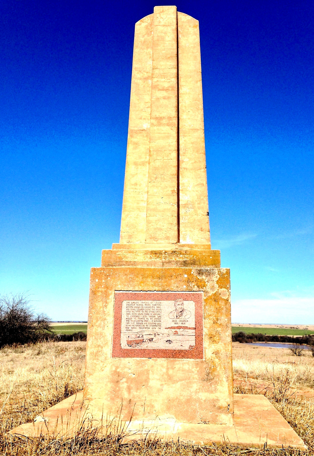
Chisholm Trail Lookout (Monument Hill)
Jefferson CountyLocation: on E1910 Rd (Monument Rd) two miles east of Addington
Coordinates: 34.245275, -97.922307
Material: Other (Concrete obelisk with granite plaques)
Sponsor(s): Pickens County Cowpunchers Association/Oklahoma Centennial Commission
Topics: Ethnic Diversity; Ranching; Territorial Period, 1861–1907; Transportation
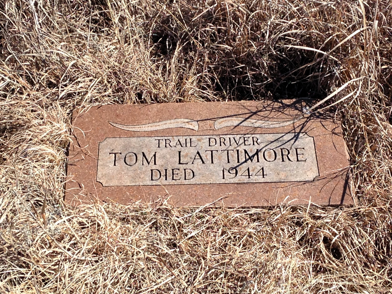
The Pickens County Cowpunchers Association organized support for the construction of a memorial on Monument Hill east of Addington to commemorate cowboys who worked along the Chisholm Trail. Monument Hill was a prominent local landmark for drovers along the trail. The concrete obelisk on site was dedicated in April 1941. Granite plaques honoring Jesse Chisholm and members of the cowpunchers association were added in the early 1980s. The Oklahoma Centennial Commission sponsored the replacement of the granite plaques in 2007. The gravesite of Tom Lattimore, a Black cowboy and ranch hand, is nearby.


San Bernardo
Jefferson CountyLocation: on OK-32, one mile north of Petersburg
Material: Aluminum
Topics: American Indians; Empire Period, 1541–1803
Oklahoma's oldest town on the Red River was a great, fortified village of the Wichita Indians. The French trading post on the north bank of the river was named for Governor Bernardo de Galvez in 1778 when Oklahoma was part of Louisiana.
Southwest Bible College
Jefferson CountyLocation: on OK-5 on east edge of Hastings (OBHC)
Topics: Early Statehood, 1907–1941; Education; Religion/Philosophy; Settlement Patterns; Social/Cultural
A Baptist college was founded in Hastings in 1907. The school later moved to Mangum. Its library became the core for the library at Oklahoma Baptist University in Shawnee.
Waurika
Jefferson CountyLocation: on US-70 in Waurika
Material: Aluminum
Topics: American Indians; Government; Settlement Patterns; Territorial Period, 1861–1907
Waurika is the only county seat located in Oklahoma on the 98th Meridian. The post office was opened on June 28, 1902. The west side of town was the Kiowa-Comanche reservation, part of Oklahoma Territory, while land east of the line was Pickens County in the Chickasaw Nation.
(Page 1 of 1)
Marker Search
Browse by County
Alfalfa County
Atoka County
Beaver County
Beckham County
Blaine County
Bryan County
Caddo County
Canadian County
Carter County
Cherokee County
Choctaw County
Cimarron County
Cleveland County
Comanche County
Cotton County
Craig County
Creek County
Custer County
Delaware County
Dewey County
Ellis County
Garfield County
Garvin County
Grady County
Grant County
Greer County
Harmon County
Harper County
Haskell County
Hughes County
Jackson County
Jefferson County
Johnston County
Kay County
Kingfisher County
Kiowa County
Latimer County
Le Flore County
Lincoln County
Logan County
Love County
Major County
Marshall County
Mayes County
McClain County
McCurtain County
McIntosh County
Murray County
Muskogee County
Noble County
Okfuskee County
Oklahoma County
Okmulgee County
Osage County
Ottawa County
Pawnee County
Payne County
Pittsburg County
Pontotoc County
Pottawatomie County
Pushmataha County
Roger Mills County
Rogers County
Seminole County
Sequoyah County
Stephens County
Texas County
Tillman County
Tulsa County
Wagoner County
Washington County
Washita County
Woods County
Woodward County
To find out more about the Oklahoma Historical Society Historical Marker Program or how to submit an application, please visit the Historical Marker Program page.
Missing or Damaged Markers
Please use our online form to report missing or damaged historical markers.
Report Missing or Damaged Markers
Contact Us
If you have questions, please contact:
Matthew Pearce
Oklahoma Historical Society
800 Nazih Zuhdi Drive
Oklahoma City, OK 73105
405-522-8659
matthew.pearce@history.ok.gov


