
- This event has passed.
Maps and Mapmaking: Historical Maps of Oklahoma exhibit closes
October 9, 2021
Event Navigation
The Chisholm Trail Museum (CTM) in Kingfisher is featuring a special temporary exhibit of historic maps from the Oklahoma Historical Society (OHS), as well as historical surveying equipment from the museum. Maps and Mapmaking: Historical Maps of Oklahoma was created in partnership with the OHS John and Eleanor Kirkpatrick Research Center at the Oklahoma History Center. It is a traveling exhibit curated by CTM Director Jason Harris and OHS Research Director Chad Williams that will be shared with museums, libraries, and other institutions throughout the state. The exhibit will be on display at CTM through October 9.
This exhibit highlights a collection of more than 20 incredible, historic maps of Oklahoma dating back to 1806. The historic maps from the Oklahoma Historical Society are joined with antique surveying and mapmaking tools and equipment from the museum’s collection. “These maps feature the rich details of Oklahoma’s past and highlight the development of the state, allowing visitors to explore Oklahoma geography, urban development, transportation, and more,” said Harris.
The Chisholm Trail Museum is located at 605 Zellers Avenue in Kingfisher. For more information, please call 405-375-5176.

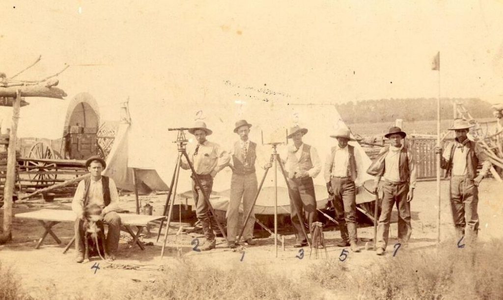
Surveying crew. Photo taken in July 1893 near the current location of Cleveland, Pawnee County, Oklahoma. Left to right: Carl Craig, teamster; T. Alexander, assistant surveyor; J.W. Duncan, U.S. special agent; W.D. Wisdom, clerk; Tom Brewer, chain & axe man; Clyde Thompson, chain & axe man, and Watie Bell, chain & axe man, (719, Oklahoma Historical Society Photograph Collection)


