The Encyclopedia of Oklahoma History and Culture
BUTTERFIELD OVERLAND MAIL.
The U.S. mail was carried through Oklahoma by the Butterfield company for only a brief period, 1858–61, but the trail it followed became famous as a western transportation route. At the end of the war with Mexico in 1848, the development of the western territories and California necessitated a means of speedy communication across the midsection of the United States. Because there was no transcontinental telegraph until 1861 or railroad until 1869, various companies developed overland stage lines and mail service between 1848 and 1869.
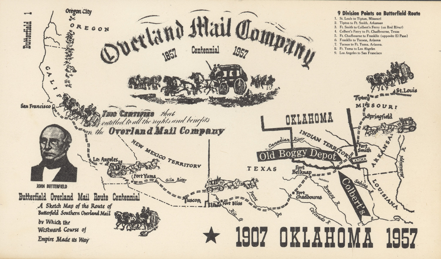
In 1857 John Butterfield, a Missouri stage line operator, contracted with the U.S. Post Office Department to set up a southern route between St. Louis/Memphis and San Francisco. Specified by contract, the route extended 2,795 miles. Butterfield inaugurated the mail service in mid-September 1858. Stages also transported "through" passengers going all the way from the Mississippi River to the West Coast, or vice versa, and "local" traffic, going shorter distances. The entire trip across the West took an average of twenty-one to twenty-three days and cost a passenger two hundred dollars. Now, for example, westbound mail could be sent from the East Coast by rail to St. Louis, Missouri, or to Memphis, Tennessee. There it transferred to horse-drawn stages. The two routes joined at Fort Smith, Arkansas. From Arkansas the Butterfield route followed a path first recommended by Capt. Randolph B. Marcy after his expedition from El Paso to Fort Smith in 1849. Of the several alternate routes that had been explored, this southern road had less rough terrain and less snow than encountered on the northern routes.
After traveling through Missouri and Arkansas, the westbound stage crossed into the Choctaw Nation from Fort Smith. The pathway stretched southwest to Colbert's Ferry on the Red River. Part of the road through Indian Territory had been used as early as 1837 by Choctaws traveling from Boggy Depot to Fort Smith. The Butterfield line went southwest through present Le Flore, Latimer, Pittsburg, Atoka, and Bryan counties to the Red River and used flatboats at Colbert's Ferry to cross over to Preston, Texas. From Geary's Station (present Atoka County) the route followed the older, well-traveled Texas Road. It entered the Chickasaw Nation briefly before it reached the Red River. The Indian Territory section of the Butterfield trail constituted 192 miles, over which it took approximately thirty-eight hours to pass through the Choctaw Nation.
The General Council of the Choctaw Nation passed legislation authorizing various individuals to build and operate bridges, turnpikes and gates, and unofficial stage stands at various places along the way. The owners charged tolls for every person, animal, and wheel that used these facilities. Therefore, the Butterfield coach would be charged for four wheels, six to nine passengers and one or two drivers, and four horses or mules.
Carefully located stations provided changes of teams, hay, grain, and water for the animals, and food, drink, and sometimes lodging for passengers. Stages changed to fresh horses an average of every ten to fifteen miles. There were twelve official Butterfield stage stations in the Choctaw Nation (as well as unofficial stops at which supplies or assistance might be obtained): in Le Flore County, Walker's near present Spiro (Skullyville/Choctaw Agency) and Traherne's at present Latham; in Latimer County, Holloway's at The Narrows near Red Oak (meals were served at Edwards's Store five miles east of Holloway's), Riddle's near present Lutie, and Pusley's near present Higgins; in Pittsburg County, Blackburn's; in Atoka County, Waddell's near present Wesley, Geary's near present Stringtown, and Boggy Depot, ten miles west of present Atoka; and in Bryan County, Nail's or Blue River near Kenefic, Fisher's at Carriage Point near Durant, and Colbert's Ferry near Colbert at Red River. Ultimately, the mail stages passed through the area twice each week.
In mid-1861 the Civil War began, interrupting the transmission of mail across Indian Territory. As a result, Butterfield shifted his operations to his northern routes. After the war ended, the 1869 completion of the transcontinental railroad spelled the end of transcontinental overland mail operations. The trail came to an end as a national thoroughfare, although local residents continued to use it as a wagon road.
In 1957 Oklahoma joined with the National Committee on Overland Mails in commemorating the service's one hundredth anniversary. The observance coincided with the Oklahoma Semicentennial exposition, during which in June and July 1957 an exhibit discussed the history of this important transportation development for the state and the nation.


