Home |  PublicationsEncyclopedia |  Quinlan

The Encyclopedia of Oklahoma History and Culture

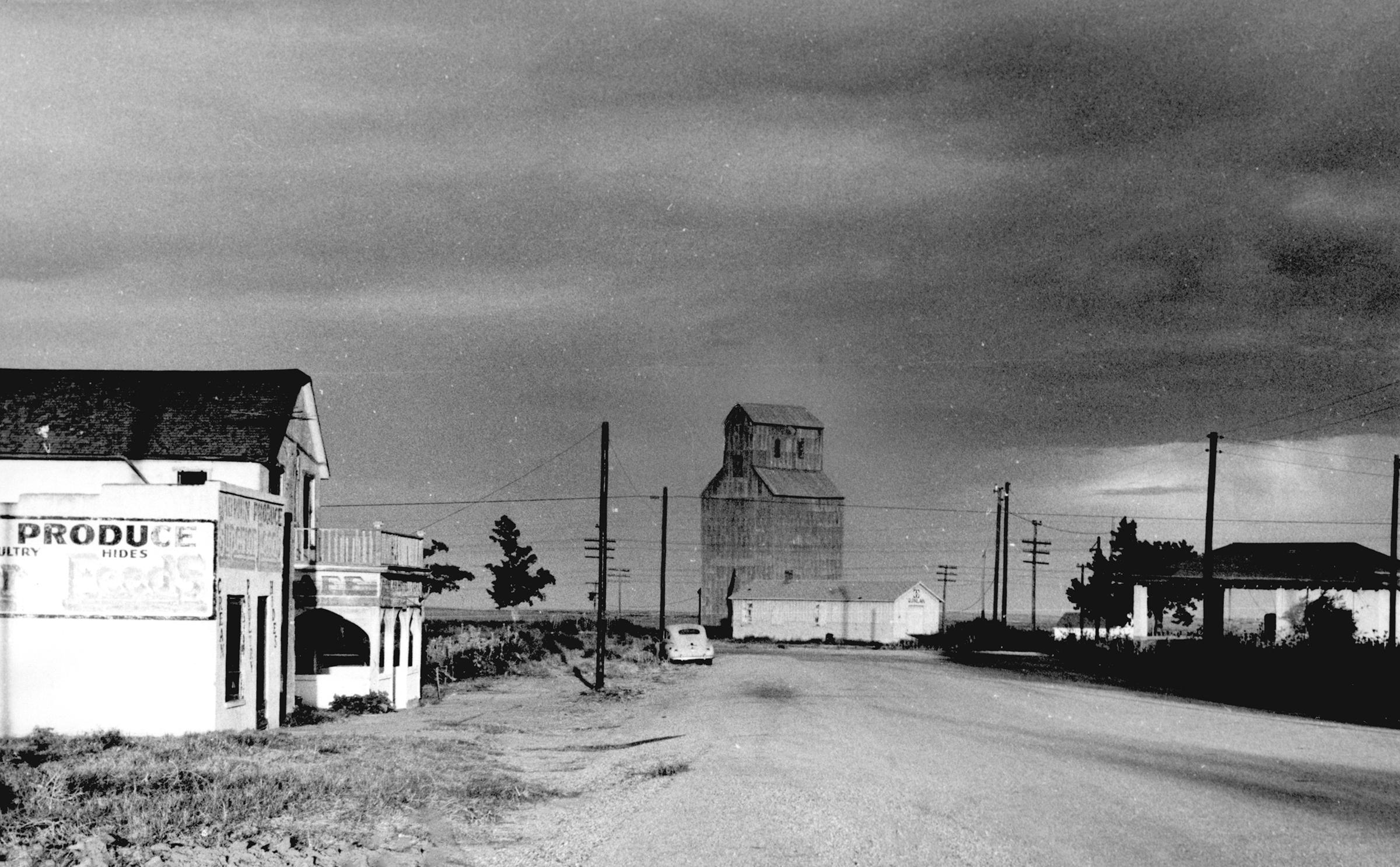
Quinlan street scene, 1965
(2012.201.B1070.0297, Oklahoma Publishing Company Photography Collection, OHS).

QUINLAN.

Located in Woodward County about twenty miles east of Woodward and 1.5 miles north of U.S. Highway 412, Quinlan began as a small agricultural community in the heart of wheat country. West of town lie the Ragged Hills, the county's highest point. Quinlan was named for a loading chute built in 1901 at a switch on the Atchison, Topeka and Santa Fe Railway by the Quinlan brothers, ranchers who ran cattle north of Mooreland before and after the 1893 Cherokee Outlet Opening. Quinlan provided a trade center for nearby ranches and farms. Agricultural products included livestock, dairy, poultry, cotton, and grain sorghum; wheat and broomcorn were major crops. The community had a post office after 1901 and hosted several newspapers, beginning in 1903 with the Quinlan Mirror, followed in 1913 by the Quinlan Advance, followed in 1919 by the Quinlan Reporter. At 1907 statehood Quinlan recorded a population of 148, and by 1910, 310. By the time of World War I the town was home to a meat market, horse dealer, several lawyers and dentists, dry goods and grocery stores, as well as a feed store and lumberyard. Nevertheless, a slow decline began in the 1910s and worsened with the 1920s agricultural depression. The town's bank folded in 1929 with the onset of the Great Depression. In 1940 only 188 persons called Quinlan home. During World War II residents left to serve in the military or in defense work. After the war ended, the rerouted state highway bypassed the town, and by the 1950s a hotel/café, grocery, food locker, and feed store remained. In the 1960s the high school closed, and in 1963 the hotel closed, leaving only the feed store. By 1990 the still-incorporated town had twenty-three residents. The April 2020 census reported Quinlan, no longer incorporated, as a Census Designated Place with a population of 28.

Dianna Everett

Browse By Topic

Urban Development

Explore

Place
Town

Learn More

Louise B. James, Below Devil's Gap: The Story of Woodward County (Perkins, Okla.: Evans Publications, 1984).

"Quinlan," Vertical File, Research Division, Oklahoma Historical Society, Oklahoma City.

Woodward County (Oklahoma) Journal, 12 December 1963.

Citation

The following (as per The Chicago Manual of Style, 17th edition) is the preferred citation for articles:
Dianna Everett, “Quinlan,” The Encyclopedia of Oklahoma History and Culture, https://www.okhistory.org/publications/enc/entry?entry=QU010.

Published January 15, 2010
Last updated March 25, 2024

Copyright and Terms of Use

No part of this site may be construed as in the public domain.

Copyright to all articles and other content in the online and print versions of The Encyclopedia of Oklahoma History is held by the Oklahoma Historical Society (OHS). This includes individual articles (copyright to OHS by author assignment) and corporately (as a complete body of work), including web design, graphics, searching functions, and listing/browsing methods. Copyright to all of these materials is protected under United States and International law.

Users agree not to download, copy, modify, sell, lease, rent, reprint, or otherwise distribute these materials, or to link to these materials on another web site, without authorization of the Oklahoma Historical Society. Individual users must determine if their use of the Materials falls under United States copyright law's "Fair Use" guidelines and does not infringe on the proprietary rights of the Oklahoma Historical Society as the legal copyright holder of The Encyclopedia of Oklahoma History and part or in whole.