
Home | About OHS | Historical Marker Program
Location: on US-6, four miles west of Hollis (DAR)
Sponsored by: Daughters of the American Revolution
Topics: Government, Westward Expansion 1803–1861
Now the Oklahoma-Texas border, the 100th Meridian was part of the disputed boundary between Spanish territory and the vast Louisiana Purchase, a boundary solidified by the Adams-Onis Treaty in 1819.

Location: on OK-156, north of Marland
Coordinates: 36.567150, -97.149150
Sponsored by: OHS/ODOT
Material: Aluminum
Topics: Ranching, American Indians, Arts, Territorial Period 1861–1907, Petroleum, Industry/Business, Agriculture
Believed to have derived its name from the 101,894 acres of the Ponca Reservation, this huge ranch was founded by George W. Miller and his sons in the early 1880s on land he leased, eventually purchased, or otherwise acquired from the Ponca Indians. The ranch became world-famous for its Wild West show, oil wells, livestock, and farm products.
Location: on OK-1 just west of Arkansas border
Topics: Transportation, Military, Westward Expansion 1803–1861, Territorial Period 1861–1907
This site was forty-eight miles from Fort Smith on the military road that ran south to Texas.
Location: on Sunset Drive in Ardmore
Topics: Urban Development, Transportation
Ardmore's beginning is traced to the establishment of the 700 Ranch. In 1870, the Roff log house was the first building erected within what would become the city limits of Ardmore. The house was moved to its present site in 1991.
Location: at the intersection of US-177 and OK-1
Topics: Retail, Mass Communication, Government, Urban Development, Territorial Period 1861–1907
Ada began in 1890 when William Jefferson Reed built a log store and dwelling. A post office was established on July 10, 1891, and named for Reed's oldest daughter, Ada. The city was incorporated in 1901 and became the county seat of Pontotoc County at statehood.
Location: 1.5 miles northwest, then one mile north and seven miles west of the Canadian River bridge on former US Highway 66
Topics: Transportation, Empire Period 1541–1803, Government, Military
At this location on October 1, 1845, a military expedition to the Rocky Mountains under the command of James William Albert paused on its return journey to sketch the buttes appearing to the south. This was the first expedition to make the overland trip with a train of wagons from Bent's Fort, in present-day Colorado, down the Canadian River to Fort Gibson.

Location: off OK 9 in Posey Park, in Eufaula
Coordinates: 35.288483, -95.585067
Sponsored by: Oklahoma Historical Society and the Oklahoma Department of Transportation
Material: Aluminum
Note: This marker was originally located in Vivian (8 miles west of Eufaula) and moved to its present location at an unknown date. The marker text indicating the location of Posey’s birthplace in relation to the marker is now incorrect.
Topics: American Indians, Arts, Territorial Period 1861–1907, Mass Communication, Government
This famous Creek poet and journalist's life prematurely ended when he drowned in the North Canadian River near Eufaula on May 27, 1908. Alexander Posey was the editor of newspapers, a member of the Dawes Commission, and widely known for his poems such as "Ode to Sequoyah."
Location: in Greenhill Cemetery in Muskogee (DAR)
Sponsored by: Daughters of the American Revolution
Topics: Government, Civil Rights, Early Statehood 1907–1941
Alice Robertson, a member of the Daughters of the American Revolution, was Oklahoma's first female member of Congress, elected in 1920 from the Second Congressional District for one term. See Greenhill Cemetery.
Location: on OK-3, 1/2 mile east of Ringold
Topics: Government, American Indians, Territorial Period 1861–1907, Folklife, Social/Cultural
The last execution under Choctaw law was carried out here in 1899. According to Choctaw custom, a prisoner sentenced to death was allowed freedom to set family affairs in order from the time of sentencing until he returned to face the firing squad.
Topics: American Indians, Law and Order
Alikchi was established in about 1834 as “Court Town“ or the District Capital of the Oklahoma Falaya (later Apukshunnubbee) District of the Choctaw Nation. On July 13, 1899, Alikchi Court grounds were the scene of the last official execution under Choctaw tribal law. With the Curtis Act of 1906, the court was closed.
Location: on Altus Air Force Base
Topics: Military, Industrial Period 1841–1892, Government
Features of Altus Air Force Base include a display of American aircraft stationed at the air base and a memorial to R. W. "Dick" Moore who was instrumental in re-establishing Altus Air Force Base after World War II.
Location: on the north side of the county courthouse in Altus
Topics: Water, Urban Development, Environmental/Cultural Ecology, Territorial Period 1861–1907
This hand-dug brick-lined well was the community's only water supply from 1889 to the late 1920s. The well was paved over in 1937 but was rediscovered and restored in 1990.
Location: 1001 N. Pennsylvania Oklahoma City, OK
Material: Aluminum
Topics: Industry/Business, Retail, Social/Cultural, Urban Development
A pioneer of the warehouse club retail industry, AMC was established by the Homsey brothers and operated on this site from 1961 until 1987. The Homseys fought in court to give business owners the right to set their own prices without interference by producers, won in the Oklahoma Supreme Court on April 18, 1961, and thus changed Oklahoma's retail environment.
Location: in Brumfield section of Seiling Cemetery
Material: Aluminum
Topics: American Indians, Military, Territorial Period 1861–1907, Government, Westward Expansion 1803–1861
Amos Chapman was a famous civilian American Indian scout employed by the US Army. He was one of only five survivors of the Buffalo Wallow Fight in 1874, an action that earned him the Congressional Medal of Honor. Chapman later married Mary Longneck, the daughter of a Cheyenne chief.
Location: on the grounds of the Wiley Post Building, 2100 North Lincoln Boulevard, Oklahoma City
Material: Granite
Topics: Social/Cultural, Urban Development, Early Statehood 1907–1941, Government, Education
Oklahoma's premier pioneer architect, Layton designed the State Capitol (1914), the Oklahoma Historical Society building (1930), and other early Oklahoma City structures, including the Mid-Continent Life Insurance Building. Statewide, Layton and his associates designed more than a hundred buildings, including thirty-two buildings at six colleges (plus at least one in Texas), twenty-one government buildings, and more than forty schools. He also designed residences in a number of communities and even a subdivision in Ponca City for the Marland Company.
Location: on OK-3 at the railroad depot in Antlers
Topics: Natural Resources, Industrial Period 1841–1892
On April 12, 1945, a tornado dipped down in Antlers, killing 86 people and leaving 1,500 homeless. The tornado continued on a deadly track to the northeast.
Location: on State Highway 66 between Luther and Arcadia

Location: on US Highway 77, north of Ardmore, Carter County
Topics: Religion/Philosophy, Education, American Indians, Territorial Period 1861–1907, Government
The Ardmore post office was named for Ardmore, Pennsylvania, and established on October 27, 1887, on the Gulf, Colorado & Santa Fe Railroad, built north from Texas. Ardmore was the home of Lee Cruce, second governor of Oklahoma from 1911–1915. Hargrove College was opened by the Methodist Church in 1895 and became Carter Seminary in 1917 for Chickasaw girls. It was named for Charles D. Carter, M.C.
Location: on OK-53, on the corner of Ardmore Industrial Airpark (See Ardmore Army Air Field)
Topics: Transportation, Military, Modern Period 1982–present
On April 22, 1966, six soldiers and a crew of six died when an American Flyers Company Electra turboprop airplane crashed in the Arbuckle Mountains about "two miles and two hills" east of the Ardmore Airpark. Seventeen survived the crash. The plane was en route from Fort Ord, California, to Fort Benning, Georgia.
Location: at Ardmore Industrial Airpark, seven miles east of Exit 40 on I-35
Topics: Military, Industrial Period 1841–1892
The Ardmore Army Air Field base was built to train airmen from 1942 to 1946. From 1953 to 1958, the facility was known as the Ardmore Air Force Base. A nearby marker honors the trainees who were casualties in World War II and the Korean War.
Location: at 117 West Broadway in Ardmore
Topics: Urban Development, Early Statehood 1907–1941, Social/Cultural, Retail
This five-story building erected in 1930 was originally called the Gilbert Building. Four radio stations, a television station, law offices, dentists, and the Ardmore Little Theater have called the building home.
Location: on BUS-69 in Greenwood Cemetery north of Eufaula
Coordinates: 35.293967, -95.582650
Sponsored by: Oklahoma Methodist Historical Society
Material: Stone monument with bronze plaque
Topics: Religion/Philosophy, Education, American Indians
Stones that make up the monument are from the original buildings of Asbury Manual Labor School (est. 1847). The original site of the school lies under Lake Eufaula. Monument dedicated to Methodist missionaries who established the school for Native children and youth.
Location: Beside OK Highway 34/U.S. Highway 283, immediately west of the Willow missile site. Willow, OK
Material: Aluminum
To counter the Soviet Union's Cold War nuclear threat in the 1950s, the United States government created the Atlas Intercontinental Ballistic Missile. Twelve Atlas F Missile sites were built near Altus Air Force Base between 1960 and 1962. One of these sites sat immediately east of this marker.
The underground silo that housed the 82-foot-long missile here was 174 feet deep with a diameter of 52 feet. Connected to the missile silo by a tunnel was the underground Launch Control Center. A five-person crew lived there around the clock, ready to fire the missile. Once fired, the Atlas stored here was capable of reaching the Soviet Union in 43 minutes.
This missile site was attached to the 577th Strategic Missile Squadron at Altus Air Force Base. All 12 Altus-area missiles were put on alert during the October 1962 Cuban Missile Crisis. On March 25, 1965, the 577th SMS was inactivated.
The Atlas Missile program was a national security priority under Presidents Eisenhower, Kennedy and Johnson. The Willow Atlas Missile site played a crucial role in the nation's Cold War nuclear arsenal from 1962 to 1965.
This marker provided by the CHARLES T. and MARY ELLEN DOYLE FAMILY.
Location: at the Falls Creek Conference Center at Turner Falls south of Davis (OBHC)
Sponsored by: Baptist General Convention of Oklahoma
Topics: Religion/Philosophy, Arts, Social/Cultural
The legendary Southern Baptist composer, who directed music at Falls Creek from 1925 to 1947, wrote the song, "Wherever He Leads I'll Go," in this cabin.
Location: in Hobart Cemetery
Topics: Education, Social/Cultural, Government
On Christmas Eve in 1924, thirty-six men, women, and children died in a fire that raged through the country school during a Christmas program. Candles ignited a Christmas tree and spread to new paint on the walls. The doors were built to open inward, and when people crowded them to escape, they were trampled. The fire resulted in new laws that required school exit doors to open outward.
Location: at front entrance of Bacone College in Muskogee (DAR)
Sponsored by: Daughters of the American Revolution
Topics: American Indians, Education, Religion/Philosophy, Territorial Period 1861–1907
Almon C. Bacone founded Bacone College for American Indians in Tahlequah, Cherokee Nation, in 1880. The school was moved to Muskogee in the Creek Nation in 1885. It is affiliated with the American Baptist Church and is the oldest college continually in operation in Oklahoma.
Location: at the Fort Gibson Historic Site
Topics: Military, Territorial Period 1861–1907, Transportation, Social/Cultural
This brick oven was constructed with the new bakery erected at Fort Gibson about 1863 to supply the garrison with fresh bread.

Location: the west side of US-81, four miles south of Hennessey
Coordinates: 36.0564576,-97.8995264
Sponsored by: Oklahoma Historical Society and Oklahoma Department of Transportation
Material: Granite
Topics: Ranching, Territorial Period 1861–1907
Site one-half mile west. This ranch station, noted water place on the old Chisholm Trail, was attacked in the last Indian Wars and found deserted a few days later, July 5, 1874, by Indian Agent J. D. Miles, who asked for U.S. Cavalry to guard the trail in this section. This site was laid out in 1890 as Baker City, a ghost town now.
Location: at 100 West Main Street in Ardmore
Topics: Petroleum, Territorial Period 1861–1907, Social/Cultural
Built in 1905, the building became a casual meeting place for early oil men seeking deals.
Location: 3 miles north of junction of US 62 and US 59 at Old Baptist Mission Church, Westville vicinity
Coordinates: 36.035258, -94.583987
Material: Aluminum
Topics: Westward Expansion 1803–1861, Religion/Philosophy, Education, American Indians
The present-day white frame building contains some of the original timbers of the log church built in 1839. Reverend James Bushyhead, the first supreme court judge of the Cherokee Nation, established the mission which the Cherokees called Bread Town. The Cherokee Messenger, a religious publication, was printed at the mission beginning in 1844. Bacone College at Muskogee is an outgrowth of the school begun at Baptist Mission.
Location: at the southeast corner of Northwest 63rd Street and Pennsylvania Avenue in Oklahoma City (OBHC)
Topics: Social/Cultural, Territorial Period 1861–1907, Education
In 1903, J. A. Scott founded an orphans' home here. The name was changed to the Oklahoma Baptist Children's Home in 1936. In 1983 the property was sold, and a new campus opened on South Western Avenue in Oklahoma City.
Location: on US-59 south of Sallisaw near junction with OK-9 (OBHC)
Topics: Religion/Philosophy, Westward Expansion 1803–1861
A Baptist church organized in a brush arbor here in 1837. This church and seven other churches formed the Short Mountain Association in 1844, the first and oldest Anglo Baptist Association in Oklahoma.
Location: at 302 Southeast Adams Street in Idabel
Topics: Family/Household, Government, Early Statehood 1907–1941
The restored 1912 home of Judge T. J. Barnes is now owned by the McCurtain County Historical Society. Barnes was McCurtain County's first county judge. The house contains World War I–era furnishings.
Location: on OK-112, one mile north of OK-120
Topics: Military, Territorial Period 1861–1907, American Indians
Union forces, led by Major General James G. Blunt, and Confederate troops, commanded by Brigadier General William L. Cabell, skirmished here in September of 1863. On July 27, 1864, a Choctaw battalion under the command of Captain Jackson McCurtain defeated federal troops nearby.
Location: on US-69, one mile south of Craig-Mayes County line
Topics: Military, Government, Territorial Period 1861–1907, American Indians, Transportation
The first Battle of Cabin Creek was fought July 1 and 2, 1863, where Cabin Creek crossed the old Fort Gibson Military Road. The second battle occurred September 18, 1864, when 2,000 Confederate troops under Brigadier General Stand Watie captured a 130-wagon federal supply train carrying $1.5 million in goods. This was the last major Civil War engagement in Indian Territory.
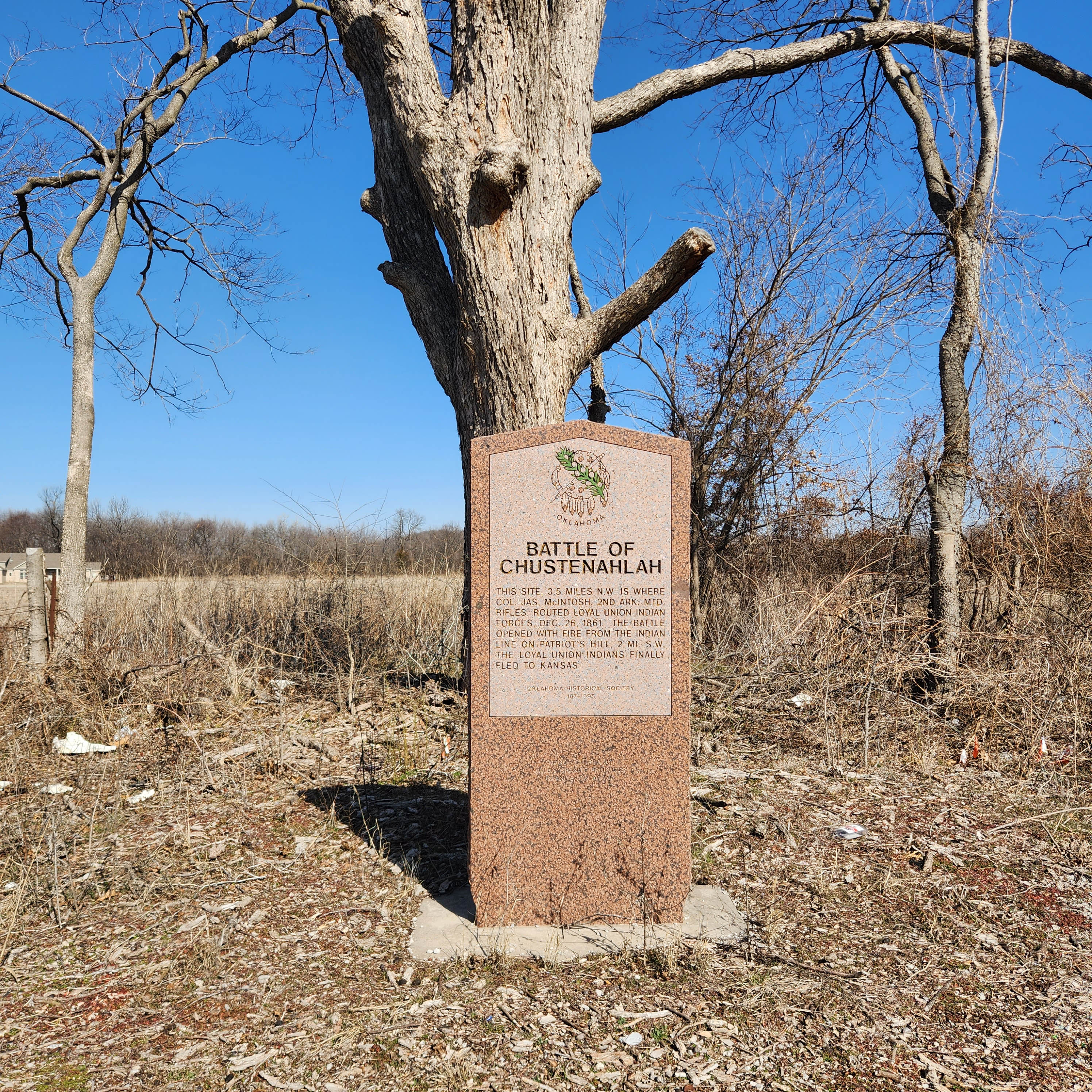
Location: A half mile west of N 52nd W Avenue on the north side of Highway 20
Coordinates: 36.368646, -96.059451
Material: Granite
Topics: Military, Government, American Indians, Westward Expansion 1803–1861
This site, 3.5 miles NW, is where Colonel James McIntosh, 2nd Arkansas Mounted Rifles, routed loyal Union Indian forces December 26, 1861. The battle opened with fire from the Indian line of Patriot's Hill, 2 miles southwest. The loyal Union Indians finally fled to Kansas.

Location: on OK-11 at 86th Street North in Tulsa
Topics: Military, American Indians, Territorial Period 1861–1907, Government
This battle was the second in a series of three engagements between pro-Northern Indians led by Opothleyahola and a combined white and Indian Confederate force on December 9, 1861, on Bird Creek.

Location: on US-69, south of Oktaha
Material: Aluminum
Topics: Military, Government, Transportation, Indian and Frontier Trade, Territorial Period 1861–1907
This battlefield east of the marker, beginning near the south edge of Oktaha, extends south over the countryside more than two and a half miles to Honey Springs on Elk Creek, located south of the Muskogee County line in McIntosh County. Beautiful, clear flowing Honey Springs can be seen about one and a half miles east and north of Rentiesville, McIntosh County. On a rise of ground several hundred feet north of the springs was a Confederate commissary depot where large stores of flour, pork, and other supplies in a big warehouse were destroyed by the Confederate troops to keep them from falling into the hands of the enemy.
Location: on OK-33 on east side of Locust Grove in parkway at "Pipe Spring," SH 33
Material: Aluminum
Topics: Military, Government, American Indians, Social/Cultural, Transportation
On July 2, 1862, federal troops under Colonel William Weer surprised a Confederate encampment here. The Southerners led by Colonel J. J. Clarkson surrendered, but heavy fighting continued throughout the day in nearby woods between Union troops and Confederate soldiers who escaped the raid.
Location: one mile north and 1/4 mile west of intersection of OK-18 and OK-51, four miles west of Yale
Material: Granite
Topics: Military, Government, American Indians, Westward Expansion 1803–1861
Between the landmark known as Round Mountain (Twin Mounds) to the south and a camp on Salt Creek two miles northwest, the first battle of the Civil War in Oklahoma was fought between a group of loyal Creeks under Opothleyahola and Confederate forces led by Colonel Douglas H. Cooper. Some scholars believe this engagement took place in Tulsa County.
Location: at junction of OK-51 and Old Dawson Road south of old Keystone
Topics: Military, Territorial Period 1861–1907, Government
The first Civil War battle in Oklahoma was fought here on November 19, 1861, between Confederate troops led by Colonel Douglas H. Cooper and Union forces led by Creek Chief Opothleyahola. The Southerners prevailed and occupied the Confederate encampment nearby. Some scholars believe this battle occurred in Payne County.

Location: in downtown Cheyenne one block south of US-283 and OK-47 intersection
Material: Granite
Topics: Military, Territorial Period 1861–1907, American Indians
On November 27, 1868, Colonel George Armstrong Custer led the 7th Cavalry in an attack on Chief Black Kettle's camp on the Washita River. The surprise, early-morning attack decimated the Cheyenne camp and no doubt was the seed for Custer's later meeting with American Indians at the Battle of Little Big Horn.
Location: on US-81 on north edge of Rush Springs
Material: Aluminum
Topics: Military, American Indians, Westward Expansion 1803–1861, Land Openings, Territorial Period 1861–1907
Four companies of the 2nd Cavalry, under the command of Major Earl Van Dorn, attacked a Comanche band near a Wichita village here on October 1, 1858, even though the Indians were on their way from a friendly council at Fort Arbuckle. Seventy Indians were killed, all because of poor communication. Pikey's Crossing was also an entry site for the Land Run of April 22, 1889.
Location: on US-64, two miles east of Camp Houston
Coordinates: 36.81235, -99.07458
Sponsored by: Cherokee Strip Volunteer League and the Oklahoma Historical Society
Material: Aluminum
Topics: American Indians, Military, Government, Territorial Period 1861–1907
The last known encounter between American Indians and the federal government in Oklahoma occurred in this area on September 13–14, 1878. Units of the 4th Cavalry battled with Northern Cheyennes led by Dull Knife and Little Wolf as they fled Indian Territory to return to the north. An Arapaho scout and three soldiers were killed.
Location: on OK-23 and US-270 in Beaver
Material: Granite
Topics: Settlement Patterns
Located on the site was a two-story frame building that served as the meeting place in March 1887 for organizing the area known as "No Man's Land" into "Cimarron Territory." The area was inhabited by ranchers, cowboys, outlaws, and settlers looking for homes. The effort to create Cimarron Territory failed, but No Man's Land became Beaver County, the seventh county of Oklahoma Territory, in 1890. At statehood in 1907, Beaver County was divided into Beaver, Texas, and Cimarron Counties.
Location: at Beavers Bend State Park near Broken Bow
Material: Granite
Topics: Government, Early Statehood 1907–1941, Environmental/Cultural Ecology, Social/Cultural, Recreation/Service
This unique park was developed between 1935 and 1941 by members of CCC Company 2815, one of many such units organized during the Great Depression by the federal government to provide employment for thousands of young men in conserving and developing the nation's natural resources

Location: in Mineral Wells Park on south edge of Guthrie
Coordinates: 35.868773, -97.426550
Sponsored by: OU/OSU Bedlam Centennial
Material: Granite
Topics: Social/Cultural, Recreational/Service, Territorial Period 1861–1907
Commemorates the first football game between Oklahoma State University and the University of Oklahoma held in present-day Mineral Wells Park in Guthrie on November 5, 1904.
Location: on US-81, eight miles north and one mile east of El Reno
Topics: Social/Cultural, Family/Household
The cemetery was established by the Beecham family to provide burial space for pioneers of the area. Many graves are marked only by crude stones, their inscriptions eroded by a century of exposure to the elements. In 1972, the Beecham Cemetery Association collected funds to provide for perpetual care for the one-acre cemetery.
Location: on US-270, five miles east of Hartshorne
Material: Aluminum
Topics: Empire Period 1541–1803, American Indians
The French explorer Bernard de La Harpe came north from Louisiana seeking trade with the Wichita Indians. He camped three miles east of Hartshorne on August 25, 1719, on his way north to the Canadian River and Wichita villages.

Location: east of Kingfisher on State Hwy 33 on SE corner of SE 1/4 of 14-16-6
Coordinates: 35.856528, -97.798852
Sponsored by: Big Four Alumni Association
Material: Granite
Topics: Education, Early Statehood 1907–1941
Big Four School, located three miles north, was formed on March 17, 1920, by a special election vote to consolidate the districts of White Cap, Twilight, Wandell, and Bird Creek. The school graduated its first senior class in 1924; its last in 1968. It continued as a grade school until closing in May 1978.


Location: on OK-70 in Grandfield
Material: Granite
Topics: American Indians, Territorial Period 1861–1907, Natural Resources, Land Openings, Settlement Patterns
A half-million acres were reserved for grazing lands when the Kiowa-Comanche-Apache lands were opened to public settlement in 1901. Because of the rich soil, pressure was brought on the federal government to open the Big Pasture to settlement. The land was sold by sealed bids beginning in December 1906. It was the last big land opening in Oklahoma.
Location: at intersection of 13th Street and South Avenue in Ponca City (DAR)
Sponsored by: Daughters of the American Revolution
Topics: Water, Westward Expansion 1803–1861, Territorial Period 1861–1907, Urban Development
Indians and explorers used this water supply before it became the main water supply for Ponca City, a village established after the opening of the Cherokee Outlet in 1892.
Location: on Poolville Road, six miles north of OK-53
Coordinates: 34.419800, -97.399538
Material: Aluminum
Topics: Territorial Period 1861–1907, Government
In 1894, US Marshal Selden Lindsey shot famous outlaw Bill Dalton here.
Location: Pioneer Woman Museum
Material: Granite
Topics: Petroleum, Government, Early Statehood 1907–1941, Natural Resources, Environmental/Cultural Ecology
Original plans for creating Interstate Compact to conserve oil and gas were developed on December 4, 1934, at the home of Governor-elect E.W. Marland, located one half mile northeast of this spot. Participants from twelve oil-producing states took part in these discussions of national and international significance. The purpose was to form a compact for bringing about conservation and prevention of waste in petroleum resources, through coordinated efforts of States Compact, creating the Interstate Oil Compact Commission. It was approved on February 16, 1935, in Dallas, Texas, and was ratified the same year by the legislatures of Oklahoma, Texas, New Mexico, Colorado, Illinois, Kansas, and consented to by Congress on August 27, 1935. By 1966, thirty states were active members, and three were associate members. Official observers included representatives from Alberta and Saskatchewan in Canada; Colombia and Venezuela in South America; US Department of Defense and Interior; and the Federal Power Commission. The headquarters of the Compact Commission were established on Capitol grounds in Oklahoma City.

Location: at 1008 North Broadway, in front of the Prague Historical Museum on SH-99-US-377 just north of the US-62 Junction in Prague
Material: Granite
Topics: American Indians, Recreational/Service, Social/Cultural, Early Statehood 1907–1941, Industrial Period 1892–1941
James Francis Thorpe, a Sac and Fox, was born as Wa-tho-huck or "Bright Path." He dominated the 1912 Olympics, winning both the decathlon and pentathlon events. He played Major League Baseball and professional football. He was the first president of the National Football League and is a member of Professional Football Hall of Fame. The Associated Press voted him the world's greatest male athlete of the first half of the twentieth century.
Location: in downtown Purcell
Topics: Government, Territorial Period 1861–1907
The first convention advocating the combining of Oklahoma and Indian territories into a single state was held at Purcell on September 13, 1893. Delegates to the convention sent their resolution to Congress, but no action was taken. Oklahoma was admitted to the Union fourteen years later.
Coordinates: 36.437944, -95.687250
Topics: American Indians
November 4, 1879-August 15, 1935. Will Rogers, world-renowned writer, humorist, and actor, was born on a ranch east of Oologah in Cooweescoowee, Indian Territory. He and Wiley Post died in an airplane crash at Point Barrow, Alaska. His birthplace was moved out of the path of Oologah Lake to 2 miles north of here and is open to the public.

Location: on US-62 in National Hall of Fame for Famous American Indians in Anadarko
Topics: American Indians, Military, Westward Expansion 1803–1861
Black Beaver, Delaware Indian frontier scout, served as the interpreter for the US Dragoon Expedition to the Plains Indians in 1834. He was awarded the rank of captain and helped guide expeditions to the Far West, including Captain Randolph Marcy's trip to the goldfields in California in 1849. Black Beaver was buried near his home northwest of Anadarko. In 1975 the Delaware tribe reinterred his body on the Fort Sill Military Reservation.
Location: at intersection of Fourth Street and Grand Avenue in Ponca City (DAR)
Sponsored by: Daughters of the American Revolution
Topics: Water, Early Statehood 1907–1941, Social/Cultural
The first watering fountain in Ponca City once stood near the Marland Estate stables. Mrs. George Fluke, the designer of the Oklahoma state flag, repainted the relief daises on the fountain.
Location: north of Pine Top School
Material: Granite
Note: Marker reported missing
Topics: Transportation, Mass Communication, Government, Westward Expansion 1803–1861
In 1857, Congress created the Butterfield Overland Mail Route to carry mail and passengers between St. Louis, Missouri, and Memphis, Tennessee, and points west. It was the first real transcontinental link between the Atlantic states and the Pacific Coast of the United States. There were twelve stations along a 197-mile route in Oklahoma, including Blackburn's Station.
Location: at Top of Oklahoma Historical Museum, 303 South Main Street, Blackwell
Topics: Social/Cultural, Land Openings, Mining, Territorial Period 1861–1907
Markers honor the centennial of Blackwell in 1993, the homesteaders who made the run into the Cherokee Outlet in 1893, and employees of Blackwell Zinc Company who served in World War II.
Location: on OK-78, one and a half miles south of Achille
Material: Granite
Note: Marker reported damaged
Topics: American Indians, Religion/Philosophy, Government, Westward Expansion 1803–1861, Education
Bloomfield Academy, a seminary for Chickasaw girls, was established in 1853 by authority of the Methodist Missionary Board. The school was located on two different sites in Bryan County before it was moved to Ardmore in 1917. There it was renamed Carter Seminary in honor of Congressman Charles D. Carter.

Location: at Harrison Avenue and Second Street in Guthrie
Coordinates: 35.877057, -97.427351
Sponsored by: Donald W. Reynolds Foundation
Material: Aluminum
Topics: Recreational/Service, Social/Cultural, Folklife, Territorial Period 1861–1907
This was one of Guthrie's most popular saloons during territorial days. Cowboy star Tom Mix was a bartender at the Blue Bell before he left for Hollywood. The original frame building was replaced by the present brick structure in 1903.
Location: four miles south of OK-7 bridge on Clear Boggy River in Boggy Depot State Park
Topics: Transportation
In 1857, Congress created the Butterfield Overland Mail Route to carry mail and passengers between St. Louis, Missouri, and Memphis, Tennessee, and points west. It was the first real transcontinental link between the Atlantic states and the Pacific Coast of the United States. There were twelve stations along a 197-mile route in Oklahoma, including Boggy Station.
Location: on Czech Hall Road
Topics: Territorial Period 1861–1907, Ethnic Diversity, Settlement Patterns, Social/Cultural
Bohemian Hall was established in 1899 by early Czech settlers. The original structure was replaced in 1924 by the present building. Bohemian Hall is the focal point of Czech social and musical functions in Oklahoma, including traditional weddings, reunions, and family gatherings. Czech plays have been performed periodically for the last fifty years. The original hand-painted canvas drops for the stage are still in existence.
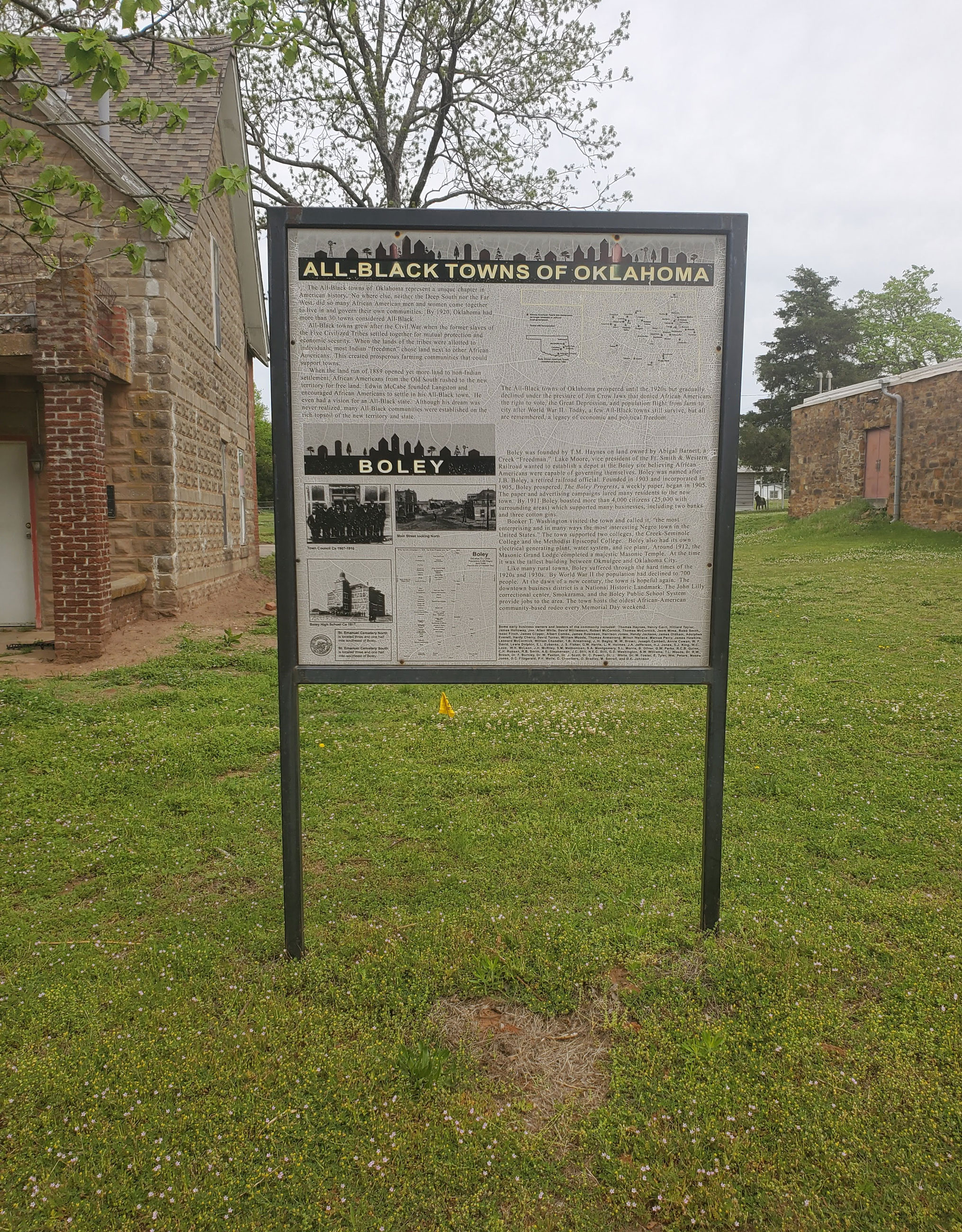
Location: in community of Boley
Coordinates: 35.493390, -96.484182
Sponsored by: Oklahoma Historical Society
Material: Other (Interpretive Panel)
Topics: Ethnic Diversity, Government, Urban Development, Territorial Period 1861–1907, American Indians, Transportation
Boley is one of thirteen All-Black towns, out of more than fifty that once existed, remaining in Oklahoma. While Tullahassee is reportedly the oldest, most were established between 1889 and 1907 as African Americans sought security and control of their own destiny in a segregated world. Boley was established in 1903 on land owned by a Creek Freedwoman, Abigail Barnett. Boley was incorporated on May 11, 1905. By 1911 it boasted more than 4,000 citizens (25,000 in surrounding areas) and many businesses, including two banks and three cotton gins. The town hosts the oldest African American community-based rodeo every Memorial Day weekend.
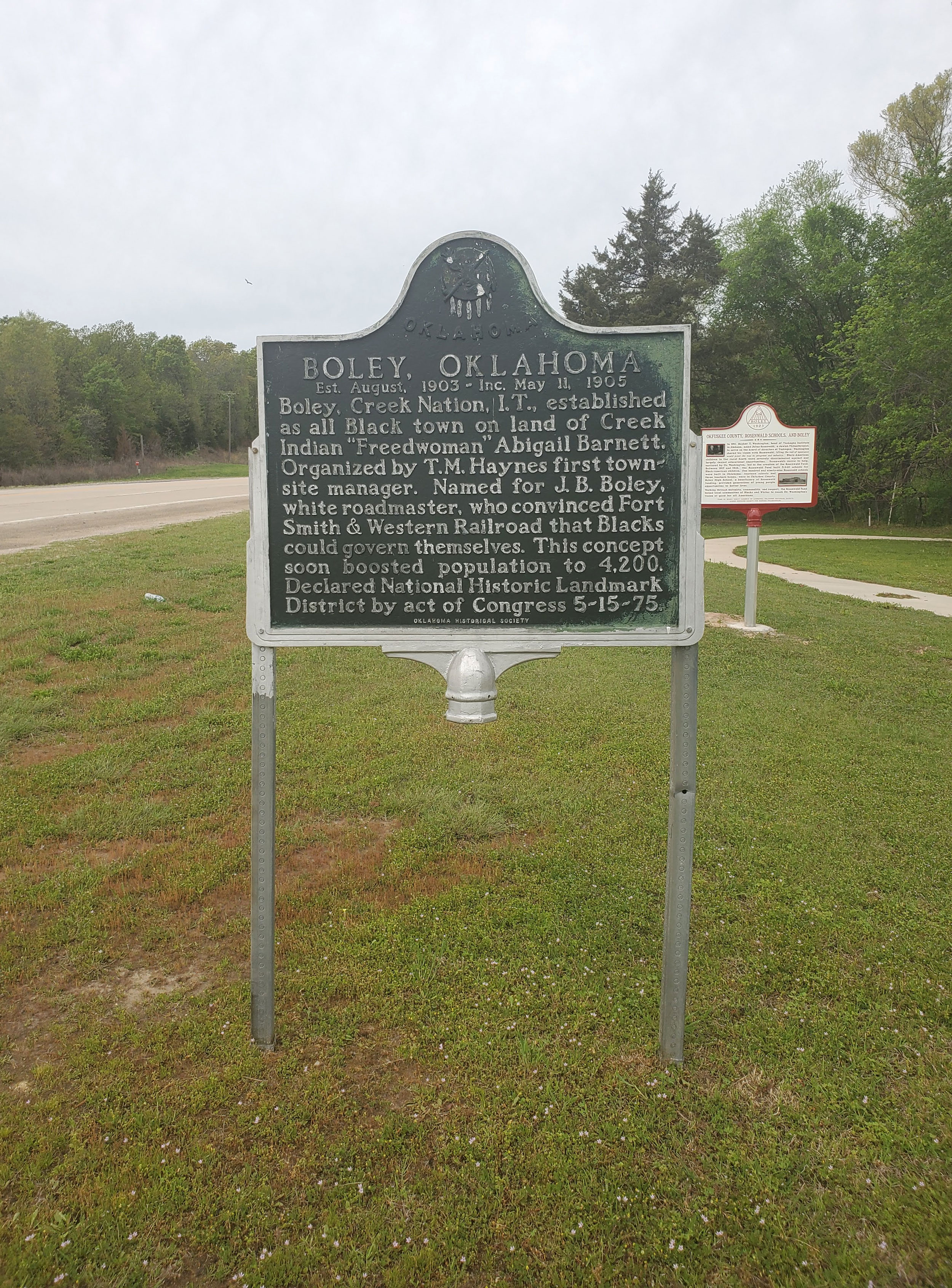
Location: on US-62 in Boley
Coordinates: 35.488219, -96.484095
Sponsored by: Oklahoma Historical Society/Town of Boley
Material: Aluminum
Topics: Ethnic Diversity, Government, Urban Development, Territorial Period 1861–1907, American Indians
Boley, Creek Nation, Indian Territory, established as an all Black town on land of Creek Indian Freedwoman Abigail Barnett. Organized by T.M. Haynes first townsite manager. Established August 1903. Incorporated May 11, 1905. Declared National Historic Landmark May 15, 1975.
Location: in the town of Skedee
Material: Granite
Bond of Friendship. Welcome to Skedee.

Location: at 107 South Second Street in Guthrie
Coordinates: 35.877679, -97.427689
Sponsored by: Donald W. Reynolds Foundation
Material: Aluminum
Topics: Industry/Business, Folklife, Mass Communication, Territorial Period 1861–1907
F. C. Bonfils ran his real estate business from an office in the first floor of this building and lived on the second floor. Bonfils, a descendant of Napoleon Bonaparte, was considered a con man in his early years. However, he later moved to Denver, Colorado, and co-founded the Denver Post newspaper.
Location: at the former Booker T. Washington School campus in Idabel
Coordinates: 33.893863, -94.838091
Sponsored by: Booker T. Washington-Slater-Riverside Alumni Association
Material: Aluminum
Topics: Social/Culture, Ethnic Diversity, Government, Early Statehood 1907–1941, Industrial Period 1941–1982
Booker T. Washington High School began independently in one room of the Masonic Hall. Around 1908, the school moved into an old store. In 1911, it was under the County Superintendent and moved into a two-room building on this site. T.F. Spigner became principal in 1925 and increased the grades steadily through 1931 when three girls graduated 12th grade. The wood building mysteriously burned in l936 and was replaced by the WPA with a stone building costing $21,735. Groundbreaking was held on August 24, 1936, and the building was dedicated on March 24, 1937.
Location: on south edge of OSU-Tulsa campus
Material: Granite
Topics: Education, Ethnic Diversity, Civil Rights, Early Statehood 1907–1941
The original school for African American students in Tulsa was a four-room wood building constructed in 1913. In 1919, a brick building was built on the same site and was one of the few structures to survive the 1921 Race Riot. The school moved to its present site in 1950.
Location: just west of North Perkins Road in Stillwater
Topics: Government, Land Openings, Settlement Patterns, Territorial Period 1861–1907
The federal government established this booth where thousands registered for the opening of the Cherokee Outlet on September 16, 1893.
Location: one mile north of US-77 and OK-142 in Ardmore
Topics: Natural Resources
On the ten-mile stretch of US-77 north of Ardmore are markers noting the unique geological features of the area. The markers include the Woodford Shale and Chert Outcropping, Chimney Hill Limestone Outcropping, Viola Limestone Outcropping, Tulip Creek and Third Bromide Sandstone Outcropping, Basil McLish Sandstone Outcropping, and the Arbuckle-West Spring Creek Lime Outcropping.
Location: at Falls Creek Conference Center at Turner Falls south of Davis (OBHC)
Sponsored by: Baptist General Convention of Oklahoma
Topics: Natural Resources, Water, Recreational/Service, Social/Cultural
The springs were formerly known as the "Devil's Bathtub," due to the unique shape of the pool.

Location: at intersection of Ranch Street and Washington Avenue in Stillwater
Material: Aluminum
Topics: Government, Land Openings, Settlement Patterns, Territorial Period 1861–1907, Agriculture
From this line, tens of thousands of settlers raced to stake 160-acre homesteads in the Unassigned Lands in the land run of 1889. This was also the boundary for the opening of the Cherokee Outlet four years later in 1893.
Location: two miles east of Binger
Sponsored by: Ramona Taylor Rich
Topics: Education, Early Statehood 1907–1941
Britton School was established in 1911 and originally known as Science Hill. Its name was changed to Britton School in honor of a pioneer family. A church located at the same site served as a grade school.

Location: at Harrison Avenue and Wentz Avenue in Guthrie
Coordinates: 35.877068, -97.424580
Sponsored by: Donald W. Reynolds Foundation
Material: Aluminum
Topics: Arts, Territorial Period 1861–1907, Social/Cultural, Early Statehood 1907–1941, Government
Constructed in 1899 by owner/manager James B. Brooks, this three-story limestone opera house seated 1,100 and contained ten finely appointed private boxes. It was furnished with folding upholstered chairs, steam heat, electric lights, hot and cold water, and other amenities. The adjacent Hotel Royal contained 80 guest rooms. On November 16, 1907, Governor Charles Haskell took the oath of office as the state of Oklahoma's first governor in room 47 of the hotel. Later that day, he was sworn in again in a public ceremony on the steps of the Carnegie Library.
Location: in community of Brooksville
Topics: Ethnic Diversity, Urban Development, Territorial Period 1861–1907, Early Statehood 1907–1941, Settlement Patterns, Land Openings
Brooksville is one of thirteen All-Black towns, out of more than fifty that once existed, remaining in Oklahoma. While Tullahassee is reportedly the oldest, most were established between 1889 and 1907 as African Americans sought security and control of their own destiny in a segregated world. Most of the towns began to decline in the 1920s and 1930s as rural African Americans faced economic hardships and began to move to urban areas. Brooksville had a post office from 1909 to 1955 and is named for the first postmaster, Alfred H. Brooks.
Location: on BUS-69 in Greenwood Cemetery north of Eufaula
Coordinates: 35.293933, -95.582783
Sponsored by: Oklahoma Baptist Historical Commission
Material: Aluminum
Topics: Religion/Philosophy, Family/Household, Westward Expansion 1803–1861
Dr. Henry F. Buckner, called the "apostle to the Creeks," and members of his family are buried here, having been moved from the Buckner home now under Lake Eufaula. Buckner came to the Creeks as a Baptist missionary in 1849.


Location: on US-81, 1 1/2 miles north of Bison
Coordinates: 36.2150336,-97.8872384
Material: Aluminum
Topics: Ranching, Transportation, American Indians, Indian and Frontier Trade, Territorial Period 1861–1907
The springs were a favorite rest stop on the Chisholm Trail on long cattle drives from Texas to Kansas. A pioneer merchant, trader, and explorer, Jesse Chisholm, a Cherokee, established the trail through western Indian Territory before the Civil War. Texas cattlemen used the trail until the late 1880s to move millions of cattle to northern markets. The trail ran from Montague County, Texas, to Abilene, Kansas. Buffalo Springs was an important gathering place for settlers making the land run on April 22, 1889.

Location: west of US-81 in Bull Foot Park, Hennessey
Coordinates: 36.1003327,-97.9004032
Sponsored by: Oklahoma Historical Society
Material: Granite
Topics: Water, Ranching, Transportation, Folklife
On the old Chisholm Trail, this station was noted for its water well. The name from a huge indentation in the ground here, resembling imprint of a bull's foot. Buildings were still standing on site, 50 yards east of the old trail, and 4.5 miles south of the north line of the Oklahoma land, which was opened to settlers by the great run, April 22, 1889.

Location: on OK-32, 1 1/2 miles east of Lebanon
Material: Aluminum
Topics: Education, American Indians, Westward Expansion 1803–1861, Territorial Period 1861–1907, Social/Cultural
The school was opened as a learning center for Chickasaw girls in 1859 under the supervision of the Cumberland Presbyterian Board. In 1887, the name was changed to Chickasaw Orphan Home and Manual Labor School. The first post office, called Burney Academy, opened on July 3, 1860.
Location: on OK-96 in Burneyville
Topics: Education, Territorial Period 1861–1907
The school, once known as Red River School, was a subscription school when it was founded in 1880s It closed in 1957.
Location: on US-271, south bank of Coal Creek, about 1/2 mile south of junction of US-271 and SHY31
Material: Aluminum
Topics: Transportation
Location: Confederate Memorial Museum and Cemetery, Atoka
Sponsored by: The Lake Atoka Reservation Association, Oklahoma City Water Utilities Trust, City of Atoka, City of Oklahoma City
Topics: Transportation
On September 16, 1857, the John Butterfield Company received a federal contract to transport mail from Missouri to San Francisco in under 25 days. Semi-weekly trips began a year later.

Location: on US-69 north of Patton
Material: Aluminum
Topics: Military
Emplacements can still be seen where cannons were set to defend the crossing of Cabin Creek. There are many unmarked graves of soldiers who died when General Stand Watie's Confederate troops captured a Federal supply train on September 18, 1864. Earlier, in July 1863, the Confederates were defeated in a small skirmish here.
Location: along highway in front of Concho Indian School, Concho
Topics: American Indians, Territorial Period 1861–1907, Education, Transportation
Noted for the purity of its waters which come from adjacent sand dune areas, Caddo Springs, sometimes called Concho Springs, was a favored spot on the Chisholm Trail. Cheyenne and Arapaho people alike shared the springs as did the Arapahoe School, later named Concho Indian School, built in 1870. The springs were named for the earliest known Oklahoma inhabitants, the Caddo Indians.
Location: on OK-34, two miles north of Leedy
Part of the road west to California first used by gold seekers in 1849 can be seen at this site.
Location: at junction of US-283 and OK-33, 14 miles north of Cheyenne
Material: Aluminum
Topics: Transportation, Settlement Patterns, Westward Expansion 1803–1861, Water, Environmental/Cultural Ecology, Government
The road was a major thoroughfare to the West for more than a half century. It was first traveled by gold seekers headed for California in 1849.

Location: on US Highway 77 just south of Wayne
Topics: Transportation, Settlement Patterns, Military
Caravans of gold seekers in the rush for California traveled this trail in spring 1849 under a military escort commanded by Captain R. B. Marcy. The route lay west from Fort Smith on the south side of the Arkansas and Canadian rivers across Oklahoma. The campground and spring, 3 miles west, was well known on this famous trail.

Location: on SH 59, one mile west of Byars
Topics: Military, Westward Expansion 1803–1861, Transportation, Settlement Patterns, American Indians
Camp Arbuckle was established in May 1850 by Captain R. B. Marcy and Company D, 5th Infantry, the site was visited in 1849 by Marcy while escorting gold seekers to California. The post was moved in 1851 to a permanent site in Garvin County. Buildings then were occupied by Delawares under Black Beaver, famous chief and guide. An Indian town, known as Beaversville, existed there until Civil War days.

Location: on US Highway 62, near boundary line of Caddo and Comanche Counties
Topics: American Indians, Military, Government
Camp Comanche was set up near a large Comanche village by the First Dragoons under Colonel Henry Dodge on July 16, 1834, while en route from Fort Gibson to Plains tribes. Seventy-five Dragoons and noted artist George Catlin were too ill to travel farther with the expedition. The camp was evacuated July 28, upon Dodge's return from peace councils with the Plains Indians.
Location: in Fort Sill Museum in Lawton
Topics: American Indians, Military, Arts, Westward Expansion 1803–1861, Government
Colonel Henry Dodge set up camp near a large Comanche village in this area in July 1834, hoping to hold talks with Comanche chiefs. Accompanying the US Dragoons Expedition was artist George Catlin, who probably made some of his most famous sketches of buffaloes and Comanches during the twelve days he spent at the camp. The exact location of the camp is unknown.

Location: on US-70 at west side of Kingston
Material: Aluminum
Topics: Military, Westward Expansion 1803–1861, Social/Cultural, American Indians
This frontier post was named for Brigadier General Henry Leavenworth, commander of the Dragoon Expedition through Oklahoma in 1834. Leavenworth died nearby after being injured in a buffalo hunt. Some historians call the 1834 expedition the greatest expeditionary force in the annals of the US Army.

Location: on US-183, one mile north of Mountain Park
Topics: Military, American Indians, Government, Westward Expansion 1803–1861
This frontier army post was manned by troops resisting hostile Indians. The camp was named for Lieutenant Charles Radziminski, a former member of the 2nd Cavalry under the command of Major Earl Van Dorn. Established in September of 1858, the post was used only a short time.

Location: on US-183, one mile east of Fort Supply
Topics: Military, Territorial Period 1861–1907, American Indians, Government
The site was used as a supply camp for Colonel George Armstrong Custer's 7th Cavalry in 1868. General Philip Sheridan received Custer here when he returned from the Battle of the Washita in December of 1868. The name was changed to Fort Supply in 1878 and abandoned in 1894. The State of Oklahoma later used the buildings for a hospital.
Location: original entrance into the camp, which is north of Tonkawa between Public and Main Streets
Topics: Military, Social/Cultural, Government, Ethnic Diversity, Agriculture, Industrial Period 1841–1892
Between October and December of 1942 more than nine hundred construction workers labored twenty-four hours a day to build Camp Tonkawa on the quarter section immediately north of this marker (SE1/2 Sec. 28-26N-1W). The 160-acre site contained more than 180 wooden structures for 3,000 German prisoners of war (POWs), as well as five hundred US Army guard troops, service personnel, and civilian employees. Activated in January 1943, the post received its first POWs in August: German troops of the Afrika Corps captured in North Africa. The facility operated at or near capacity throughout its existence. Prisoners worked on area farms and ranches as well as at an alfalfa dryer plant in Tonkawa. In November 1943, a disturbance among the prisoners resulted in the death of one German soldier. Eight POWs escaped from the camp but all were recaptured. Camp Tonkawa closed in September 1945, and the POWs were returned to Europe.

Location: on OK-51, 1/2 mile west of Canton
Topics: Military, Religion/Philosophy, Territorial Period 1861–1907, American Indians
Colonel Richard Dodge established this post in March of 1879 as part of the US Army's attempt to intercept hostile American Indians raiding into Kansas and Nebraska. Major General Philip H. Sheridan directed the construction of the post on the Cheyenne-Arapaho Reservation. Three years later, the stone buildings were abandoned and were eventually used as a Mennonite mission, a federal Indian school, and Indian agency.
Location: on I-40 in Canute
Material: Granite
Topics: Urban Development, Government, Territorial Period 1861–1907
Initially called Oak, this town was named for the king of Denmark. The first post office was established on February 24, 1899.
Location: on North A Street in McAlester
Material: Granite
Topics: Government, Social/Cultural, Recreational/Service, Industrial Period 1841–1892
Educated in a one-room schoolhouse at Bugtussle, Carl Albert became the highest-ranking Oklahoman ever to serve in the federal government. A Rhodes scholar, Albert was a Democratic member of the US House of Representatives from Oklahoma's Third Congressional District and rose to the position of Speaker of the House.

Location: at 402 East Oklahoma Avenue in Guthrie
Coordinates: 35.878167, -97.421080
Sponsored by: Donald W. Reynolds Foundation
Material: Aluminum
Topics: Arts, Social/Cultural, Government, Territorial Period 1861–1907, Early Statehood 1907–1941
Constructed in 1902 with a $25,000 grant from Andrew Carnegie, this restored building is now connected to the Oklahoma Territorial Museum. The last territorial governor and the first state governor took their oaths of office here. The mock wedding symbolizing the joining of Oklahoma and Indian Territory as the state of Oklahoma took place on the library steps on November 16, 1907.

Location: outside main entrance of Oklahoma Territorial Museum in Guthrie
Coordinates: 35.878187, -97.420805
Sponsored by: Daughters of the American Revolution
Material: Aluminum
Topics: Arts, Social/Cultural, Territorial Period 1861–1907
Celebrating our rich heritage of early literacy promotion by recognizing the oldest Carnegie Library in Oklahoma still in existence.
Location: at north edge of Bartlesville
Material: Aluminum
Topics: Industry/Business, Territorial Period 1861–1907, Agriculture
In 1870, Nelson F. Carr built a gristmill on the Caney River. A few years later, Jacob Bartles bought the mill and added a flour mill. The mills were the first commercial enterprises in what became the city of Bartlesville.

Location: on US-183 south of intersection with US-60
Coordinates: 36.140223, -98.955791
Sponsored by: Oklahoma Historical Society
Material: Aluminum
Topics: Settlement Patterns, Social/Cultural, Family/Household
Carry Nation and her husband David lived in a log cabin on this site after the opening of the Cheyenne-Arapaho lands in 1892. After moving to Medicine Lodge, Kansas, in 1899, Nation began her famous crusade against liquor, including using a hatchet to smash saloons.
Location: in Boiling Springs State Park
Material: Granite
Topics: Environmental/Cultural Ecology, Social/Cultural, Government, Early Statehood 1907–1941, Recreation/Service
Company 2822 of the Civilian Conservation Corps (CCC) built the Boiling Springs State Park from 1935 to 1940 as part of the federal government's program to provide jobs during the Great Depression.
Location: in Lake Murray State Park
Material: Granite
Topics: Early Statehood 1907–1941, Recreational/Service, Government
The men of the Civilian Conservation Corps (CCC) Companies 1813 and 849 lived and worked in a camp during the Great Depression and built Lake Murray State Park. The CCC was a make-work program created by Congress at the suggestion of President Franklin D. Roosevelt to help alleviate the shortage of jobs in America. Three hundred young men worked for seven years carving the rock for the Lake Murray dam, built shelters, picnic tables, roads, and trails and landscaped the park.
Location: in Osage Hills State Park
Topics: Recreational/Service, Social/Cultural, Government, Early Statehood 1907–1941
Men of the Civilian Conservation Corps (CCC) built structures and roads in the park in the 1930s.
Location: in Quartz Mountain State Park
Topics: Government, Environmental/Cultural Ecology, Natural Resources, Social/Cultural, Recreational/Service
Members of Company 2810 of the Civilian Conservation Corps (CCC) built the state park from 1937 to 1939. Approximately 150 young men lived in tents and were paid $30 per month, of which $25 was sent to their homes. CCC members built trails, roads, shelters, picnic tables, and cabins, and landscaped the park.
Location: in Robbers Cave State Park
Topics: Government, Social/Cultural, Recreational/Service, Early Statehood 1907–1941, Water
Members of the Civilian Conservation Corps (CCC) constructed Robbers Cave State Park in the 1930s on land donated by State Representative Carlton Weaver, who is buried in the main park circle. Carlton Lake is named for him.
Location: on OK-A8 off OK-51 in Roman Nose State Park north of Watonga
Topics: Early Statehood 1907–1941, Social/Cultural, Government, American Indians, Recreational/Service
Men of the Civilian Conservation Corps (CCC) built roads and buildings in the state park during the Great Depression. Opened in 1937, the park is located on land that Cheyenne Chief Henry Roman Nose used as a campground. Chief Roman Nose was a veteran of Plains Indian warfare. He was imprisoned at Fort Marion, Florida, then attended school at Hampton Institute in Virginia and Carlisle Indian School in Pennsylvania.
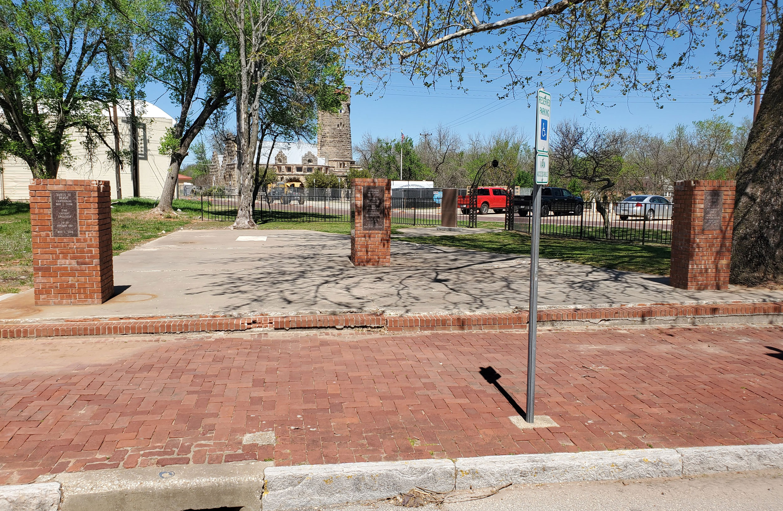
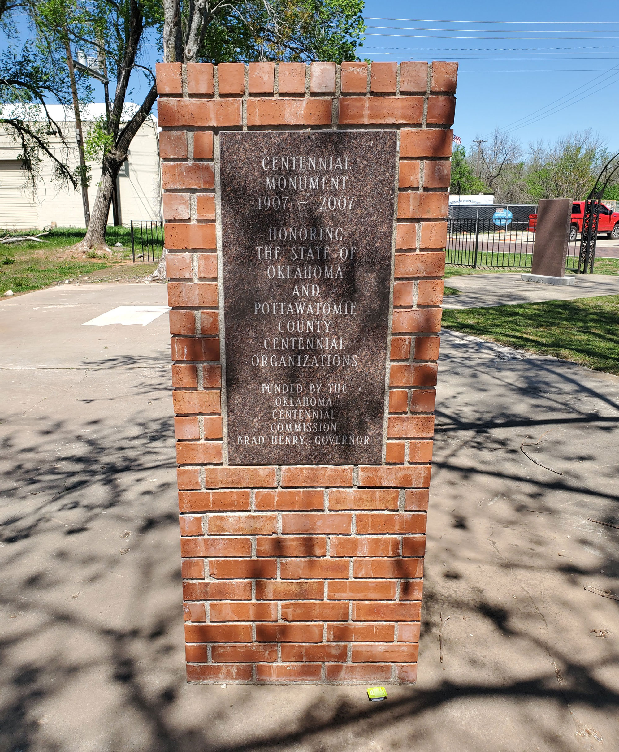
Location: near grounds of Santa Fe Museum on East Main Street in Shawnee
Coordinates: 35.327594, -96.916127
Sponsored by: Oklahoma Centennial Commission
Material: SC/TN/ES/IL/MN
Topics: Social/Culture, Transportation, Early Statehood 1907–1941, Industrial 1941–1982, Modern 1982 to present
Honoring the State of Oklahoma and Pottawatomie County Centennial Organizations, 1907–2007. Includes two other markers: one commemorating the dedication of Centennial Park (September 22, 1991), and one commemorating the centennial of the Santa Fe Depot (May 7, 2004).
Location: at southeast corner of the county courthouse in Alva (DAR)
Coordinates: 36.803911, -98.664710
Sponsored by: Daughters of the American Revolution
Material: Other (Brick wall with bronze plaque and statuary)
Topics: Land Openings, Settlement Patterns, Government, Territorial Period 1861–1907
The 1,600 bricks in the wall list the names of past and present Woods County families and commemorate the centennial of the opening of the Cherokee Outlet in 1893.

Location: at Second Street and Boulevard in Edmond
Material: Aluminum
Topics: Education
The Oklahoma Territorial Legislature established the school for the training of teachers in December of 1890. Known as Central State Teachers College, Central State College, and Central State University, the institution is now the University of Central Oklahoma. Old North, built in 1892, is the oldest building on campus.

Location: on US-70 at the eastern city limits of Bokchito
Material: Aluminum
Topics: American Indians, Westward Expansion 1803–1861, Territorial Period 1861–1907, Government, Education
This settlement was also called Choctaw City and was the site of Armstrong Academy, established by the Choctaw Nation in 1845. The Choctaw National Council met in the main hall of the academy for twenty years. Chahte Tamaha served as the Confederate capital during the Civil War. Delegates to a meeting of the United Nations of Indian Territory met here at the beginning of the Civil War to ally with the Confederacy. Armstrong Academy continued as a Choctaw boys school until a fire destroyed the building in 1919.
Location: on US-64, eleven miles east of Buffalo
Material: Granite
Topics: Government, Retail, Urban Development, Industry/Business, Transportation, Settlement Patterns
The town of Charleston was named for Charles Eilerts who was appointed postmaster on May 18, 1901. The town had two general stores, a drug store, a newspaper, a livery stable, and a doctor until the railroad bypassed it in 1920.
Location: on East Poplar Street in Fort Gibson
Material: Aluminum
Topics: American Indians, Social/Cultural, Westward Expansion 1803–1861, Territorial Period 1861–1907, Government
Before the Civil War, the Cherokees designated the cemetery as a national cemetery. The Cherokee Nation maintained the cemetery until 1906 when it was transferred to the town of Fort Gibson. Cherokee Principal Chief William P. Ross and other tribal leaders are buried here.
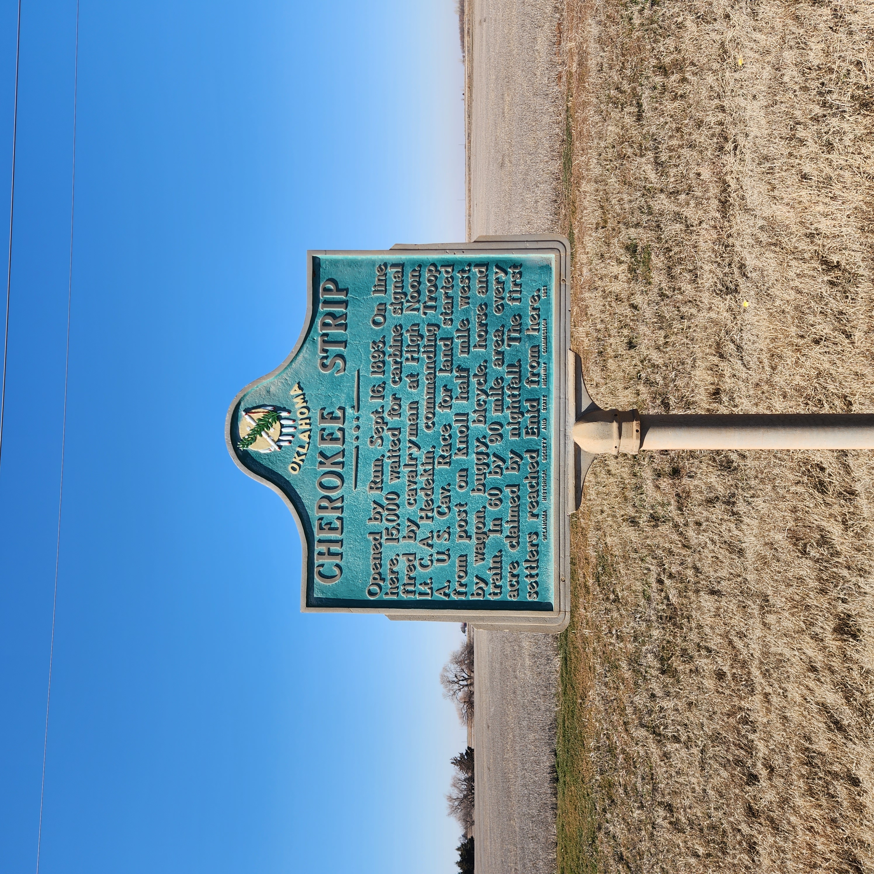
Location: on US-81 near Garfield-Kingfisher County line south of Bison
Coordinates: 36.164368,-97.8900864
Material: Aluminum
Topics: Land Openings, Territorial Period 1861–1907, Agriculture, Government
Opened by Run, Sept. 16, 1893. On line here, 15,000 waited for carbine signal fired by cavalryman at High Noon. Lt. C. A. Hedekin, commanding Troop A, U.S. Cav. Race for land started from post on knoll half mile west, by wagon, buggy, bicycle, horse and train. IN 60 by 90 mile area, every acre claimed by nightfall. The first settlers reached Enid from here.
Location: at intersection of Flynn and Post Office streets in Alva (DAR)
Coordinates: 36.804733, -98.664470
Sponsored by: Daughters of the American Revolution
Material: Stone with bronze plaque
Topics: Land Openings, Settlement Patterns, Government, Territorial Period 1861–1907
The first land office in the Cherokee Outlet was located here.
Location: on US-77 at Oklahoma-Kansas border (DAR)
Sponsored by: Daughters of the American Revolution
Topics: Land Openings, Territorial Period 1861–1907, Settlement Patterns
The east-west line marks the northern border of the Cherokee Outlet, opened for settlement on September 16, 1893.
Location: on US-59 at Buffalo Creek
Material: Aluminum
Topics: American Indians, Settlement Patterns, Government
In 1831, more than 400 members of the Seneca Tribe in Ohio gave up their reservation land in exchange for a tract of land in the northeastern part of the Cherokee Nation. This was the boundary between the Cherokee land and the Seneca territory that comprised an area of 67,000 acres, seven miles by fifteen miles.
Location: on OK-33, three miles east of Hammon
Material: Aluminum
Note: Marker reported to be missing original post, shows wear, and is difficult to read (December 2023)
Topics: Ranching
The main headquarters for this million-acre ranch was on the Washita River at the mouth of Quartermaster Creek. The ranch was also known as the Apple Ranch.
Location: in Chickasaw Museum, 200 North Fisher, Tishomingo
Topics: Westward Expansion 1803–1861, Territorial Period 1861–1907, American Indians, Government, Social/Cultural
A log cabin, now restored to near original condition, served as the official meeting place of Chickasaw leaders from 1856 until 1858 when a new brick building was constructed. Fire destroyed that building in 1890, and the final Chickasaw capitol, now the Johnston County Courthouse, was built in 1897.

Location: on US Hwy 70 between Broken Bow and Arkansas state line
Topics: Westward Expansion 1803–1861, American Indians, Government, Settlement Patterns, Transportation
During the late 1830s and early 1840s, Chickasaws removed by the United States government from Mississippi and Alabama passed near here on their way to a new homeland in present-day south-central Oklahoma. In 1937 an estimated 6,000 Chickasaws traveled by various routes to lands purchased from the Choctaws. This journey became known as the Chickasaw Trail of Tears.
Location: in Quartz Mountain State Park
Material: Granite
Topics: Military, Social/Cultural, Folklife
On March 5, 1869, William Gruber, the popular young bugler of the 19th Kansas Cavalry, was killed in a hunting accident while his regiment was in bivouac in the area. He was buried at dawn with the honors of war.
Location: east of junction of US-177 and US-60, south of Ponca City
Material: Granite
Topics: American Indians, Settlement Patterns
The Nez Perce Indians were removed to this area from their native lands in Idaho (1878–1884).
Location: at Jessie Chisholm's gravesite near Left Hand Springs northeast of Geary
Topics: American Indians, Westward Expansion 1803–1861, Religion/Philosophy
Chief Left Hand was born in the 1840s near Fort Supply. This noted warrior and survivor of the Sand Creek Massacre attended the Medicine Lodge conference in 1867, which resulted in the removal of his people to Indian Territory. He became principal chief of the Southern Arapaho in 1889 and encouraged his tribe to accept the white man's ways. However, he believed the Ghost Dance movement promised a return to the old ways. His allotment included this site, then known as Raven Springs, now Left Hand Springs. In the early 1900s, blindness forced Chief Left Hand to relinquish his position as chief.
Location: in Hall Cemetery south of Cameron on Raymond Adams Road
Material: Granite
Topics: American Indians, Settlement Patterns, GP, Westward Expansion 1803–1861
Chief Mosholatubbee was one of three Choctaw chiefs who signed early treaties with the United States, including the 1830 Treaty of Dancing Rabbit Creek, which provided for the removal of the Choctaws to Indian Territory. He moved with his people to a new home off the Fort Towson Road, north of Sugar Loaf Mountain, and died August 3, 1838. In his honor, the Choctaw Nation region from the Arkansas River to the Winding Stair Mountains was called Mosholatubbee District.

Location: on US-69, 1/4 mile north of Arkansas River bridge
Material: Granite
Topics: American Indians, Social/Cultural, Recreational/Service, Westward Expansion 1803–1861
Chief Pushmataha led a Mississippi Choctaw hunting expedition to the area in January of 1807 and attacked armed men under the leadership of French trader Joseph Bogy. Pushmataha County, in southeastern Oklahoma, is named for this great Choctaw leader.
Location: on OK-8A in Roman Nose State Park
See CCC-Roman Nose State Park
Location: on East Taft Avenue near South Division Street in Sapulpa (DAR)
Sponsored by: Daughters of the American Revolution
Topics: Social/Cultural, American Indians, Indian and Frontier Trade, Territorial Period 1861–1907
Chief Sapulpa Cemetery, one block south of the marker, is named for a full-blood Creek Indian named "Chief" Sapulpa, although he was not a chief. He owned an early trading post and was a Confederate officer in the Civil War. His real name was Sepulcher, but over time the name became corrupted to Sapulpa. The local DAR chapter purchased the burial ground in 1923.
Location: on OK-58 north of Fort Sill Military Reservation
Material: Aluminum
Topics: American Indians, Territorial Period 1861–1907, Settlement Patterns, Government
Stumbling Bear, a Kiowa, was the last signer of the Medicine Lodge Treaty in 1867. Stumbling Bear founded the first permanent settlement of Plains Indians in the area. In 1877 the federal government built houses for the Indians on Canyon Creek, north of the Wichita Mountains.
Location: on county road, two miles northeast of Swink
Material: Granite
Topics: American Indians, Family/Household, Westward Expansion 1803–1861, Government
According to some this is the oldest house still standing in Oklahoma, having been built in 1832 by the federal government for Choctaw District Chief Thomas LeFlore under its treaty obligations with the Choctaw Nation. Recent scholarship indicates that the home built for LeFlore stood west of Wheelock Mission in McCurtain County. However, this old house is representative of a typical Choctaw planter's home in the mid-nineteenth century.

Location: on US-77, three miles south of the Kansas border
Material: Granite
Topics: Education, American Indians, Territorial Period 1861–1907, Industrial Period 1841–1892, Ethnic Diversity
Congress authorized this school for Indian children in 1882. Before its closing in the 1970s, Chilocco was one of the largest Indian schools in the United States. On part of the original 9,000 acres set aside for the school, a major archaeological find proved the existence of Ferdinandina, a French trading post established around 1746 and considered to be the first white settlement in what would become Oklahoma.
Location: on US-81, three miles north of El Reno
Material: Granite
Topics: Indian and Frontier Trade, American Indians, Transportation, Ranching
A pioneer merchant, trader, and explorer, Jesse Chisholm, a Cherokee, established a trail through western Indian Territory before the Civil War. Texas cattlemen used the trail until the late 1880s to move millions of cattle to northern markets. The trail ran from Montague County, Texas, to Abilene, Kansas.
Location: North of Enid on Highway 81 on the east side of the road just north of the Highway 45 intersection
Coordinates: 36.4641915,-97.8731928
Sponsored by: The Jesse Chisholm Trail and Memorial Association
Material: Granite
Topics: American Indians, Indian and Frontier Trade, Transportation, Westward Expansion 1803–1861, Territorial Period 1861–1907
ere passed the old cattle trail, blazed by Jesse Chisolm, which finally stretched for eight hundred miles, from San Antonio, Texas, to Abilene, Kansas, over which cowboys from the pasturelands of the great southwest drove the herds to the railroads. Many tales of the adventure will perhaps remain untold with the passing of those who traveled the trail. To them, this memorial is dedicated, in the year 1945.

Location: One mile north of Pond Creek on Highway 81, on the west side of the road (DAR)
Coordinates: 36.6807398,-97.804301
Sponsored by: Daughters of the American Revolution
Material: Stone with bronze plaque
Topics: American Indians, Indian and Frontier Trade, Transportation, Westward Expansion 1803–1861, Territorial Period 1861–1907, Ranching
A pioneer merchant, trader, and explorer, Jesse Chisholm, a Cherokee, established the trail through western Indian Territory before the Civil War. Texas cattlemen used the trail until the late 1880s to move millions of cattle to northern markets. The trail ran from Montague County, Texas, to Abilene, Kansas.

Location: Approximately 400 feet west of Eighth Street in Pond Creek on Highway 81, on the north side of the road (DAR)
Coordinates: 36.666028, -97.812611
Sponsored by: Daughters of the American Revolution
Material: Stone with bronze plaque
Topics: American Indians, Indian and Frontier Trade, Transportation, Westward Expansion 1803–1861, Territorial Period 1861–1907
A pioneer merchant, trader, and explorer, Jesse Chisholm, a Cherokee, established the trail through western Indian Territory before the Civil War. Texas cattlemen used the trail until the late 1880s to move millions of cattle to northern markets. The trail ran from Montague County, Texas, to Abilene, Kansas.

Location: on US-81 at north edge of Dover
Sponsored by: Oklahoma Historical Society and Oklahoma Department of Transportation
Material: Granite
Note: Marker may be missing
Topics: American Indians, Indian and Frontier Trade, Transportation, Ranching, Westward Expansion 1803–1861
A pioneer merchant, trader, and explorer, Jesse Chisholm, a mix-blood Cherokee, established a trail through western Indian Territory before the Civil War. Texas cattlemen used the trail until the late 1880s to move millions of cattle to northern markets. The trail ran from Montague County, Texas, to Abilene, Kansas.
Location: on OK-7, two miles east of Duncan
Topics: American Indians, Indian and Frontier Trade, Transportation, Territorial Period 1861–1907, Ranching
A pioneer merchant, trader, and explorer, Jesse Chisholm, a Cherokee, established a trail through western Indian Territory before the Civil War. Texas cattlemen used the trail until the late 1880s to move millions of cattle to northern markets. The trail ran from Montague County, Texas, to Abilene, Kansas.
Location: on US-81 in Memorial Park in Duncan
See Chisholm Trail
Location: in front yard of home five miles south of Smithville
Topics: Government, American Indians, Westward Expansion 1803–1861, Territorial Period 1861–1907, Folklife
This Creek Indian leader opposed allotment of tribal lands and led rebellions against the federal government's abandonment of early treaties with the Indians. He died here in 1909 in the home of Choctaw citizen, Daniel Bob, after being wounded in a gun battle with federal deputy marshals.
Location: on US-271 east of Spiro
Topics: American Indians, Government, Westward Expansion 1803–1861
The first building to house Choctaw Indian agents at this location was completed in 1832. The village later was known as Skullyville where a new Choctaw constitution was adopted at a convention in 1857.

Location: on US-271, 1 1/2 miles west of Tuskahoma
Material: Aluminum
Topics: American Indians, Settlement Patterns, Westward Expansion 1803–1861, Transportation, Social/Cultural, Government
The first Choctaw capitol, Nanih Waiya, was completed in 1838. The first Choctaw constitution was written here in 1834. At Nanih Waiya are buried the bones of the Choctaws who died en route to Indian Territory from their ancestral homeland in Mississippi in the 1830s.
Location: in Waterhole Cemetery three miles south of Garvin
Topics: American Indians, Government, Family/Household, Westward Expansion 1803–1861, Social/Cultural
Garvin served as principal chief of the Choctaws from 1879 to his death in 1880.
Location: one mile west of Wheelock Mission on private land
Topics: American Indians
Leflore, chief of the Apuckshunnubbe District of the Choctaw Nation, 1834–1838 and 1842–1850, lived in a home built here under the 1830 Treaty of Dancing Rabbit Creek. He died in 1859 and was buried in a family cemetery nearby.
Location: on OK-2, one mile north of US-271 junction
Topics: American Indians, Territorial Period 1861–1907, Government
The last Choctaw capitol was erected here in 1884. The tribal government was housed in the building until statehood. The Choctaw Nation's headquarters are now located in Durant.
Location: at a point on US Hwy 70 near Broken Bow, Oklahoma
Topics: Westward Expansion 1803–1861, American Indians, Government, Transportation, Social/Cultural, Settlement Patterns
During the early 1830s, Choctaw Indians removed by the United States government from Mississippi passed near here on their way to new homes in present-day Oklahoma. An estimated 15,000 Choctaws traveled by steamboat, wagon, and on foot to Oklahoma. Approximately one-quarter of the tribe perished from cold, disease, and starvation during the removal journey. This journey became known as the "Choctaw Trails of Tears.
Location: at the intersection of Monroe Street and Strong Boulevard in McAlester (OBHC)
Topics: Religion/Philosophy, Territorial Period 1861–1907, American Indians
Baptist women's work in Oklahoma began in 1876 with the organization of the Choctaw-Chickasaw Woman's Missionary Union.

Location: on public school grounds in Salina
Topics: Indian and Frontier Trade, Westward Expansion 1803–1861, American Indians, Settlement Patterns, Military
Auguste Chouteau and his brother, Pierre, traded with the Arkansas band of Osage in the Three Forks area where the Arkansas, Verdigris, and Grand Rivers merge. Colonel A. P. Chouteau—Pierre's son and the fourteenth man to graduate from the US Military Academy at West Point— built a trading post on the Grand River in 1817, recognized as the oldest permanent American settlement in what became Oklahoma. He built a home near the trading post on the eastern bank of the Grand River.
Location: at Park Lane and East Broadway in Altus
Topics: Military, Industrial Period 1841–1892
In 1955, this B-47, christened City of Altus, was the first bomber to land on the runway at Altus Air Force Base.
Location: on grounds of Wiley Post Building, 2100 North Lincoln Boulevard, Oklahoma City
Material: Aluminum
Topics: Military, Arts, Early Statehood 1907–1941
This three-inch, muzzle-loading field cannon was used in battle by the New Jersey Volunteer Artillery and for entertainment by Pawnee Bill's Wild West Show. Major Gordon W. Lillie (Pawnee Bill) gave the cannon to his long-time publicist Frank Stuart who kept it at his Nichols Hills home before bequeathing it to the Oklahoma Historical Society.

Location: on Bison Road west of US 177, in Chickasaw National Recreation Area
Coordinates: 34.501550, -96.971633
Sponsored by: Oklahoma CCC Alumni and the Oklahoma Historical Society
Material: Granite
Topics: Government, Social/Cultural, Recreational/Service, Early Statehood 1907–1941
In the 1930s, young men of Civilian Conservation Corps (CCC) Company 808 contributed a major part to the building of Platt National Park, which was the only national park located in Oklahoma. The area is now part of the Chickasaw National Recreation Area.

Location: on OK-88, one mile north of County Road 44
Material: Aluminum
Topics: American Indians, Petroleum, Natural Resources, Westward Expansion 1803–1861
Named for the great Osage chief, Clermont, the area was the site of an Osage village destroyed by the Cherokees in 1817. Oil was discovered a century later on the Osage Reservation nearby.

Location: on OK-88, one mile north of County Road
Coordinates: 36.382000, -95.632833
Material: Granite
Topics: American Indians, Petroleum, Natural Resources, Westward Expansion 1803–1861
on OK-88 west of County Road 411
Location: at 6th and F Street, Lawton
Topics: Social/Cultural, Modern Period 1982–present
Clarence Wilson, a Lawton native, is Lawton's only bombing victim. Clarence was a dedicated public servant and was a mentor for all youth.
Location: on US-70 on west edge of Valliant
Topics: Arts, Water, Industry/Business, Ethnic Diversity
The water mill was established here in 1818. At the site, the Negro spiritual, "Swing Low Sweet Chariot," was first introduced in writing. The song had been oral tradition until then.
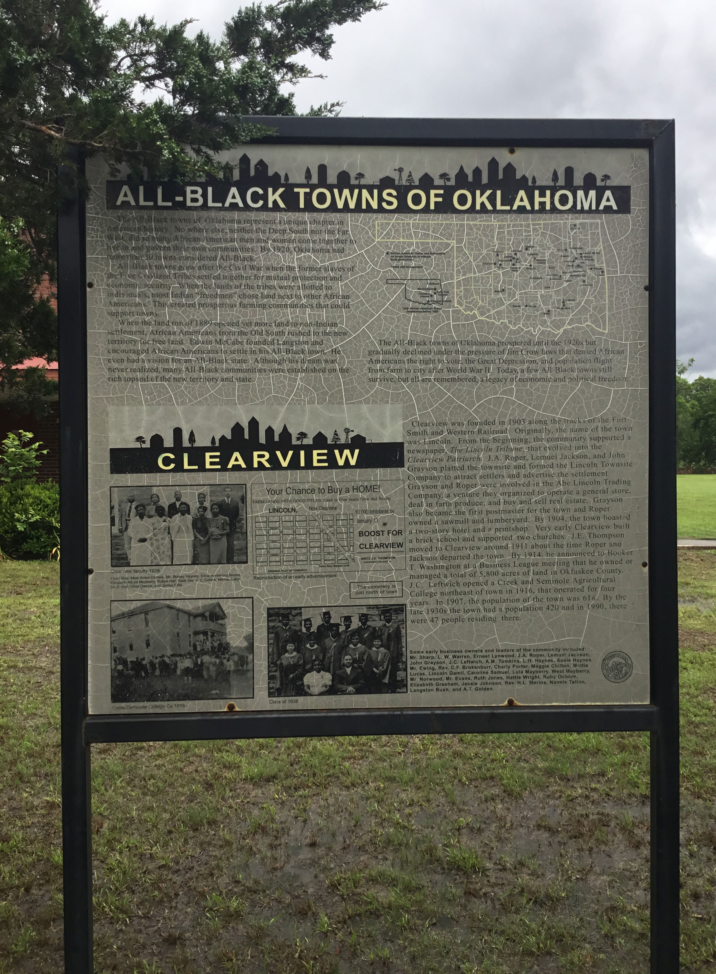
Location: on ground of Clearview School in Clearview
Coordinates: 35.398074, -96.190880
Sponsored by: Oklahoma Historical Society
Material: Other (Interpretive Panel)
Topics: Ethnic Diversity, Government, Mass Communication, Territorial Period 1861–1907, Urban Development
Clearview is one of thirteen All-Black towns, out of more than fifty that once existed, remaining in Oklahoma. While Tullahassee is reportedly the oldest, most were established between 1889 and 1907 as African Americans sought security and control of their own destiny in a segregated world. Clearview was founded in 1903 along the tracks of the Fort Smith and Western Railroad. J. A. Roper, Lemuel Jackson, and John Grayson platted the townsite and formed the Lincoln Townsite Company to attract settlers and advertise settlement.
Location: on US-64 at Triangle Oil and Historical Museum in Cleveland
Topics: Petroleum, Urban Development, Territorial Period 1861–1907, Industry/Business
The town of Cleveland became a boomtown in 1904 when oil was discovered nearby.
Location: on US-64 and OK-99 in Cleveland
Topics: Urban Development, Petroleum, Territorial Period 1861–1907, American Indians, Natural Resources
Cleveland, established in 1894, was named for President Grover Cleveland. It became an early boomtown after oil was discovered in the immediate vicinity and in nearby Osage County in the early twentieth century.
Location: on county courthouse grounds in Cordell
Topics: Environmental/Cultural Ecology, Water, Early Statehood 1907–1941, Government
The government constructed 1,140 conservation dams in the Washita River Basin, of which Cloud Creek was a part.
Location: on OK-54B in Colony
Topics: Environmental/Cultural Ecology, Government, Water, Early Statehood 1907–1941
This was the first of more than 1,000 dams built in the Washita River Basin and the first of more than 10,000 flood control dams constructed in the United States by the USDA Soil Conservation Service.

Location: on OK-199, thirteen miles east of Madill in Fort Washita Cemetery
Material: Granite
Topics: American Indians, Government
For 200 years, some of the most famous tribal leaders of the Chickasaw Nation came from this family. Their leadership abilities were well-known and utilized during negotiations with the federal government. The marker is a tribute to Charley Colbert, auditor of the Chickasaw Nation.

Location: on US-69 in Colbert
Topics: Transportation, American Indians, Government, Social/Cultural, Westward Expansion 1803–1861
Colbert's Ferry was located on the Red River about three-fourths of a mile from the home of Benjamin F. Colbert. Colbert owned the ferry that provided travelers with a safe journey across the river. Colbert's home served as a stop on the Butterfield Mail Route from 1858 to the early days of the Civil War. The Colbert post office was established here on November 17, 1853.

Location: at 103 North Main Street, Miami
Topics: Arts, Early Statehood 1907–1941
The Coleman Theatre, built in 1929 as a vaudeville/movie theatre palace, has hosted many legendary performers. Never closed, it holds the original Mighty Wurlitzer Pipe Organ that has entertained generations. Programs and acts of all types are still performed regularly.
Location: on OK-54B in Colony
Topics: Territorial Period 1861–1907, Settlement Patterns
The town took its name from Seger Colony, founded by John Seger in 1896. See Seger Colony.
Location: five miles east, at Lacey and Sheridan
Topics: Agriculture, Government, Mass Communication, Transportation, Settlement Patterns
Located five miles to the east in old Oklahoma Territory, this agricultural community was the site of a post office from February 21, 1890, to February 28, 1913. Named for a local merchant, Columbus Fash, the town disappeared after being bypassed by the railroad.
Location: beneath the Henry post Airfield on the St. Sill Military Reservation
Location: on US-69 at the Confederate Memorial Museum on the east side of Atoka
Topics: Military
The cemetery contains graves of Confederate soldiers who fought in the Civil War.
Material: Granite
Topics: Education, Settlement Patterns
Commemorating the dedication, foresight, and skill of teachers, administrators, and early residents who built these schools and the Con 8 community.

Location: inside City Hall, 101 North Second, Guthrie (DAR)
Coordinates: 35.878274, -97.427782
Sponsored by: Daughters of the American Revolution
Material: Bronze tablet
Topics: Government, Territorial Period 1861–1907, Early Statehood 1907–1941
Oklahoma's Constitutional Convention was held in 1906 and 1907 in the old City Hall at this site.
Location: on US-183 at Third Street in Cordell
Material: Aluminum
Topics: Religion/Philosophy, Education, Territorial Period 1861–1907, Early Statehood 1907–1941
Built in 1906 as a Dutch Reformed Church project, the school operated until 1911. The school's stated goals was to teach youth Christian living.
Location: at US-183 and Second Street in Cordell
Topics: Education, Early Statehood 1907–1941, Civil Rights, Religion/Philosophy
The college began in 1907 and operated until 1931 under the names of Cordell College, Western Oklahoma Christian College, and Oklahoma Christian College.
Location: on OK-54B in Corn
Topics: Education, Religion/Philosophy, Early Statehood 1907–1941, Agriculture
In 1893, forty Mennonite families settled the area and brought 'Turkey red' wheat to plant in the western Oklahoma soil. The original name of the settlement was Korn but was anglicized to Corn in 1918 during the war with Germany. The Korn Bible Academy, one of the state's oldest parochial schools, opened in 1903. The town of Corn was incorporated in 1954.
Location: on US-270, two miles east of Forgan
This Spanish explorer is popularly noted as Oklahoma's first tourist, passing through Beaver County in 1541 to reach Quivira on the Arkansas River north of present-day Oklahoma.

Location: near Northwest Tenth Street and the North Canadian River in Bethany (DAR)
Coordinates: 35.479047, -97.663289
Sponsored by: Daughters of the American Revolution
Topics: American Indians, Indian and Frontier Trade, Westward Expansion 1803–1861, Military
Jesse Chisholm opened a trading post here in 1858. In 1865, Comanche and Kiowa met nearby with Confederate leaders. Barracks were constructed on the site to house soldiers to clear timber for the construction of Fort Reno.
Location: on West Reno Avenue in Oklahoma City
Material: Granite
Topics: Education, Territorial Period 1861–1907, Early Statehood 1907–1941, Mass Communication, Government
This was one of the first schools in Oklahoma County. It was later moved by wagon to the corner of Melrose Lane and Council Road. A second building was constructed in 1900 and the present red brick structure was completed in 1938. A post office was established at Council Grove on June 11, 1892. Two years later, the post office became Council but closed in 1906.
Location: on OK-32, 3 1/4 miles east of Jefferson County line
Topics: Education, Settlement Patterns, Early Statehood 1907–1941
Originally serving students in the town of Courtney, the school closed in 1928 when the county border changed and several small schools were consolidated.
Location: approx. 12 miles north of Camp Houston
Coordinates: 36.96656, -99.14971
Sponsored by: Alva Monument
Material: Granite
Topics: Territorial Period 1861–1907, Settlement Patterns, Ranching, Indian Frontier and Trade
On September 12, 1878, the bodies of Reuben Bristow and Fred Clark were found near here. It was believed they had been killed by Northern Cheyenne Indians led by Chief Dull Knife. Bristow and Clark were cowboys hauling salt for Comanche pool cattle when Dull Knife fled harsh conditions on the reservation near Canton. The salt haulers, probably killed for their mule team, inadvertently crossed the path of the Cheyenne during their desperate flight home to the Northern Plains.
Location: on US-77 south of Salt Fork of the Arkansas River
Topics: Recreational/Service, Ranching, Industry/Business
Zack Miller of the famous 101 Ranch gave this property to the Cherokee Strip Cowpunchers Association in 1930 to use as a location for annual reunions of "those who had ridden the range" in the Cherokee Strip. The site was later given to the Oklahoma Historical Society to maintain the graves of Miller and trick-shop performer Jack Webb.

Location: on city square in Okmulgee
Topics: American Indians, Government, Territorial Period 1861–1907
This former capitol of the Creek Nation was constructed in 1878. Indian Territory tribal delegates met on this site in 1870 to draft the Okmulgee Constitution. Though never adopted or approved, the document called for the organization of Indian Territory under one government.
Location: inside north door of Creek Capitol (DAR)
Sponsored by: Daughters of the American Revolution
Material: Aluminum
Topics: American Indians, Territorial Period 1861–1907, Government
The Creek Council House, now a museum, occupies an entire city block in downtown Okmulgee. An original building was erected in 1868 but was razed for construction of the present structure in 1878. See Creek Capitol.

Location: at Eufaula Indian community at Seventh and Forest in Eufaula
Sponsored by: Oklahoma Historical Society
Topics: Military, Government, American Indians, Social/Cultural, Recreational/Service
Confederate Commissioner Albert Pike met with Creek leaders at North Fork Town, now covered by the waters of Lake Eufaula, on July 10, 1861, to sign a treaty in which the Creeks pledged their support to the South in the Civil War.
Location: southwest corner of West 15th Street and South Cheyenne Avenue in Tulsa
Coordinates: 36.140502, -95.989655
Sponsored by: Tulsa County Historical Society
Material: Aluminum
Note: Marker is no longer extant
Topics: American Indians, Government,Social/Cultural, Westward Expansion 1803–1861
4 blocks south on the north side of 18th St. stands a great oak, focal point of the old Creek Ceremonial Grounds. Here, overlooking the Arkansas, in 1828, the Indians deposited ashes from their Alabama ancestral home, kindled a fire to begin anew in the west, thus founding present-day Tulsa.
Sponsored by: Student Council and Patrons of Paden, 1987-1988
Material: Granite
Topics: Petroleum, Natural Resources, Industry/Business, American Indians, UB, Social/Cultural, Government, Folklife, Ethnic Diversity, Education
The Cromwell oil field and town were named for Joe I. Cromwell of Muskogee, Oklahoma. A gas well, the #1 Jim Willis in the SE/4 SE/4NW/4 of Section 15-10N-8E, was completed at a depth of 3,466 feet by the Cosden Oil Co. on November 11, 1922. However, it was not until the discovery of oil by the Cromwell Oil & Gas Company at the #1 Bruner in the NW/4 NE/4 SW/4 of Section 15-10N-8E on October 2, 1923, that the drilling boom started. This well was completed to a depth of 3,475 feet. A total of 393 wells produced oil in the field with the largest oil well producing 5,600 barrels per day, and the largest gas well producing 125,000,000 M.C.F. The town of Cromwell and the surrounding oil field had a peak population of 10,000 during 1923 and 1924. Lawlessness became rampant and caused the town to be named "Cromwell the Wicked". In September 1924, prisoners from Cromwell were handcuffed to a log cabin and marched 14 miles to the county jail in Wewoka. To help curb the lawlessness in the town, William (Bill) Tilghman, a pioneer law officer and one of the famous "Three Guardsmen" of Oklahoma was named Chief of Police in September 1924. On November 1, 1924, at the age of seventy, Tilghman was slain at the entrance of Murphy's dance hall located where this marker stands.
Location: on I-35 at scenic turnout between mile markers 49 and 50
Note: Marker reported missing
Topics: Environmental/Cultural Ecology
Explains the Arbuckle Mountain Anticline geological structure. A nearby marker explains that the technique of oil exploration using reflection seismograph was born here.
Location: on OK-34 at Ninth Street and Jefferson in Woodward
Topics: Transportation, American Indians, Indian and Frontier Trade, Settlement Patterns, Military
Originally a trail from Camp Supply to Darlington in the Cheyenne/Arapaho lands beginning in 1869, the road eventually became the main route of travel and supply between the two western forts.
Location: on OK-50, one mile west and three miles west of Mooreland
Topics: Transportation
See Crossing of Fort Supply to Fort Reno Road.
Location: in Quartz Mountain State Park
Material: Granite
Topics: Military, Transportation, American Indians, Government, Territorial Period 1861–1907
On March 5, 1869, General George Armstrong Custer and two cavalry regiments met a large supply train dispatched from Camp Supply by General Philip H. Sheridan. Three days earlier, Custer and his troops had departed Medicine Creek Camp, later Fort Sill, on an expedition against Plains Indians.
Location: on OK-54, two miles south of Cooperton
Topics: American Indians, Westward Expansion 1803–1861
In the spring of 1833, an Osage war party attacked an undefended Kiowa camp nearby, killing many elderly men, women, and children. Young braves had left the camp days earlier to hunt buffalo in the Quartz Mountains.
Topics: American Indians, Westward Expansion 1803–1861
The Cutthroat Gap Massacre site is approximately 2.5 miles east of this marker. In the early summer of 1833, the summer before "The Stars Fell", an Osage war party attacked an undefended Kiowa camp. The camp of Islandman A'D'Ate, Principal Chief of the Kiowa, consisted of women, children, the elderly, and a few warriors. Most of the warriors were on a raid against the Utes while others were hunting buffalo. The Osage tracked Islandman's band from Saddle Mountain through the mountains to the camp site.
Location: in Eagletown Cemetery north of US-70
Topics: Religion/Philosophy, Education, Westward Expansion 1803–1861, Social/Cultural, Arts
Byington established Stockbridge Mission at Eagletown in 1834 where he produced the Dictionary of the Choctaw Language. The federal government finally published the grammar book in 1915. It is recognized as one of the greatest contributions to the field of American ethnology.
Location: on corner of Coonrod Drive and SH-51, Mannford
Sponsored by: Keystone Crossroads Historical Society
Topics: Environmental/Cultural Ecology, American Indians, Government, Folklife
Located approximately 3.3 miles west is a cave where, according to the 1930s WPA Guide to Oklahoma, Creek Indian Tom Bartee sheltered and fed the Daltons when they were pursued by deputy US marshals.

Location: on US-81, two miles north of El Reno
Topics: American Indians, Retail, Government, Religion/Philosophy, Transportation, Territorial Period 1861–1907, Mass Communication
An important stop on the Chisholm Trail, the Cheyenne-Arapaho Agency was established at Darlington in 1870. The settlement is named for Brinton Darlington, a Quaker who was appointed Indian agent by President U. S. Grant. A post office opened in Darlington in 1873 and the first newspaper published in western Indian Territory, the Cheyenne Transporter, was printed in the community in 1879.
Location: at 107 East Main in Ardmore
Topics: Urban Development, Retail
Established at this location in the early twentieth century, the Daube's Department Store was the cornerstone around which Ardmore was built. The business closed in 1990 after 102 years as Oklahoma's oldest, privately owned, family-operated business.
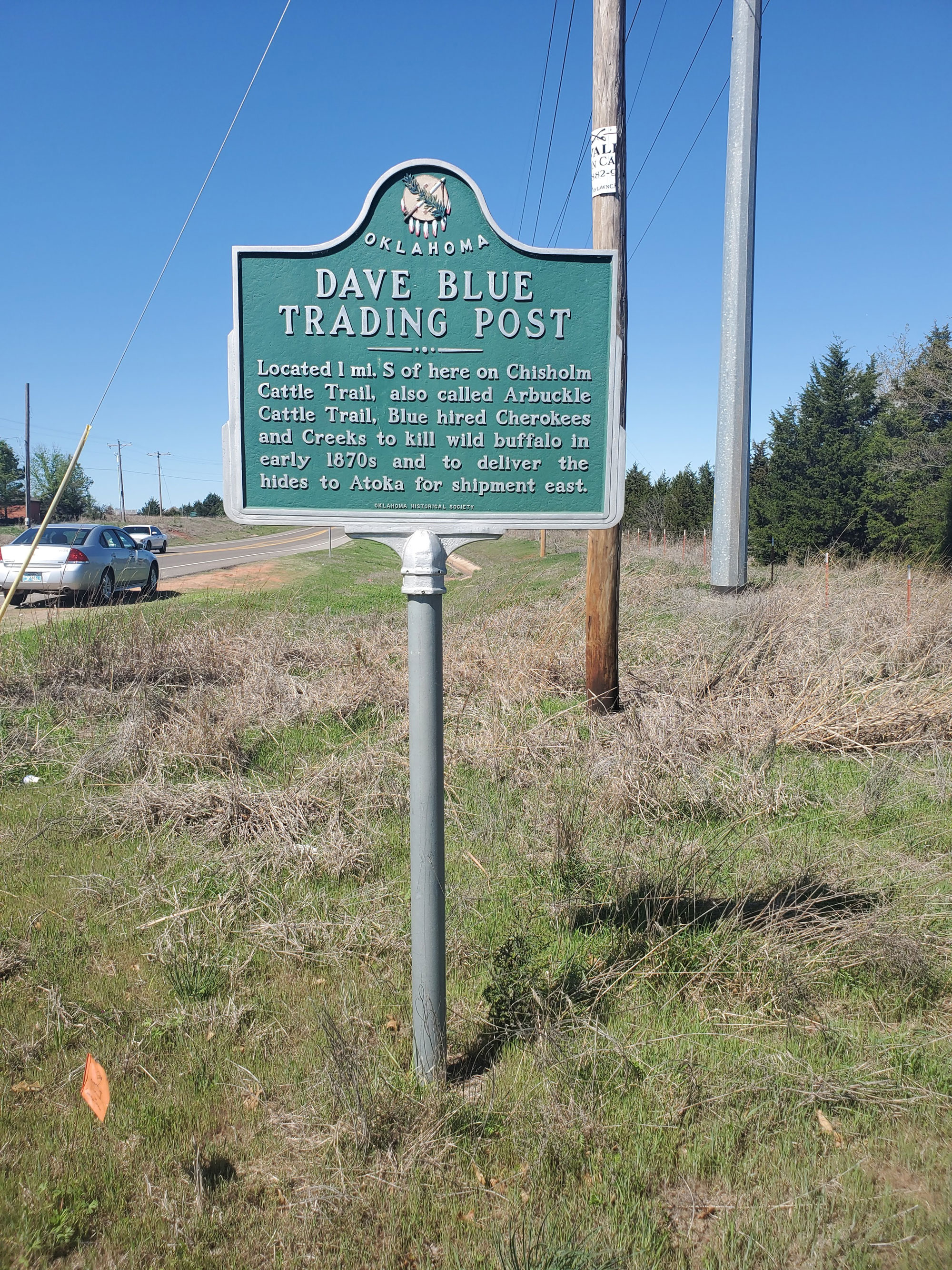
Location: at intersection of 48th Avenue Southeast and East Imhoff Road (OK-9) in Norman
Coordinates: 35.189750, -97.370517
Sponsored by: Oklahoma Historical Society
Material: Aluminum
Topics: American Indians, Indian and Frontier Trade
Dave Blue was a trader in the 1870s who hired Cherokee and Creeks to kill wild buffalo. Blue shipped the hides to Atoka for transportation to market in the eastern United States. Blue's trading post was built along the Arbuckle Cattle Trail.
Location: at grave site of David Payne in Boomer Lake Park at Washington and Lakeview in Stillwater
Topics: Land Openings, Settlement Patterns, Social/Cultural
David Payne was the father of the Oklahoma Boomer movement. After his death, he was buried in Kansas. His remains were moved to Stillwater in January 1995.

Location: at Division Street and Oklahoma Avenue in Guthrie
Coordinates: 35.878109, -97.424779
Sponsored by: Donald W. Reynolds Foundation
Material: Aluminum
Topics: Natural Resources, Industry/Business, Territorial Period 1861–1907
Built in 1890 by the De Steiguer brothers, banking pioneers, this building was actually two buildings, constructed to look as one. This building is one of few historic downtown structures with a façade of Oklahoma native red sandstone.

Location: at 116 South Second Street in Guthrie
Coordinates: 35.877456, -97.427513
Sponsored by: Donald W. Reynolds Foundation
Material: Aluminum
Topics: Urban Development, Territorial Period 1861–1907, Social/Cultural
Possibly the gem of Joseph Foucart's architecture in downtown Guthrie, this building was completed in 1890. Irwin S. DeFord, the original owner, lived upstairs. In 1981, the building was given to the Logan County Historical Society.

Location: on OK-1, two miles south of Ada
Topics: Environmental/Cultural Ecology, Transportation, Westward Expansion 1803–1861
This natural plateau divides the headwaters of the Muddy Boggy and Clear Boggy creeks. From the top of the divide, travelers on the old California Road had a clear view of pristine wilderness.
Location: on West Reno Avenue and South Western Avenue near the Oklahoma River in Oklahoma City
Material: Granite
Topics: Recreational/Service, Social/Cultural, Folklife, Territorial Period 1861–1907, Early Statehood 1907–1941
Once reportedly the largest amusement park west of the Mississippi River, Delmar Garden occupied 140 acres along the North Canadian River. The magnificent park, which boasted an outdoor theater, beer garden, dance hall, swimming pool, baseball park, and race track, opened barely a dozen years after Oklahoma City was carved out of a prairie. The park operated from 1902 to 1910 when a mosquito epidemic caused by high water closed the park. Apache Chief Geronimo once signed autographs here.
Location: on OK-150 in Lake Eufaula State Park
Coordinates: 35.419127, -95.628342
Sponsored by: Oklahoma Historical Society
Material: Granite
Topics: Government, Recreational/Service, American Indians, Territorial Period 1861–1907
James Nakedhead was a deputy US marshal killed in the line of duty in Indian Territory on February 27, 1895. A Cherokee policeman, he was the first town marshal of Tahlequah in 1890. He was a Cherokee policeman and the first town marshal in Tahlequah in 1890.
Location: one mile north of Fort Towson
Material: Granite
Topics: Indian and Frontier Trade, Westward Expansion 1803–1861, American Indians, Government
This town was the commercial center of the region shortly after it was established by Josiah Doak in 1824. At one time it was the capital of the Choctaw Nation. The name of the post office at nearby Fort Towson was changed to Doaksville on November 11, 1847.
Location: on County Road East 179 southwest of Tipton
Topics: Ranching, Transportation
The Texas Cattle Trail (Dodge City or Great Western Trail) crossed the Red River here where C. F. Doan operated a store. More than 19 million cattle crossed the river until the crossing was abandoned in 1895. See Great Western Cattle Trail.
Location: on US-60, five miles west of Vici
Material: Aluminum
Topics: Ranching, Transportation, Territorial Period 1861–1907
From 1874 to 1893, millions of cattle and horses were driven from Texas through what became western Oklahoma over the westernmost of the famous cattle trails. The Dodge City Trail crossed the Red River and Doan's Crossing in Jackson County and continued north to Dodge City, Kansas. A series of markers throughout Oklahoma preserve the memory of the trail.
Location: on grounds of Fort Towson Historic Site
Material: Granite
Topics: Social/Cultural, Industrial Period 1841–1892
Orton, a lifelong Fort Towson resident and postmistress from 1953 to 1968, was a member of the Fort Towson Commission. She was a driving force in the preservation and restoration of the old fort.
Location: at 15 East Main in Ardmore
Topics: Government, Early Statehood 1907–1941
This sidewalk stone recounts the infamous shooting of US Marshal Dow Brazil by Deputy Sheriff Bud Ballew in 1918.
Location: at the Fred and Addie Drummond Home, 305 North Price in Hominy
Topics: Ethnic Diversity, American Indians, Ranching, Petroleum, Retail, Natural Resources, Family/Household
Frederick Drummond immigrated to the United States from Scotland in the 1880s. After moving to the Osage Reservation, he established the Hominy Trading Company in 1904 and expanded his operations into the cattle business and buying and leasing Indian lands, eventually building one of the state's largest ranches. Drummond and his wife, Addie, constructed this substantial Victorian home in 1905. Most of the original fine furnishings, as well as personal family records, photographs, and other items, are still in the house.

Location: on US-69 on north side of Durant
Topics: American Indians, Government, Territorial Period 1861–1907, Early Statehood 1907–1941
The town of Durant was named for Dixon Durant, member of a prominent Choctaw-French family in the Choctaw Nation. The first Durant post office was established on February 20, 1879. Durant was home to one of the state's greatest leaders, Robert Lee Williams, a member of the constitutional convention, chief justice of the Oklahoma Supreme Court, governor of Oklahoma, a federal district judge, and judge of the Tenth Circuit Court of Appeals.

Location: on US-64 east of Vian at junction with road to Marble City
Material: Granite
Topics: Religion/Philosophy, Education, American Indians, Westward Expansion 1803–1861
The American Board of Commissioners for Foreign Missions purchased and used the site as a base for missionary work. Reverend Cephas Washburn built a school for the Cherokees here in 1828, a successor to a school he founded in Arkansas. For four decades, Washburn provided educational leadership among the Cherokees.
Location: in Lake Murray State Park
Topics: Transportation
E. J. Johnson designed the Memorial Bridge at Lake Murray

Location: on US-70 west of Mountain Fork River at Eagletown
Material: Granite
Topics: American Indians, Westward Expansion 1803–1861, Government, Religion/Philosophy, Education, Ethnic Diversity, arly Statehood, 1907–1941
The first permanent settlement among Western Choctaws was west of Mountain Fork River, but the present town was platted east of the river in 1821. Oklahoma's first post office was established here on July 1, 1834.

Location: at 7th Street and Choctaw Avenue in Claremore
Coordinates: 36.312650, -95.604966
Sponsored by: Rogers State University - Brent Ortolani
Material: Aluminum
Topics: Education, Early Statehood 1907–1941
Eastern University Preparatory School, the predecessor of Rogers State University (RSU), was founded in 1909 at this location, the former site of Claremore School. The original school was demolished and a new Claremont Elementary School was built on this site. RSU is now located on College Hill on the west side of Claremore.
Location: in Greater Southwest Historical Museum, 35 Sunset Drive, Ardmore
Topics: Family/Household, Territorial Period 1861–1907, Petroleum
James Eaves built this one-room log cabin in 1898 and later added a second room. The cabin is typical of a pioneer home in southern Oklahoma. The Brady family, descendants of James Eaves, donated the cabin to the museum. It was disassembled and rebuilt in the museum in 2000. In the area adjacent to the museum is a marker honoring early oil well drillers.
Location: In railroad right-of way northeast of intersection of Kelley Avenue and 33rd Street in Edmond
Coordinates: 35.627104, -97.487186
Material: Granite
Topics: Transportation, Social/Cultural, Folklore/Folklife, Territorial 1861–1907
Frank Mosier and Willie Davis were employees of the Southern Kansas Railroad laying rail through present-day Edmond in September 1886. They died in a fight two miles south of the first Edmond train station. Because they were railroad employees, the men were buried side-by-side on the west side of the railroad right-of-way. Frank Mosier’s grave was originally marked by a sandstone marker that read, “Frank Mosier, Died September 17, 1886, Age 22.” The grave of Willie Davis is marked by a simple metal cross presumably erected by his brother years after the consequential fight and burial occurred.
Location: on Broadway North of 2nd Street, Edmond
Material: Granite
Topics: Transportation
The Atchison, Topeka, and Santa Fe Railroad gave birth to Edmond, Oklahoma, in terms of location and name on April 22, 1889. During road construction it was known as Mile 103 or "Summit," a side stop on a high point (elev. 1198 feet) of the railway grade between the Cimarron and the North Canadian Rivers. On March 28, 1887, the stop was officially named "Edmond Station" for Edmond Burdick, the Santa Fe's traveling freight agent, and full train service began in June. The AT&SF's first coaling barn for the Unassigned Lands was located here. John N. Steen, the first permanent resident, completed the water well for the steam locomotives in May of 1888. The conical-covered well, pump house, water tower, depot, telegraph and express office that were along the railroad right-of-way from Third Street to north of west Second and the coaling barn near Fifth were "Edmond" before the land run. The name was retained by the '89ers who established the town around the station.
Location: on OK-32 at Ennville
Material: Aluminum
Topics: American Indians, Settlement Patterns, Westward Expansion 1803–1861, Government
Born in Mississippi, Pickens came west with the Chickasaws in 1837 and was their first elected chief after the nation removed to Indian Territory. Pickens County in the Chickasaw Nation was named for him.
Location: seven miles northeast of Red Oak
Topics: Transportation, Government, Westward Expansion 1803–1861, Indian and Frontier Trade, Mass Communication
In 1857, Congress created the Butterfield Overland Mail Route to carry mail and passengers between St. Louis, Missouri, and Memphis, Tennessee, and points west. It was the first real transcontinental link between the Atlantic states and the Pacific Coast of the United States. There were twelve stations along a 197-mile route in Oklahoma, including Edwards Store, the log home of Thomas Edwards. The first Red Oak post office was opened here on March 11, 1868, with Edwards as postmaster.
Location: at Worcester Cemetery at Park Hill
Material: Granite
Topics: American Indians, Government, Westward Expansion 1803–1861, Mass Communication
Kulakenna "Buck" Watie, brother of Stand Watie, took the name of his benefactor, Elias Boudinot of New Jersey. After completing his education, Boudinot signed the Treaty of New Echota (Georgia) in 1835 that provided for the removal of the Cherokees to Indian Territory. He was clerk of the Cherokee National Council and editor of the Cherokee Phoenix before removal. After he came west, Boudinot was assassinated on June 22, 1839, near the Park Hill Mission Press where he was assisting the famous missionary Reverend Samuel Worcester.
Location: on US-70, on west edge of Valliant,
Material: Aluminum
Topics: Education
The Presbyterian Board of Missions opened a boarding school for children of freed slaves here in 1886. It was called Oak Hill Industrial School until 1912 when David Elliott contributed funds for the construction of a dormitory in memory of his wife, Alice. Hundreds of African American students were trained here before the school closed in 1936.

Location: in Seminole county, five miles south of Wewoka at intersection of US-270 and State-56
Topics: American Indians, Education
A school for Seminole Indian girls was established in 1894 operated by the Seminole Nation. Reverend W.P. Blake was the first superintendent. Mrs. Alice Brown Davis, who later became first female chief of the Seminole, was the superintendent in 1908 at Emahaka Mission. The school was abandoned in 1914, in a closing of Seminole government properties.
Location: Chickasaw White House
Sponsored by: Letha Clark, Johnston County Historical Society
Topics: Urban Development, Westward Expansion 1803–1861, Religion/Philosophy, Education
One of the first towns established in Johnston County. Emet originated when the Chickasaw Council House was moved from Boggy Depot to this area, two miles east of the Pleasant Grove Mission in the early 1850s. The Pleasant Grove Mission School was established by the Methodist Episcopal Church in 1844 to serve the children of the Chickasaws.

Location: on OK-66 in Texola
Material: Aluminum
Topics: Government, Settlement Patterns
This marker is on the 100th Meridian, now the west boundary of Oklahoma. Under the terms of the Adams-Onis Treaty of 1819 it was the international boundary between the United States and Spanish Territory. Ownership of Old Greer County (the area between the North Fork of Red River and Red River) was claimed by fourteen different governments from 1629 to 1896 when the US Supreme Court declared the area part of Oklahoma Territory.

Location: 500 S. Independence, Enid, OK 73701
Coordinates: 36.388302,-97.8862934
Material: Aluminum
Topics: Education, Government, Social/Cultural
The observatory at Enid High School has been an inspiration to generations of local students. Now called the Dr. Nancy Currie-Gregg Observatory, the roof-top facility was the brainchild of Jim Smeltzer, a young physics teacher. Through his efforts, funding for the observatory was obtained in 1962 through the National Defense Education Act (NDEA), a Cold War-era federal program established in response to the Soviet Union's launch of the Sputnik I satellite in 1957. The NDEA sought to strengthen science and technological training in America's schools and ignited what came to be known as the Space Race. With the dome's construction in 1963 and the installation of an eight-inch telescope in 1965, Enid became the only high school observatory in Oklahoma. Astronomy curriculum created by Smeltzer brought both state and national attention to the district. Through the years, students viewing the night sky from this place have become astronomers, physicists, educators, engineers, researchers, and doctors, among many pursuits. Dr. Currie-Gregg was a NASA Astronaut who flew four times on the Space Shuttle. In 2017 she and her husband, Tim, an EHS alumnus, led the community-wide effort to preserve and modernize this important educational resource.
Location: at Leon Baptist Church in Leon (OBHC)
Topics: Religion/Philosophy, American Indians, Territorial Period 1861–1907
In August 1885, the Enon Baptist Association was founded at Wilson Creek Church in the Chickasaw Nation.
Location: on US-69 Alternate just south of Kansas-Oklahoma border
Topics: American Indians, Settlement Patterns, Westward Expansion 1803–1861
This area was granted to the Quapaw tribe in 1833. Nearby, members of twenty other tribes received lands from the federal government.


Location: on US-64 west of Arkansas border at Moffett
Material: Originally aluminum, now granite
Topics: Transportation, Westward Expansion 1803–1861
The first highway in Oklahoma, fifty-six miles from Fort Smith to Fort Gibson, was completed in 1827.
Location: on grounds of Sapulpa Junior High School at Lee Avenue and Mission Street
Material: Granite
Topics: Religion/Philosophy, Education, Territorial Period 1861–1907, Industrial Period 1841–1892
In 1891, the Presbyterian Mission Board established a school for the children of Euchees in the area. The school opened with fifty students in 1894 and was located one mile east of Sapulpa. Euchee and Methodist minister Noah Gregory was the first superintendent of the school. The school closed in 1947, and the land and buildings were sold to the local public school district.

Location: at junction of OK-100 and US-59 on south edge of Stilwell
Note: Marker reported missing
Topics: Westward Expansion 1803–1861, Religion/Philosophy, Education, American Indians
The mission building, completed in 1829 by Dr. Marcus Palmer, a missionary to the Cherokees, stood in a grove of large trees a few hundred feet east of the cemetery now known as McLemore Cemetery. Noted missionaries and teachers at the mission included Elizur Butler, Charles C. Torrey, Clarissa Palmer, Lucy Butler, and Esther Smith. A circulation library, possibly the state's first, was established at the mission in 1832.
Location: at 600 South Dunn Street, Roosevelt
Sponsored by: Brook Roberts
Topics: Education, Territorial Period 1861–1907
The Fairview School House was one of the largest pioneer schools in Kiowa County. Constructed in 1903, it was a one-room school until 1916 when another room was added. It was located on R. W. and Alice Henderson's land in the northwest corner of Section 17 Township 4 Range 16. The school was transferred to Roosevelt School property in town when the prairie schools consolidated to Roosevelt High School.
Location: at Falls Creek Conference Center at Turner Falls south of Davis (OBHC)
Sponsored by: Baptist General Convention of Oklahoma
Topics: Transportation, Government, Religion/Philosophy, Early Statehood 1907–1941
Baptist leaders prayed here to dedicate the grounds to Baptist youth in 1917.
Location: at 200 West Main in Ardmore
Topics: Government, Territorial Period 1861–1907
Carter County's only official hanging took place outside the jail that was built in 1898.
Location: in Atoka (OHBC)
Topics: Religion/Philosophy
This church is the oldest white Baptist church in Oklahoma with continuous service. It was organized May 6, 1869.
Location: at corner of College and Downing Streets in Tahlequah. OHBC
Topics: Ethnic Diversity, Religion/Philosophy, Education
American Indian, African American, and white Baptists convened here in June 1883 to form the Missionary and Educational Convention, Oklahoma's first Baptist Convention.
Location: on OK-51 in downtown Wagoner
Topics: Urban Development
The first permanent brick building in Wagoner stands at this site.

Location: North 1st Street and West Oklahoma Avenue in Guthrie
Coordinates: 35.878517, -97.426500
Sponsored by: Fogarty Jr. High School
Material: Stone
Topics: Urban Development, Government, and Territorial Period 1861–1907
This stone marks the site of the first city hall and water works of Guthrie. The old well is a few feet east of this marker. The jog in the alley is due to the building the alley around the first city hall and jail.

Location: Oklahoma Historical Society grounds
Topics: Timber, Folklife, Social/Cultural
Transplanted from Colonel A. P. Chouteau's post at Salina, Oklahoma's first permanent settlement, this tree is a descendant of the first trees planted in present-day Oklahoma by Chouteau in the early nineteenth century.
Location: east side of US-75, 300 feet south of 141st Street in Tulsa
Material: Granite
Topics: Industry/Business, Petroleum, Natural Resources, Transportation, Early Statehood 1907–1941
The beginning of Oklahoma's famous oil boom brought the need for processing facilities located near the source of the raw material. Kiefer, Oklahoma, the closest unloading point on the Frisco Railroad to the newly opened oil fields, was the site selected for the first casing-head gas-treating plant which extracted gasoline from wet gas, west of the Mississippi River. The location of the plant in this region was a tremendous boost to the infant, but thriving oil industry in Oklahoma.

Location: on West Eleventh Street, between Jackson and Lawton streets, in Tulsa
Topics: Social/Cultural, Recreational/Service, Territorial Period 1861–1907
The site is two blocks north. Tulsa's first chartered Hospital and Training School for Nurses was organized on November 20, 1906. It was headed by Fred S. Clinton, M.D., president; C. L. Reeder, M.D., secretary; C. Z. Wiley, M.D., treasurer; and H. C. C. Ziegler, R.N., superintendent of nurses. It safeguarded health in a wide area of Indian Territory.

Coordinates: 35.878183, -97.421317
Sponsored by: Fogarty Jr. High School
Material: Stone
Topics: Urban Development, Territorial Period 1861–1907, and Social/Cultural
This is the first Carnegie Library in Okla. Frank Frantz, last Territorial Governor and Charles Haskell, first State Governor were inaugurated on the steps here. The mock wedding of Miss Indian Territory and Mr. Oklahoma Territory was here. The first state flag was made here by 90 Okla. women on June 16, 1908.
Location: on US-271 on Whinding Stair Mountain about eight miles northeast of Talihina
Material: Granite
Topics: Transportation, Indian and Frontier Trade, Mass Communication, Government, Military, Territorial Period 1861–1907
Here, between 1874 and 1890, supply wagons, a daily stagecoach and the US mail moved over this earliest-known trail from Dodge City, Kansas, to Fort Elliott, Texas. The fort, first known as Cantonment on Sweetwater was established after the Kiowa, Comanche, and Cheyenne attack on Adobe Walls in June of 1874.
Location: at 15 West Main in Ardmore
Topics: Industry/Business
Ardmore's oldest financial institution occupied this building from 1918 to 1975.

Location: on 66 at the north side of Red Fork
Topics: American Indians, Settlement Patterns, Petroleum, Natural Resources, Industrial Period 1841–1892
This well about a half-mile west of the marker was on the Creek allotment of Dr. Bland's wife and was in production with oil royalties, paying the Bland heirs until the well was closed down around 1952.
Location: southwest corner of Second and Boulevard in Edmond
Sponsored by: Edmond Historical Preservation Trust (City of Edmond)
Topics: Education, Social/Cultural
One of the first recognized official Oklahoma Centennial Projects was the preservation of Oklahoma Territory's first public schoolhouse, located in Edmond.


Location: on US-81 in Memorial Park in Hennessey
Coordinates: 36.1108233,-97.8993253
Sponsored by: Oklahoma Historical Society and Oklahoma Department of Transportation
Material: Aluminum
Topics: Government, Mass Communication, Transportation, Territorial Period 1861–1907
Oklahoma's 1st rural mail route was established at Hennessey on August 15, 1900, with Albert W. Darrow as carrier, his salary at $500 a year. J. A. Felt was the Hennessey postmaster. Route ran east over 24 miles, serving population of 700, in 31 square miles.
Location: on OK-34A southeast of Willow
Topics: Early Statehood 1907–1941, Environmental/Cultural Ecology, Government, Agriculture
As part of President Franklin D. Roosevelt's program to stabilize blowing topsoil in the Dust Bowl, the Prairie States Forestry Project coordinated the planting of wide belts of trees from North Dakota to Texas. The first shelterbelt in the nation was planted on the H. E. Curtis farm near Mangum on March 18, 1935. For the next seven years more than 18,000 miles of shelterbelts were planted, including nearly 3,000 miles in Oklahoma.
Location: on Tinker Air Force Base
Topics: Military, Industrial Period 1841–1892, Natural Resources
On March 25, 1948, two Tinker Air Force Base officers issued the first tornado forecast several hours before a tornado struck the base. Major Ernest J. Fawbush and Captain Robert C. Miller developed tornado forecasting techniques still in use today. Their work brought national attention to warning the public of potential danger of severe weather.


Location: on OK-74E in Marshall
Material: Aluminum
Note: Presumed missing
Topics: Urban Development, Government, Territorial Period 1861–1907
The town of Marshall began at the site of the Crossroads store on the claim of Sylvan T. Rice. The post office was established on March 1, 1890. The new townsite was occupied in 1894.
Location: two miles south of US-70, four miles west of Durant
Material: Granite
Topics: Social/Cultural, Transportation, Government, Social/Cultural
In 1857, Congress created the Butterfield Overland Mail Route to carry mail and passengers between St. Louis, Missouri, and Memphis, Tennessee, and points west. It was the first real transcontinental link between the Atlantic states and the Pacific Coast of the United States. There were twelve stations along a 197-mile route in Oklahoma, including Fisher's.

Location: three miles west of Davis, one mile south of Indian Meridian/Base Line intersection (DAR)
Sponsored by: Daughters of the American Revolution
Material: Aluminum
Topics: Military, Westward Expansion 1803–1861
Captain Randolph Marcy established Fort Arbuckle in April 1851. From this major army post, Marcy and George B. McClellan, later the commander in chief of the Army of the Potomac, set out to explore the source of the Red River. The post was abandoned to Confederate forces in May of 1861. After being garrisoned by US troops after the Civil War, Fort Arbuckle was abandoned in 1870.

Location: in Brush Creek Park near Sand Springs
Sponsored by: Tulsa County Historical Society
Topics: Military, American Indians, Westward Expansion 1803–1861
The site of Fort Arbuckle is less than one mile north. One of the two US military posts on the western frontier of the Creek Nation, this "first" Fort Arbuckle in Indian Territory was built in 1834 by troops of the 7th Infantry with Major George Birch in command. The stockade buildings were garrisoned only a few months.

Location: on OK-9 in Fort Cobb
Material: Aluminum
Topics: Military, American Indians, Western Expansion 1803–1861, Territorial Period 1861–1907
Established October 1, 1859, Fort Cobb was manned by Federal troops to allay fears of raids by Plains Indians on Choctaws, Chickasaws, and white settlers moving West. Four companies of infantry were garrisoned at the fort until it was evacuated in May of 1861. During the Civil War, the fort was occupied by Confederate soldiers. After the Battle of the Washita (1868), Fort Cobb was headquarters of General W. B. Hazen, special Indian agent, General Philip H. Sheridan, and Colonel George Armstrong Custer. The US Army abandoned the post in March of 1869.

Location: on US-271 east of Spiro
Material: Aluminum
Topics: Military, Westward Expansion 1803–1861, American Indians, Education
Named in honor of General John Coffee of Tennessee, Fort Coffee was established by the 7th Infantry on June 16, 1834, on the southern bank of the Arkansas River. Because of relative peace in the area, the fort was abandoned four years later. In 1842, the Choctaw Council established the Fort Coffee Academy for boys. Confederate forces used the barracks during the Civil War. However, Federal troops overran the post in October of 1863 and burned the main buildings.

Location: on OK-16, one mile north of Bacone College
Topics: Military, Government, Territorial Period 1861–1907
Brigadier General Albert Pike established this frontier post in November of 1861 to house Confederate forces. It was named for Confederate President Jefferson Davis who had served in present-day Oklahoma in his army career. Union forces completely destroyed the heavily fortified post two days after Christmas in 1862.
Location: on US-183 in Buffalo
Material: Aluminum
Topics: Military, Transportation, Mass Communication, Territorial Period 1861–1907
The 7th Cavalry first used this military trail in November of 1868, carrying 1,000 men and 400 wagons to set up Camp Supply, Indian Territory. The army later built a telegraph line along the route from Fort Dodge to Camp Supply and other forts. With the coming of the railroads, usage of the trail diminished.
Location: on OK-80 in Fort Gibson
Topics: Military, Westward Expansion 1803–1861, Territorial Period 1861–1907, Settlement Patterns
Fort Gibson has a long and colorful history. The first post was erected by Colonel Matthew Arbuckle in 1824 and named for the head of the army's commissary department. At the time, it was the westernmost fort built by the military to guard the western frontier.

Location: on US-62 east of Fort Gibson
Topics: Military, Government, Territorial Period 1861–1907, Settlement Patterns, American Indians
In the twenty-six years before the Civil War, more than a hundred West Point graduates served at Fort Gibson, including Confederate President Jefferson Davis. In 1841, the post was headquarters of Brigadier General and later President Zachary Taylor. Known as Fort Blunt and occupied by federal troops during the Civil War, the post was abandoned in 1890. See Fort Gibson.
Location: in city of Fort Gibson
Topics: Mass Communication, American Indians, Territorial Period 1861–1907
The first commercial long distance telephone line in Oklahoma was built here by a group of Cherokees in 1886, connecting Fort Gibson with Tahlequah and Muskogee.

Location: on OK-48 west of Kenefic
Note: Marker reported missing
Topics: Military, American Indians, Westward Expansion 1803–1861
This frontier fort was established by Lieutenant Theophilus Holmes who later rose to the rank of lieutenant general in the Confederate Army. Holmes built temporary barracks for troops in 1834 to serve as an advance base for troops stationed at Fort Towson. General Henry Leavenworth visited here on his 1834 expedition to the Plains Tribes.

Location: on OK-48 west of Kenefic
Material: Aluminum
Note: Marker reported missing
Topics: Government, Military, Territorial Period 1861–1907
Brigadier General Albert Pike built Fort McCulloch in 1862 as a major Confederate stronghold in Indian Territory. The post was named for Brigadier General Ben McCullough who was killed in the Battle of Pea Ridge. During the Civil War, the fort was home to 3,000 soldiers and eighteen pieces of artillery. The post was abandoned soon after Pike was relieved of his command in the fall of 1862.

Location: on OK-325, 16 miles west and 3 1/2 miles north of Boise City
Topics: Religion/Philosophy, Settlement Patterns, Westward Expansion 1803–1861
Frontier legend Kit Carson established Fort Nichols in 1865 to guard travelers along the Santa Fe Trail. Stone buildings were constructed. Troops occupied the fort for less than a year. One can see a fine trace of the Santa Fe Trail from the site.

Location: on OK-66 at entrance to Fort Reno
Material: Aluminum
Topics: Military, Government, American Indians, Territorial Period 1861–1907, Early Statehood 1907–1941
Named for General Jesse L. Reno, who died in action in the Battle of Antietam in 1862, Fort Reno was a prominent outpost among the Cheyenne. US troops camped in the area during an Indian uprising in 1874, and a permanent site for the post was chosen the following year. The post was abandoned as an active military installation in February 1908, but it served as an army remount station until 1949. Many of the original structures still stand.
Location: at entrance to Cemetery Road Parade Ground (DAR)
Sponsored by: Daughters of the American Revolution
See Fort Reno
Location: on Sheridan Road, just inside Key Gate at Fort Sill
Topics: Military, Government, Territorial Period 1861–1907
The US Army post was named in 1869 for Brigadier General Joshua W. Sill, killed in the Battle of Stone River, Tennessee, during the Civil War. The frontier post was previously referred to as "Camp on Medicine Bluff Creek" or "Camp Wichita.
Location: on I-44 between Fort Sill and Lawton
Material: Aluminum
Topics: American Indians, Education, Religion/Philosophy, Territorial Period 1861–1907
Quaker teacher Reverend Josiah Butler opened the school for Kiowa, Apache, and Comanche children in February of 1871.
Location: on OK-1 east of US-271 junction
Material: Aluminum
Topics: Transportation, Military, Westward Expansion 1803–1861, Indian and Frontier Trade, Settlement Patterns
Over rugged terrain and through raging streams, Colonel Robert Bean blazed this frontier road which was constructed by Captain John Stuart in 1832. It was used to carry supplies and emigrants from Fort Smith to Fort Towson.

Location: on US-70 at east edge of Fort Towson
Material: Granite
Topics: Military, Westward Expansion 1803–1861, American Indians, Government
Colonel Matthew Arbuckle ordered the construction of the fort in May 1824 to guard the US boundary with Mexico. After Indian removals to the area in the 1830s, the fort served as a permanent army post until 1854. During the Civil War, the fort was occupied by Confederate forces. Brigadier General Stand Watie surrendered his Confederate troops here in June 1865, the last Confederate general to lay down his arms. Fort Towson was abandoned after the Civil War.

Location: on US-70 at east edge of Fort Towson
Topics: Industry/Business, Retail, Indian and Frontier Trade, American Indians, Transportation
The Fort Towson Landing was south of here on the banks of the Red River. Also known as the Public Landing, it served as a receiving point for soldiers and supplies delivered by keelboats and steamboats from 1824 to 1854. Traders at the Choctaw settlement of Doaksville and local planters received goods and transported cotton to New Orleans. The cotton went to textile mills in Great Britain and the eastern United States helping to fuel the Industrial Revolution. Commercial navigation on the Upper Red River continued until the early 1900s when railroads surpassed it an as economical mode of transportation.


Location: on OK-199 east of Lake Texoma bridge, thirteen miles east of Madill
Material: Originally aluminum, now granite
Topics: Military, Government, Territorial Period 1861–1907
The site for Fort Washita was selected by the post's first commander, and later President of the United States, Zachary Taylor. US Army troops manned the fort from April 23, 1843, until it was abandoned to Confederate forces on May 1, 1861. After the Civil War, the fort was never again used as a military installation, but the post office remained open until May 1880.
Location: on US-59 on south edge of Watts
Coordinates: 36.105500, -94.574600
Sponsored by: Oklahoma Historical Society
Material: Granite
Topics: Westward Expansion 1803–1861, Military, American Indians
Established in 1838 by Lt. Col. R.B. Mason, 1st Dragoons, U.S. Army, at request of Arkansas citizens fearing Cherokees who were being removed from southeastern U.S. Named in honor of Gen. "Mad" Anthony Wayne, the fort was originally located in NE corner of present-day Watts on a hill, overlooking Illinois River. Considered poor location because many soldiers died there including Capt. John Stuart, 7th infantry. In 1839, fort was abandoned and moved to Beatie's Prairie west of Maysville, Arkansas. That site abandoned in 1842 and troops moved north to establish Fort Scott, Kansas.
Location: on SH20, about one mile west of Arkansas line
Material: Aluminum
Topics: Military, Settlement Patterns, Westward Expansion 1803–1861, American Indians
Fort Wayne was originally intended as a link in the great line of forts extending north and south to afford protection on the frontier of the unknown West. It was soon realized that such extensive precautions were not necessary, and the locations were abandoned. One building had been completed, with four more under construction. These improvements were given to the Cherokee Nation and were in use until after the War Between the States. The exact site is known, but the buildings no longer exist and today nothing remains to mark the location of this frontier army post.

Location: at Harrison Avenue and Division Street in Guthrie
Coordinates: 35.876876, -97.426153
Sponsored by: Donald W. Reynolds Foundation
Material: Aluminum
Topics: Industry/Business, Retail, Urban Development, Territorial Period 1861–1907
Built in 1891, the structure housed many retail businesses and offices, including the office of building architect Joseph Foucart.
Location: on US-69, three miles north of the Arkansas River north of Muskogee
Topics: Religion/Philosophy
The church was formerly known as Ebenezer Church.
Location: at 1107 South Cherokee in Bartlesville
Topics: Petroleum, Family/Household, Early Statehood 1907–1941
Phillips Petroleum Company founder Frank Phillips built the Greek Revival home in 1908.
Location: at OK-76 and Fourth Street in Healdton
Topics: Petroleum, Early Statehood 1907–1941
In 1913, Wirt Franklin brought this well in, marking the beginning of the great Healdton Field discovery. The well produced 100 barrels a day at 1,076 feet.
Location: two miles east on Hwy 19, and 1/8 mile south of Hwy 81 & 19 junction, south of Chickasha
Material: Granite
Topics: Indian and Frontier Trade, Retail, Transportation, Government, Religion/Philosophy
An Indian Territory trading post was established by Colonel Frank Fred in the 1870s, and it was the crossroads of the Chisholm Trail and the Fort Cobb stage road. The post office was established in 1884 and a Methodist Church was established in 1889.
Location: four miles south of Tipton, Oklahoma on Hwy. 5
Sponsored by: Tillman County Historical Society
Topics: Folklife, Recreational/Service, Government, Early Statehood 1907–1941
Bud and Temple Abernathy, ages five and nine, rode alone on horseback from Crossroads Ranch near Frederick, Oklahoma, to New York City, leaving this vicinity on April 5, 1910. Jack Abernathy, father of the daring young boys, was a close friend of President Theodore Roosevelt and was planning to meet the President in New York City after a safari trip to Africa. His two young sons begged him to allow them to go ahead and travel the 2,000 miles on horseback to meet their dad and President Roosevelt.

Location: at Broad Street and Harrison Avenue in Guthrie
Coordinates: 35.877125, -97.422562
Material: Aluminum
Topics: Social/Cultural, Religion/Philosophy, Territorial Period 1861–1907, Early Statehood 1907–1941
The cornerstone for Oklahoma's first Scottish Rite Masonic Temple was laid here on October 4, 1899. The building served Masons until a new edifice was constructed at 900 East Oklahoma Avenue in 1920. The old building was razed in 1956.
Location: on County Road East 159 at site of former school northeast of Altus.
Topics: Education, Religion/Philosophy, Settlement Patterns, Early Statehood 1907–1941, Industrial Period
From 1937 to 1963, children from surrounding areas were educated in this country school. Initially called Clabber Flat School, the school acquired its new name because it was the home of Friendship Baptist Church. The town of Alfalfa also took the name.
Location: on US-70 west of Mountain Fork River
Material: Aluminum
Topics: American Indians, Government, Territorial Period 1861–1907, Religion/Philosophy, Family/Household
Now privately owned, this two-story home belonged to Jefferson Gardner, principal chief of the Choctaws from 1894 to 1896. Well-known Choctaw minister and builder James Dyer constructed the house in 1884 near the site of old Eagletown.

Location: on OK-3, three miles west of the Oklahoma-Arkansas border
Topics: Social/Cultural, American Indians, Agriculture
This cemetery was the family burying ground for prominent Choctaws. Chief Samuel Garland, 1864–1866, established a plantation here after arrival over the Trail of Tears in the 1830s. Buried here are Chief Garland and his mother-in-law, Sophia Pitchlynn, the mother of Choctaw Chief Peter Pitchlynn.

Location: on Main Street (Route 66) south of downtown Miami
Coordinates: 36.871467, -94.877467
Material: Aluminum
Note: UD,TN,ES
Topics: Urban Development, Transportation, Early Statehood 1907-1941
A replica of a sign originally constructed in the 1900's that spanned Central and C Street adjacent to the railroad station. For many years this sign welcomed visitors to downtown Miami. The original sign was removed during the 1930's. Today's replica welcomes visitors to a revitalized downtown Miami.
Material: Granite
Topics: Transportation
This site was the location of a stage stand of Butterfield Overland Mail Route, under Act of Congress, March 3, 1857. The first mail stage arrived here in September 1858, en route to San Francisco. Service continued until the outbreak of the War Between the States.

Location: on OK-199, thirteen miles east of Madill in Fort Washita Cemetery
Material: Granite
Topics: American Indians, Government, Military, Westward Expansion 1803–1861, Territorial Period 1861–1907
General Cooper was appointed as the US Indian agent to the Choctaws in 1853 and to the Chickasaws in 1856. He consolidated the two agencies and moved them to Fort Washita. When the Civil War began, Cooper's friend, Confederate President Jefferson Davis, appointed him Choctaw-Chickasaw agent for the Confederacy. As commander of the Choctaw-Chickasaw Confederate mounted riflemen, he saw much action. He later was promoted to commander of the Indian Territory Military District, C.S.A., and was named Superintendent of Indian Affairs by President Davis. He died at Fort Washita in 1879 and is buried in an unmarked grave.
Location: the Turner Falls Scenic Turnout on Highway 77
Coordinates: 34.427300, -97.145737
Sponsored by: Citizens of Ardmore
Topics: Transportation
Two markers commemorating the construction of a highway through the Arbuckle Mountains. One is dedicated to George A. Ramsey, who initiated the highway’s construction. The other notes that the highway was constructed by prison laborers between 1925 and 1926.

Location: 1/2 mile east of junction of OK-8 and OK-11, north of Cherokee
Coordinates: 36.805565, -98.245647
Material: Stone with bronze plaque
Topics: American Indians, Government, Environmental/Cultural Ecology, Settlement Patterns
Sibley, an Osage Indian agent, and two others were believed to be the first whites to view the Great Salt Plains on an expedition to the area in the summer of 1811. Sibley called the geological phenomenon "a perfect level plain covered in dry hot weather from two to six inches deep with a beautiful clean white salt.
Location: in Granite, Oklahoma only 38 minutes south of Elk City or 30 minutes north of Altus
Material: Granite
Topics: American Indians, Arts, Social/Cultural, Early Statehood 1907–1941
Will Rogers (face, 30' wide and 28' tall) was dedicated November 10, 1979, in recognition of Rogers' 100th birthday anniversary. This giant mosaic is comprised of 195 two-foot-square granite panels.
Location: near Chisholm Trail marker in Yukon
Material: Aluminum
Topics: Ranching, Transportation, Social/Cultural
This memorial commemorating the famous Chisholm Trail was a gift of Oklahoma City philanthropist John E. Kirkpatrick. See Chisholm Trail.

Location: at the town of Glenpool, Tulsa County on the east side of US-75 at junction with SH-67.
Topics: Territorial Period 1861–1907, Petroleum, Industry/Business, Natural Resources
Glenn Pool opened on November 22, 1905. About one-half mile northwest of this point, Robert Galbreath and Frank Chesley brought in the Ida E. Glenn No. 1 Oil Well. This began the great growth of the oil industry in the city of Tulsa and the state of Oklahoma.
Location: in Great Plains State Park
Topics: Mining, Natural Resources, Early Statehood 1907–1941, Industry/Business
The Gold Belle (or Bell) was one of several gold-mining shafts in the Wichita Mountains during a flurry of prospecting activity in the early twentieth century. The Gold Belle shaft was capitalized for $500,000 in 1903 but failed to produce paying ore. It was abandoned by 1914.

Location: on OK-2A, one mile south of Hugo
Material: Aluminum
Topics: Religion/Philosophy, Education, Westward Expansion 1803–1861, Military, Modern Period 1982–present
The first church and school were built here in 1850. During the Civil War, Choctaw troops drilled on the campus for service in the Confederacy. However, after the war, the school returned to its primary mission of educating Indian youth. Later, the mission school was called the Goodland Indian Orphanage, operated by the Southern Presbyterian Church. As the Goodland Presbyterian Children's Home since 1960, it is one of the oldest schools in continuous operation in Oklahoma.

Location: on US-70, one mile west of Kiamichi River bridge
Topics: Religion/Philosophy, Education, American Indians, Social/Cultural
In 1837, Reverend Ebenezer Hotchkins established the mission that became a Choctaw seminary for girls in 1842. The school closed at the beginning of the Civil War. Only the graves of the missionaries who served there mark the site.

Location: at northwest corner of Government Springs Park in Enid (DAR)
Coordinates: 36.3924789,-97.8717339
Sponsored by: Enid Chapter of the Daughters of the American Revolution
Material: Granite
Topics: Social/Cultural, Transportation, Ranching
Government Springs was a camping place on the Chisholm Trail used originally by Indians and later by all travelers. See Buffalo Springs.

Location: on US-177, eight miles south of Sulphur
Note: Marker reported missing
Topics: American Indians, Government, Social/Cultural
After adoption of a new constitution in 1856, the Chickasaws elected Cyrus Harris as the first governor of the Chickasaw Nation, a position he held for twenty-two years. Speaking both Chickasaw and English fluently, Harris was an interpreter at several early Chickasaw removal councils and represented the tribe in Washington, DC, in the 1850s.

Location: in Arnett vicinity, 11 miles south of Arnett on US-283
Material: Aluminum
Note: The marker is in poor condition, with faded paint and lettering
Topics: Government, Settlement Patterns, Early Statehood 1907–1941
Grand was the county seat of Day County in Oklahoma Territory until statehood, and the seat of Ellis County until 1908. Little remains today to indicate its importance in territorial and early statehood days.

Location: at Division Street and West Oklahoma Avenue in Guthrie
Coordinates: 35.877983, -97.425567
Sponsored by: Donald W. Reynolds Foundation
Material: Aluminum
Topics: Urban Development, Industry/Business, Territorial Period 1861–1907, Early Statehood 1907–1941
Wm. H. “Harry” Gray, a naturalized Canadian, homesteaded the lot bearing the west half of this building. He staked it April 22, 1889 and immediately relocated his grocery and wholesale business from Udall, Kan. His brother, George, joined him in buying the corner lot, where they built in 1890 the elaborate brick and sandstone structure that commands the intersection.
Location: in community of Grayson
Topics: Ethnic Diversity, Land Openings, Settlement Patterns, Urban Development, Territorial Period 1861–1907, Early Statehood 1907–1941
Grayson is one of thirteen All-Black towns, out of more than fifty that once existed, remaining in Oklahoma. While Tullahassee is reportedly the oldest, most were established between 1889 and 1907 as African Americans sought security and control of their own destiny in a segregated world. Most of the towns began to decline in the 1920s and 1930s as rural African Americans faced economic hardships and began to move to urban areas.
Location: on OK-46, eleven miles north of Gage
Topics: Ranching, Transportation, Territorial Period 1861–1907, Military
From 1874 to 1893, millions of cattle and horses were driven from Texas over the westernmost of the famous cattle trails. The trail crossed the Red River at Doan's Crossing in Jackson County and continued north to Dodge City, Kansas.
Location: on US-62, two miles east of Altus
Topics: Ranching, Transportation
From 1874 to 1893, millions of cattle and horses were driven from Texas through what became western Oklahoma over the westernmost of the famous cattle trails. The trail crossed the Red River and Doan's Crossing in Jackson County and continued north to Dodge City, Kansas. A series of markers throughout Oklahoma preserve the memory of the trail.

Location: on US-60, five miles west of Vici
Material: Granite
See Dodge City Trail.
Location: near S. 6th Street and Forest Avenue at Creek Nation Health Clinic in Eufaula
Coordinates: 35.282639, -95.591389
Sponsored by: Oklahoma Historical Society
Material: Granite
Topics: American Indians, Religion/Philosophy, Social/Culture
To the Creeks, the Green Corn dance was a major annual religious celebration of the harvest season. Around a central fire, men, women, and children dressed in colorful costumes, danced, chanted, and sang. After the rites, green corn was served.
Location: at intersection of York and North Streets in Musgokee
Topics: Social/Cultural, Territorial Period 1861–1907, Government
Greenhill Cemetery began in 1894 and moved to its present location in 1904 when town leaders contributed 250 acres to be used as the town's official burial site. The cemetery is the final resting place for Oklahoma's first governor, Charles Haskell; Oklahoma's first congresswoman, Alice Robertson; and Alexander Posey, newspaperman and poet laureate of the Creek Indians.

Location: on US-77 in south Guthrie
Sponsored by: Oklahoma Department of Tourism and Daughters of the American Revolution
Note: No longer extant
Topics: Government, Territorial Period 1861–1907, Early Statehood 1907–1941, Social/Cultural
Guthrie was the capital of Oklahoma Territory and first capital of the state of Oklahoma, named in honor of Kansas Judge John Guthrie. The town's first post office opened on April 4, 1889. Guthrie was a station on the Santa Fe Railroad before the run of April 22, 1889. The constitutional convention was held here, and Charles Haskell, the state's first governor, was inaugurated here on November 16, 1907.

Location: in Mineral Wells Park on south edge of Guthrie
Coordinates: 35.868752, -97.426179
Sponsored by: Daughters of the American Revolution
Material: Granite with stone base
Topics: Government, Territorial Period 1861–1907, Early Statehood 1907–1941, Social/Cultural
This area opened April 22, 1889, became 1st capital of new state of Oklahoma and was only capital of Oklahoma Territory. State constitutional convention held here in 1906. Capitol Building now part of Scottish Rite Consistory. History typical of early land rush area with unique political role. Many early public buildings and homes survive.

Location: at Second Street and Oklahoma Avenue in Guthrie
Coordinates: 35.878163, -97.427701
Sponsored by: Donald W. Reynolds Foundation
Material: Aluminum
Topics: Territorial Period 1861–1907, Government
The cornerstone for the Guthrie City Hall building was laid on April 9, 1902. The second floor of the structure was used for Oklahoma's Constitutional Convention beginning in November 1906. The city hall was razed in 1955, and a new building was constructed.

Location: at Division Street and Harrison Avenue in Guthrie
Coordinates: 35.876916, -97.425855
Sponsored by: Donald W. Reynolds Foundation
Material: Aluminum
Topics: Mass Communication, Territorial Period 1861–1907
Built in 1891, the building became home to the Guthrie Daily Leader three years later. The paper was the prominent Democratic newspaper in Oklahoma Territory. The structure was completely remodeled in 1976.

Location: at First Street and Oklahoma Avenue in Guthrie
Coordinates: 35.878103, -97.426731
Material: Aluminum
Topics: Industry/Business, Urban Development, Government, Territorial Period 1861–1907, Early Statehood 1907–1941
The bank was the first brick structure built in what would become Oklahoma Territory. Completed in the summer of 1889, the building housed the grand reception for a visiting congressional delegation in September of that year. In 1923, the present building replaced the original structure. The Guthrie National Bank was the first national bank chartered in either of the twin territories.
Location: Hwy-271, 7.6 miles south of Clayton, Oklahoma
Sponsored by: Leona Mars, Granddaughter
Topics: American Indians, Transportation, Indian and Frontier Trade, Water, Westward Expansion 1803–1861
Thomas Hardy, a Choctaw Indian from Nashoba, Oklahoma, camped at this creek bank before and after he went to Clayton, Oklahoma, to buy supplies. People started identifying this creek as Hardy Creek.
Location: at 500 Lake Murray Drive Southeast in Ardmore
Topics: Ranching, Early Statehood 1907–1941, Social/Cultural
Hardy Murphy gained international fame with his training of Buck, Silver Cloud, and other horses from 1930 to 1943. Ardmore's coliseum is named for Murphy.
Location: at 9th Avenue and D Street Northwest in Ardmore
Topics: Religion/Philosophy, Territorial Period 1861–1907, Education
Named for Bishop Robert H. Hargrove, this Methodist college was established here in 1894. After it burned in 1907, the college was rebuilt north of Ardmore.
Location: on East Main Street at Museum
Sponsored by: Harrah Historical Society
Topics: American Indians, Westward Expansion 1803–1861, Transportation, Settlement Patterns, Territorial Period 1861–1907, Urban Development
The present site of Harrah was first settled in 1876 by French-Potawatomi Indian, Louis Navarre. In 1892, E. W. Sweeney built a bridge at a strategic ford across the North Canadian River, increasing the settlement's prospects. The railroad's arrival in 1896 assured success. Entrepreneur, Frank Harrah, purchased eighty acres from Navarre of which a portion was used for development. A forty-acre tract was surveyed, platted, and officially entered as the town of Harrah on February 18, 1899. This marker stands within the original tract in the heart of the town's early business district.
Location: on US-259, one mile south of Harris
Topics: Family/Household, Territorial Period 1861–1907, American Indians, Government, Transportation, Agriculture
Judge Henry C. Harris built the house in 1867. He served the Choctaw tribal government in several positions, including supreme judge of the Apukshunnubbe District. He founded Harris Ferry and operated a large plantation along the Red River.
Location: south side Hwy 70, one mile from Arkansas border
Location: on OK-76 in Healdton
Topics: Urban Development, Petroleum, Government, Territorial Period 1861–1907, Early Statehood 1907–1941
Healdton was named for prominent citizen C. H. Healdton. The first post office was established in 1883. The Healdton Oil Field (1913) made the area one of the famous oil drilling sites in Oklahoma.
Location: in Greenwood Cemetery north of Eufaula
Topics: Religion/Philosophy, Family/Household, Westward Expansion 1803–1861
Commemorates the work of Dr. Henry F. Buckner
Location: on OK-11, four miles north of Skiatook
Material: Aluminum
Topics: Religion/Philosophy, Social/Cultural, American Indians, Environmental/Cultural Ecology, Territorial Period 1861–1907
Reverend John Murdock established the Hillside Mission school in 1882 under the auspices of the Society of Friends. A nearby cemetery contains the grave of William C. Rogers, the last elected principal chief of the Cherokees prior to statehood.
Location: off Hwy. 69-one mile north of Narcissa, 1/2 mile after the water tower, turn right
Topics: Transportation
Location: on US-259 at Hochatown Union Church and Cemetery
Material: Granite
Topics: Pre-European Contact, before 1541 AD, Westward Expansion 1803–1861, American Indians, Territorial Period 1861-1907, Water, Industrial Period 1892–1941
Prehistoric hunters left spear points along the Mountain Fork River at Hochatown around 6,000 B.C. Caddo Indians occupied the area from 1,000–1791 A.C. The town was named for a Choctaw Indian, Hocha, who arrived on the Trail of Tears in 1833. White settlers moved into the area in 1900. The original town was inundated by waters from Broken Bow Lake in 1968.
Location: three miles northeast of Red Oak
Material: Granite
Topics: CV, Territorial Period 1861–1907, Mass Communication, Indian and Frontier Trade
Holloway's Station was a stage stand along the Butterfield Overland Mail Route at the "Narrows." See Edwards Store.
Location: on Keystone Expressway (US-64) at the intersection of 45th West Avenue in Tulsa
Topics: Religion/Philosophy, Social/Cultural, American Indians, Environmental/Cultural Ecology, Territorial Period 1861–1907
Holmes Peak is the only geographical feature on Earth officially named by a government in honor of Sherlock Holmes. The US Board on Geographic Names approved the name on October 24, 1984. Another officially named geographic feature to honor Holmes is a crater on the Moon named by Astronaut Harrison Schmidt on the Apollo 17 Moon Landing.
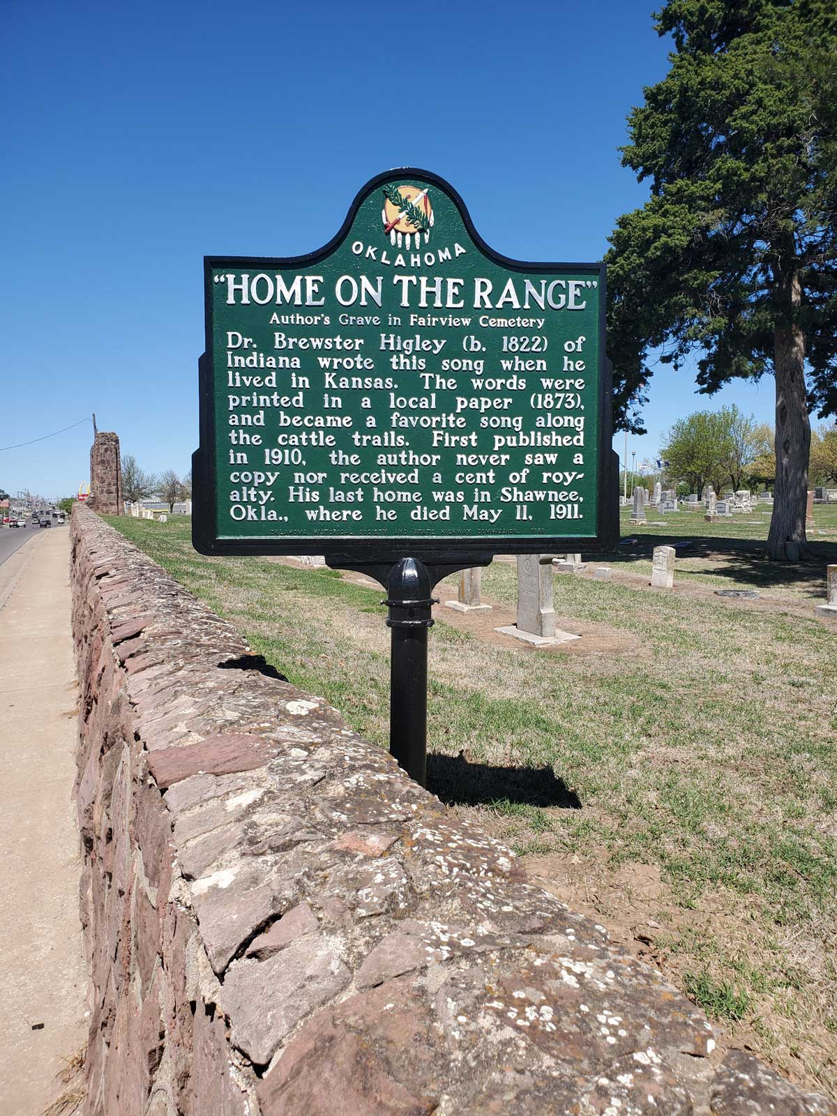
Location: on OK-18 in Fairview Cemetery in Shawnee
Coordinates: 35.343130, -96.911991
Sponsored by: Oklahoma Historical Society and Oklahoma Department of Transportation
Material: Aluminum
Topics: Arts, Social/Cultural, Territorial Period 1861–1907, Early Statehood 1907–1941
Dr. Brewster Higley died in Shawnee in 1911, several years before his song, "Home on the Range," was declared an American frontier ballad. The words to the song were first printed in a newspaper in 1873. Dr. Higley never saw a printed copy of the song or received a penny's royalty.
Location: on grounds of Honey Springs Battlefield Historic Site, Checotah vicinity
Coordinates: 35.530309, -95.486041
Material: Granite
Topics: Military, Ethnic Diversity, Government, American Indians, Territorial Period 1861–1907
Five granite markers commemorate those who fought in the Civil War Battle of Honey Springs on July 17, 1863. Included are markers dedicated to Union soldiers, the Five Tribes, the First Regiment of Kansas Colored Volunteers, Confederate soldiers, and Texas Confederate soldiers. Marker sponsors include the Oklahoma Historical Society, the Intertribal Council of the Five Civilized Tribes, the Community Heritage Recognition Community, and Daughters of the Confederacy.

Location: at intersection of East Maine Street and South Grand Avenue in Enid (DAR)
Coordinates: 36.3954215,-97.8785324
Sponsored by: Daughters of the American Revolution
Material: Granite
Topics: Urban Development, Social/Cultural, Recreational/Service
The solid granite trough was originally located in the public square in downtown Enid and was used through the decades as a place to water thirsty horses and later as the center of a children's wading pool.
Location: at 15 North Washington in Ardmore
Topics: Industry/Business, Recreational/Service, Territorial Period 1861–1907, American Indians
Hotel Wisnor, a fifty-room, three-story hotel built in 1884, was named in honor of Benjamin Wisnor Carter, the prominent Chickasaw Indian for whom Carter County is named. In 1903, the Carter-Booker Building was constructed at this location, providing offices for the Cotton Exchange.
Location: on OK-31 near Blocker
Topics: Ranching, Environmental/Cultural Ecology, Territorial Period 1861–1907
The J.R. Hughes Ranch was founded in 1904 and occupied more than 25,000 acres where up to 4,000 head of cattle grazed. The ranch began when Hughes unloaded 3,000 cattle at Reams Switch in Indian Territory and turned them out into the open range. The ranch is now known as the James M. Collins Wildlife Management Area.
Location: four miles south and one mile west of intersection of OK-6 and 152 south of Elk City
Material: Granite
Topics: Retail, Territorial Period 1861–1907, Early Statehood 1907–1941, Education
The Highway community was founded in 1892. At one time the town contained two general stores, a barber shop, a blacksmith shop, and a grain mill. A new consolidated school building was dedicated in 1922. The school closed in 1957.
Location: on wall of Old Post Chapel at Fort Sill (DAR)
Sponsored by: Daughters of the American Revolution
Topics: American Indians, Military
I-See-O was a famous Kiowa scout who attained the rank of sergeant in the US Army. Many consider him to be the last of the Indian scouts who faithfully served the army on the western frontier.
Location: on US-81 in Memorial Park in Duncan
Material: Aluminum
Topics: Government, Territorial Period 1861–1907, Settlement Patterns
All land descriptions in Oklahoma except the Panhandle are designated from the Indian Meridian and the Base Line. The survey which established the line was made by E. N. Darling from Texas to Kansas in 1870.
Location: at entrance of Owen Park on West Edison Street in Tulsa (DAR)
Sponsored by: Daughters of the American Revolution
Topics: Government, American Indians
This is the spot where the Creek, Cherokee, and Osage national boundaries joined.

Location: northeast of intersection of Logan Road and Washington Avenue in Langston
Coordinates: 35.942161, -97.246934
Material: Granite
Surveyed by E.N. Darling, Texas to Kansas, 1870. East is Iowa Indian Reservation (settled September 22, 1891). West is Unassianged Lands (settled Apr 22, 1889). All farms, town lots, oil wells in Oklahoma east of the Panhandle are designated from Indian Meridian and Base Line. Main road Guthrie to Stillwater early 1890. Monument erected About 1922 on proposed Ozark Trail. Original plaque by Early Day Settlers. Plaque erected 1967. Replacement erected 2013.
Location: on Tenth Street in Chandler (DAR)
Sponsored by: Daughters of the American Revolution
Topics: Water, American Indians, Social/Cultural, Transportation
The site of the first water supply for Chandler was used originally by Plains Indians as a water stop campground. A metal teepee covers the spring.
Location: near OK-7 in the Arbuckle Mountains west of Davis
Topics: Settlement Patterns, Government, American Indians
Initial Point marks the exact location of the intersection of the north-south Indian Meridian and the east-west Base Line. Following the 1866 treaties with the Five Civilized Tribes, who agreed to the survey of their lands, the General Land Office in 1870 directed E. N. Darling to select the Indian Point (near Fort Arbuckle). The two lines he ran represent the basis of all future land descriptions in Oklahoma except the Panhandle. The rough stone pillar that marks Indian Point is on private land.


Location: at Second Street and Harrison Avenue in Guthrie
Coordinates: 35.876901, -97.427370
Sponsored by: Donald W. Reynolds Foundation
Material: Aluminum
Topics: Retail, Territorial Period 1861–1907, Manufacturing
This building housed numerous retail establishments when it was erected in 1890. Barber F.E. Knowlton developed his famous Danderine Hair Tonic here. The building was razed in the 1960s.
-001.jpg)
Location: on Tulsa State Fair Grounds
Material: Granite
Topics: Arts, Petroleum, Urban Development, Folklife, Natural Resources, Early Statehood 1907–1941
The huge Golden Driller honors the founding of the international showcase of the oil industry. During Tulsa's heyday as "Oil capital of the world," the annual exposition drew oil field exhibitors from around the world.
Location: on grounds of Marland Estate, 901 Monument Road, Ponca City
Topics: Government, Petroleum, Natural Resources, Environmental/Cultural Ecology, Early Statehood 1907–1941
Governor Ernest W. Marland helped found the compact in 1935 among the oil and gas producing states. The compact was the beginning of efforts to conserve the nation's oil and gas reserves.
Location: on Mehan Road northeast of Ripley (DAR)
Sponsored by: Daughters of the American Revolution
Topics: Westward Expansion 1803–1861, Arts, Natural Resources
Writer Washington Irving camped here on October 20, 1832, in his tour of the American prairie. In his description of the campground, Irving wrote, "It reminded me of the ruin of some Moorish castle, crowning a height in the midst of a lonely Spanish landscape.
Location: on US-69 at south edge of Savanna
Material: Aluminum
Topics: Urban Development, Recreational/Service, Social/Cultural, Territorial Period 1861–1907
J.E. Wright opened the first permanent dental office in Indian Territory in Savanna in 1885. He was co-founder of the Indian Territory Dental Association.
Location: on SH-31 near Blocker
Topics: Natural Resources, Recreational/Service, Environmental/Cultural Ecology, Ranching, Transportation, Territorial Period 1861–1907
Historically known as the J. R. Hughes Ranch, the James M. Collins Wildlife Management Area occupies over 25,000 acres. At its zenith, 4,000 head of cattle grazed the land enclosed by more than 125 miles of fence. The Hughes Ranch began in 1904 when J. R. Hughes unloaded 3,000 Texas steers at Reams Switch in Indian Territory and drove them onto the open range. The Hughes family accumulated lands near Featherston and developed what became the largest ranch in the region.
Location: on OK-33 at west edge of Thomas
Material: Aluminum
Topics: Religion/Philosophy, Social/Cultural, Agriculture
Abe Eisenhower, uncle to President Dwight D. Eisenhower, started the orphanage in 1901 as a project of the Brethren of Christ Church. The surrounding cropland continues to provide income for missionary efforts of the organization.
Location: two miles southeast of Drumright
Sponsored by: Leonard Shelton
Topics: Petroleum, Industry/Business
The Jackson Barnett #11 oil well was the first oil well in the world to produce one million barrels of oil in a one year period. It is on the National Register of Historic Places.
Location: on county road, three miles west of Cerro Gordo
Topics: Settlement Patterns
The community was named for a pioneer Doan family member who settled the area before statehood.
Location: north side of SH11, 1/2 mile east of the Bird Creek Bridge east of Barnsdall
Material: Aluminum
Topics: American Indians, Indian and Frontier Trade, Natural Resources, Territorial Period 1861–1907
After the Civil War, Bigheart became chief of the Osage. He operated a trading post at Big Heart, now Barnsdall, and led his people to retain all mineral rights to their lands which brought great wealth to the Osage people.
Location: on US-77 between Purcell and Lexington
Topics: Mass Communication, Government
James C. Nance was a member of the Oklahoma legislature and Purcell newspaper publisher.
Location: on US-69 at edge of Salina
Topics: Indian and Frontier Trade, American Indians
The Chouteau family had extensive holdings which included salt works and trading posts. Jean Pierre and his brother, Auguste, from a base in St. Louis, Missouri, traded with Osages in the area.
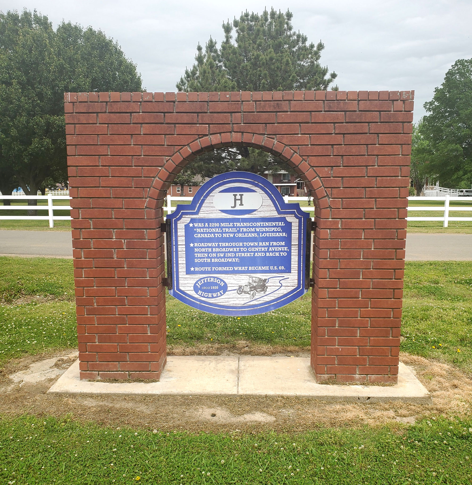
Location: at intersection of N. Broadway St. (BUS-69) and W. North Ave. in Checotah
Coordinates: 35.478463, -95.521519
Sponsored by: Checotah Landmark Preservation Society
Material: Other (Interpretive Panel set in brick arch)
Topics: Transportation, Early Statehood 1907-1941
The Jefferson Highway (circa 1920) was a 2,290-mile transcontinental roadway from Winnipeg, Canada, to New Orleans, Louisiana. The highway through Checotah ran North Broadway to Gentry Avenue, then on Southwest 2nd Street and back to South Broadway. The route formed what became US Highway 69.

Location: on US-281, north of Geary
Material: Aluminum
Topics: Indian and Frontier Trade, American Indians, Ranching, Territorial Period 1861–1907
A pioneer merchant, trader, and explorer, Jesse Chisholm established a trail through western Indian Territory before the Civil War. Texas cattlemen used the trail until the late 1880s to move millions of cattle to northern markets. Chisholm died and was buried near this site in March 1868.

Location: at section 32, 15 north, 10 west
Material: Granite
Topics: American Indians, Indian and Frontier Trade, Ranching
Jesse Chisholm, for whom the Chisholm Trail was named, camped at Left Hand Spring in early March 1868. Becoming ill, probably from food poisoning, he died on March 4 and was buried on a nearby knoll.

Location: On OK-39, two miles east of Asher
Coordinates: 34.985850, -96.887380
Sponsored by: Carrie Boggs and Pottawatomie County Historical Society
Material: Stone
Topics: Westward Expansion 1803–1861, American Indians, American Indian and Frontier Trade
This marker placed by the Pottawatomie County Historical Society Oct. 1938 marks the near site of the Jesse Chisholm Trading Post and Spring of territorial fame.
Location: in Jim Thorpe Municipal Park in Yale
Topics: American Indians, Social/Cultural, Folklife, Territorial Period 1861–1907
In 1912, Jim Thorpe won both the decathlon and pentathlon in the Olympics and was praised for his athletic prowess by the entire world. He played both professional baseball and football and is considered one of the greatest athletes of American sports history.
Location: at 706 East Boston in Yale
Material: Aluminum
Topics: American Indians, Social/Cultural, Folklife, Territorial Period 1861–1907
This was the home of the Thorpe family beginning in 1917.
Location: at 706 East Boston in Yale
Topics: American Indians, Recreational/Service, Social/Cultural, Early Statehood 1907–1941, Industrial Period 1892–1941
James Francis Thorpe, a Sac and Fox, was born as Wa-tho-huck or "bright path." He dominated the 1912 Olympics, winning both the decathlon and pentathlon events. He played Major League baseball and professional football. He was the first president of the National Football League and is a member of Professional Football Hall of Fame. The Associated Press voted him the world's greatest male athlete of the first half of the twentieth century.
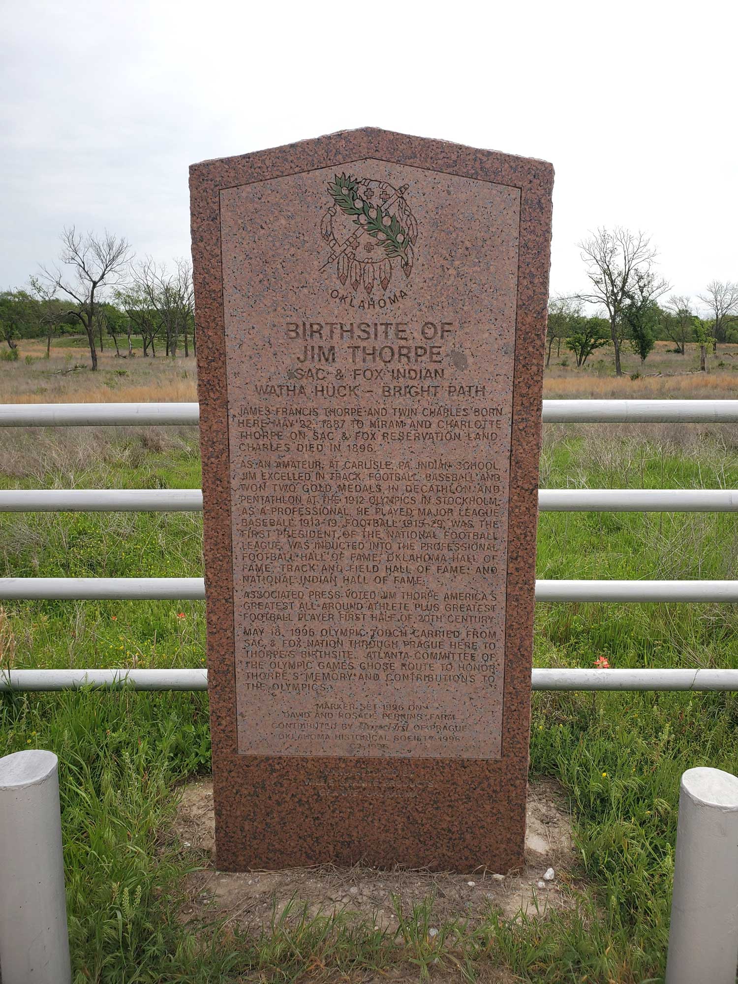
Location: approx. 6 miles southwest of Prague and approx. 5 miles south of US 62 on NS Rd 3510
Coordinates: 35.421941, -96.753523
Sponsored by: BancFirst of Prague and the Oklahoma Historical Society
Material: Granite
Topics: American Indians, Social/Cultural, Recreational/Service, Early Statehood 1907–1941
James Francis Thorpe, a Sac and Fox, was born as Wa-tho-huck or "bright path." He dominated the 1912 Olympics, winning both the decathlon and pentathlon events. He played major league baseball and professional football. He was the first president of the National Football League and is a member of Professional Football Hall of Fame. The Associated Press voted him the world's greatest male athlete of the first half of the twentieth century.
Location: in Big Cedar
Material: Granite
Topics: Government, Social/Cultural, Folklife
This monument, commemorating the visit of President John F. Kennedy to Big Cedar, was erected under the auspices of the Knights of Columbus, who deeded shaft and land to the Oklahoma Historical Society on October 30, 1966.
Location: at intersection of Elm and Jackson Streets in Fort Gibson
Note: Marker reported missing
Topics: American Indians, Government
John Martin, a Cherokee Indian who was the first chief justice of the first supreme court established in the Cherokee Nation, is buried here.
Location: in Rose Hill Cemetery, Oklahoma City
Material: Granite
Topics: Social/Cultural, Government, Territorial Period 1861–1907, Early Statehood 1907–1941
Joseph Thoburn (1866–1941), Oklahoma's pioneer historian, was born in Bellaire, Ohio, and reared and educated in Kansas. Thoburn was secretary of the Oklahoma Commercial Club and the Oklahoma Territorial Board of Agriculture. He was the director of the Oklahoma Historical Society for thirty-eight years and admitted to the Oklahoma Hall of Fame in 1932. He was also active in religious, educational, and civic works.
Location: on US-70 at Daisy Lane in Dickson
Topics: Arts
Joseph Callaway gained international recognition as a director, critic, and Shakespearean actor.
Location: near Douglas Cooper monument at Fort Washita
Material: Granite
Topics: American Indians, Social/Cultural, Territorial Period 1861–1907, Military
Sponsored by the Julia Jackson Chapter of the United Daughters of the Confederacy, the nearby granite marker honors Douglas Hancock Cooper, the first Confederate agent for the Choctaws and Chickasaws and later commander of the Choctaw-Chickasaw Mounted Rifles.

Location: On south Main Street in Broken Arrow
Coordinates: 36.048503, -95.790847
Material: Granite
Topics: Transportation
Construction began on the 24 x 50 foot depot on May 13, 1903. It was of wood set on timber pilings with a red tin roof. It jutted onto Main Street to allow a good view of the town. Grain elevators and cotton gins sprang up south of the tracks with a stockyard to the east. In 1988 the old depot was moved to Discoveryland. (BA. 100 yr. history, pg 63_ Broken Arrow Centennial 2002.
Location: at entrance to Kaw City Museum, 910 Washunga Drive, Kaw City
Topics: Government, Natural Resources, Environmental/Cultural Ecology, Territorial Period 1861–1907, Industrial Period 1841–1892, Urban Development, Land Openings, Petroleum, Social/Cultural, Natural Resources
The "old" town of Kaw City was covered by the waters of Kaw Lake in the 1970s and the new town rebuilt on higher ground nearby. The only commercial building moved was the 1902 train depot which became the home of the Kaw City Museum. Kaw City native Kenneth Brill made a fortune in the oil and gas business and contributed much to preserve Kaw City history.

Location: on OK-99 north of North Canadian River
Note: Marker reported missing
Topics: American Indians, Territorial Period 1861–1907, Settlement Patterns, Urban Development, Social/Cultural
After the land run into the Sac and Fox Reservation on September 22, 1891, the Keokuk Falls town site became an important settlement in Indian Territory. The boomtown boasted two distilleries and many saloons.
Location: three miles north of Talihina at campground (OBHC)
Topics: Religion/Philosophy, Recreational/Service, Industrial Period 1841–1892
The Kiamichi Baptist Assembly campground was established in July 1941.
Location: three miles north of Talihina (OBHC)
Topics: Religion/Philosophy, Recreational/Service, Industrial Period 1841–1892
Commemorates the founding of a campground and the Latimer Baptist Association in July 1941.
Location: in Gracelawn Cemetery in Edmond
Material: Granite
Topics: Mass Communication, Land Openings, Settlement Patterns, Folklife, Government, Territorial Period 1861–1907
Publisher and founder of the Edmond Sun, Milton W. "Kicking Bird" Reynolds was a nationally known newspaperman who promoted opening the Unassigned Lands in the 1880s. He made the Land Run of 1889 by train and is credited as being the first to call Oklahoma "Land of the Fair God." He was a member of Oklahoma's first territorial legislature. He died in 1890.
Location: Oklahoma Historical Society grounds
Material: Granite
Topics: Empire Period 1541–1803, Government, Settlement Patterns
The charter of 1663 granted a large section of land from the east coast to the west coast to eight Lords Proprietors and supporters of Charles II. Much of present-day Oklahoma is included in the proposed boundaries of this charter.


Location: on US-81, present grounds of the post office in Kingfisher
Coordinates: 35.8643008,-97.9328127
Sponsored by: Oklahoma Historical Society and Oklahoma Department of Transportation
Material: Aluminum
Topics: Transportation, Social/Cultural, Territorial Period 1861–1907, Ranching, Land Openings
This was U.S. Land Office site for filing claims at opening of "Old Oklahoma," April 22, 1889; also, at opening of Cheyenne and Arapaho lands on April 19, 1892. J. C. Robberts was first Register and J. V. Admire, first Receiver. First post office, Lisbon, established April 20, 1899; name changed to Kingfisher, July 18, 1889.

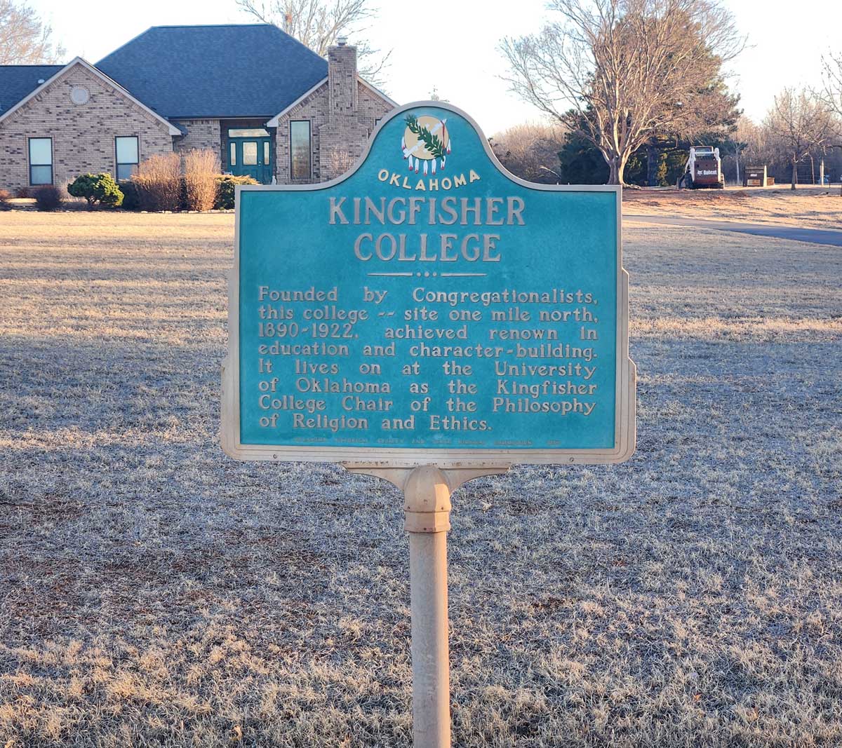
Location: on OK-33 on east side of Kingfisher
Coordinates: 35.856833, -97.906900
Sponsored by: Oklahoma Historical Society and Oklahoma Department of Transportation
Material: Aluminum
Topics: Education, Religion/Philosophy, Territorial Period 1861–1907, Early Statehood 1907–1941
The Congregationalists founded the Kingfisher College in 1890. When the school closed in 1922, its endowment was transferred to the University of Oklahoma to fund the Kingfisher Chair of Religion and Ethics.

Location: on OK-33, one mile west of Kingfisher
Coordinates: 35.860633, -97.941133
Sponsored by: Oklahoma Historical Society and Oklahoma Department of Transportation
Material: Aluminum
Topics: Transportation, Ranching, Urban Development, Social/Cultural, Land Openings, Government, Settlement Patterns
This stage stop on the old Chisholm Trail from 1867 to 1889 and the town were named for King Fisher, owner of the station. See Chisholm Trail.
Location: on US-81 on grounds of Kingfisher post office
Material: Aluminum
Note: Marker may be missing
From a land office at this location, the federal government prescribed rules and regulations governing the opening of the Unassigned Lands in central Oklahoma on April 22, 1889. The office also registered claims for the April 19, 1892, opening of Cheyenne and Arapaho lands.
Location: near John F. Kennedy Monument, Big Cedar
Topics: Social/Cultural, Government, Folklife
Sponsored by the members of the Poteau Knights of Columbus Council, the nearby granite and bronze marker commemorates the site where John F. Kennedy made his only address as President in Oklahoma.

Location: on US-69, 1/4 mile north of Arkansas River bridge
Topics: American Indians, Westward Expansion 1803–1861, Settlement Patterns
Reverend R. M. Loughridge founded this Creek Indian school in 1843 and named it for an ancient Creek town in Alabama.
Location: on Second Street at the entrance to Holiday Inn Express
Topics: Settlement Patterns, Land Openings, Agriculture, Industry/Business, Transportation, Early Statehood 1907–1941
James and Katherine Kunc and son, William, made the run and homesteaded a quarter section on the southwest corner of Second and Sooner on April 22, 1889. In 1923, Everett Bradbury purchased one acre of land on the northeast corner of the homestead and established a campground and filling station. This intersection was the junction of US Highway 66 and US Highway 77 and became known as Bradbury Corner.
Location: on US-62, three miles east of Hollis
Material: Granite
Topics: Education, Early Statehood 1907–1941
The La Casa School was formed in 1925 by consolidating three schools: Mesquite, Star Valley, and Bearden. The first class graduated in 1928. The school closed in 1957.

Location: on US-64 south of Haskell city limits
Material: Aluminum
Topics: Government, Empire Period 1541–1803, American Indians
First peace council and alliance between a European government and Oklahoma Indian tribes occurred here in 1719 when French explorer Bernard de la Harpe explored the area.
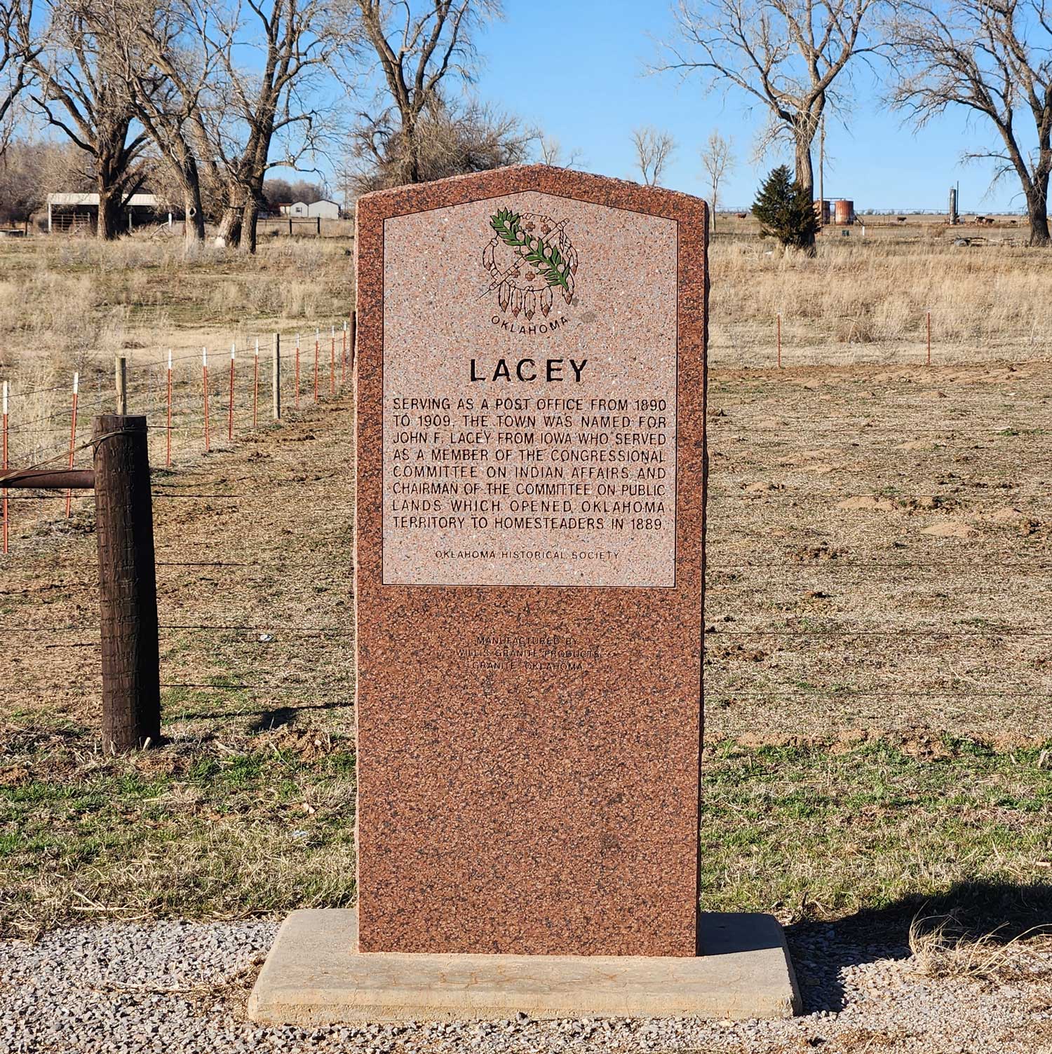
Location: on OK-51, ten miles west of Hennessey
Coordinates: 36.116037, -98.085605
Sponsored by: Oklahoma Historical Society and Oklahoma Department of Transportation
Material: Granite
Topics: Government, Social/Cultural, Land Openings, Settlement Patterns
The town of Lacey was named for Congressman John F. Lacey of Iowa, chairman of the House Public Lands Committee, who crafted much of the legislation that allowed the opening of lands in Oklahoma to public settlement.
Location: on county road, two miles west of OK-6 north of Granite
Material: Granite
Topics: Settlement Patterns, Agriculture, Territorial Period 1861–1907, Education, Religion/Philosophy, Environmental/Cultural Ecology, Government, Transportation
Pioneers settled the Lake Creek area beginning in 1898. The consolidated Lake Creek School served area children until 1957. The community included the oldest church in Greer County, the Lake Creek Baptist Church, founded in 1888.
Location: at entrance to lodge in Lake Murray State Park
Topics: Industry/Business, Recreational/Service, Industrial Period 1841–1892
Lake Murray Lodge was built in 1951 during the administration of Governor Roy Turner.
Location: seven miles north of Gotebo on SH-54
Sponsored by: People of Lake Valley Communmity
Material: Granite
Topics: Education, Territorial Period 1861–1907
The site of Lake Valley School District #4 was located within the original East Bethel School District #15. The site was established during the school term 1892–1893 with approximately thirteen and one-half square miles.

Location: at Second Street and Oklahoma Avenue in Guthrie
Coordinates: 35.877894, -97.426715
Sponsored by: Fogarty Jr. High School
Material: Aluminum
Topics: Land Openings, Settlement Patterns, Government, Territorial Period 1861–1907
On this site stood the federal government's land office where each of the 20,000 persons making the Land Run of 1889 had to appear and file his claim. This was also the site of the first post office in Oklahoma Territory.
Location: 210 N. Wood Dr., Okmulgee OK
Material: Granite
Topics: Ethnic Diversity, Early Statehood 1907–1941, Social/Cultural, Urban Development
The vision for this building became a reality when the city acquired four lots from William Morton in 1920. In 1922 Okmulgee's black citizens secured $25,000 in donations from federated clubs and their own leading citizens to complete the funding to construct the first "colored hospital" to be opened in the state of Oklahoma. Even though the building was completed, the black community had to raise additional funds to equip the hospital and make the building operational. In 1924 a group of black citizens formed the Colored Hospital Association. The hospital was opened in 1924 and housed 18-20 beds with living quarters for a staff of six to seven nurses. The building was estimated to cost $50,000. In 1936 the building was leased for three years to Dr. J. H. Burt.
Important medical services and care were provided at the hospital, but it also served as a symbol of segregation prior to the Civil Rights Movement. When Okmulgee integrated a number of health facilities in 1957 the Okmulgee Colored Hospital was closed.
In 1984 the building was listed in the National Register of Historic Places.

Location: on Langston University campus in Langston
Coordinates: 35.942474, -97.260493
Sponsored by: Oklahoma Historical Society
Material: Other (Interpretive Panel)
Topics: Ethnic Diversity, Land Openings, Settlement Patterns, Urban Development, Education
Langston is one of thirteen All-Black towns, out of more than fifty that once existed, remaining in Oklahoma. While Tullahassee is reportedly the oldest, most were established between 1889 and 1907 as African Americans sought security and control of their own destiny in a segregated world. Most of the towns began to decline in the 1920s and 1930s as rural African Americans faced economic hardships and began to move to urban areas. Langston was organized in 1890 by E. P. McCabe, who also boosted Oklahoma as an All-Black state. It takes its name from John M. Langston, a well-known educator and member of Congress. Langston became home to the Colored Agricultural and Normal University (Langston University) in 1897.

Location: on OK-40 near south edge of Stillwater
Material: Aluminum
Topics: Land Openings, Settlement Patterns, Social/Cultural, Military, Territorial Period 1861–1907
Boomers were followers of David L. Payne, who insisted upon the opening of central Oklahoma to settlement. Near here, 300 armed Boomers made their last stand for settlement of the Oklahoma country when they surrendered to US cavalry troops. The Boomers had built log cabins and dugouts and founded the town of Stillwater on December 12, 1884.
Location: on Hy 177 north of Shawnee and Tecumseh
Note: Presumed missing
Topics: Military, Recreational/Service, Industry/Business, Industrial Period 1841–1892
Leroy Cooper was one of the first seven American astronauts named in 1959. He flew one of the early missions into space aboard Faith 7 in 1963. His 22 orbits around the earth became the longest space flight at that time in history. Cooper died in 2004.
Location: on the grounds of the Oklahoma History Center, 800 Nazih Zuhdi Drive, Oklahoma City
Material: Granite
Topics: Government, Social/Cultural, Industrial Period 1841–1892
For the 1950 US Independence Savings Bond Drive, the government ordered one Liberty Bell replica for each state. Cast in France, this bell was transported around the state on a flatbed truck to promote the sale of savings bonds. It was originally located at the Wiley Post building in Oklahoma City, and was later moved to the Oklahoma History Center grounds.
Location: in community of Lima
Topics: Ethnic Diversity, Territorial Period 1861–1907, Early Statehood 1907–1941, Settlement Patterns, Urban Development, Education
Lima is one of thirteen All-Black towns, out of more than fifty that once existed, remaining in Oklahoma. While Tullahassee is reportedly the oldest, most were established between 1889 and 1907 as African Americans sought security and control of their own destiny in a segregated world. Most of the towns began to decline in the 1920s and 1930s as rural African Americans faced economic hardships and began to move to urban areas. Lima had a post office from 1907 to 1957. It is the site of a Rosenwald School, which was constructed in 1921 with funding from Julius Rosenwald, president of Sears, Roebuck and Company and trustee of the Tuskegee Institute.
Location: at 500 Lake Murray Drive Southeast in Ardmore
Topics: Industry/Business, Transportation, Early Statehood 1907–1941
Locomotive 1108 brought doctors and nurses to Ardmore after the 1915 explosion that leveled most of the town's downtown business district.
Location: at 601 Katy Drive in Altus
Topics: Transportation, Social/Cultural, Mining, Industrial Period 1841–1892
The Russian czar Nicholas II, ordered this steam locomotive for use in World War I. When the Russian regime was overthrown, the Frisco Railroad purchased the locomotive. It was later used in lead and zinc mines in northeast Oklahoma.

Location: on grounds of Pottawatomie County Museum on East Main Street in Shawnee
Coordinates: 35.327583, -96.916033
Sponsored by: Wunagisa Chapter Daughters of the American Revolution
Material: Granite
Topics: Arts, Government, Social/Cultural, Recreational/Service, Folklife
Louise Funk Fluke (1900–1986), designer of the State Flag of Oklahoma, was born in Arkansas and raised in Shawnee. She entered the winning flag design in a statewide contest in 1925 through the Wunagisa Chapter, Daughters of the American Revolution. She is buried at Fairview Cemetery.
Location: on OK-32 east of US-77 junction
Topics: Government, Early Statehood 1907–1941
The cornerstone of the first county courthouse built after statehood was laid on April 29, 1910.

Location: at intersection of OK-74D and Main Street in Lovell
Coordinates: 36.057936, -97.635495
Material: Granite
Topics: Religion/Philosophy, Social/Cultural, Urban Development, Government, Transportation, Settlement Patterns
The Lovell Christian Church was built by area families on this site donated by the J. W. Lovell Family. The first trustees were C. J. Gragg, G. I. Pollard and W. B. Young. The church was chartered in May 1911 and dedicated on July 11, 1911, with 200 in attendance. Pastors were primarily ministerial students from Phillips University Seminary (Enid, OK). The church was closed in 1971. 50-, 60- and 90-year anniversaries of the church were celebrated in 1961, 1971, and 2001. The Town of Lovell was originally named Perth (US Post Office established in May 1889). A nearby hamlet, Standard, merged with Perth in 1902 after a Santa Fe Railroad was built nearby. The Post Office name was changed from Perth to Lovell in February 1906 after James W. Lovell platted sites on his land for town expansion.


Location: in Lovell, at intersection of OK-74D and Main Street
Coordinates: 36.05749, -97.63567
Sponsored by: Lovell Memorial Committee
Material: Granite
Topics: Settlement Patterns, Land Openings, Territorial Period 1861–1907, Early Statehood 1907–1941
Dedicated in honor of homesteaders and other pioneer settlers of this area. In recognition of their faith and courage to explore the unknown and to endure the Great Depression, two world wars, droughts, and untold hardships, and in appreciation of the heritage of joy and thanksgiving they passed on to succeeding generations. Descendants of these pioneer families respectfully reaffirm our ancestors reverence for freedom, family, and commitment to democracy.
Location: on OK-44 near Lugert grain elevator
Frank Lugert, an Austrian immigrant, ran the post office, train depot, and general store in the town he founded after the Kiowa-Comanche-Apache Reservation opened for settlement in 1901. The town thrived until it was destroyed by a tornado in 1912. The original townsite is now covered by the waters of Lake Altus-Lugert.
Location: on the west side of Hwy 44 near the Lugert grain elevator
Sponsored by: Terri Stern
Topics: Ethnic Diversity, Land Openings, Government, Retail, Territorial Period 1861–1907, Early Statehood 1907–1941, Industrial Period 1892–1941
Austrian immigrant Frank Lugert (1868–1958) founded the town of Lugert when the Kiowa-Comanche-Apache Reservation opened for settlement in 1901. Mr. Lugert ran the post office, train depot, and a general store. The town thrived until 1912 when a tornado destroyed it. In 1947 the dam was completed, covering the townsite.
Location: at 214 West Main in Ardmore
Topics: Retail, Territorial Period 1861–1907, Transportation
In 1893, E. B. Luke opened his store that sold everything from victrolas to pianos. He kept six teams of horses and mules to deliver pianos and organs to customers.
Location: at 1307 Southeast Adams Street in Idabel
Topics: Family/Household, Early Statehood 1907–1941, Government
This two-story private home was built in 1912 for federal magistrate George A. Spaulding.
Location: on OK-82 south of Tahlequah, one mile east of the Cherokee-Muskogee County line
Topics: Military, Territorial Period 1861–1907, Indian and Frontier Trade
Named for early-day fur trader Pierre Manard, a member of the Chouteau family, the settlement was the site of a Civil War skirmish on July 27, 1862, in which Federal troops and the Indian Home Guard routed Confederate forces.
Location: on US-77 in Noble just south of Maguire Road
Topics: Military, American Indians, Westward Expansion 1803–1861
Captain Nathan Boone, son of pioneer legend Daniel Boone, led 100 men and officers on an expedition to gather information about the Plains Indians. The 1843 expedition camped near this site.
Location: at 1000 East Grand Avenue, Ponca City (DAR)
Sponsored by: Daughters of the American Revolution
Topics: Family/Household, Early Statehood 1907–1941, Natural Resources, Industry/Business, Government
Plaques at the flagpole and on a bird bath recall the grandeur of the first home built by oilman E. W. Marland in 1916. Before he was elected governor of Oklahoma, Marland founded what became Conoco and at one time controlled 10 percent of the nation's oil production.
Location: at 15863 South County Road 201
The Martha School served the area's children beginning in 1896.
Location: at 1 West Main in Ardmore
Topics: Industry/Business, Social/Cultural, Territorial Period 1861–1907
Built in 1896, the First National Bank originally occupied the first two floors of the Masonic Temple Building with the Masons on the third floor. Later, the Masons used the entire building and converted the third floor into a ballroom that served Ardmore residents for social events for many years.


Location: on US-81 in Memorial Park in Hennessey
Coordinates: 36.111395, -97.899118
Sponsored by: Oklahoma Historical Society and Oklahoma Department of Transportation
Material: Aluminum
Topics: Transportation, Indian and Frontier Trade, Territorial Period 1861–1907, American Indians
Freighter Pat Hennessey's charred body tied to his wagon wheel was found in a smoldering fire near 3 of his drivers, all killed on Jul 6, 1874, in last Indian wars when his train was on way along Chisholm Trail to Kiowa Agency. Grave is 2 blocks west.
Location: north of Washita River, four miles east of Fort Cobb
Topics: Retail, Early Statehood 1907–1941
May Brothers was established in Bartlesville in 1910 in this building by H. M. May and his five sons: Ben, Max, Harry, Paul and Jacob. It is the oldest retail store in Oklahoma operated continuously by the same family.
Location: on county road, three miles north and three miles west of Marietta
Topics: Education, Early Statehood 1907–1941, Industrial Period 1841–1892
This community school served area children from 1930 to 1958. It was created when schools from the Bowles, Eastman, Marsden, and New Hope districts were consolidated.

Location: on OK-59, four miles southwest of Seminole
Topics: Education, American Indians, Early Statehood 1907–1941
Opened in 1891, this school educated Seminole boys until it became coeducational in 1914. The name came from an ancient Seminole war town. The school closed in 1930.
Location: on US-69 near bridge over Middle Boggy Creek
Material: Granite
Topics: Military
On this site lie Confederate soldiers who died in battle, February 13, 1864. The Confederate encampment here at Middle (or Muddy) Boggy Crossing on the Boggy Depot Road was held by Lieutenant Colonel John Jumper, Seminole Battalion. Captain Adam Nail's Company A of First Choctaw and Chickasaw Cavalry and a detachment of the Twentieth Texas Regiment was suddenly attacked by Federal forces; three companies of Fourteenth Kansas Cavalry with Major Charles Willetts in command and a section of howitzers under Captain Solomon Kaufman. The Confederates, though poorly armed, made a firm stand in a kat fight of thirty minutes in which forty-seven of their men were killed and others wounded. Word of Confederate forces riding in from Boggy Depot (1.2 miles southwest) caused a harried retreat of the Federal troops toward Fort Gibson north.
Location: at St. John's Episcopal Church at Tenth and Texas Streets in Woodward (DAR)
Sponsored by: Daughters of the American Revolution
Topics: Military, RD, Territorial Period 1861–1907, Retail, Transportation
Once considered to have been a military chapel at Fort Supply, the building was never located at the fort and actually was constructed sometime after 1888 in Woodward. A local businessman later had the building moved to its present location to accommodate a shorter walking distance for his wife.
Location: on US-70 at chamber of commerce office in Broken Bow
Topics: Transportation, Settlement Patterns, American Indians
Cut from Washington, Arkansas, to Fort Towson in 1831 for removal of Choctaws from Mississippi, the road became known as the "Trail of Tears" after thousands of suffering Indians used it to reach the new land. The road served as a major east-west artery for the Choctaw Nation until early 1900s. Important early settlement along the road were Harris Mill, Eagletown, Lukfata, Wheelock, and Clear Creek. Segments of the road are still visible.
Location: on US-270, one mile west of Fort Supply (DAR)
Sponsored by: Daughters of the American Revolution
Topics: Transportation, Military, Indian and Frontier Trade, Social/Cultural, Territorial Period 1861–190
A military road from Dodge City, Kansas, via Fort Supply, to Fort Elliott, Texas, carried supply wagons and a daily stagecoach through this area from 1874 to 1890.
Location: on US-283, six miles south of Shattuck
A military road from Dodge City, Kansas, via Fort Supply to Fort Elliott, Texas, carried supply wagons and a daily stagecoach through this area from 1874 to 1890.
Location: on OK-15, 1/2 mile east of Gage
See Military Road Crossing from Fort Supply.

Location: on US-259 near US-70 junction in Idabel
Topics: Government, Westward Expansion 1803–1861, Mass Communication, American Indians, Settlement Patterns
In 1821 this was the site of the first judicial proceedings in what would become Oklahoma. In 1824, a post office was established at an unknown site nearby as county seat of Miller County, Arkansas Territory. White settlers were forced out when the area was ceded to the Choctaws by treaty. The courthouse and post office burned in 1828.

Location: at intersection of OK-9 and OK-115, one mile east of Mountain View
Topics: American Indians, Social/Cultural, Territorial Period 1861–1907
Millie Durgan was 18 months old when she was captured by Kiowa Indians in the Elm Creek Raid in north Texas in 1864. The girl was adopted by the Kiowa tribe and later married a Kiowa.
Location: on the Osage Agency grounds in Pawhuska
Material: Granite
Topics: Petroleum, Natural Resources, American Indians, Folklife, Social/Cultural, Territorial Period 1861–1907
The discovery of "black gold" in Oklahoma precipitated one of the greatest rushes in the history of the West. One of the most famous oil discoveries took place on the Osage Reservation in the northeastern portion of Oklahoma. The mineral rights to the lands were sold to the highest bidder at auctions held under a large elm tree in Pawhuska. Because of the tremendous wealth that traded hands beneath its limbs, the tree became known as the "Million Dollar Elm".

Location: in Mineral Wells Park on south edge of Guthrie (DAR)
Coordinates: 35.869066, -97.425895
Sponsored by: Early Day Settlers
Material: Stone
Topics: Water, Social/Cultural, Recreational/Service, Government, Early Statehood 1907–1941
Originally called Island Park, this site received its name from the different waters developed there that reportedly had healing benefits. A huge picnic was held in the park after Oklahoma officially became the 46th state of the Union on November 16, 1907. It also was a favorite camp site for large civic and family groups.
Location: 1/4 mile south of Hwy 10C in Ottawa
Topics: American Indians, Settlement Patterns, Social/Cultural, Government
All that remains of the original 4,000-acre Modoc Reservation is this 4 1/2 acre cemetery, the final resting place of Scarfaced Charley, Shacknasty Jim, James Long, Long George, and other leaders of California's Modoc War. Fought over 100 years ago in lava beds near Tulelake, California, this full-scale military campaign against "Captain Jack" and his band is famous in annals of Indian Wars. Today, the rolls of the vanishing Modoc contain only fifty-two descendants of those who peacefully exiled to the Quapaw Agency as prisoners-of-war in November 1873.
Location: in Fort Gibson (DAR)
Sponsored by: Daughters of the American Revolution
Topics: Military, American Indians, Government, Westward Expansion 1803–1861, Empire Period 1541–1803
A former governor of North Carolina and an Indian agency, Montford Stokes died at Fort Gibson in 1842, the only Revolutionary War soldier buried in Oklahoma.


Location: on OK-156, north of Marland
Coordinates: 36.569482, -97.144809
Sponsored by: 101 Ranch
Material: Stone
Topics: American Indians, Agriculture, Ranching, Territorial Period 1861–1907, Early Statehood 1907–1941
Dedicated in 1927 and constructed by the 101 Ranch, this stone monument is dedicated to Ponca Chief White Eagle. Once the site of an ancient trail marker that served as one of several guideposts for various tribes traveling through the area during seasonal migration and hunting trips. The stone cairn is fourteen feet tall, five feet in diameter, and capped by a 200-pound concrete white eagle. A small cemetery is on site and includes the grave of Black cowboy Bill Pickett.
Location: New Springplace Mission near Oaks
Location: at New Springplace Mission near Oaks
Topics: American Indians, Westward Expansion 1803–1861, Religion/Philosophy, Territorial Period 1861–1907
Established as a Cherokee mission in 1842 by the Moravian Church, the institution was an outgrowth of a similar mission in Georgia, which was begun in 1802. Closed during the Civil War, the mission reopened afterward and continued to operate until 1902, when it was transferred to the Danish Lutheran Church. Only the walled spring and the gravestones of the cemetery, where many of the early missionaries were buried, remain.
Location: on the Santa Fe Trail northwest of Boise
The Mormon Battalion crossed into present-day Oklahoma on September 19, 1846, and camped just north and west of Boise City enroute to Mexico as part of General Kearney's Army during the War with Mexico. When they reached Mexico the war was over. The Army was ordered to form a trail to San Diego. At San Diego they built a courthouse. They were then ordered to Los Angeles, then back to San Diego, where they were discharged.
Location: about thirteen miles southwest of Wilburton, Latimer County, at top of Blue Mountain on the county road, west side from gate to Mountain Station Cemetery
Topics: Transportation, Westward Expansion 1803–1861, American Indians, Mass Communication, Government
Old Ft. Smith-Boggy Depot Road. A stage stand for changing horses and a toll road over this mountain pass were established here in 1866 under Choctaw law. This road was the Butterfield Overland Mail route in 1858–61.
Location: 419 North Elgin Avenue, Tulsa
Topics: Religion/Philosophy
Mt. Zion Baptist Church was organized in 1909 in a one-room frame school building located in the 300 block of North Hartford under the Revered Sandy Lyons. Church Founders included Mr. Aaron Ellis, Mrs. Kate Bell Baldridge, Reverend Alexander Brown, Mrs. Georgia Brown, Mrs. Cornelia Dallas, Mrs. Mary A. Grayson, Mrs. Hannah Hale, Mr. Jim Hale, Mrs. Ella Bell Johnson, Mrs. Caroline Lollis, Mrs. Ella Suggs, Mrs. Ida Rector, Mrs. Jeanette E. Webb and Mrs. Nellie Brown Wharton. Soon after Reverend R.A. Whitaker assumed the pulpit at Mt. Zion, the congregation was forced to move from the school building with only three days notice. Hardships, discouragement and disappointment would not deter the congregation and a permanent church home was erected at 419 North Elgin.The first service was held in the new $92,000 church on April 4, 1921. Nearly one month later, the imposing structure of Mount Zion was reduced to ashes during the Tulsa Race Riot on June 1, 1921. It took twenty-one years, until November 23, 1942, for the original mortgage of $50,000 to be retired. Reverend J. H. Dotson immediately started a Building Fund for a new church. W. S. and J. C. Latimer were architects and members of Mount Zion. Graduating from Booker T. Washington's famed Tuskegee Institute, the two brothers completed the drawings and plans for the new church. Bit by bit, Mt. Zion's members paid for rebuilding the basement of the old church and a new church. On Sunday, October 21, 1952, dedication services were held in "The Church That Faith Built." Nearly one year later, Rev. Dotson's health began to fail and the Reverend G. Calvin McCutchen accepted the leadership of Mt. Zion. Dr. McCutchen, serving longer than any other pastor, led the church in paying off the mortgage of the church. Under his leadership numerous improvements have been made including a nursery, the J. H. Dotson Memorial Scholarship Fund was established for Mt. Zion college students, and the addition of a multi-purpose facility known as the Family Life Center. The Center was renamed to the G. Calvin McCutchen Sr. Family Life Center in honor of Dr. McCutchen in 1998.

Location: on US-77 in Mulhall
Coordinates: 36.065050, -97.406950
Material: Aluminum
Topics: Government, Territorial Period 1861–1907, Folklife, Ranching, Arts
The post office of Alfred was established here in 1889. The town name was changed the following year to honor Zack Mulhall, an area rancher who also started his own Wild West Show.
Location: two miles south of Lindsay on SH-76 in Erin Springs
Topics: Territorial Period 1861–1907, Family/Household, Social/Cultural, Transportation, Agriculture
Constructed by Frank Murray, who had settled in Indian Territory in the early 1870s, the home became one of the most imposing mansions in the region. When Murray first arrived in the area there was only a small one-room shack on the bank of the Washita River, which served as a stage station, and the four-room log cabin. However, Murray soon acquired vast holdings (one field alone was three miles wide and five miles long) and built the mansion for his growing family. Occupying a prominent position on a hill, the home was furnished with all the luxuries of the period and soon became the social center of the region.
Location: at 110 North Hightower, Altus
Topics: Education, Territorial Period 1861–1907, Social/Cultural
Illustrating the colorful past of the western portion of Oklahoma, this museum contains many interesting exhibits portraying the early homesteaders of the region.
Location: on east side of Blue River two miles southwest of Kenefic
Topics: Transportation, Government, Social/Cultural
Nail's Crossing was a stage stand of the Butterfield Overland Mail Route. See Fisher's Station.

Location: on US-64, one mile west of Camp Houston
Coordinates: 36.81231, -99.12906
Sponsored by: Oklahoma Historical Society and State Highway Commission (ODOT)
Material: Aluminum
Note: Marker reported missing
Topics: Military, Westward Expansion 1803–1861, Government, Settlement Patterns
The son of frontiersman Daniel Boone, Nathan Boone, led an expedition to Indian Territory and through this area in 1843.

Location: on US-64, four miles south of Pryor
Topics: Military, Social/Cultural, Indian and Frontier Trade, Ranching
Born in Virginia about 1783, Nathaniel Pryor was related to family of Jefferson Davis and a member of the Lewis and Clark Expedition of 1803. He re-entered the army in 1813 as a 1st Lieutenant and discharged as Captain in 1815. Pryor entered into Indian trade at Three Forks on the Verdigris and soon became one of the most noted figures of early Oklahoma history. He was the first to bring fine Kentucky horses to Oklahoma.

Location: on OK-1 northeast of Fitzhugh
Topics: Transportation, Westward Expansion 1803–1861, Military, Environmental/Cultural Ecology
A famous landmark on the California Road through Oklahoma, the high hill was shown on the map made by Captain Randolph Marcy in 1849. A major reference point on several surveys, the site became a triangulation station for the US Coast and Geodetic Survey.
Material: Granite
Topics: Education

Location: on OK-412A, three miles north of Oaks
Material: Aluminum
Topics: Westward Expansion 1803–1861, Religion/Philosophy, Social/Cultural, American Indians
Established by the Moravian Church in 1842, the old mission was closed during the Civil War after missionary James Ward was ambushed and killed. Prominent Cherokee families such as Adair, Fields, Ridge, Vann, and Watie attended the mission.
Location: in downtown pocket parks in Newkirk
Topics: Land Openings, Settlement Patterns, Petroleum, Urban Development, Ethnic Diversity, Recreational/Service
Enameled historical markers with photographs commemorate the Cherokee Outlet, Cherokee allotments, the Oil Boom, the Fire of 1901, Newkirk Country Club, Kay County Fair, Newkirk African-Americans, and the history of Newkirk.
Material: Granite
Location: on OK-23, eight miles south of Elmwood
See Beaver County
Location: on OK-3, six miles east of Slapout
See Beaver County
Location: at Panhandle State College in Goodwell
Topics: Territorial Period 1861–1907, Government, Settlement Patterns
Cimarron Territory, or No Man's Land, has a unique history. For a period of time the region was not attached to any state or territory, and one attempt was made to have the area admitted as a separate territory. This museum illustrates the vivid history of the early pioneers of the Oklahoma Panhandle and the High Plains region.
Location: at 128 West Main in Ardmore
Topics: Petroleum, Retail, Territorial Period 1861–1907
Noble Brothers Hardware moved to this location in 1902 from East Main Street. One of the brothers, Sam, was the father of Lloyd Noble, who established the Noble Drilling Company, Samedan Oil Company, and the Samuel Roberts Noble Foundation.
Location: across from Noble Foundation campus in Ardmore
Topics: Agriculture, Government, Family/Household, Early Statehood 1907–1941
The two-story Noble farmhouse was built in 1922 on land originally allotted by the Dawes Commission.
Location: at 2610 Noble Parkway in Ardmore
Topics: Recreational/Service, Industrial Period 1841–1892
Dedicated in 1952, the core of this building remains the oldest operational building on the campus of the Noble Foundation.
Location: on Highway 92, Norge, where the 98th meridian intersects the highway
Topics: American Indians, Urban Development, Ethnic Diversity
Norge, formerly Allie, is located on the 98th meridian, separating the old Chickasaw Nation to the east and the Kiowa, Comanch,e and Apache Reserve to the west. The town received its name from a Norwegian settlement in the area. Situated on a high plain not far from the Keechi Hills, Norge is four miles southwest of Chickasha.
Location: on US-77, 1/2 mile north of intersection with OK-9
Topics: Government, Transportation, Settlement Patterns
This is the camp site of Abner Norman, a member of an 1873 survey party in Indian Territory. Members of his party burned "Norman's Camp" into a large elm at the site. The Norman Station was on the Santa Fe Railroad (1886–1889) and later the town of Norman took his name.

Location: at the intersection of Elm and Main Streets in Eufaula
Coordinates: 35.290390, -95.582318
Sponsored by: City of Eufaula and the Oklahoma Historical Society
Material: Aluminum
Note: Marker is currently missing
Topics: American Indians, Military, Westward Expansion 1803–1861
Important center of Texas Road in Creek Nation, from 1836. Post office established at Micco, 1853. Albert Pike secured treaties for Confederate States, signed here, 1861, by Choctaw, Chickasaw, and Creek Nations., Asbury School approved by Creek Council and supervised by Methodist Board established near here, 1848.

Location: in City Park in Carrier (DAR)
Coordinates: 36.4771082,-98.0223918
Sponsored by: Daughters of the American Revolution and Carrier Community Association, 1968
Material: Granite
Topics: Education, Religion/Philosophy, Territorial Period 1861–1907
Northwestern Academy opened in 1898 under the auspices of the Congregational Home Missionary Society of Boston, Massachusetts. A three-story building was the prominent structure of the school that was an important educational and religious center for twelve years.

Location: on OK-56, nine miles west of Okmulgee
Material: Aluminum
Topics: Education, Civil Rights, Government, Territorial Period 1861–1907
Through the efforts of educator Alice Robertson, who also served as Oklahoma's only female member of Congress, the mission was established by the Presbyterian Board and the Creek Nation in 1882. Robertson also founded Henry Kendall College which became the University of Tulsa.

Location: at South 2nd Street and West Harrison Avenue in Guthrie
Coordinates: 35.877367, -97.427667
Sponsored by: Donald W. Reynolds Foundation
Material: Aluminum
Topics: Ethnic Diversity, Government, and Territorial Period 1861–1907
Oklahoma–an all black state with a black governor–was the dream of E. P. McCabe, lawyer, farmer, and Republican activist. McCabe vigorously promoted black settlement and assumed role as spokesman for black people in Washington with President Benjamin Harrison. As a candidate for Territorial Governor, he was quoted in the St. Louis Globe - Democrat: Should I become governor, I promise to rule fairly and fearlessly." McCabe became Logan County treasurer by appointment of Gov. Steele in 1890. He served as secretary of the Territorial Legislature in 1890. and was deputy auditor of the Territory from 1897 to 1907. He was chiefly responsible for the founding of Langston and helped in the location and establishment of Langston University.
Location: in Municipal Plaza in downtown Tulsa
Material: Granite
Tulsa has long been known as the Oil Capital of the World and the City That Oil Built. The rise of Tulsa to a place of preeminence in the petroleum industry began on June 25, 1901, when a well was brought in at Red Fork across the Arkansas River to the southwest. Tulsa leaders caused a bridge to be built between the two points and national publicity focused attention on Tulsa as a center of a new oil region. "When a major oil strike took place at the nearby Glenn Pool on Nov. 22, 1905, the production of oil in the area became so great that the term "Oil Capital of the World" was universally applied to Tulsa. Other fields were discovered and developed in adjacent areas to a point where, for a time, it was the largest oil producing center on earth. Tulsa remained in the forefront of exploration and development, financing, equipment manufacturing and provided skills and executive direction for a growing worldwide industry–hence it continued to hold the title: Oil Capital of the World.
Location: at intersection of Adams and Harrison in Cushing
Material: Granite
Topics: Petroleum, Natural Resources, Industry/Business, Urban Development, Government, Mass Communication
In March 1912, Tom Slick and C. B. Shafer discovered oil nearby. The Cushing field became one of history's greatest oil finds. For eight years, it led the nation in oil production. The oil discovery turned Cushing into a boomtown. The post office of Cushing was established November 10, 1891. The town was named for Marshall Cushing, private secretary to Postmaster General John Wanamaker. In 1919, the Cushing-Drumright area accounted for 17 percent of the nation's oil production.
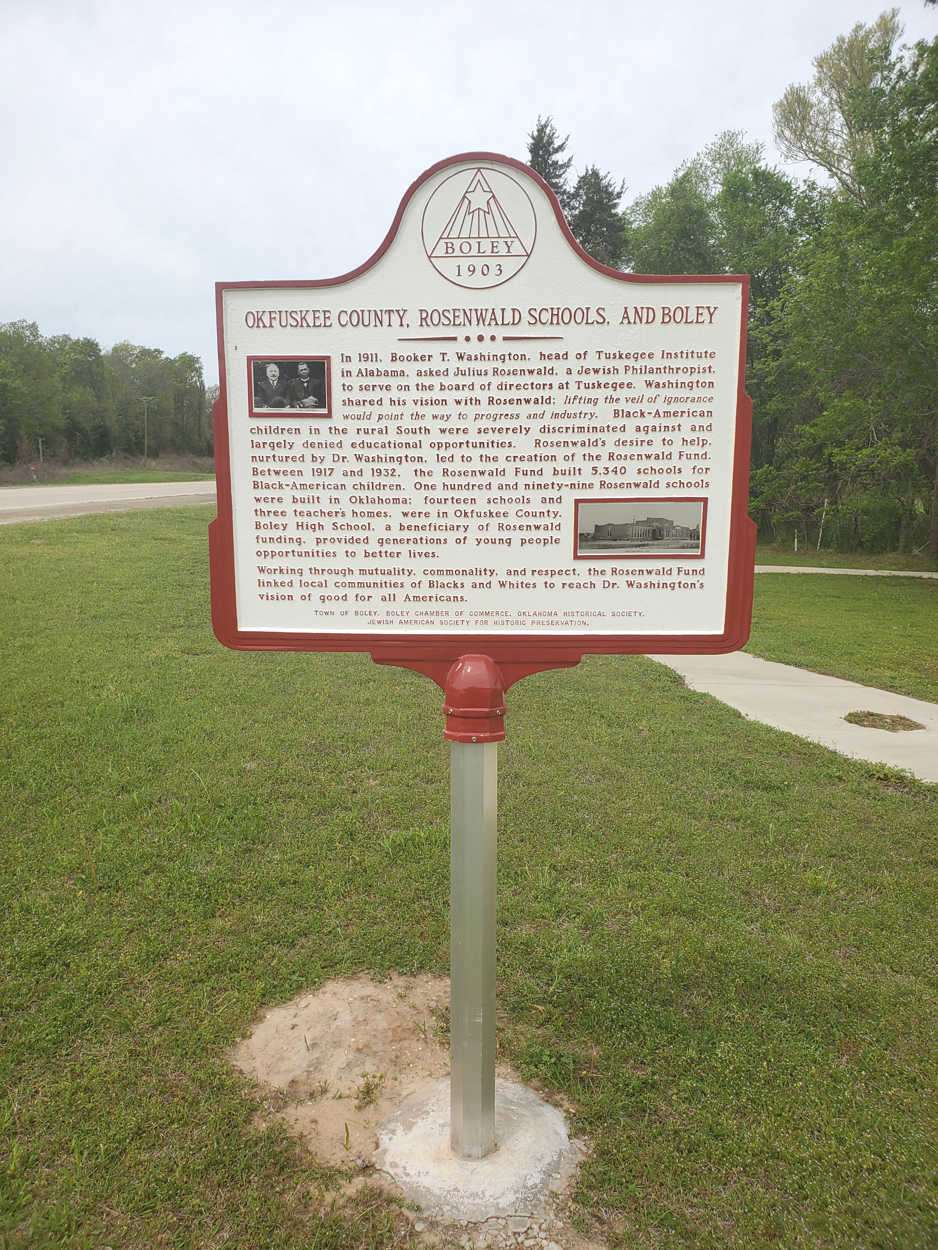
Location: on US-62 in Boley
Coordinates: 35.488227, -96.484178
Sponsored by: Jewish American Society for Historic Preservation/Town of Boley
Material: Aluminum
Topics: Education, Ethnic Diversity, Religion/Philosophy, Early Statehood 1907–1941
In 1911, Booker T. Washington, head of Tuskegee Institute in Alabama, asked Julius Rosenwald, a Jewish Philanthropist, to serve on the board of directors at Tuskegee. Rosenwald's desire to help, nurtured by Dr. Washington, led to the creation of the Rosenwald Fund. Between 1917 and 1932, the Rosenwald Fund built 5,340 schools for Black-American children. One hundred and ninety-nine Rosenwald schools were built in Oklahoma: fourteen schools and three teacher's homes were in Okfuskee County. Boley High School, a beneficiary of Rosenwald funding, provided generations of young people opportunities to better lives.

Location: on South Main Street at south edge of Stillwater
Material: Aluminum
Topics: Education, Territorial Period 1861–1907, Government
The college, now Oklahoma State University, was established December 25, 1890, by the Oklahoma territorial legislature. The prairie was broken for establishment of an experimental farm in 1891.
Location: on grounds of Top of Oklahoma Historical Museum, 303 South Main Street, Blackwell
Topics: Education, Religion/Philosophy, Territorial Period 1861–1907, Early Statehood 1907–1941
The Oklahoma Baptist College was founded in 1899 by the Oklahoma Baptist Convention. The school opened in 1901 and closed in 1913. Top enrollment was 208 in 1911.
Location: in downtown Blackwell (OBHC)
Topics: Education, Religion/Philosophy
The college was a forerunner of Oklahoma Baptist University in Shawnee.

Location: at Division Street and Oklahoma Avenue in Guthrie
Coordinates: 35.878112, -97.425190
Sponsored by: Donald W. Reynolds Foundation
Material: Aluminum
Topics: Government, Territorial Period 1861–1907, Transportation
Completed in 1901, this imposing structure was leased to Oklahoma Territory for office space for the final four territorial governors. A basement stable for horses and carriages was the forerunner of today's parking garages.
Location: at 212 Northwest 15th Street in Oklahoma City (DAR)
Sponsored by: Daughters of the American Revolution
Topics: Recreational/Service, Social/Cultural, Folklife
The Oklahoma City Chapter of the Daughters of the American Revolution was organized in 1904 in the home of Mrs. Robert Carpenter.

Location: near the intersection of Southeast 59th and Bryant
Material: Granite
Topics: Petroleum, Natural Resources, Industry/Business, Early Statehood 1907–1941
On December 4, 1928, the Oklahoma City No. 1 blew, opening Oklahoma's most productive oil and gas field and the sixth largest in the nation. It was drilled by the Indian Territory Illuminating Oil Company, a subsidiary of Cities Service Oil Company and the Foster Petroleum Company. The well was deeded to the State of Oklahoma as a historic site after producing over a million barrels of oil.
Location: northeast corner of the Flag Plaza at State Capitol
Material: Granite
Topics: Petroleum, Natural Resources, Industry/Business, Early Statehood 1907–1941
The discovery of the famous Oklahoma City Oil Field was made by H. V. Foster, president of the Indian Territory Illuminating Oil Company, on December 4, 1928, when Oklahoma City No. 1 began production. Located at Southeast 57th Street and Indian Territory Illuminating Oil Company Boulevard, this well marked the beginning of a great rush for "black gold" in the area. The site is now under the control of the Oklahoma Historical Society.
Location: at Oklahoma City Zoo, NE 50th and Eastern in Oklahoma City
Material: Granite
Topics: Recreational/Service, Social/Cultural, Territorial Period 1861–1907
First in the southwest, the Oklahoma City Zoo was established in Wheeler Park in 1904. It was destroyed by the flood of 1923. It was then moved to Lincoln Park.

Location: at Second Street and Harrison Avenue in Guthrie
Coordinates: 35.876806, -97.427681
Sponsored by: Donald W. Reynolds Foundation
Material: Aluminum
Topics: Mass Communication, Territorial Period 1861–1907
This building, completed in 1902, housed Oklahoma Territory's first newspaper and the largest printing plant west of the Mississippi River. In 1975, the building was given to the Oklahoma Historical Society.
Location: across the street from Johnston County Courthouse
Sponsored by: Johnston County Historical Society
Topics: Agriculture, Social/Cultural, Territorial Period 1861–1907
Struggling farmers united to form Farmers Union at Point, Texas in 1902. Spreading into the Twin Territories, William H. "Alfalfa Bill" Murray helped establish the Indiahoma Farmers' Educational and Co-Operative Union of America.

Location: on grounds of county courthouse at Kingfisher
Coordinates: 35.860717, -97.932500
Sponsored by: Oklahoma Historical Society and Oklahoma Department of Transportation
Material: Aluminum
Topics: Mass Communication, Social/Cultural, Territorial Period 1861–1907
The Oklahoma Press Association founded the Oklahoma Historical Society (OHS) at its convention in Kingfisher on May 27, 1893. The purpose of the new organization was to preserve files on all publications of Oklahoma and Indian territories and documents relating to the history of the region. The OHS headquarters remained in Kingfisher until 1895 when it was moved to Norman. The OHS moved to Oklahoma City in 1901.
Location: at 800 Nazih Zudhi Drive, Oklahoma City
Topics: Recreational/Service, Social/Cultural, Early Statehood 1907–1941, Government
Containing one of the finer collections of Indian artifacts in the United States, this museum is the headquarters of the Oklahoma Historical Society. It portrays all aspects of Oklahoma's heritage, from its prehistoric Indian culture exhibits to its "Oklahoma in Space" display.
Location: on Oklahoma State University campus in Stillwater
Topics: Government, Social/Cultural, Recreational/Service
The Oklahoma Museum of Higher Education is housed in Old Central, built in 1894, the first permanent building on the OSU campus. It is the nation's only museum devoted to a state's higher education history.
Location: at 402 East Oklahoma Street in Guthrie
Material: Other (highway sign)
Note: Missing
Topics: Government, Social/Cultural, Territorial Period 1861–1907, Early Statehood 1907–1941
Portraying the vast panorama of the heritage of Oklahoma Territory, the museum is adjacent to the oldest Carnegie Library in the state. It was on this location that the last territorial governor, Frank Frantz, and the first state governor, Charles N. Haskell, were inaugurated. The structure is one of the best examples of territorial-era architecture


Location: on US-77 just south of Kansas line, Kay County
Material: Aluminum
Topics: Settlement Patterns, American Indians, Government, Land Openings, Westward Expansion 1803–1861, Territorial Period 1861–1907
Land in this area was granted to Cherokee Indians by the US in 1828. It opened to white settlement in 1893. The Kaw Indian Tribal Reservation is located five miles east. There was located the land allotment of the Honorable Charles Curtis, Kaw Indian, Vice President of the United States, 1928–32.

Location: on US-177 west of Braman
Topics: Settlement Patterns, Land Openings, Mass Communication, Military, Territorial Period 1861–1907
Captain David L. Payne published the first newspaper in the Cherokee Outlet, the Oklahoma War Chief, on June 14, 1884, in a printing plant in a tent in this area. The printing office was burned by federal troops two months later.
Location: on US-69, 1/4 mile north of Arkansas River bridge
Topics: Religion/Philosophy, Westward Expansion 1803–1861
A Baptist congregation was established here in 1832.
Location: at 2001 South Mississippi Avenue in Atoka
Material: Aluminum
St. Patrick's Church was built in 1872. Father Isidore Robot was the first resident priest and the first Prefect Apostolic of Indian Territory. Robot later founded Sacred Heart Mission in the Potawatomi lands east of present-day Asher.
Location: on the south bank of the Caney River in Johnstone Park, Bartlesville
Material: Aluminum
Topics: Petroleum, Territorial Period 1861–1907, Natural Resources, American Indians
Nellie Johnstone No. 1, the first commercial oil well in Indian Territory, was completed on April 15, 1897, by the Cudahy Oil Company on the south bank of Caney River. The site is 3.1 milies northwest of this marker.
Location: at Healdton Oil Museum
Topics: Petroleum, Government
Healdtown was the first oilfield regulated by the Oklahoma Corporation Commission.

Location: four miles south of Nowata on US-169 south of County Road 30 south of Nowata
Coordinates: 36.583610, -95.670688
Material: Granite
Topics: Early Statehood 1907–1941, Petroleum, Industry/Business, Natural Resources, Water
In May of 1931, Bert Collins first used injection of water into an oil reservoir to increase recovery, a process that became known as water flooding. Billions of barrels of crude oil have been recovered from world oil reserves by water flooding.
Topics: Petroleum, Territorial Period 1861–1907, American Indians, Land Openings
On July 2, 1904, the Lowery #1 came in just south of Cleveland, opening the Cleveland Sand and creating Oklahoma's first oil boom town. Here also was Jordan's Fort, built in 1886 by Colonel J. W. Jordan, Cherokee agent and deputy US marshal, to keep Boomers out of the Cherokee Outlet.
Location: the Turner Falls Scenic Turnout on Highway 77
Coordinates: 34.427285, -97.145737
Sponsored by: Oklahoma-Kansas Oil and Gas Association
Material: Granite
Topics: Environmental/Cultural Ecology
Oklahoma is the birthplace of the reflection seismic technique of oil exploration. This geophysical method records reflected seismic waves as they travel through the earth, helping to find oil-bearing formations. It has been responsible for the discovery of many of the world's largest oil and gas fields, containing billions of barrels of oil and trillions of cubic feet of natural gas. Pioneering research and development was led by Dr. J. C. Karcher, an Oklahoma physicist. The Arbuckle Mountains of Oklahoma were selected for a pilot survey of the technique and equipment because an entire geologic section from the basal permain to the basement mass of granite is exposed here. This survey followed limited testing in June 1921 in the outskirts of Oklahoma City. Verification and confirmation testing was conducted in the Arbuckles beginning July 4, 1921, by Dr. Karcher and Dr. W. P. Haseman, Dr. D. W. O'Hern, and Dr. Irving Perrine, of the University of Oklahoma. Results were promising. The world's first reflection seismograph geological section was measured on August 9, 1921, along Vines Branch a few miles north of Dougherty near here. The reflection technique has become the major method of energy exploration throughout the world. By 1983 more than 80 percent of the members of the Society of Exploration Geophysicists in 112 countries were involved in reflection seismography.

Location: on west side of Boggy Depot State Park
Material: Aluminum
Topics: Transportation
Boggy Depot was a stop on the Butterfield Overland Mail Route. See Boggy Station.

Location: on US-54, 4 1/2 miles northeast of Optima
Material: Aluminum
Topics: Retail, Urban Development, Government, Settlement Patterns, Territorial Period 1861–1907
The town of Old Buffalo was an important business and social center of "Cimarron Territory," now the Oklahoma Panhandle. The first post office in No Man's Land was established here on March 8, 1888.
Location: on OK-51, 1/2 mile west of Canton
Topics: Territorial Period 1861–1907, Government, Military
The road to Fort Cantonment crossed the North Canadian River in this area.

Location: on US H66, in the roadside park, one mile south of Sayre
Topics: Empire Period 1541–1803, Settlement Patterns, Government
Greer County was named and governed as part of Texas from 1860 until 1896 when a US Supreme Court decision made it part of Oklahoma Territory. This county area was claimed by fourteen different governments from 1669 to Oklahoma statehood in 1907; since then it has been divided into three counties and the south part of Beckham County.
Location: on courthouse grounds in Mangum
Material: Granite
Topics: Government, Territorial Period 1861–1907
The North Fork of the Red River was originally the northern boundary of Spanish territory after the Louisiana Purchase of 1803. The area between the North Fork and the main stream of the Red River became Greer County, Texas. However, in 1896, the US Supreme Court ruled that the main branch of the river was the northern boundary of Texas and Old Greer County became part of Oklahoma Territory.
Location: on OK-3 on west edge of Hardesty
Material: Granite
Topics: Indian and Frontier Trade, Ranching, Territorial Period 1861–1907, Transportation, Retail, Settlement Patterns
Old Hardesty was a trading post established in No Man's Land in 1886. It was named for Colonel Jack Hardesty, a local prominent rancher. Old Hardesty flourished while trail herds crossed the area but faded away when the Rock Island Railroad bypassed the community.

Location: at junction of OK-82 and OK-85, two miles west of Ketchum
Topics: Transportation, Military
The army built a system of roads in Indian Territory between forts. Near this marker traces of the road from Fort Gibson to Fort Leavenworth, Kansas, can be seen.

Location: on Old US-8, six miles south of Duncan
Topics: Military, Westward Expansion 1803–1861, Transportation
The trail of Captain Randolph Marcy and the Dragoon Expeditions of the 1830s crossed Beaver Creek at the Rock Creek Crossing in southwestern Stephens County.
Location: on OK-115, 1 1/2 miles north of Mountain View
Topics: Government, Settlement Patterns, Territorial Period 1861–1907, Urban Development
Because of an error in the original survey, Mountain View was established in Washita County in 1899. When the error was discovered, the town was moved two miles southwest into Kiowa County because the legal proceedings to approve the first site were invalid.
Location: at site of old chapel at Fort Sill (DAR)
Sponsored by: Daughters of the American Revolution
Topics: Military, Religion/Philosophy, Territorial Period 1861–1907
Built in 1870 by the 10th US Cavalry, Old Post Chapel served the religious needs of thousands of soldiers who passed through Fort Sill. Two markers preserve the history of the chapel which is the second-oldest house of worship still in use in Oklahoma.
Location: at the Fort Sill Museum (DAR)
Sponsored by: Daughters of the American Revolution
Topics: Tn, Military, American Indians, Territorial Period 1861–1907, Ethnic Diversity
Known originally as the Quartermaster Corral, this structure, which replaced an earlier wooden corral, is located southeast of the original post quadrangle near Key Gate. The 10th Cavalry constructed the corral in 1870 to hold the horses, oxen, and mules used by the quartermaster for transport of men and supplies and for jobs such as road building. After 1875 the army used the corral for temporary incarceration of Plains Indians. In the 1880s, as boomers tried to enter and settle in the Indian Territory, the military rounded up and held the illegal settlers in the corral until the party was large enough to warrant military escort out of the area.
Location: on county road seven miles west and one mile north of exit 42 on I-35
During the settlement of Oklahoma, early travelers used this water. Later residents used the water for medicinal, drinking, and household needs.

Location: on US-54 at Texas border near Texhoma
Topics: Westward Expansion 1803–1861, Government, Settlement Patterns, Territorial Period 1861–1907
Following admission to the Union in 1846, the state of Texas, as a slave state, ceded the "Public Land Strip" to the United States to comply with the Missouri Compromise of 1850, which forbade slavery north of 36° 30'. The area remained unorganized but was promoted as Cimarron Territory in the 1880s with some attempts to establish a government. No Man's Land became part of Oklahoma Territory on May 2, 1890.
Location: east site of SH-48, north the 48/51 junction at the turnoff into old Mannford Ramp Park
Topics: Settlement Patterns, Transportation, American Indians
The original townsite of Mannford began 1/4 mile east of the creek headrights of Tom and Hazel Mann. The town was named for Mann's Ford across the Cimarron River in 1895. G. M. Evans leased this ninety acres and surrounding land. The Arkansas Valley and Western Railway (AV&W RR/Frisco) came in 1902, and a post office was established on April 11, 1903. Hall C. Miller bought the ninety acres for the townsite on February 21, 1906. The townsite was relocated in 1962–63 due to the Keystone Dam.

Location: at front entrance to First National Bank, 100 West Main, Pawhuska (DAR)
Sponsored by: Daughters of the American Revolution
Topics: American Indians, Government, Territorial Period 1861–1907
The first Osage Indian Agency, a hand-cut stone building, was erected on this site by the Department of the Interior in 1873 to handle relations between the Osage and the federal government.
Location: on Grandview Avenue in Pawhuska
Material: Aluminum
Topics: American Indians, Government, Natural Resources, Petroleum, Folklife, Social/Cultural, Territorial Period 1861–1907
The Osage agency was established in 1872 to oversee the federal government's relationship with the Osage. Congress allowed the Osage to retain ownership of minerals in their reservation lands. When oil was discovered in the area, the allotted Osage became the richest Indian tribe in American history. On the grounds is an elm tree under which many early-day oil deals were made. The tree is called the "million-dollar elm.
Location: east of Pawhuska on Lookout Mountain
Topics: American Indians, Government, Territorial Period 1861–1907, Industrial Period 1841–1892
Fred Lookout was the last hereditary chief of the Osage. After being educated in the East, he returned to the Osage Nation in 1884. He served as the leader of his people longer than anyone. He died in 1949 at the age of ninety-eight. His wife, Julia, was a descendant of Chief Pawhuska.
Location: at 700 Lynn Avenue, Pawhuska
Topics: American Indians
The vivid history of the Osage Nation and the surrounding region is recorded in this museum. It preserves intact the heritage of the only Indian reservation to be included within the boundaries of Oklahoma.
Location: on US-60 between Pawhuska and Bartlesville
Topics: American Indians, Natural Resources, Environmental/Cultural Ecology, Ranching
First settled by the Osage Indians in 1796, the area is now part of the Tallgrass Prairie Preserve, a protected remnant of the original North American prairie, a 500-mile wide stretch of land in the central part of the United States that extended from Canada to the Gulf of Mexico. The tallgrass prairie exists today only in those areas which are not tillable or have soils not conducive to farming. Rich grasses in the prairie have sustained cattle-grazing operations since the 1880s.
Location: on US-60 northeast of Pawhuska
Topics: Government, Recreational/Service, Social/Cultural, Early Statehood 1907–1941, Natural Resources
The Osage Hills State Park, built by Civilian Conservation Corps Company 895 from 1936 to 1939, is centrally located in the lush, rolling hills and a densely wooded canyon between Pawhuska and Bartlesville.

Location: on OK-1, 3 1/2 miles southwest of Allen
Note: Marker reported damaged/faded on 3/28/2023
Topics: American Indians, MilitaryWestward Expansion 1803–1861
This early Osage encampment contained more than 300 inhabitants. Chief Black Dog, seven feet tall and blind in one eye, was the leader of the Osage who welcomed General Henry Leavenworth and his First Dragoons on a peace expedition to the area in 1834.

Location: at Otoe-Missouria Complex off US-177
Coordinates: 36.491250, -97.074000
Sponsored by: Oklahoma Historical Society
Material: Aluminum
Topics: American Indians, Settlement Patterns, Territorial Period 1861–1907
The Otoes were prairie-dwellers and Hunters. They migrated from the Lake Michigan area to Iowa then to Nebraska in 1700. The Missouria merged with the Otoe Tribe in 1798. Removal to Indian Territory (Oklahoma) began October 5 with arrival at the present site October 23, 1881 on 129,113 acres of land purchased and conveyed in trust by deed July, 1893 from the Cherokees.

Location: at intersection of OK-51 and Bethel Road east of Stillwater
Topics: Government, Folklife, Territorial Period 1861–1907
Three US marshals and two citizens were killed in a September 1, 1893, gunfight between lawmen and members of the Dalton-Doolin outlaw gang. It was the beginning of the end of the notorious outlaw gang.
Location: at the Henry and Anna Overholser Mansion, 405 Northwest 15th Street in Oklahoma City
Material: Granite
Topics: Urban Development, Land Openings, Settlement Patterns, Arts, Family/Household, Transportation
Henry Overholser arrived in Oklahoma as an '89er and soon became a prominent civic leader. He worked tirelessly to bring several railroads to Oklahoma City and operated the Overholser Opera House for many years. He constructed this Victorian mansion in 1904. It became a showplace and the center of the city's social and cultural life.
Location: near intersection of Central and Main Streets, Miami
Topics: Transportation, Social/Cultural, Early Statehood 1907–1941
The Ozark Trails Movement, founded in 1913, played an early role promoting east-west highways and the future US 66 in Oklahoma, Texas, and New Mexico. This obelisk was originally located in the intersection of Main and Central Street. It was constructed in 1920 and removed in the late 1920s as a traffic hazard.
Location: on Main Street in Paden
Coordinates: 35.506979, -96.567939
Sponsored by: Paden Community Council/Paden High School Student Council
Material: Granite
Topics: Government, Urban Development, Territorial Period 1861–1907
In 1903, the town was founded by and named for deputy US Marshal Paden Tolbert who served the federal court in the Western District of Arkansas presided over by Judge Isaac C. Parker, the "hanging judge."
Location: in Tyrone on grounds of First Baptist Church (OBHC)
Topics: Religion/Philosophy
Baptist work in the Oklahoma Panhandle began with the founding of Pleasant View Baptist Church with eight members on August 5, 1894.
Location: 1/2 mile east of junction of US-62 and OK-82 on south edge of Tahlequah.
Topics: Family/Household, American Indians, Social/Cultural
Before the Civil War, Park Hill was the center of culture and learning in the Cherokee Nation. See Park Hill Press.

Location: 1/2 mile east of junction of US-62 and OK-82 on south edge of Tahlequah.
Material: Aluminum
Topics: American Indians, Mass Communication, Religion/Philosophy
In 1837, Reverend Samuel Worcester moved his printing plant from Union Mission to Park Hill. Over the next quarter-century, more than 25 million pages were printed in English and American Indian languages.

Location: in Barnsdall
Material: Granite
Topics: Manufacturing
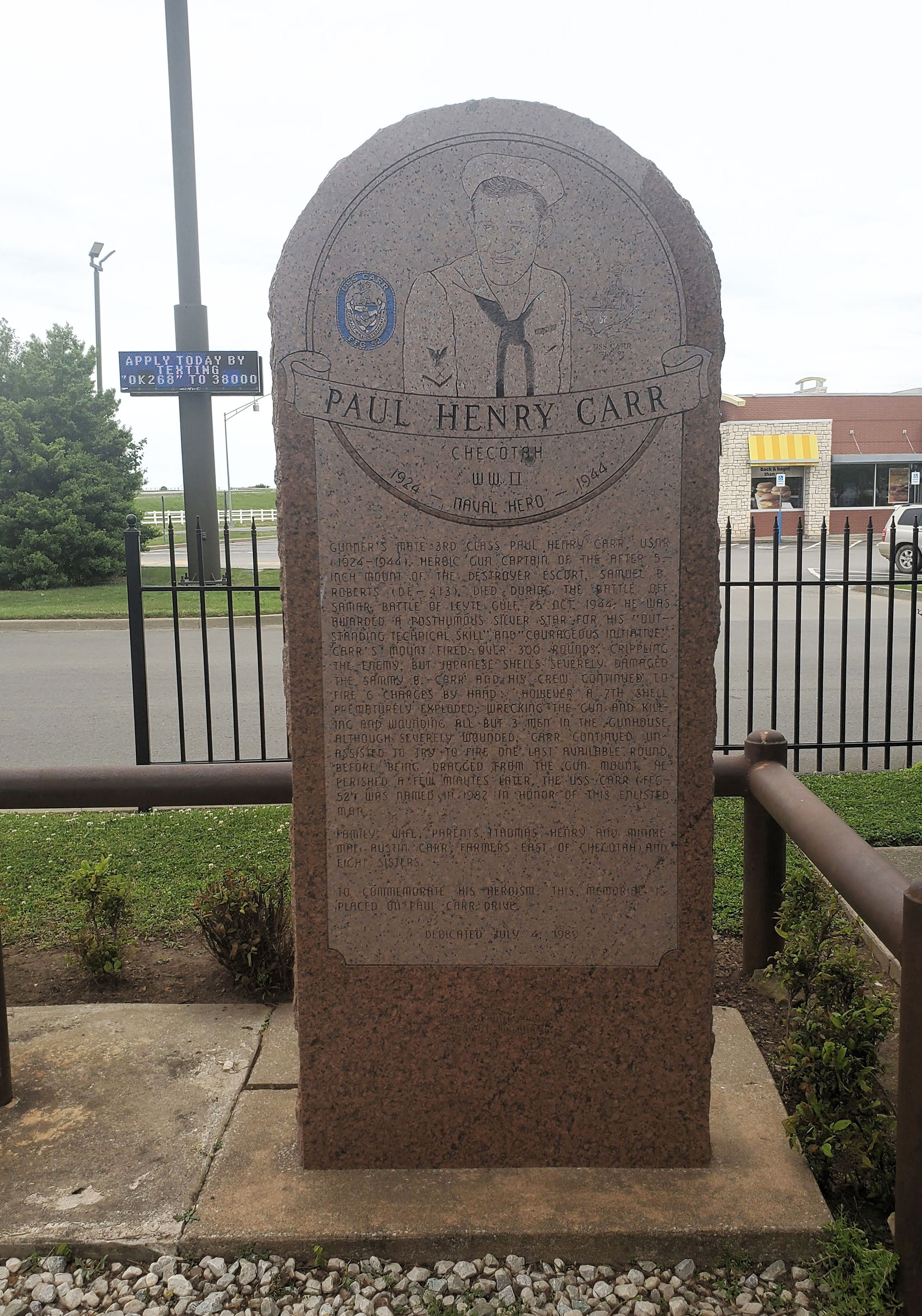
Location: on grounds of Katy Depot Museum and Visitor Center in Checotah
Coordinates: 35.471295, -95.536944
Material: Granite
Topics: Military, Industrial Period, 1941 to 1982
Paul Henry Carr died during World War II in the Battle of Leyte Gulf, October 25, 1944. He was awarded a posthumous Silver Star for his "outstanding technical skill" and "courageous initiative" on the USS Samuel B. Roberts during the battle.

Location: on US-64 west of Pawnee
Material: Aluminum
Topics: American Indians, Government, Land Openings, Settlement Patterns, Territorial Period 1861–1907
Established in 1874, the agency supervised the Pawnee Indians who sold their lands in Nebraska and bought a reservation in present-day Pawnee County. The unallotted surplus lands of the Pawnee Reservation were opened to settlement in September 1893.
Location: near intersection of Stanton L. Young and Lindsey in Oklahoma City (DAR)
Sponsored by: Daughters of the American Revolution
Topics: Transportation, Water, Land Openings
A nearby spring provided water for cattlemen and Indians prior to settlement. The campground was a favorite of Captain David L. Payne, the early leader of the Boomer movement for opening the Unassigned Lands.

Location: at junction of US-283 and OK-44 near Quartz Mountain State Park
Material: Aluminum
Topics: Natural Resources, American Indians, Military, Westward Expansion 1803–1861
One of Oklahoma's most important peace conferences was held at the mouth of Devil's Canyon on July 21, 1834. It was the first meeting between army dragoons, led by Colonel Henry Dodge, and Plains Indians, and the first formal contact between the federal government and the Indian tribes of the Great Plains. The dragoons camped a mile away from the Indian village that contained more than 200 grass lodges.
Location: on US-259, one mile south of Harris
Topics: Religion/Philosophy, Indian and Frontier Trade, Westward Expansion 1803–1861
In 1818 Methodist minister Reverend William Stevenson held the first Protestant church service in present-day Oklahoma here at a trading post established three years earlier by George and Alex Wetmore.

Location: in Perry Lake Park, approx. 300 ft from park entrance off OK-86
Coordinates: 36.266333, -97.280850
Sponsored by: Oklahoma Centennial Commission and Cherokee Strip Centennial Corporation
Material: Aluminum
Topics: Government, Social/Culture, Recreational/Service, Early Statehood 1907–1941
The creation of the Civilian Conservation Corps (CCC) by President Franklin D. Roosevelt in 1933 gave promise to many communities affected by the Great Depression of the 30s. Through the cooperative efforts of the Chamber of Commerce, city officials and interested citizens, 170 acres of land referred to as "The Perry City Farm" was designated as the site for a CCC Camp. Will Rogers, at the time Oklahoma's Congressman at Large, worked with the United States Department of the Interior to ensure a Camp would be located in Perry.

Location: on US-69, three miles south of McAlester
Material: Aluminum
Note: Marker reported missing on 12/30/2023
Topics: Indian and Frontier Trade, Westward Expansion 1803–1861, Transportation, Military, Government
James Perry established an important trading post here in 1849 at the intersection of the Texas and California roads. Many famous expeditions passed through the area. A Confederate supply depot here was attacked and destroyed by Union soldiers on August 25, 1863.
Location: on US-59, four miles south and three miles west of Heavener
Topics: Government, American Indians, Family/Household
Peter Conser was a leader of the Choctaw Lighthorsemen and also served as a senator in the Choctaw Legislature. His home is restored to show life in the Choctaw Nation before statehood.
Location: in Keota (OBHC)
Topics: Religion/Philosophy, American Indians
Reverend Peter Folsom was instrumental in the establishment of the First Choctaw Baptist Church.
Location: 1 1/2 mile south of Picher at Junction 69 north and 66 east and west
Topics: Mining, Early Statehood 1907–1941, Industrial Period 1841–1892, Military
From 1917 to 1967 Picher Mining Field yielded 450 million tons of ore, 21 million tons of concentrate, 11 million tons of metal; from 1921 to 1946, it was known as the world's largest and richest lead and zinc field. Picher Mining Field and people who worked here produced key materials for World Wars I and II and the Korean Conflict.

Location: on SH-4 bridge crossing over the South Canadian River between SH-152 and SH-37 (between Mustang and Tuttle).
Coordinates: 35.322898, -97.723439
Topics: American Indians, Government, Military, Territorial Period 1861–1907
Pikey's Crossing (circa 1867) on the South Canadian River was established by Benson Pikey, a Chickasaw born in Mississippi and Trail of Tears survivor (circa 1837). He was elected as a Representative to the Chickasaw House before and after the Civil War. During the Civil War, Ben fought for the Confederacy, serving as Captain of Company G in Shecoe's Chickasaw Battalion Mounted Volunteers.
Location: on east side of Red Road 1/2 mile north of Doaksville/Fort Towson Cemetery
The Presbyterian minister Reverend Cyrus Kingsbury established the Pine Ridge Mission in 1836. The Choctaw Council established a school for girls, Chuahla Female Seminary, at the mission in 1842, which Kingsbury supervised. The school was closed during the Civil War.
Location: at entrance to Pioneer Cemetery in Durant
Sponsored by: Daughters of the American Revolution
Topics: Social/Cultural, American Indians, Westward Expansion 1803–1861, Government
The Pioneer Cemetery was first used as a burial plot for family members of Fisher Durant, who settled the area following removal of the Choctaws from Mississippi in 1834. Also in the cemetery is the grave of Dixon D. Durant, founder of the town of Durant.
Location: on North Fifth Street in Ponca City
Topics: Petroleum, Natural Resources, Industry/Business
Pioneer Park's gate honors pioneer oil and gas prospector C.H. Ruby. The city's first gas supply came from wells located on the present site of North Park.
Location: on the grounds of the Pioneer Woman Museum in Ponca City

Location: on US-64, at village of Leonard, about nine miles east of Bixby, Tulsa County
Topics: American Indians, Military, Government, Territorial Period 1861–1907, Religion/Philosophy
The home and grave near here are of the noted Creek leader, Pleasant Porter (1840–1907). Lt. Creek Reg. Mtd. Vols., Confederate Army; Porter was superintendent of schools in the Creek Nation, 1871; Captain of the lighthorsemen in the "Green Peach War," 1883; a delegate to Washington; president of the Sequoyah Statehood Convention, 1905; and Principal Chief of the Creek Nation, 1899-1907. His home was near the location of Woalaka Mission founded in 1881.
Location: 1501-1509 Summers Place, Ponca City, OK
Material: Aluminum
Topics: Military, Education, Industry/Business
Ponca Military Academy was established in 1940 by the late Colonel William V. Cox and his wife Blanche. PMA made a vibrant contribution to the Ponca City community and to the state of Oklahoma. Dedicated to the growth and advancement of young men, Ponca Military Academy opened their doors to not only young men from Oklahoma, but throughout the country. Originally located on 56 acres of land, the academy occupied what was a former training facility and country club for E.W. Marland's oil company which became the Continental Oil Company (Conoco). An administration building, barracks, gym, parade grounds, athletic fields, tennis courts, and a playground encompassed the academy. They were located one-half mile south of this location at the end of Academy Road and along Cadet Road. At its height PMA had 150 student cadets and 14 faculty. After 34 years of operation the decision was made to close the academy in 1974. Approximately 4,000 young men attended PMA through its 34 years.
Location: at the crossing of Hwy-66 and the navigation channel
Sponsored by: The Propeller Club
Material: Aluminum
Topics: Transportation, Water, Natural Resources, Industrial Period 1841–1892
Head of navigation for the McClellan-Kerr Arkansas River Navigation System, the Tulsa Port of Catoosa is located one mile upstream from this marker. The McClellan-Kerr Arkansas River Navigation System is a 448-mile channel stretching form the Mississippi River up the Arkansas and Verdigris Rivers to the Tulsa Port of Catoosa. Barges are raised a total of 420 feet via 17 locks and dams from the Mississippi to Catoosa and the entire waterway connects with much of the nation's 29,000 miles of inland waterways.
Location: on OK-44, six miles south of OK-44 and OK-152 junction
Material: Granite
Topics: Education, Industrial Period 1841–1892, Religion/Philosophy, Social/Cultural
Port School, constructed in the center of the school district, once was considered the largest consolidated school in the nation. It closed in 1966.
Location: on OK-76, 17 miles west and nine miles north of Marietta
Topics: Early Statehood 1907–1941, Industrial Period 1841–1892, Education
The Post Oak school existed from 1916 to 1950 and was part of a joint district that served students in Love and Carter Counties.

Location: at Second Street and Oklahoma Avenue in Guthrie
Coordinates: 35.877950, -97.427400
Sponsored by: Donald W. Reynolds Foundation
Material: Aluminum
Topics: Government, Mass Communication, Territorial Period 1861–1907, Social/Cultural
Dennis T. Flynn opened the Guthrie post office in a tent on April 23, 1889, the day after the famous run of 1889. With volunteer help, he handed out the mail. Within a few weeks, the post office was handling 3,000 letters and 1,000 newspapers daily.
Location: on US-54 on east side of Texhoma
Topics: Territorial Period 1861–1907, Folklife
Texhoma was originally called Loretta, for Loretta Cain, the first postmaster. The town's name was changed in 1902.
Location: at the Fort Gibson Historic Site
Topics: Military, Westward Expansion 1803–1861
Erected to provide storage space for the gunpowder and ammunition used by the troops stationed at the post, this building was constructed about 1842.
Location: 319 East Illinois, Vinita, OK
Material: Aluminum
Topics: Water, Early Statehood 1907–1941, Government
On June 13th, 1936, President Roosevelt stopped his re-election special train in Vinita to honor citizens' request to help fund construction of the Grand River Dam. A large, rowdy crowd estimated at 5,000 greeted him.
President Roosevelt thanked the crowd for arranging the event and said he would see what he could do about it when he returned to Washington, D.C.
In September 1937, he signed legislation for $20 million to fund the project. Construction began in February 1938. The dam was finished in 1940 and the lake filled by the end of summer.
Grand Lake O' the Cherokees has 1,300 miles of scenic shoreline and approximately 50,000 surface acres of water. The dam is located on State Highway 28 near Langley, Oklahoma, some 14 miles southeast of this site.
Location: at Falls Creek (OBHC)
Sponsored by: Baptist General Convention of Oklahoma
Topics: Religion/Philosophy, Recreational/Service, Early Statehood 1907–1941
In 1916, Baptist leaders saw a picture of the falls and wanted to purchase the land for a Baptist assembly. Price's Falls was not available, so Baptists bought land farther up the mountain and named it Falls Creek Baptist Assembly. In 1998, the Price's Falls area finally became part of the Baptists' Falls Creek complex.
Location: southwest of Higgins
Note: Marker reported missing
Topics: Transportation, Westward Expansion 1803–1861, Mass Communication, Government
Pusley's Station was a stop on the Butterfield Overland Mail Route south of Gaines Creek. See Edwards Store.


Location: on US-62, eleven miles west of Cache
Material: Granite
Topics: American Indians, Westward Expansion 1803–1861, Territorial Period 1861–1907, Family/Household
The last Comanche chief, born in 1850 in the Wichita Mountains, bridged the gap between the old world as a war chief and the new world as a civil chief without losing his Comanche identity. Parker avoided capture for many years before leading the Comanche peacefully to Fort Sill in 1875. In 1889, he built Star House, a ten-room home, for his wives and children. He died in 1911 and was buried at Post Oak Mission. His remains were moved to Fort Sill in 1957.
Location: south of Gotebo Hwy 54 near Rainy Mountain
Topics: American Indians, Education
Location: at 209 West Main in Ardmore
Topics: Folklife, Early Statehood 1907–1941, Government, Petroleum, Social/Cultural
Jake Hamon was shot in the Randol Hotel where huge oil deals were consummated. The hotel burned in 1925.
Location: in community of Red Bird
Topics: Ethnic Diversity, Urban Development, Territorial Period 1861–1907, Early Statehood 1907–1941, Goveernment, Mass COmmunication
Red Bird is one of thirteen All-Black towns, out of more than fifty that once existed, remaining in Oklahoma. While Tullahassee is reportedly the oldest, most were established between 1889 and 1907 as African Americans sought security and control of their own destiny in a segregated world. Most of the towns began to decline in the 1920s and 1930s as rural African Americans faced economic hardships and began to move to urban areas. Red Bird was established with a post office in June 1902.
Location: on OK-152, five miles west of Cordell
Material: Aluminum
Area residents organized this Baptist church in 1898 and constructed the building one mile west of Red Bluff School in the early 1900s. The church served the area until the 1960s, when the building was moved into Cordell to be used as a lodge hall.
Location: 200 East Redfork Drive in Dover
Sponsored by: Citizens and Friends of Dover, 1998
Material: Granite
Topics: Indian and Frontier Trade, Ranching, Territorial Period 1861–1907, Land Openings, Agriculture, Urban Development
On this site once stood the trading post known as the Red Fork Ranch. The original ranch building was constructed in 1872 by the Lee and Reynolds Company. Over the following years, the ranch was operated by a number of different individuals, the last being John G. Chapin, who was operating the ranch when the Unassigned Lands were opened on April 22, 1889. Chapin formally claimed the homestead which included the townsite of Dover and which was platted by him in 1892. John Chapin could well be characterized as "the father of Dover".

Location: on US-81 in Dover
Coordinates: 35.9868352,-97.9087232
Sponsored by: Oklahoma Historical Society and Oklahoma Department of Transportation
Material: Aluminum
Topics: Transportation, Indian and Frontier Trade, Ranching, Military, American Indians
The stage station and supply depot was an important shipping point for cattle moving up to the Chisholm Trail. Soldiers from Fort Sill fortified Red Fork during the Cheyenne and Arapaho uprising in 1874. The station was named for the first name of the Cimarron River-Red Fork of the Arkansas. See Chisholm Trail.
Location: in Colbert City Park, Colbert, Oklahoma
Topics: Folklife, Government, Social/Cultural, Transportation, Early Statehood 1907–1941
The Red River bridge, constructed in 1931, was the site where Oklahoma Governor William H. "Alfalfa Bill" Murray defied a federal court injunction and stood with National Guard troops to make the toll bridge a free bridge. It became the first free bridge across the Red River. The structure was replaced with a new bridge in 1996.
Location: on OK-66 at east edge of Clinton
Material: Granite
Topics: Land Openings, Ethnic Diversity, Agriculture
Prior to the Cheyenne and Arapaho Reservation land run of April 19, 1892, this quarter-section of land was allotted to a Cheyenne woman named Red Wheat. Mennonite emigrants from Russia introduced 'Turkey red' winter wheat to northwest Oklahoma.

Location: at Second Street and Harrison Avenue in Guthrie
Coordinates: 35.877200, -97.427683
Sponsored by: Donald W. Reynolds Foundation
Material: Aluminum
Topics: Social/Cultural, Territorial Period 1861–1907, Industry/Business
This notorious gambling house opened in a tent on April 23, 1889. It was later housed in a frame building which gave way to a brick structure. For fifteen years, until prohibition at statehood, the casino never closed its doors, day or night.
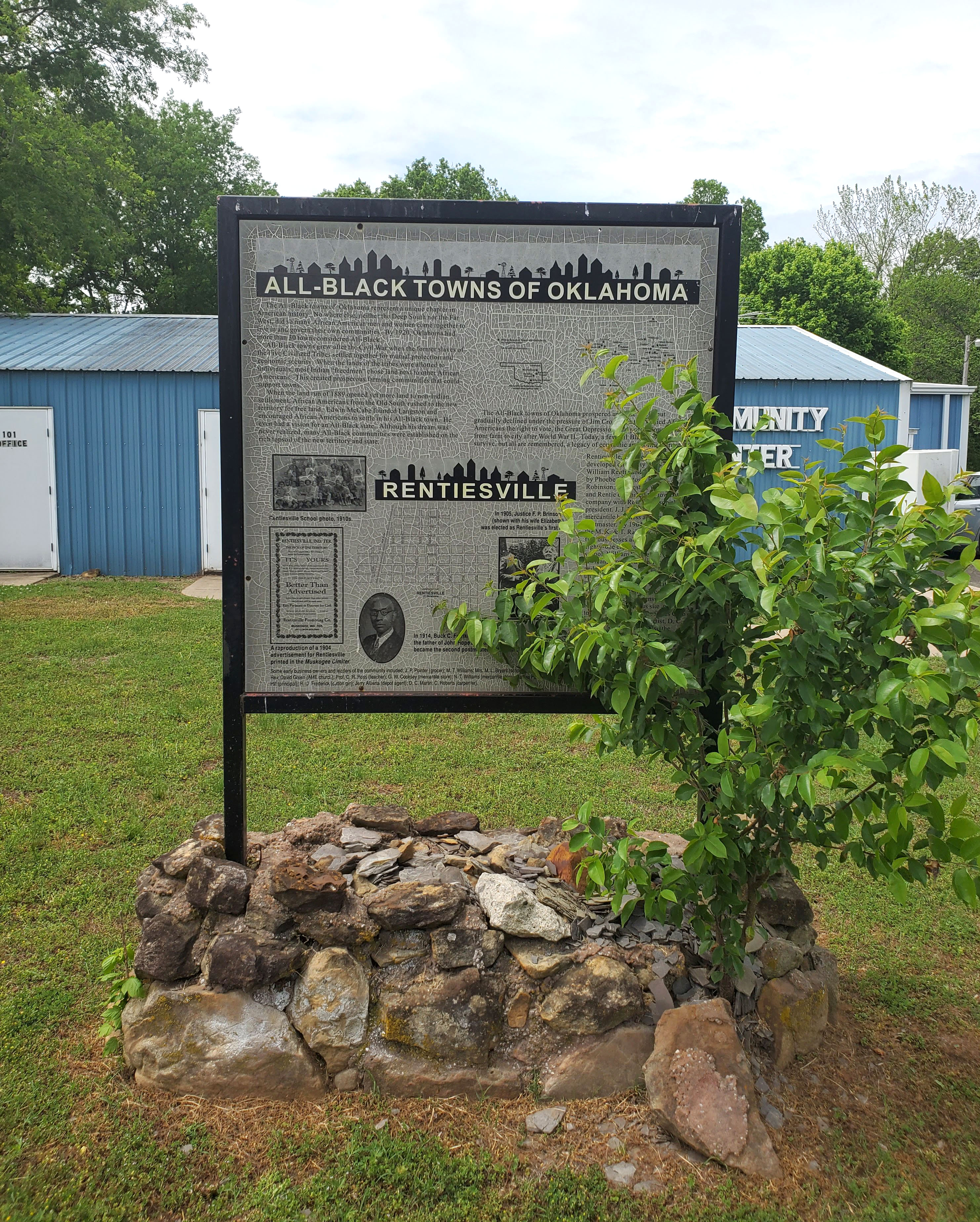
Location: in community of Rentiesville
Coordinates: 35.522796, -95.496731
Sponsored by: Oklahoma Historical Society
Material: Other (Interpretive Panel)
Topics: Ethnic Diversity, Urban Development, Settlement Patterns, Territorial Period 1861–1907, Early Statehood Early Statehood 1907–1941
Rentiesville is one of thirteen All-Black towns, out of more than fifty that once existed, remaining in Oklahoma. While Tullahassee is reportedly the oldest, most were established between 1889 and 1907 as African Americans sought security and control of their own destiny in a segregated world. Rentiesville was founded in 1903 and a post office opened in 1904. The town soon boasted a lumber store, cotton gin, and several businesses. It is the birthplace of historian John Hope Franklin and hosts the Dusk 'til Dawn Blues Festival each year.
Location: on OK-112 south of Pocola
Material: Granite
Topics: Religion/Philosophy, Transportation, American Indians, Government, Recreational/Service
A well-known missionary/circuit minister for the Southern Methodist Church, Page sometimes served as an interpreter in the Choctaw Nation. He was a Choctaw representative to the meeting that resulted in the Reconstruction Treaty of 1866. He was treasurer of the Choctaw Council and a judge on the supreme court of the Choctaw Nation.
Location: on OK-112 south of Pocola
Material: Granite
Topics: American Indians, Religion/Philosophy, Westward Expansion 1803–1861
Reverend Folsom, a Choctaw, was born in Mississippi and removed with his family to Indian Territory in the 1830s. After being educated, he served as an interpreter for white missionaries among the Choctaws and was ordained a deacon in the Methodist Episcopal Church South. He was a great frontier preacher whose influence was widespread among both whites and Choctaws.
Location: at intersection of OK-112 and old OK-112
Topics: Military, Family/Household, Government, Territorial Period 1861–1907
J.E. Reynolds was a Confederate veteran and pioneer rancher and merchant. His "castle" was built of stone, complete with turrets and two-foot thick walls. Reynolds was a delegate to the Sequoyah Convention, an attempt to create a separate Indian state of the Union.
Location: on county road at Old Riddle Cemetery
Topics: Transportation, Westward Expansion 1803–1861, Mass Communication, Government
Riddle's Station was a stop on the Butterfield Overland Mail Route east of Wilburton at the community of Lutie. See Edwards Store.
Location: 1/2 mile east of junction of US-62 and OK-82 on south edge of Tahlequah.
Material: Aluminum
Topics: Religion/Philosophy, Westward Expansion 1803–1861, American Indians
In 1843, Reverend Thomas Bertholf built Riley's Chapel on a hill south of the Cherokee capital. The first annual Indian Mission Conference of the Methodist Church was held at the chapel on October 23, 1844. The building was razed in 1868.
Location: southeast of Ripley
Location: on US 281, near entrance to Riverside School north of Anadarko
Material: Aluminum
Topics: American Indians, Education, Territorial Period 1861–1907
Established by Alfred J. Standing on September 23, 1871, east of Fort Cobb on the Washita River, the Riverside Indian School became a highly successful boarding school for Wichita and Caddo children. Fire destroyed the original building in 1878, but the school was rebuilt nearby. It is one of the oldest Indian schools in continuous operation in the nation.
Location: at 1401 NW 3rd Street, Oklahoma City
Topics: Manufacturing
On this site in 1936 R. W. Robberson located the Robberson Steel Company, opening a new industrial area in Oklahoma City. Beginning his career in 1913 with John Kline, 110 N. Francis, he acquired ownership in 1928. His foresight and initiative have for sixty-four years contributed to the industrial growth and progress of Oklahoma.
Location: three miles north of the junction of US-59 and OK-62
Topics: Westward Expansion 1803–1861, Settlement Patterns, American Indians
Robert Rogers, father of Clem Vann Rogers and grandfather of Will Rogers, was born in Georgia on July 16, 1815. He and his wife, Sally Vann, moved to Indian Territory before the removal of the Five Tribes from the southeastern United States. Robert Rogers was a signer of the removal Treaty of New Echota. He died on July 4, 1842.

Location: on US-281, one mile south of Hinton
Topics: Westward Expansion 1803–1861, Government, Military, Social/Cultural
In 1849, Captain Randolph Marcy and his party camped nearby on their way to the gold fields in California. Several of Marcy's junior officers were enamored with a 17-year-old maiden, Mary Conway, a cousin of President James Madison. To seek her favor, the men raced to the crest of the nearby hill. Lieutenant J.H. Simpson planted an American flag and named the hill "Rock Mary" in her honor. They became engaged, but Simpson was killed by an outlaw party before they could marry.
Location: on OK-8, three miles north of Anadarko (OBHC)
Topics: Religion/Philosophy, American Indians, Territorial Period 1861–1907
Rock Springs was the first Baptist church established among the Plains Indians. The church was organized in 1874 by John McIntosh, a Creek Indian who was the first known Baptist missionary to the Plains tribes.
Location: on OK-30, seven miles north of Hollis
Material: Granite
Topics: Education, Early Statehood 1907–1941
The Ron School began in 1939 with the consolidation of schools at Dryden, McKnight, Metcalf, and Teacross. The last class graduated in 1964 when the school became part of the Hollis Public Schools.

Location: on US-70, two miles east of Hugo
Topics: Family/Household, American Indians, Social/Cultural, Agriculture, Ethnic Diversity
Rose Hill, constructed before the Civil War, was the plantation home of Colonel Robert M. Jones, the wealthiest citizen of the Choctaw Nation. At one time, he owned 500 slaves to farm the land along the Red River. His mansion was decorated with crystal chandeliers imported from Europe. Rose Hill burned to the ground on Christmas night 1912. Only a row of massive cedar trees mark the site of the home today. Nearby, Jones is buried with his wife and children in a family cemetery.
Location: at US-70 and Daisy Lane in Dickson
Topics: American Indians, Arts
Rosella Hightower is one of the state's five American Indian prima ballerinas depicted in a mural in the State Capitol in Oklahoma City. A world-renowned Chickasaw ballerina, she was born near Dickson.

Location: 1/2 block east of Hwy-77 on Harrison Street, Guthrie, on south side
Coordinates: 35.876900, -97.424900
Sponsored by: Donald W. Reynolds Foundation
Material: Aluminum
Two weeks after war was declared on Spain, 85 volunteers, mostly members of the Territorial National Guard, on May 5, 1898, filled the Territory's quota as Troop A, 1st United States Volunteer Calvary, the famed "Rough Riders


Location: on Route 66 in Arcadia, across from Round Barn
Material: Granite
Topics: Transportation
Whether motorists called Route 66 the Ozark Trail, the Will Rogers Highway, Main Street America or the Mother Road, all remember Arcadia's Round Barn. The well-known landmark was built in 1898 by W. H. Odor. After the route was designated a national highway in 1926, improvements were made to the 1917 roadbed. The original road between Edmond and Arcadia was constructed by convict labor. The highway through Arcadia was paved in 1929. Many Arcadia businesses catered to travelers' needs with gasoline stations, cafes, lodging facilities and a grocery and general store.

Location: on OK-51, one mile east of Kingfisher County line
Coordinates: 36.116229, -97.659737
Sponsored by: Donald W. Reynolds Foundation
Material: Aluminum
Topics: Urban Development, Industry/Business, Petroleum, Natural Resources, Early Statehood 1907–1941
Logan County's only boom town was established in 1927 when the No. 1 McCully gushed in as the first mile-deep well in the state. The town declined after a refinery fire in the early 1930s.


Location: one mile south of OK-51 on N300 Rd
Coordinates: 36.10155, -97.65721
Sponsored by: Private
Material: Granite
Topics: Urban Development, Industry/Business, Petroleum, Natural Resources, Early Statehood 1907–1942
Roxana Oil Co. hit McCully well 29 June 1927. First well in Oklahoma drilled over a mile deep. Town platted 16 July 1927 by George L. Ross. Application to vacate the town site 17 March 1939 except property owned by John J. Traynor, who ran Roxana Service Station. Roxana Ranch founded in 1992.


Location: on US-81 in Memorial Park in Hennessey
Coordinates: 36.111145, -97.899130
Sponsored by: Oklahoma Historical Society and Oklahoma Department of Transportation
Material: Aluminum
Topics: Social/Cultural, Territorial Period 1861–1907, Military
Roy V. Cashion, 1st Okla. Vol. U.S. Cavalry. After his regiment helped in the victory at Las Quasimas, Cuba, he was killed as he charged over San Juan Hill, July 1, 1898, in the Spanish-American War. This Oklahoma boy Hennessey High School graduate rode horseback to Guthrie, and enlisted on May 5, 1898, in Rough Riders under Col. Theodore Roosevelt.
Location: in IOOF Cemetery on South Waverly Avenue in Ponca City
Topics: Military, Social/Cultural, Transportation, Urban Development, Settlement Patterns, Territorial Period 1861–1907, Industrial Period 1892–1941
England's Royal Air Force fliers trained in Ponca City as they prepared to defend the United Kingdom in World War II. The cemetery also contains a flagpole dedicated to Jack Barrington, an Englishman who trained in Ponca City, married a local girl, and returned to live out his life there. There is also a large memorial in the cemetery that honors men and women who served in the armed forces.

Location: on OK-66, four miles east of Arcadia
Topics: American Indians, Government
The eastern boundary of the Unassigned Lands was the western border of the Iowa, Sac and Fox, Kickapoo, Pottawatomi, and Absentee Shawnee reservations.

Location: on US-77 at Logan-Noble county line, one mile north of Orlando
Coordinates: 36.158890, -97.371849
Sponsored by: Donald W. Reynolds Foundation
Material: Aluminum
Topics: Land Openings, Territorial Period 1861–1907, Settlement Patterns
This east-west line notes the location of the north boundary of the Unassigned Lands which were opened for homesteading on April 22, 1889, comprising the major part of six present-day Oklahoma counties.

Location: on US-81, three miles north of Hennessey on Garfield-Kingfisher County line
Coordinates: 36.1643744,-97.8900608
Sponsored by: Oklahoma Historical Society and Oklahoma Department of Transportation
Material: Aluminum
At the opening of "Old Oklahoma," April 22, 1889, this was the north line for the run starting at 12 o'clock noon. Prairies and hills in the 2,000,000-acre tract, south, were peopled by tens of thousands, homes were planted and tent cities sprang up before nightfall.

Location: on US-77 at east end of South Canadian River bridge in Lexington
Topics: Settlement Patterns, Land Openings, Territorial Period 1861–1907
The South Canadian River was the south boundary line for the Unassigned Lands in central Oklahoma opened to settlement on April 22, 1889, in the first of five land runs in Oklahoma.
Location: on OK-37 east of Cimarron Road in Tuttle
Topics: Land Openings, Settlement Patterns, Territorial Period 1861–1907
The South Canadian River was the south boundary line of the Unassigned Lands in central Oklahoma which was opened to settlement on April 22, 1889, in the first of five land runs in Oklahoma.

Location: on US Highway 66, one mile west of El Reno
Topics: Land Openings, Territorial Period 1861–1907
At the opening of the "Old Oklahoma," April 22, 1889, this was the west line for the run starting at noon. Prairies and hills in the 2-million-acre tract, south, were peopled by tens of thousands. Homes were planted and tent cities sprang up before nightfall.


Location: on OK-3/OK-33 three miles west of Kingfisher, next to the Run of ’92 marker
Coordinates: 35.8549, -97.958200
Sponsored by: Oklahoma Historical Society and Oklahoma Department of Transportation
Material: Granite
Topics: Land Openings, Settlement Patterns, Territorial Period 1861–1907
On this line–98 degrees west longitude–many campers sat by their fires the night before the opening of "Old Oklahoma." The next day at noon on April 22, 1889, many people set out running on foot and by horse for 160 acre land claims in unassigned land east.

Location: on OK-33, two miles west of intersection with US-81
Coordinates: 35.854917, -97.958167
Sponsored by: Oklahoma Historical Society and Oklahoma Department of Transportation
Material: Granite
Topics: American Indians, Land Openings, Settlement Patterns, Territorial Period 1861–1907
East boundary of Indian Country–98 degrees west longitude. West of this line lay the land of the Cheyenne and Arapaho. Each member of their two tribes had been allotted 160 acres before the surplus land was opened to settlers at noon April 19, 1892. They ran west from this line for homesteads. Gov. A.J.Seay of Oklahoma Territory was living at Kingfisher. His grave is near.
Note: Marker is missing
Topics: Land Openings, Settlement Patterns, Government
This site marks the east-west boundary line between the Unassigned Lands, opened on April 22, 1889, and the Cherokee Outlet, opened on September 16, 1893. See also: Cherokee Strip marker in Garfield County

Location: on US-81, one mile north of Kingfisher
Coordinates: 35.8943648,-97.9336192
Sponsored by: Oklahoma Association of Electric Cooperatives
Material: Aluminum
Topics: Industry/Business, Social/Cultural, Agriculture, Early Statehood 1907–1941
Consumers Rural Electric Company was formed on December 23, 1936, and established the first rural electric cooperative in Oklahoma (later known as Cimarron Electric Cooperative). On Christmas Eve of 1937, the first home in Oklahoma to receive power from a rural electric cooperative was that of Earl Harrison.

Location: at junction of OK-66 and OK-99 in Stroud
Material: Aluminum
Topics: Government, Territorial Period 1861–1907, American Indians, Education
For nearly four decades, the agency was an important center of influence among the tribes in central Indian Territory. Established in 1870, the site was home to Indian agency offices and a boarding school for the Potawatomi, Shawnee, Kickapoo, Sac and Fox, and Iowa tribes.
Location: in the vicinity of the old Sac and Fox Agency site on SH 99, about four and one-half miles south of Stroud
Topics: American Indians, Settlement Patterns, Territorial Period 1861–1907, Education, Land Openings
Sac and Fox Indians came from Kansas to new lands here in 1870. The Agency was built soon; a brick building for the Boarding School was erected and opened in 1872. The old home of Chief Moses Keokuk stands 2 miles west of here. Sac and Fox country was opened to white settlement on September 22, 1891.

Location: on OK-39, six miles east of Asher
Sponsored by: Oklahoma Historical Society and the Oklahoma Department of Transportation
Material: Aluminum
Note: No longer extant
Topics: American Indians, Religion/Philosophy, Education, Territorial Period 1861–1907
Founded in 1876 by Father Isidore Robot on Potawatomi Indian lands, the mission served both the educational and spiritual needs of the Native Americans in the region. The educational work was eventually transferred to St. Gregory's College in Shawnee.

Location: at Sacred Heart Catholic Church, six miles east of Asher
Coordinates: 34.999126, -96.810716
Material: Granite
Topics: American Indians, Religion/Philosophy, Education, Territorial Period 1861–1907, Early Statehood 1907–1941
Site west in valley at foot of this hill founded 1876 by Rt. Rev. Isidore Robot, a Benedictine monk from the abbey of La Pierre. Sacred Heart Monastery and Abbey, 1877-1929. Headquarters of Catholic Church in Indian and Oklahoma territories, 1877-1891. St. Benedict Industrial School for Indians, 1877-1901. Sacred Heart College 1883-1927. Predecessor of St. Gregory's Abbey and College, Shawnee, Oklahoma.
Location: 1 1/2 miles north of North Council Road and Northwest 234th Street in Oklahoma City
Topics: Religion/Philosophy, Territorial Period 1861–1907
As a mission of St. John the Baptist Catholic Church in Edmond, St. Patrick was reportedly the first rural church of any denomination to be built in the Unassigned Lands following the Run of 1889, with the cornerstone being placed in 1891. Known by several names over the years (Kerry Patch, Deer Creek, and Lockridge), the church was abandoned in the 1930s and no longer stands.
Location: at Salina High School
Topics: Folklife, Early Statehood 1907–1941, Social/Cultural, Education
A large monument erected in 1916 to commemorate Oklahoma's first white settlement was used as a cornerstone during construction of Salina High School.

Location: at Second Street and Harrison Avenue in Guthrie
Coordinates: 35.876900, -97.427183
Sponsored by: Donald W. Reynolds Foundation
Material: Aluminum
Topics: Social/Cultural, Territorial Period 1861–1907
This was one of the many open saloons that thrived in Guthrie before prohibition came with statehood. When prohibitionist Carry Nation threatened to wield her bar-breaking hatchet against the saloon, the owner posted a sign on the door, "All nations welcome except Carry.
Location: on OK-56 on grounds of Creek Council House Square in Okmulgee
Material: Aluminum
Topics: American Indians, Education, Military, Westward Expansion 1803–1861
Samuel Checote was the first elected Creek chief after the Civil War and spent much of his life serving as a Methodist minister. Checote was a lieutenant colonel in the Confederate Army.
Location: on OK-32, one mile north of Petersburg
Material: Aluminum
Topics: American Indians, Empire Period 1541–1803
Oklahoma's oldest town on the Red River was a great, fortified village of the Wichita Indians. The French trading post on the north bank of the river was named for Governor Bernardo de Galvez in 1778 when Oklahoma was part of Louisiana.
Location: on US-283, ten miles south of Cheyenne
The site of the world's first upstream flood prevention project that was completed in 1953 and drains more than 68,000 acres.

Location: at 409 West Oklahoma Avenue in Guthrie
Coordinates: 35.877917, -97.429400
Sponsored by: Donald W. Reynolds Foundation
Material: Aluminum
Topics: Transportation, Territorial Period 1861–1907, Land Openings, Settlement Patterns
The first Santa Fe depot was a small red frame building on the west side of the Santa Fe tracks. The Santa Fe was the only railway into Oklahoma Territory at the time of the 1889 land run. Twenty trains brought up to 1,500 land seekers into the station on the day before the run. The present two-story red brick station was completed in 1903.
Location: on OK-325, 16 miles west and 3 1/2 miles north of Boise City
Material: Granite
Topics: Transportation, Indian and Frontier Trade, Westward Expansion 1803–1861, Territorial Period 1861–1907
The Santa Fe Trail provided one of the earliest contacts with the Southwest. Running 780 miles from Independence, Missouri, to Santa Fe, New Mexico, it cut across the Oklahoma Panhandle and became an important trade route that was patrolled by army troops. The heaviest traffic came in 1849 as Easterners headed for the gold fields in California. The trail remained in use until the railroads came in 1880.
Location: on county road at Oklahoma-New Mexico state line 27 miles west and one mile south of Boise City (DAR)
Sponsored by: Daughters of the American Revolution
See Santa Fe Trail
Location: on OK-287, nine miles north of Boise City.
See Santa Fe Trail

Location: Near the corner of Taft Avenue and Division Street in Sapulpa
Coordinates: 35.988244, -96.100699
Material: Aluminum
Topics: American Indians, Military, Westward Expansion 1803–1861, Settlement Patterns, Social/Cultural
Creek Indian "Chief" Sapulpa had a ranch, blacksmith shop, and store here by 1850. Serving in Confederate Army, he was discharged a lieutenant, and is buried north of his old homestead in a cemetery owned by the Nancy Green Chapter, NSDAR.

Location: on SH56, two miles west of Sasakwa
Material: Aluminum
Topics: American Indians, Government, Religion/Philosophy, Westward Expansion 1803–1861
Home of Governor John F. Brown for fifty-four year who was Principal Chief of the Seminole Nation, succeeding his father-inaw. Chief John Jumper, Col 1st Reft. Seminole Mtd: Vols. Confederate Army in Civil War. Young Brown was Lieut., 1st Reft. Creek Mid. Vols. C.S.A. Each in turn was pastor of Spring Church, near here, founded 1850 by Baptists.

Location: on OK-152, two miles east of OK-115 junction
Material: Aluminum
Topics: American Indians, Settlement Patterns, Religion/Philosophy, Education
Seger Colony was opened by the Cheyenne and Arapaho in 1886 under John H. Seger, a missionary widely known for his work among the Plains Indians in western Oklahoma. A school opened in 1893. Some of their original buildings can be seen in the community of Colony.
Location: on Stipe family home place on Peacable Mountain north of Blanco, south of McAlester
Material: Granite
Topics: Government, Social/Cultural, Recreational/Service, Industrial Period 1841–1892
When he retired in 2003, Gene Stipe had served in a state legislature longer than anyone else in American history. He was first elected to the Oklahoma House of Representatives in 1948 and moved to the State Senate in 1957, serving as the senior member of that body for many years.

Location: on US-60 near Missouri border west of Seneca, Missouri
Material: Aluminum
Note: Marker reported missing
Topics: American Indians, Government, Settlement Patterns, Westward Expansion 1803–1861
The federal government established this agency in 1832 for the Seneca and remnants of seven other tribes who had been relocated in Indian Territory from Ohio.
Location: on OK-101, eleven miles northeast of Sallisaw
Topics: Westward Expansion 1803–1861, Family/Household, American Indians, Arts
Built in the 1830s, this log cabin served as home to George Guess, also known as Sequoyah, the developer of the Cherokee syllabary. Sequoyah is considered one of the great leaders in American Indian education because of the development of a written language for the Cherokees.
Location: at junction of US-54 and county road at southeast edge of Tyrone
Topics: Ranching, Transportation, Water, Territorial Period 1861–1907
During the heyday of cattle drives through the Panhandle of Oklahoma, this well served as a watering place. Thousands of head of cattle were driven here to await shipment to northern markets.
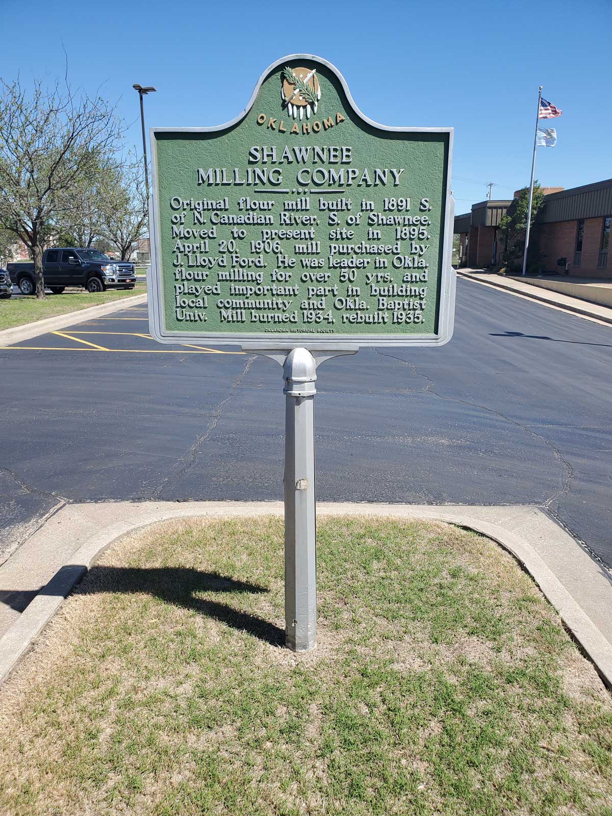
Location: two miles south of Shawnee on OK-18 near old Shawnee Friends Mission Church
Coordinates: 35.293700, -96.925967
Sponsored by: Shawnee Milling Company and the Oklahoma Historical Society
Material: Aluminum
Topics: Industry/Business, Territorial Period 1861–1907, Early Statehood 1907–1941, Agriculture
Founded in 1891, the mill moved to its present site at 201 South Broadway in 1895. J. Lloyd Ford purchased the mill in 1906 and was a leader in flour milling in the state for a half century. The mill burned in 1934 but was rebuilt the following year.

Location: two miles south of Shawnee on OK-18 near old Shawnee Friends Mission Church
Coordinates: 35.293700, -96.925967
Sponsored by: Oklahoma Historical Society and the Oklahoma Department of Transportation
Material: Aluminum
Topics: Religion/Philosophy, Education, American Indians
The Society of Friends founded this mission in 1871 for the Absentee Shawnee Indians. The original log cabin was replaced in 1885. The school closed in 1924 but the property was transferred to the Pottawatomie County Historical Society in 1936.

Location: on OK-12, one mile west of Atwood
Note: Marker reported missing
Topics: American Indians, Urban Development, Settlement Patterns, Territorial Period 1861–1907
The town was a settlement of Absentee Shawnee and Delaware on the California Road. The tribes had migrated from Ohio before 1800 and were allowed by the Choctaw National Council to remain in the area. The Absentee Shawnee occupied the site on the South Canadian River until 1857 when they moved northward to the Creek Nation and settled near Tecumseh in present Pottawatomie County.
Location: on US-259 near US-70 junction in Idabel
Topics: American Indians, Westward Expansion 1803–1861, Settlement Patterns
In the early 1800s a group of Absentee Shawnee Indians occupied a site near the Red River, southwest of present-day Idabel. The Shawnees departed in the 1830s when the area was ceded to the Choctaws.

Location: on OK-51, ten miles east of Hennessey
Coordinates: 36.115622, -97.711296
Sponsored by: Oklahoma Historical Society and Oklahoma Department of Transportation
Material: Aluminum
Topics: Land Openings, Settlement Patterns, Urban Development, Territorial Period 1861–1907
At the opening of the Unassigned Lands to homesteaders on April 22, 1889, a quarter-section in the Skeleton Township was reserved for a townsite named in honor of Lieutenant General Philip H. Sheridan. The town flourished until 1902 when Marshall became the rail center of the area.
Location: at US-81 and OK-7 intersection north of Duncan
Topics: Westward Expansion 1803–1861, Government, Folklife
On May 12, 1930, Stephens County Sheriff W.A. "Wal" Williams was wounded in a gun battle with outlaws here. He died the following day. Five of the combatants were shot, and two died. The incident was called the "Gunfight at Gatlin" for the nearby school.
Location: on grounds of Fort Sill
Material: Granite
Topics: Ethnic Diversity, Military, Territorial Period 1861–1907, American Indians
Constructed of native stone by members of the 10th Cavalry, this structure was home to General William Tecumseh Sherman when he conducted a tour of frontier army posts in the early 1870s. He narrowly escaped assassination by Kiowa warriors on the porch in May 1871.
Location: at 400 West Main in Ardmore
Topics: Petroleum, Industrial Period 1841–1892
Noble Drilling Corporation secretly sent Oklahoma drilling crews to tap oil under the Sherwood Forest in England in 1943 during World War II.
Location: at intersection of OK-37 and Cimarron Road in Tuttle (DAR)
Sponsored by: Daughters of the American Revolution
See Chisholm Trail
Location: on OK-9, four miles east of Stigler
Topics: Military, Industry/Business, Indian and Frontier Trade, Territorial Period 1861–1907, American Indians, Transportation
On June 15, 1864, Confederate forces led by Brigadier General Stand Watie captured and sunk the Union steamboat J. R. Williams on the Arkansas River. The cargo was valued at $120,000. Southern troops included Choctaws, Chickasaws, Creeks, and Seminoles in what is known as the most inland naval battle of the Civil War.
Location: southeast of OK-54 and OK-152 junction
Material: Granite
Topics: American Indians, Government, Territorial Period 1861–1907
Cloud Chief, originally Tacola, served as the first county seat. The area was settled by land run on April 19, 1892. On August 7, 1900, citizens voted to move the county seat to Cordell, but the US Supreme Court voided the election since the US Congress had designated Cloud Chief the county seat. In 1906, Congress officially named Cordell the county seat.
Location: in town of Skedee
Topics: American Indians, Petroleum, Natural Resources, Social/Cultural, Folklife
Likenesses of Osage Chief Bacon Rind and Colonel E. E. Walters commemorate the cooperation of two different cultures. For many years, Walters served as the public auctioneer for oil lease rights on 160-acre tracts of the Osage Reservation, the revenue from which was distributed to the more than 2,000 Osage headrights. The auctions were held under the "million-dollar elm.
Location: on OK-11 and OK-20 in Skiatook
Material: Granite
Topics: American Indians, Indian and Frontier Trade, Territorial Period 1861–1907, Government, Mass Communication
W. C. Rogers, later a chief of the Cherokee Nation, established a trading post near here in 1872. A post office was opened in Rogers' store on March 12, 1880. The name comes from Skiatooka, a prominent Osage who traded in Rogers' store.
Location: 3/4 mile north of US-270 on black top road 1.6 miles east of Main Street in Spiro
Material: Granite

Location: at Division Street and Oklahoma Avenue in Guthrie
Coordinates: 35.878150, -97.425683
Sponsored by: Donald W. Reynolds Foundation
Material: Aluminum
Topics: Territorial Period 1861–1907, Social/Cultural, Folklife, Industry/Business
Nathanial McKay was given the right in 1899 to build a two-story brick privy on his property. McKay, who became a Guthrie developer, made the privy accessible from the second floor of adjacent buildings.
Location: on US-259, 1/4 mile west of Smithville
Topics: Indian and Frontier Trade, Religion/Philosophy, Westward Expansion 1803–1861, Education, Early Statehood 1907–1941
Town's original name was Hatobi, but it was renamed in 1890. A nearby salt lick inspired the name of Big Lick Presbyterian Church, founded in the 1830s. The Folsom Training School was established here in the early 1920s.

Location: on OK-8, five miles north of Cleo Springs at Sod House Museum
Coordinates: 36.472189, -98.425992
Material: Granite
Topics: Settlement Patterns, Environmental/Cultural Ecology, Territorial Period 1861–1907, Agriculture, Land Openings
This is the only complete, restored, and intact sod house remaining in Oklahoma. As Oklahoma was settled, homesteaders cut long furrows of sod into blocks and stacked them to form walls. Openings were left for windows and doors. Thousands of sod houses once dotted the prairie but eventually were destroyed by the harsh climate of the Great Plains. This house, constructed by Marshall McCully, was protected by trees and a frame building.
Location: at Wright City
Topics: American Indians, Military
Location: in Garland Cemetery near town of Tom (DAR)
Sponsored by: Daughters of the American Revolution
Topics: Social/Cultural, American Indians, Agriculture
In this cemetery is the grave of Sophia Folsom Pitchlynn, wife of Major John Pitchlynn, who served under General George Washington in the Revolutionary War.
Location: on OK-5 on east edge of Hastings (OBHC)
Topics: Education, Religion/Philosophy, Settlement Patterns, Social/Cultural, Early Statehood 1907–1941
A Baptist college was founded in Hastings in 1907. The school later moved to Mangum. Its library became the core for the library at Oklahoma Baptist University in Shawnee.
Location: on OK-66, 1/2 mile east of Weatherford
Topics: Government, Education, Territorial Period 1861–1907
The Sixth Legislative Assembly of Oklahoma Territory established the college on March 8, 1901. Classes began two years later with James Robert Campbell as the first president. The school is now known as Southwestern Oklahoma State University.
Location: on Hwy 283 north of Sayre
Sponsored by: Chrissy MacDougall c/o Charlies Abernathy
Topics: Empire Period 1541–1803, Transportation, Government, Indian and Frontier Trade
The Spaniards developed the first-known trail in Oklahoma. Deep, indelible ruts were cut into the prairie by heavily laden wooden carts. Known as the Great Spanish Road to Red River, it connected Santa Fe and Natchitoches. The real beginning of highway construction was under Governor Holloway with Alvin Moore as State Senator.

Location: on US-70 in Sawyer
Material: Granite
Topics: Education, American Indians, Ethnic Diversity, Arts, Westward Expansion 1803–1861
A noted school for boys, Spencer Academy was established by the Choctaw Nation in 1841 and named for Secretary of War John C. Spencer. Students who became Choctaw leaders included Allen Wright, Jackson McCurtain, and Jefferson Gardner.
Location: at the Spiro Mounds Archaeological Center
Material: Granite
Topics: Pre-European Contact before 1541 AD, American Indians, Settlement Patterns
Location: at intersection of OK-20 and Blackburn Road, eleven miles west of Hominy
Material: Granite
Note: Marker reported missing on 12/20/2023
Topics: Education, American Indians, Religion/Philosophy, Territorial Period 1861–1907
The St. John's School for Osage boys was founded by the Bureau of Catholic Indian Missions in 1888 on the banks of Hominy Creek. A four-story stone building was erected in 1893 to replace the original log school. The school closed in 1913 but the buildings were maintained until the 1950s when they were torn down.
Location: just off US-60 south and west of Clear Creek Bridge in Pawhuska
Topics: American Indians, Education, Social/Cultural, Religion/Philosophy
This Osage girls school was founded in 1887 by Mother Mary Katharine Drexel, a Philadelphia heiress who entered a convent as a young woman and used her fortune to support educational institutions across the southern United States, and the Bureau of Catholic Indian Missions. The school's original frame building burned in 1889 and was replaced by a four-story stone building. In 1942, the school became St. Louis Academy. Later, the buildings were razed and replaced with a low-income housing project. In 2000, Mother Katharine was named a saint by Pope John Paul II.
Location: in Polson Cemetery, two miles northwest of South West City, Missouri
Material: Granite
Topics: American Indians, Military, Government, Territorial Period 1861–1907
Stand Watie, a leader of the pro-removal faction of Cherokees in the southeastern United States, was the first Indian commissioned in the Civil War as a general officer. At the close of the conflict, he commanded all Confederate troops in the Department of Indian Territory. In May of 1865, he surrendered to Union troops near Fort Towson, the last Confederate general to lay down his arms.
Location: at Doaksville
Material: Granite
Topics: Military
Location: at junction of OK-100 and US-59 on south edge of Stilwell
Note: Marker reported missing
Topics: Westward Expansion 1803–1861, American Indians, Environmental/Cultural Ecology, Settlement Patterns
Starr Springs was the head of Sallisaw Creek, a source of water for Stilwell since 1910. The area was the site of the 1853 murder of Andrew Adair and his son, George W. Adair, because of their support for Cherokee removal. The spring was named for George Harlan Starr, a prominent Cherokee, who purchased the site in 1867. The marker is a tribute to D.M. "Mack" Starr, respected and knowledgeable Cherokee historian, who died in 1995.

Location: at East Harrison Avenue and South Broad Street in Guthrie
Coordinates: 35.876867, -97.422650
Sponsored by: Fogarty Jr. High School
Material: Stone
Topics: Government, Early Statehood 1907–1941
This building was the state capitol when the state seal was stolen from here and taken to Oklahoma City, on the night of June 11, 1910, thus moving the site of the state capitol. The first university of Oklahoma was located here in 1892. It operated as such for two years.

Location: at south city limits of Muskogee
Material: Aluminum
Topics: Industry/Business, Petroleum, Natural Resources, Territorial Period 1861–1907
Muskogee Oil Refining Company, organized in March 1905, built a "finishing plant" near this site in November 1904. It soon was producing lamp kerosene, lubricating oil and industrial fuel—the beginning of oil refining in Oklahoma, a leading industry today.

Location: on OK-66 west of junction with US-281
Topics: Military, Government, Westward Expansion 1803–1861
Exploring parties saw these natural mounds and named them for Major Enoch Steen of the First Dragoon Regiment who commanded an escort on a road survey to California in 1858. The easternmost of the mounds is named Rock Mary.

Location: on OK-11, two miles east of junction with US-64, north of Cherokee
Coordinates: 36.797050, -98.324543
Material: Aluminum
Topics: Religion/Philosophy, Territorial Period 1861–1907, Education, Settlement Patterns, Transportation
Buildings near here from 1897. Under auspices of Friends Church, the Academy was noted for high moral, spiritual and scholastic standards. Closed 1922. Named for the teacher of first school (1893) in this vicinity, a sod house near Stella Church in Cherokee Strip.
Location: at Sixth Avenue and Perkins Road in Stillwater
Topics: Land Openings, Settlement Patterns, Social/Cultural, Territorial Period 1861–1907, Urban Development
Boomers, led by William C. Couch, settled nearby on Stillwater Creek in December 1884. When ordered to leave, they defied the US cavalry. In his wire for reinforcements, Lieutenant Mathias Day said, "They call this place Stillwater," the first recorded reference to a town in Oklahoma Territory. The Boomers departed, but Stillwater was settled in the first hour of the Land Run on April 22, 1889.
Location: 1/2 mile north of southern entrance to Stringtown on Hwy 69
Sponsored by: Gwin Walker
Topics: Law and Order
Near this place on August 5, 1932, Atoka County Sheriff C.G. Maxwell and Deputy Sheriff Eugene Moore were involved in a shoot-out with Clyde Barrow, Raymond Hamilton, Everett Milligan, and James Acker. (Although not known at the time, Bonnie Parker was also present.) The incident occurred when the two lawmen tried to arrest the men at a dance in Stringtown. As the lawmen approached, the foursome opened fire, killing Moore instantly and severely wounding Maxwell.
Location: on campus of Oklahoma Baptist University in Shawnee (OBHC)
Sponsored by: Baptist General Convention of Oklahoma
Material: Aluminum
Note: Destroyed by tornado and removed (2023)
Topics: Religion/Philosophy, Territorial Period 1861–1907, Early Statehood 1907–1941
Cortez Stubblefield (1848–1930) was a Baptist pastor and denominational statesman. The building, originally located at 207 North Union Avenue, was moved to its present location in 1963. The Baptist General Convention of Indian Territory, antecedent to the present Baptist General Convention of Oklahoma, held its final meeting in the building in 1906.

Location: on OK-7/W. Broadway Ave. in Sulphur
Coordinates: 34.506250, -96.974183
Sponsored by: Rotary Club of Sulphur and OHS
Material: Aluminum with stone base
Topics: Environmental/Cultural Ecology, Natural Resources, Recreational/Service, Early Statehood 1907–1941
Springs in this area were first used by American Indians, wildlife, and cattlemen. In 1902 Sulphur Springs Reservation was founded, renamed Platt National Park in 1906, and became part of Chickasaw National Recreation Area in 1976. The town was moved twice to its present site in the 1920s and 1930s. Sulphur was famous for its mineral waters.
Location: in community of Summit
Topics: Government, Mass Communication, Transportation, Territorial Period 1861–1907, Environmental/Cultural Ecology
Summit, the highest point on the Missouri, Kansas and Texas Railroad between the Arkansas River and the North Canadian River, was established with a post office in 1896.
Location: on county courthouse grounds in Cordell
Material: Granite
Topics: Education
Created in 1892, Tacola School met in a dugout until 1894 when a 30' x 50' building was built 1/2 mile southwest of this marker. In 1918, the school moved to a new building north of this marker. During the 1921 consolidation of school districts, the name changed to Cloud Chief. The high school moved to Cordell in 1958 and the school closed in 1960.
Location: in town of Taft; see Red Bird
Topics: Government, Urban Development, Ethnic Diversity, Social/Cultural, Education, Recreational/Service, Territorial Period 1861–1907
Taft was initially named Twine after an early-day resident, editor, and activist W. H. Twine. The name was changed to Taft in 1904 to honor William Howard Taft, secretary of war and later president of the United States. Taft was home to several state-operated facilities for the state's African American population, including the Industrial Institute for the Deaf, Blind, and Orphans of the Colored Race, State Training School for Negro Girls, and State Hospital for the Negro Insane.

Location: on OK-51 between Lee and Morris Streets in Tahlequah
Material: Aluminum
Topics: American Indians, Government, Mass Communication
Tahlequah was the capital of the Cherokee Nation until statehood and the closing of the Cherokee government. Oklahoma's first newspaper, the Cherokee Advocate, was printed here. The last Cherokee capitol, constructed on the city square in 1872, became the Cherokee County courthouse at statehood.

Location: on US-64, two miles east of Gore
Material: Aluminum
Topics: Westward Expansion 1803–1861, American Indians, Folklife, Indian and Frontier Trade
In 1829, the village became the western capital of the Cherokees. Sam Houston often visited the area in trade missions into Indian Territory and was given the name "The Raven" by Cherokee leaders.
Location: on OK-9, four miles east of Stigler
Topics: Transportation, American Indians, Government, Westward Expansion 1803–1861, Territorial Period 1861–1907
Tamaha was an important port and ferry crossing on the Arkansas River in the 1830s. Steamboats brought Choctaw Indians from the Mississippi River up the Arkansas to Tamaha in 1831. The post office opened in 1884 and a jail was built at Tamaha in 1886. The last steamboat touched at Tamaha Landing in 1912.
Location: in community of Tatums
Topics: Ethnic Diversity, Territorial Period 1861–1907, Early Statehood 1907–1941
Tatums is one of thirteen All-Black towns, out of more than fifty that once existed, remaining in Oklahoma. While Tullahassee is reportedly the oldest, most were established between 1889 and 1907 as African Americans sought security and control of their destiny in a segregated world. Most of the towns began to decline in the 1920s and 1930s as rural African Americans faced economic hardships and began to move to urban areas. Tatums was established in 1896 and is named for Lee Tatum, the first postmaster and a United States marshal.
Location: 50 Broadway Circle, Oklahoma City
Sponsored by: Goldring/Woldenberg Institute of Southern Jewish Life; Jewish American Society for Historical Preservation.
Topics: Ethnic Diversity, Territorial Period 1861–1907, Religion/Philosophy
Jews have lived in Oklahoma since the mid-nineteenth century. In 1903, Jews in Oklahoma City organized Temple B'Nai Israel. During its first few years, the congregation met at several local churches. The synagogue, located at 50 Broadway Circle, was dedicated on January 17, 1908. Temple B'Nai Israel remained in this building until 1955, when they moved to a new synagogue on North Pennsylvania Street. Temple B'Nai Israel affirmed the American principals of freedom of religion and assembly in Oklahoma.
Location: Sidewalk Peninsula at the Northeast Corner of 9th Street and Main in downtown Woodward, Oklahoma.
Material: Aluminum
Temple Lea Houston, the“lawyer with a gun,” was the youngest child of General Sam Houston of Texas fame. Temple was a gifted orator and an accomplished attorney. Possessed of great intellect, he contributed to the writing of many early Territorial statutes.
On this 800 block of Main Street, from his arrival in Woodward in 1893 until his untimely death in 1905, Temple Houston practiced law, spoke to rapt audiences, participated in a gunfight with the Jennings brothers, and was tried and acquitted for manslaughter in the shooting death of Ed Jennings.
A native Texan, he accomplished more in the last 12 years of his life here in the Oklahoma Territory than most people could achieve over the course of three lifetimes. He rests eternally here in his adopted home of Woodward next to his wife, Laura and three of their children.
"Mr. Houston dies regretted by the people of Oklahoma and Texas, each alike in their regard, one the state of his nativity, the other the land of his adoption. In neither never lived a brighter man or a kinder heart or one who leaves so many friends to regret his death," William Ezra Bolton, 1905
Location: on OK-16 near Verdigris River Bridge (DAR)
Sponsored by: Daughters of the American Revolution
Topics: Transportation, Indian and Frontier Trade, American Indians
This marker commemorates the Old Texas Road, the oldest road in Oklahoma; Three Forks, the oldest trading post in Oklahoma; and the site of the first Creek and Osage Indian agencies on the banks of the Verdigris River.
Location: on OK-16 north of Verdigris River in Okay (DAR)
Sponsored by: Daughters of the American Revolution
Topics: Transportation, Indian and Frontier Trade, American Indians, Arts, Westward Expansion 1803–1861
A monument commemorates the Texas Road, the most ancient trail through Oklahoma, the Three Forks trading post, the Creek and Osage agencies, and Washington Irving's visit to the area.
Location: on top of Rock Mary southwest of Hinton
Topics: Military, Government, Social/Cultural, Westward Expansion 1803–1861
Lieutenants M.P. Harrison and J.H. Simpson unfurled the Stars and Stripes on top of Rock Mary on May 23, 1849. See Rock Mary.
Location: Veterans Park 410 N. Main, Granite OK
Material: Aluminum
Topics: Military, Early Statehood 1907–1941, Government
The 36th Infantry Division was organized by combining the Oklahoma and Texas National Guards. Sixty men that volunteered from Old Greer County were kept together and placed in the 132nd Machine Gun Battalion in that Division. On October 8th, 1918, these men fought on Hill 140 at Saint Etienne France. The Division suffered 1,300 casualties in the first day of fighting, which was the single day highest casualty rate of the war. After three days of heavy fighting, the enemy began to retreat, and one month later, the war came to an end on November 11, 1918.
Fifty-five other men from Old Greer County fought in the same battle with the 141st and 142nd Infantry Regiments of the 36th Division. One of these soldiers, Sergeant Samuel Sampler from Mangum, received the Medal of Honor for his action on Hill 140 as he fought alongside his fellow Doughboys from Southwest Oklahoma. These men were from Granite, Mangum, Blake, Reed, Willow, Duke, Eldorado, Gould, Hollis, Victory, Vinson, Blair, Altus, Elmer, Headrick, Martha, Olustee and Delhi.
This marker is dedicated on the Centennial of this historic World War I battle by American Legion Post 121 from Mangum and the City of Granite.
Location: GAR Cemetery, 129 5th Ave, Miami OK
Material: Aluminum
Topics: Military, Social/Cultural, Early Statehood 1907–1941
During WWII 1941-1945, the Spartan School of Aeronautics, British Flying Three was established in Miami, OK to train British Pilots without the rest of interference. Miami's roster included 2124 Royal Air Force cadet and 117 United cadets of which 1493 pilots were awarded RAF wings. 15 British cadets lost their lives in training and interred here. Each year in October, G.A.R, Cemetery holds an annual British Flyers Remembrance ceremony to honor the lives of these 15 British cadets and to educate the public, young and old, to continue their legacy. Lest we forget.
Location: at Oklahoma City Zoo
Material: Granite
Topics: Recreational/Service, Government, Early Statehood 1907–1941, Social/Cultural
This park was created between 1933 and 1936 by members of Civilian Conservation Corps No. 875 and 895. These companies were two of many such companies organized by the federal government during the Great Depression to provide useful employment for thousands of young men and to develop and save the nation's natural resources.
Location: American Legion Park in Freedom
Coordinates: 36.769423, -99.112640
Sponsored by: Cimarron Cowboys Association
Material: Granite
Topics: Land Openings, Settlement Patterns, Ranching, Territorial Period 1861–1907, Early Statehood 1907–1941
Commemorates the cowboys and ranchers who founded and developed the cattle industry in the Cimarron country of northwest Oklahoma.
Topics: Family/Household, Settlement Patterns, Land Openings, Territorial Period 1861–1907
Constructed in 1895, six years after the 1889 Run, this house, known as the Harry Lindsey Home, has been restored as a classic example of pre-statehood architecture.
Location: Fort Supply
Sponsored by: Leland Bement
Topics: Pre-European Contact before 1541 AD, Social/Cultural, Recreational/Service, Environmental/Culural
Two miles northeast of here is the Cooper Paleo-Indian bison kill site. The site was the scene of three of the largest Folsom (ca. 10,500 years ago) bison kills known. Each event saw more than thirty bison herded into a dead-end gully. Hunters on the gully rim killed the animals with spears tipped with finely crafted Folsom points. A bison skull beneath the second kill was painted with red zigzag lines to ensure a successful hunt. The mineral pigment was red hematite. This is the oldest painted skull in North America and is the earliest evidence of hunting ritual for the Plains region.
Location: eleven miles east of Frederick, Oklahoma at Hammsville, Oklahoma
Sponsored by: Tillman County Historical Society
Topics: Government, Folklife, Recreational/Service, Transportation, Territorial Period 1861–1907
President Theodore Roosevelt arrived by train in Frederick, Oklahoma, on April 5, 1905. A passionate hunter and ardent believer in the wild outdoor life, the President was there to join famed world hunter Jack "Catch 'em Alive" Abernathy for a wolf hunting expedition. More than 500 excited citizens packed the streets of downtown Frederick to get a glimpse of the President and hear his speech.
Location: 609 Chautauqua, Norman
Sponsored by: The Jacobson Foundation
Material: Aluminum
Topics: Arts, Early Statehood 1907–1941, Industrial Period 1841–1892, American Indians
The home of Swedish born artist Oscar B. Jacobson and Jeanne d'Ucel became a center for international celebrities, artists and writers from 1918–1966. Jacobson, director of the OU School of Art from 1915–1945, revolutionized art education in Oklahoma. He is also credited with nurturing the "renaissance" of American Indian painting on the Southern Plains in the 1920s.
Location: at 1419 North Okmulgee in Muskogee
Topics: Family/Household, Government, Military, Social/Cultural
Residence was built by John R. Thomas, a federal judge and former congressman from Illinois. He was known as the father of the United States Navy for his congressional work to increase the size of the American navy. His daughter, Carolyn Thomas, married his law partner, Grant Foreman, and they lived out their lives in the home. The Foremans were outstanding authorities on the history of Oklahoma and the Five Civilized Tribes.
Location: on US-70 west of Mountain Fork River
Topics: American Indians, Government, Social/Cultural
Three prominent Choctaw principal chiefs made Eagletown their home: George Hudson (1860–1862); Peter Pitchlynn (1864–1866); and Jefferson Gardner (1894–1896).
Location: on Avenue D, west of building 1, TAFB
Topics: Military, Industrial Period 1841–1892, Government
Established in March 1942 as the Oklahoma City Air Depot for the maintenance and repair of B-17, B-24, and B-29 bombers and named for Oklahoma Native Major General Clarence L. Tinker in October 1942. The base has provided important logistical support for the US war efforts in Korea, Vietnam and the Middle East.

Location: on OK-99 west of Tishomingo
Material: Aluminum
Topics: American Indians, Transportation, Settlement Patterns, Government, Westward Expansion 1803–1861, Urban Development
The capital of the Chickasaw Nation was named after the last war chief of the Chickasaws, Tishomingo, who died on the Trail of Tears during removal from Mississippi. Soon after its founding in 1856, Tishomingo became the trade and cultural center of the Chickasaw Nation.
Location: at 721 North Delaware, Dewey
Topics: Arts, Social/Cultural, Early Statehood 1907–1941
One of the most nearly complete collections of Tom Mix memorabilia, the displays at this museum offer graphic illustrations of the early-day motion-picture industry and one of its famous stars.
Material: Granite
Location: at Latham, eight miles west of Shady Point
Material: Granite
Note: Marker reported missing
Topics: Transportation, Westward Expansion 1803–1861, Mass Communication, Government
Trahern's Station was a stop on the Butterfield Overland Mail Route west of Shady Point at the community of Latham. See Edwards Store.
Location: on US-70 between Vallient and Idabel
Material: Granite
Topics: Transportation, Military, Settlement Patterns, Social/Cultural, Folklife
During the early 1800s, present southeastern Oklahoma was a major transportation crossroads. Roads connected Fort Towson in the Choctaw Nation to military installations to the north, south, and west. On the Texas side of the Red River, Jonesboro was a major entry point for thousands headed for Austin's Colony and other settlements in Texas. Along these routes traveled such notable persons as General Zachary Taylor, Sam Houston, David Crockett, Jefferson Davis, and Benjamin Milan.
Location: in community of Tullahassee; see Red Bird
Material: Granite
Topics: American Indians, Education, Religion/Philosophy, Westward Expansion 1803–1861, Ethnic Diversity, Territorial Period 1861–1907
Tullahassee, a Creek word meaning "old town," now occupies the site of Tullahassee Mission, established in the Creek Nation in 1850 by Reverend Robert M. Loughridge under the auspices of the Presbyterian Board of Foreign Missions. After the mission burned and was abandoned, Creek freedmen moved to the area, receiving a post office in 1899.
Location: on US-69, 1/4 mile north of Arkansas River
Material: Aluminum
Topics: American Indians, Religion/Philosophy, Education, Government, Civil Rights
Tullahassee was established as a Creek mission by Presbyterian Reverend R. M. Loughridge in 1848. Alice Robertson, later Oklahoma's first congresswoman and the first woman postmaster in America, was born here.

Location: 6060 American Plaza in Tulsa
Topics: Transportation
This street was the original runway for the Tulsa Commercial Airport (subsequently named Cherokee Airpark). During the 1930s aviation in Tulsa included multiple airfields which were converted to residential neighborhoods as Tulsa grew. Tulsa Commercial Airport operated until the mid-1950s. The road you are viewing was the main runway, and a second runway extended northwest from this location.

Location: at junction of OK-99 and OK-33
Material: Aluminum
Topics: Ranching, Transportation, Territorial Period 1861–1907
During the height of the Texas trail drives through Oklahoma, this ranch, owned by James Jerome and Leslie Combs, was used to fatten cattle before their final trip to markets in Kansas. Roundups were held on the present site of Cushing.
Location: in the Clayton vicinity
Material: granite slab
Note: Marker is no longer standing
Location: at intersection of OK-9 and NS-411 (OBHC)
Coordinates: 35.289504, -95.698383
Sponsored by: Oklahoma Baptist Historical Commission
Material: Aluminum
Topics: Social/Cultural, Religion/Philosophy, Folklife, Territorial Period 1861–1907
Annie Walker Armstrong was corresponding secretary of the Woman's Missionary Union of the Southern Baptist Convention which sent missionaries to the area. The church was founded here in 1867. Nearby is another marker that notes the rock that Armstrong used to mount her horse during a visit to the church in 1900.
Location: one mile west and 1/2 mile north of Intersection of US-75 and 171st Street on Tulsa/Creek County Road.
Material: Aluminum
Topics: Transportation, American Indians, Territorial Period 1861–1907, Retail
Twin Mounds Cemetery was named for the prominent landmark 3/4 mile northeast of where the town of Twin Mounds sat. The town was moved to a new place in 1903 as the railroad bypassed the first site. William Gilcrease ran the store in Posey, and Tom Gilcrease's allotment was nearby.
Location: one mile west and 1/2 mile north of intersection of US-75 and 171st Street on Tulsa/Creek County Road.
Material: Aluminum
Topics: Social/Cultural, American Indians, Transportation, Retail, Petroleum
This was the first cemetery in the area. Twin Mounds, first called Posey for Creek poet Alex Posey, sat 3/4 mile northeast between mounds used as landmarks. The town moved to Mounds in 1903 when the railroad bypassed it. William Gilcrease owned the store in Posey; Thomas Gilcrease's allotment was 1/4 mile north. Glenn Pool oil find of 1905 started the boom.
Note: Marker is missing
Topics: Land Openings
See Run of ’89 North Boundary and Run of ’89 West Boundary markers.

Location: on Honor Heights (Agency) Hill next to Veterans Administration hospital in Muskogee
Material: Aluminum
Topics: Recreational/Service, Social/Cultural, Government, Territorial Period 1861–1907, American Indians
Now housing the Five Civilized Tribes Museum, this original Union Agency building was constructed in 1875 by the federal government to oversee the affairs of the Five Civilized Tribes. Cornerstone was laid by members of the Masonic Lodge, believed to be the first Masonic cornerstone laying in Oklahoma.

Location: on US-69, two miles of Chouteau
Material: Aluminum
Topics: American Indians, Education, Religion/Philosophy, Westward Expansion 1803–1861, Social/Cultural
The mission was organized for the Osage in 1820 and the future state's first school opened for classes on September 1, 1821. On the grounds is what is believed to be the oldest marked grave in Oklahoma, that of Reverend Epaphras Chapman, a victim of typhus on June 7, 1825. The first printing press in present-day Oklahoma was located at Union Mission.
Location: inside Union Mission Cemetery south of Chouteau south of Mazie Landing Road (DAR)
Sponsored by: Daughters of the American Revolution
Material: Granite
Topics: Social/Cultural, Religion/Philosophy, Education, Westward Expansion 1803–1861
This is the burial ground of members of missionary families who died at Union Mission from 1822 to 1825. The mission was a pioneer institution, the site of the state's first church and school.

Location: at 206 West Main in Norman
Material: Aluminum
Topics: Education, Government, Social/Cultural
The University of Oklahoma was established by the first Territorial Legislature in 1890 and classes began in 1892. Cleveland County, Oklahoma Territory, contributed $10,000 and citizens of Norman donated forty acres for the campus. David Ross Boyd was the first president.

Location: on South Second Street in Guthrie
Coordinates: 35.877667, -97.427500
Sponsored by: Donald W. Reynolds Foundation
Material: Aluminum
Topics: Territorial Period 1861–1907, Land Openings, Settlement Patterns, Government
A frame building was erected here before the land run of 1889. Thousands of settlers wanting to claim free land were required to register here and at a similar office in Kingfisher.
Location: in Campbell Park
Sponsored by: Oklahoma City Community Foundation
Topics: Military, Early Statehood 1907–1941, Government
Commissioned in 1916, the USS Oklahoma was revered as one of the great naval vessels of the times. The USS Oklahoma had the distinction of being the first ship in the history of the US Navy to be christened for peace and not for war. After seeing limited action toward the end of World War I, the USS Oklahoma escorted President Woodrow Wilson on his voyages to France for the peace negotiations.
Location: in community of Vernon
Coordinates: 35.216608, -95.926825
Sponsored by: Oklahoma Historical Society
Material: Other (Interpretive Panel)
Topics: Urban Development, Ethnic Diversity, Religion/Philosophy, Early Statehood 1907–1941
Vernon is one of thirteen All-Black towns, out of more than fifty that once existed, remaining in Oklahoma. While Tullahassee is reportedly the oldest, most were established between 1889 and 1907 as African Americans sought security and control of their own destiny in a segregated world. Vernon, established in March 1912, is named for William T. Vernon, a minister and bishop in the African Methodist Episcopal Church, who also served as registrar of the United States Treasury from 1906 to 1912 under President Theodore Roosevelt and William Taft.

Location: on First Street and Harrison Avenue in Guthrie
Coordinates: 35.877067, -97.426733
Sponsored by: Donald W. Reynolds Foundation
Material: Aluminum
Topics: Industry/Business, Territorial Period 1861–1907, Urban Development, Folklife
When it was completed in 1893, the building was hailed as the finest commercial building in Guthrie. Its basement was connected to other downtown buildings by tunnel. The Joseph Foucart design was restored in the 1980s.
Location: on OK-9 in Vinson
Topics: Government, Early Statehood 1907–1941, Education, Modern Period 1982–present
A post office was established here on August 20, 1903, named for Henry B. Vinson, the owner of the townsite. The Vinson School closed in 1964 after serving children for decades from the surrounding communities of Cave Creek, Independence, Union Grove, Madge, Opal, Carl, Sulphur, Union Hill, Hurst, Hackberry, and Elm Valley.
Location: on county road three miles west of Wesley
Material: Granite
Topics: Transportation
Waddell's Station was a stop on the Butterfield Overland Mail Route. See Boggy Station.
Location: at intersection of US-69 and OK-51 in Wagoner
Material: Granite
Topics: Urban Development, Westward Expansion 1803–1861, Education
In 1896, Wagoner became Indian Territory's first incorporated town. The following year, the territory's first public schools began here.
Location: in Lake Eufaula State Park
Topics: Government, Recreational/Service, Social/Cultural, Industrial Period 1841–1892
A tribute to Oklahoma Highway Patrol trooper Bill Walker and Fountainhead State Park superintendent Leo Newton who were gunned down in a shoot-out in 1971.
Location: at site of Old Choctaw Agnecy, about one and a half miles northeast of Spiro
Material: Granite
Topics: Transportation, Government, Mass Communication, Westward Expansion 1803–1861
Here was located a stage stand of the Butterfield Overland Mail Route, created under an Act of Congress on March 3, 1857. The first mail stage arrived here in September 1858, enroute to San Francisco. Service continued until the outbreak of the War Between the States.
Location: on Hwy 5, west of Expo Building in Walterson
Coordinates:
Material: Granite
Topics: Settlement Patterns, Land Openings, Territorial Period 1861–1907, Urban Development
Founded at the opening of Kiowa-Comanche-Apache lands, the original townsite of Walters was in Comanche County, SW 1/4, T-2-S, R-11-W. Its original name, McKnight, was rejected because another post office had that name. The name Walters was then chosen in honor of City Commissioner W. R. Walter in September 1901. The Town of Walters incorporated in December 1902, but the post office and depot used "Walter" until an Act of Congress in June 1917 made "Walters" official.
Location: at junction of OK-7 and OK-70
Material: Aluminum
Topics: Education, American Indians, Social/Cultural
The Chickasaw Council established this major educational effort for Chickasaw children in 1852. Near the ruins of the school is the grave of Mary C. Greenleaf, a teacher at the academy, who died in 1857.
Location: in the Jim Thorpe Municipal Park in Yale
Topics: Arts, Westward Expansion 1803–1861, Folklife
Washington Irving camped nearby during his tour of the prairies in 1832.
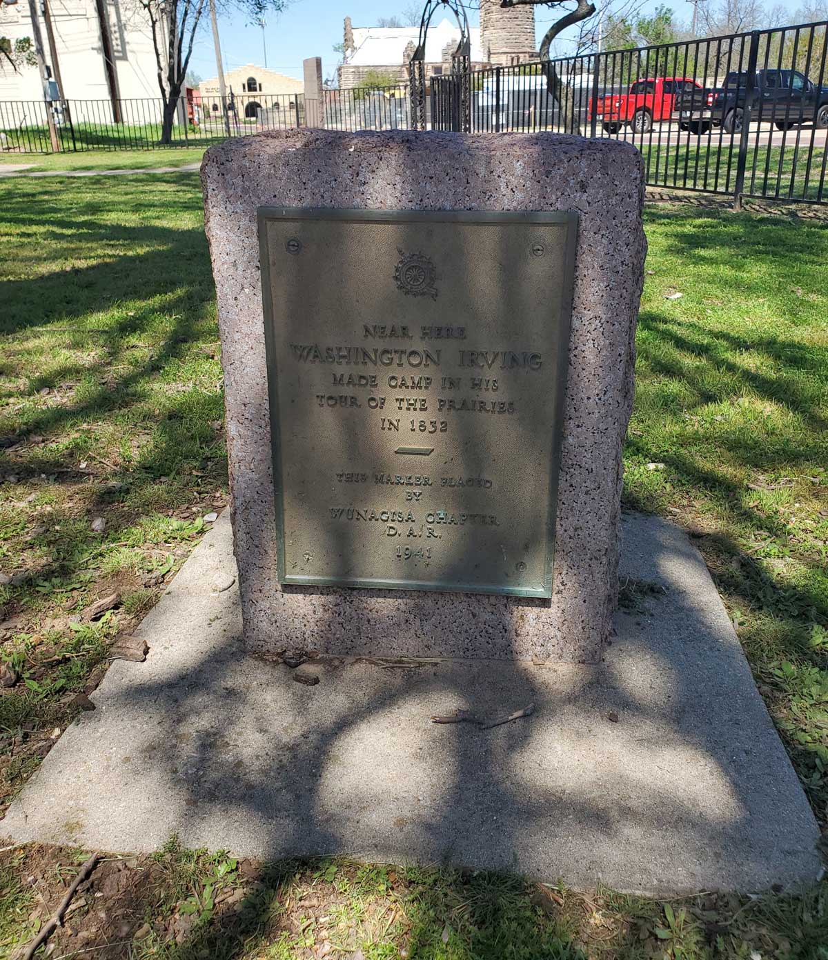
Location: on grounds of Santa Fe Museum on East Main Street in Shawnee (DAR)
Sponsored by: Daughters of the American Revolution
Topics: Arts, Westward Expansion 1803–1861
Writer Washington Irving camped near here on his tour of the prairies in 1832.
Location: on OK-9 in Little Axe Park ten miles east of Norman (DAR)
Coordinates: 35.231711, -97.207471
Sponsored by: Daughters of the American Revolution
Material: Concrete with bronze plaque
Note: Marker was reported as damaged.
Topics: Arts, Settlement Patterns, Westward Expansion 1803–1861
Noted American author Washington Irving and his party camped near Norman on his tour of the prairies in 1832, giving the outside world its first glimpse at the land that would become Oklahoma.

Location: on OK-66 in Arcadia
Material: Aluminum
Topics: Arts, Westward Expansion 1803–1861, Folklife
Washington Irving camped in this area in October 1832. During his tour of the prairies, Irving and his fellow explorers hunted wild horses. His description of the hunt filled a chapter of his classic, A Tour on the Prairies.

Location: at West Easton Avenue and North Vancouver Street in Tulsa
Topics: Arts, Westward Expansion 1803–1861, Transportation
Washington Irving traveled through Tulsa County in 1832 during his tour of the prairies.
Location: three miles west of OK-9 near Fort Cobb
Topics: Early Statehood 1907–1941, Education, Government
From 1923 to 1955, area students were educated in a two-story red brick building. A gray stone gymnasium, built by the Works Progress Administration during the Great Depression, was home to the Washita Eagles but was torn down in 1996.
Location: at 601 Katy Drive in Altus
Topics: Military, Government
A mock Atlas missile was used to test this underground silo's weight-and-balance systems at nearby Altus Air Force Base in the 1960s. It was called "waterbird," because it was filled with water, rather than the liquid oxygen in the actual missiles.
Location: on county road three miles south of Garvin
Topics: Social/Cultural, American Indians, Territorial Period 1861–1907
One of the first community cemeteries in McCurtain County, Waterhole was used by two Choctaw families in the 1870s, but later became a burial ground for all races. Choctaw Principal Chief Isaac Garvin is buried here.

Location: on US-59, 1/2 mile south of Grove
Material: Aluminum
Topics: American Indians, Settlement Patterns, Government, Military
Watie and his cousin, John Ridge, were signers of the 1835 treaty that brought about the removal of the Cherokees from Georgia to Indian Territory. Ridge was killed by opponents of removal, but Watie escaped and became a general in the Confederate Army during the Civil War. See Stand Watie.
Location: on US-70 in Waurika
Material: Aluminum
Topics: Government, Settlement Patterns, Territorial Period 1861–1907, American Indians
Waurika is the only county seat located in Oklahoma on the 98th Meridian. The post office was opened on June 28, 1902. The west side of town was the Kiowa-Comanche reservation, part of Oklahoma Territory, while land east of the line was Pickens County in the Chickasaw Nation.


Location: on US-64 at west end of the Arkansas River Bridge
Material: Originally aluminum, now granite
Topics: American Indians, Indian and Frontier Trade, Westward Expansion 1803–1861, Water, Transportation, Territorial Period 1861–1907
Western Cherokee Chief Walter Webber established a trading post here in 1829. The falls on the Arkansas were reportedly six feet high in 1806, sufficient to block travel for river steamers. The village of Webbers Falls was burned by federal troops in the Civil War in April 1863.


Location: on County Road 210 in town of Friendship
Material: Aluminum
Topics: Urban Development, Settlement Patterns, Religion/Philosophy, Territorial Period 1861–1907
The town of Friendship, once called Alfalfa, derived its name from the Friendship Baptist Church, established in 1908. Friendship once had a dozen businesses until a decline in rural population caused its demise after World War II. See Great Western Trail.
Location: on county road, nine miles north and eight miles west of Buffalo
Material: Granite
Topics: Ranching, Transportation, Territorial Period 1861–1907
From 1874 to 1893, millions of cattle and horses were driven from Texas through what became western Oklahoma over the westernmost of the famous cattle trails. The trail crossed the Red River and Doan's Crossing in Jackson County and continued north to Dodge City, Kansas.
Location: on US-70, 1 1/2 miles east of Millerton
Material: Aluminum
Topics: Education, American Indians, Social/Cultural, Territorial Period 1861–1907
This boarding school for Choctaw orphan girls was completed in 1884 northeast of the Wheelock Church. Five of the buildings survived and are being restored by the Choctaw Nation.

Location: on US-70, 1 1/2 miles east of Millerton at church site
Material: Aluminum
Topics: Education, Religion/Philosophy, Westward Expansion 1803–1861, American Indians
Wheelock is the oldest church building in Oklahoma. Built by Reverend Alfred Wright in 1846, the stone church is still used. Wright had established the mission among the Choctaws fourteen years earlier. Nearby was the Wheelock Academy, a famous school for Choctaw girls.

Location: on US-75, three to four miles south of Calvin
Material: Aluminum
Note: Marker reported missing on 6/8/2023
Topics: Military, Government, Transportation, Westward Expansion 1803–1861, Arts, Natural Resources
Under instructions of Jefferson Davis, US Secretary of War, Lieutenant A. W. Whipple (later Major General, US Army) made the first railroad survey from Fort Smith to the Pacific Coast in 1853. With H. B. Mollhausen, artist, Jules Marcou, geologist, and other scientists in the party, they crossed here on August 10 from camp a few miles east near Shawnee Town.
Location: thirteen miles west of Greenfield, on county road and south of the small creek near the north line of SE 1/4 of Sec. 32, T 15 N, R 13 W. Whirlwind Cemetery is near this location
Topics: Religion/Philosophy, Territorial Period 1861–1907, American Indians
A day school for Cheyenne children, named for friendly Chief Whirlwind, opened here at this location in 1897. From 1904 to 1917, it was a well-known mission school under the auspices of the Protestant Episcopal Church.

Location: on US-62, eight miles west of Anadarko
Material: Aluminum
Topics: American Indians, Government, Military, Westward Expansion 1803–1861
This first Indian agency opened by the federal government in western Oklahoma began operations in 1859 on the site of an abandoned Kichai village. Agents controlled relations with the Wichitas and exiled tribes from Texas, including Caddo, Anadarko, Tawakoni, Waco, and Ionie. Federal Indian forces attacked the agency on the night of October 23, 1862, before the federal troops all but exterminated the Confederate Tonkawa tribe in a bloody massacre nearby. The attacks closed the work of the agency until after the Civil War when it was moved to Anadarko.

Location: on US-69, one mile north of Arkansas River bridge
Material: Granite
Topics: Indian and Frontier Trade, Folklife, American Indians, Westward Expansion 1803–1861
Wigwam Neosho was a trading post from 1829–33, named and operated by Sam Houston, Ex-Gov. of Tennessee and future president of the Republic of Texas. Houston was called Colonneh (The Raven) by his Cherokee friends. American author Washington Irving visited Houston in 1832 as he made notes for his book, A Tour of the Prairies, now an Oklahoma classic.
Location: nine miles south of Stillwater, four miles west, and one mile north of OK-33
Topics: Westward Expansion 1803–1861, Arts, Folklife
Writer Washington Irving and his party camped on Wild Horse Creek during his tour of the prairies in 1832.
Location: on OK-19 at intersection with Williams Street in Maysville
Material: Granite
Topics: Social/Cultural, Industry/Business, Manufacturing, Early Statehood 1907–1941, Transportation
Wiley Post lived with his family in Maysville during his childhood. In 1933 he became the first person to fly solo around the earth. He also invented the pressurized flying suit and discovered the jet stream. He is considered one of the greatest pioneers in aviation.
Location: in Memorial Park Cemetery at Memorial Road and Broadway Extension in Oklahoma City
Material: Granite
Topics: Recreational/Service, Social/Cultural, Industry/Business, Early Statehood 1907–1941
The "Father of Modern Aviation," Wiley Post, in 1933, was the first person to fly alone around the world. This self-taught scientist grew up in Oklahoma, discovered the jet stream, and invented the pressurized flying suit. Post's 1935 funeral was the largest in Oklahoma history; 75,000 people gathered.
Location: on grounds of Will Rogers Memorial in Claremore (DAR)
Sponsored by: Daughters of the American Revolution
Topics: Arts, American Indians, Early Statehood 1907–1941, Mass Communication
The famous Oklahoman charmed the world with his wit and wisdom in vaudeville, radio, the movies, and as a newspaper columnist.
Location: in Will Rogers Park, 3500 North Portland, Oklahoma City
Topics: Government, Social/Cultural, Recreational/Service, Early Statehood 1907–1941
Civilian Conservation Corps Companies 872, 875,and 895 built this vast city park during the Great Depression from 1933 to 1942. The young men planted trees and built roads and nurseries. The park is widely known for its flower gardens.

Location: on the grounds of the Old Greer County Museum and Hall of Fame, 222 W. Jefferson, Mangum, OK
Coordinates: 34.873322, -99.507031
Material: Granite
Topics: Military, Early Statehood 1907–1941, Industry/Business
Captain William Thomas Ponder of Mangum, OK joined the Lafayette Flying Corps in France in 1917-1918. He was awarded five French Croix de Guerras and the Distinguished Service Cross for extraordinary heroism. Ponder outnumbered thirteen to one, destroyed one enemy plane, so demoralizing the enemy they fled back to Germany. Ponder married Jeanine Dezerville of Paris. They settled in Oklahoma and he became city manager. He later worked for Lockheed as a test pilot and instructor. He is one of the few aces to survive WWI.
Location: on West Broadway Street in Okemah
Coordinates: 35.431312, -96.304030
Sponsored by: Friends of Libraries U.S.A./Grammy Museum
Material: Other (Brick with bronze plaque)
Topics: Social/Culture, Arts, Folklore/Folklife, Early Statehood 1907–1941, Industrial Period 1941–1982
There are two historical markers commemorating the birthplace and hometown of Woody Guthrie at this site. Woody Guthrie was born in Okemah on July 14, 1912. A renowned folk singer and writer, Guthrie penned This Land is Your Land and numerous other songs, poems, and books. Guthrie's music inspired subsequent generations of musicians of every genre. There is another marker on site dedicating the park in memory of Dale Wolfe and Lawrence Powers.
Location: on OK-99 near Wynona
Topics: Government, Folklife, Social/Cultural, Territorial Period 1861–1907
Near here in 1903, lawman Wiley G. Haines and a small posse killed Sam and Will Martin who were wanted for murder, robbery, and other crimes in five states. A third member of the Martin Gang, Clarence Simmons, escaped.
Location: on OK-137 in Twin Bridges State Park, .2 mile north of US-60
Material: Granite
Topics: American Indians, Westward Expansion 1803–1861, Government
The Wyandots moved from Kansas to the north side of the Seneca Reservation in Indian Territory in the 1850s but did not control their own affairs until passage of the Oklahoma Indian Welfare Act of 1936.
Location: five miles west of Verden on Hwy 62, north one mile to road end at "T", then west 1/2 mile to drive leading south across cattle guard and ending in Parrish yard
Material: Granite
Location: on OK-99, eight miles south of Pawhuska
Topics: Government, Territorial Period 1861–1907, Mass Communication
Post office was established in 1903 in Wynona, a Sioux word meaning "first-born daughter.

Location: 2910 East Highway 71, Porum
Sponsored by: Dr. Ron Hood
Material: Aluminum
Topics: Law and Order
Formerly a strong southerly bend in the Canadian River was located here. The course of the river was permanently changed after the construction of the Lake Eufaula Dam in 1964. It is thought that the bend is named for Cole Younger who served in the Civil War as a member of Quantrill’s Raiders and operated in this area 1862-64. After the war, Cole Younger and his brothers would join Frank and Jesse James to form the James-Younger Gang. Although visited by many other famous Outlaws of the time, Younger’s Bend is best known as the home of Sam and Belle Starr 1880-1889. Both lived here until the separate events of their untimely deaths. It remains the quiet final resting place of Belle Starr. “On the Canadian River …far from society, I hoped to pass the remainder of my life in peace.” Belle Starr
Le Flore County
Lincoln County
Logan County
Love County
Marshall County
Mayes County
McClain County
McCurtain County
McIntosh County
Murray County
Muskogee County
Noble County
Okfuskee County
Oklahoma County
Okmulgee County
Osage County
Ottawa County
Pawnee County
Payne County
Pittsburg County
Pontotoc County
Pottawatomie County
Pushmataha County
Roger Mills County
Rogers County
Seminole County
Sequoyah County
Stephens County
Texas County
Tillman County
Tulsa County
Wagoner County
Washington County
Washita County
Woods County
Woodward County
Historical Marker Program
Search Results
Your search returned 709 results.
100th Meridian
Harmon CountyLocation: on US-6, four miles west of Hollis (DAR)
Sponsored by: Daughters of the American Revolution
Topics: Government, Westward Expansion 1803–1861
Now the Oklahoma-Texas border, the 100th Meridian was part of the disputed boundary between Spanish territory and the vast Louisiana Purchase, a boundary solidified by the Adams-Onis Treaty in 1819.
101 Ranch
Noble CountyLocation: on OK-156, north of Marland
Coordinates: 36.567150, -97.149150
Sponsored by: OHS/ODOT
Material: Aluminum
Topics: Ranching, American Indians, Arts, Territorial Period 1861–1907, Petroleum, Industry/Business, Agriculture
Believed to have derived its name from the 101,894 acres of the Ponca Reservation, this huge ranch was founded by George W. Miller and his sons in the early 1880s on land he leased, eventually purchased, or otherwise acquired from the Ponca Indians. The ranch became world-famous for its Wild West show, oil wells, livestock, and farm products.
48 Milepost Old State Line
Le Flore CountyLocation: on OK-1 just west of Arkansas border
Topics: Transportation, Military, Westward Expansion 1803–1861, Territorial Period 1861–1907
This site was forty-eight miles from Fort Smith on the military road that ran south to Texas.
700 Ranch House
Carter CountyLocation: on Sunset Drive in Ardmore
Topics: Urban Development, Transportation
Ardmore's beginning is traced to the establishment of the 700 Ranch. In 1870, the Roff log house was the first building erected within what would become the city limits of Ardmore. The house was moved to its present site in 1991.
96th Parallel
Osage CountyAda
Pontotoc CountyLocation: at the intersection of US-177 and OK-1
Topics: Retail, Mass Communication, Government, Urban Development, Territorial Period 1861–1907
Ada began in 1890 when William Jefferson Reed built a log store and dwelling. A post office was established on July 10, 1891, and named for Reed's oldest daughter, Ada. The city was incorporated in 1901 and became the county seat of Pontotoc County at statehood.
Albert Expedition
Blaine CountyLocation: 1.5 miles northwest, then one mile north and seven miles west of the Canadian River bridge on former US Highway 66
Topics: Transportation, Empire Period 1541–1803, Government, Military
At this location on October 1, 1845, a military expedition to the Rocky Mountains under the command of James William Albert paused on its return journey to sketch the buttes appearing to the south. This was the first expedition to make the overland trip with a train of wagons from Bent's Fort, in present-day Colorado, down the Canadian River to Fort Gibson.
Alexander Posey
McIntosh CountyLocation: off OK 9 in Posey Park, in Eufaula
Coordinates: 35.288483, -95.585067
Sponsored by: Oklahoma Historical Society and the Oklahoma Department of Transportation
Material: Aluminum
Note: This marker was originally located in Vivian (8 miles west of Eufaula) and moved to its present location at an unknown date. The marker text indicating the location of Posey’s birthplace in relation to the marker is now incorrect.
Topics: American Indians, Arts, Territorial Period 1861–1907, Mass Communication, Government
This famous Creek poet and journalist's life prematurely ended when he drowned in the North Canadian River near Eufaula on May 27, 1908. Alexander Posey was the editor of newspapers, a member of the Dawes Commission, and widely known for his poems such as "Ode to Sequoyah."
Alice Robertson
Muskogee CountyLocation: in Greenhill Cemetery in Muskogee (DAR)
Sponsored by: Daughters of the American Revolution
Topics: Government, Civil Rights, Early Statehood 1907–1941
Alice Robertson, a member of the Daughters of the American Revolution, was Oklahoma's first female member of Congress, elected in 1920 from the Second Congressional District for one term. See Greenhill Cemetery.
Alikchi Court Ground
McCurtain CountyLocation: on OK-3, 1/2 mile east of Ringold
Topics: Government, American Indians, Territorial Period 1861–1907, Folklife, Social/Cultural
The last execution under Choctaw law was carried out here in 1899. According to Choctaw custom, a prisoner sentenced to death was allowed freedom to set family affairs in order from the time of sentencing until he returned to face the firing squad.
Alikchi Springs
McCurtain CountyTopics: American Indians, Law and Order
Alikchi was established in about 1834 as “Court Town“ or the District Capital of the Oklahoma Falaya (later Apukshunnubbee) District of the Choctaw Nation. On July 13, 1899, Alikchi Court grounds were the scene of the last official execution under Choctaw tribal law. With the Curtis Act of 1906, the court was closed.
Altus Air Force Base
Jackson CountyLocation: on Altus Air Force Base
Topics: Military, Industrial Period 1841–1892, Government
Features of Altus Air Force Base include a display of American aircraft stationed at the air base and a memorial to R. W. "Dick" Moore who was instrumental in re-establishing Altus Air Force Base after World War II.
Altus Jackson County Well
Jackson CountyLocation: on the north side of the county courthouse in Altus
Topics: Water, Urban Development, Environmental/Cultural Ecology, Territorial Period 1861–1907
This hand-dug brick-lined well was the community's only water supply from 1889 to the late 1920s. The well was paved over in 1937 but was rediscovered and restored in 1990.
American Mutual Company
Oklahoma CountyLocation: 1001 N. Pennsylvania Oklahoma City, OK
Material: Aluminum
Topics: Industry/Business, Retail, Social/Cultural, Urban Development
A pioneer of the warehouse club retail industry, AMC was established by the Homsey brothers and operated on this site from 1961 until 1987. The Homseys fought in court to give business owners the right to set their own prices without interference by producers, won in the Oklahoma Supreme Court on April 18, 1961, and thus changed Oklahoma's retail environment.
Amos Chapman
Dewey CountyLocation: in Brumfield section of Seiling Cemetery
Material: Aluminum
Topics: American Indians, Military, Territorial Period 1861–1907, Government, Westward Expansion 1803–1861
Amos Chapman was a famous civilian American Indian scout employed by the US Army. He was one of only five survivors of the Buffalo Wallow Fight in 1874, an action that earned him the Congressional Medal of Honor. Chapman later married Mary Longneck, the daughter of a Cheyenne chief.
Andrew Solomon Layton
Oklahoma CountyLocation: on the grounds of the Wiley Post Building, 2100 North Lincoln Boulevard, Oklahoma City
Material: Granite
Topics: Social/Cultural, Urban Development, Early Statehood 1907–1941, Government, Education
Oklahoma's premier pioneer architect, Layton designed the State Capitol (1914), the Oklahoma Historical Society building (1930), and other early Oklahoma City structures, including the Mid-Continent Life Insurance Building. Statewide, Layton and his associates designed more than a hundred buildings, including thirty-two buildings at six colleges (plus at least one in Texas), twenty-one government buildings, and more than forty schools. He also designed residences in a number of communities and even a subdivision in Ponca City for the Marland Company.
Antlers Tornado
Pushmataha CountyLocation: on OK-3 at the railroad depot in Antlers
Topics: Natural Resources, Industrial Period 1841–1892
On April 12, 1945, a tornado dipped down in Antlers, killing 86 people and leaving 1,500 homeless. The tornado continued on a deadly track to the northeast.
Arcadia Historical Marker
Oklahoma CountyLocation: on State Highway 66 between Luther and Arcadia
Ardmore
Carter CountyLocation: on US Highway 77, north of Ardmore, Carter County
Topics: Religion/Philosophy, Education, American Indians, Territorial Period 1861–1907, Government
The Ardmore post office was named for Ardmore, Pennsylvania, and established on October 27, 1887, on the Gulf, Colorado & Santa Fe Railroad, built north from Texas. Ardmore was the home of Lee Cruce, second governor of Oklahoma from 1911–1915. Hargrove College was opened by the Methodist Church in 1895 and became Carter Seminary in 1917 for Chickasaw girls. It was named for Charles D. Carter, M.C.
Ardmore Air Crash
Carter CountyLocation: on OK-53, on the corner of Ardmore Industrial Airpark (See Ardmore Army Air Field)
Topics: Transportation, Military, Modern Period 1982–present
On April 22, 1966, six soldiers and a crew of six died when an American Flyers Company Electra turboprop airplane crashed in the Arbuckle Mountains about "two miles and two hills" east of the Ardmore Airpark. Seventeen survived the crash. The plane was en route from Fort Ord, California, to Fort Benning, Georgia.
Ardmore Army Air Field
Carter CountyLocation: at Ardmore Industrial Airpark, seven miles east of Exit 40 on I-35
Topics: Military, Industrial Period 1841–1892
The Ardmore Army Air Field base was built to train airmen from 1942 to 1946. From 1953 to 1958, the facility was known as the Ardmore Air Force Base. A nearby marker honors the trainees who were casualties in World War II and the Korean War.
Ardmoreite Building
Carter CountyLocation: at 117 West Broadway in Ardmore
Topics: Urban Development, Early Statehood 1907–1941, Social/Cultural, Retail
This five-story building erected in 1930 was originally called the Gilbert Building. Four radio stations, a television station, law offices, dentists, and the Ardmore Little Theater have called the building home.
Asbury Manual Labor School
McIntosh CountyLocation: on BUS-69 in Greenwood Cemetery north of Eufaula
Coordinates: 35.293967, -95.582650
Sponsored by: Oklahoma Methodist Historical Society
Material: Stone monument with bronze plaque
Topics: Religion/Philosophy, Education, American Indians
Stones that make up the monument are from the original buildings of Asbury Manual Labor School (est. 1847). The original site of the school lies under Lake Eufaula. Monument dedicated to Methodist missionaries who established the school for Native children and youth.
Atlas F Intercontinental Ballistic Missile Site
Greer CountyLocation: Beside OK Highway 34/U.S. Highway 283, immediately west of the Willow missile site. Willow, OK
Material: Aluminum
To counter the Soviet Union's Cold War nuclear threat in the 1950s, the United States government created the Atlas Intercontinental Ballistic Missile. Twelve Atlas F Missile sites were built near Altus Air Force Base between 1960 and 1962. One of these sites sat immediately east of this marker.
The underground silo that housed the 82-foot-long missile here was 174 feet deep with a diameter of 52 feet. Connected to the missile silo by a tunnel was the underground Launch Control Center. A five-person crew lived there around the clock, ready to fire the missile. Once fired, the Atlas stored here was capable of reaching the Soviet Union in 43 minutes.
This missile site was attached to the 577th Strategic Missile Squadron at Altus Air Force Base. All 12 Altus-area missiles were put on alert during the October 1962 Cuban Missile Crisis. On March 25, 1965, the 577th SMS was inactivated.
The Atlas Missile program was a national security priority under Presidents Eisenhower, Kennedy and Johnson. The Willow Atlas Missile site played a crucial role in the nation's Cold War nuclear arsenal from 1962 to 1965.
This marker provided by the CHARLES T. and MARY ELLEN DOYLE FAMILY.
B. B. McKinney Cabin
Murray CountyLocation: at the Falls Creek Conference Center at Turner Falls south of Davis (OBHC)
Sponsored by: Baptist General Convention of Oklahoma
Topics: Religion/Philosophy, Arts, Social/Cultural
The legendary Southern Baptist composer, who directed music at Falls Creek from 1925 to 1947, wrote the song, "Wherever He Leads I'll Go," in this cabin.
Babbs Switch Fire
Kiowa CountyLocation: in Hobart Cemetery
Topics: Education, Social/Cultural, Government
On Christmas Eve in 1924, thirty-six men, women, and children died in a fire that raged through the country school during a Christmas program. Candles ignited a Christmas tree and spread to new paint on the walls. The doors were built to open inward, and when people crowded them to escape, they were trampled. The fire resulted in new laws that required school exit doors to open outward.
Bacone College
Muskogee CountyLocation: at front entrance of Bacone College in Muskogee (DAR)
Sponsored by: Daughters of the American Revolution
Topics: American Indians, Education, Religion/Philosophy, Territorial Period 1861–1907
Almon C. Bacone founded Bacone College for American Indians in Tahlequah, Cherokee Nation, in 1880. The school was moved to Muskogee in the Creek Nation in 1885. It is affiliated with the American Baptist Church and is the oldest college continually in operation in Oklahoma.
Bake Oven
Muskogee CountyLocation: at the Fort Gibson Historic Site
Topics: Military, Territorial Period 1861–1907, Transportation, Social/Cultural
This brick oven was constructed with the new bakery erected at Fort Gibson about 1863 to supply the garrison with fresh bread.
Baker's Ranch
Kingfisher CountyLocation: the west side of US-81, four miles south of Hennessey
Coordinates: 36.0564576,-97.8995264
Sponsored by: Oklahoma Historical Society and Oklahoma Department of Transportation
Material: Granite
Topics: Ranching, Territorial Period 1861–1907
Site one-half mile west. This ranch station, noted water place on the old Chisholm Trail, was attacked in the last Indian Wars and found deserted a few days later, July 5, 1874, by Indian Agent J. D. Miles, who asked for U.S. Cavalry to guard the trail in this section. This site was laid out in 1890 as Baker City, a ghost town now.
Bankers National Bank Building
Carter CountyLocation: at 100 West Main Street in Ardmore
Topics: Petroleum, Territorial Period 1861–1907, Social/Cultural
Built in 1905, the building became a casual meeting place for early oil men seeking deals.
Baptist Mission
Adair CountyLocation: 3 miles north of junction of US 62 and US 59 at Old Baptist Mission Church, Westville vicinity
Coordinates: 36.035258, -94.583987
Material: Aluminum
Topics: Westward Expansion 1803–1861, Religion/Philosophy, Education, American Indians
The present-day white frame building contains some of the original timbers of the log church built in 1839. Reverend James Bushyhead, the first supreme court judge of the Cherokee Nation, established the mission which the Cherokees called Bread Town. The Cherokee Messenger, a religious publication, was printed at the mission beginning in 1844. Bacone College at Muskogee is an outgrowth of the school begun at Baptist Mission.
Baptist Orphans' Home
Oklahoma CountyLocation: at the southeast corner of Northwest 63rd Street and Pennsylvania Avenue in Oklahoma City (OBHC)
Topics: Social/Cultural, Territorial Period 1861–1907, Education
In 1903, J. A. Scott founded an orphans' home here. The name was changed to the Oklahoma Baptist Children's Home in 1936. In 1983 the property was sold, and a new campus opened on South Western Avenue in Oklahoma City.
Baptists at Cowlington
Sequoyah CountyLocation: on US-59 south of Sallisaw near junction with OK-9 (OBHC)
Topics: Religion/Philosophy, Westward Expansion 1803–1861
A Baptist church organized in a brush arbor here in 1837. This church and seven other churches formed the Short Mountain Association in 1844, the first and oldest Anglo Baptist Association in Oklahoma.
Barnes-Stevenson House
McCurtain CountyLocation: at 302 Southeast Adams Street in Idabel
Topics: Family/Household, Government, Early Statehood 1907–1941
The restored 1912 home of Judge T. J. Barnes is now owned by the McCurtain County Historical Society. Barnes was McCurtain County's first county judge. The house contains World War I–era furnishings.
Battle of Backbone Mountain
Le Flore CountyLocation: on OK-112, one mile north of OK-120
Topics: Military, Territorial Period 1861–1907, American Indians
Union forces, led by Major General James G. Blunt, and Confederate troops, commanded by Brigadier General William L. Cabell, skirmished here in September of 1863. On July 27, 1864, a Choctaw battalion under the command of Captain Jackson McCurtain defeated federal troops nearby.
Battle of Cabin Creek
Mayes CountyLocation: on US-69, one mile south of Craig-Mayes County line
Topics: Military, Government, Territorial Period 1861–1907, American Indians, Transportation
The first Battle of Cabin Creek was fought July 1 and 2, 1863, where Cabin Creek crossed the old Fort Gibson Military Road. The second battle occurred September 18, 1864, when 2,000 Confederate troops under Brigadier General Stand Watie captured a 130-wagon federal supply train carrying $1.5 million in goods. This was the last major Civil War engagement in Indian Territory.
Battle of Chustenahlah
Osage CountyLocation: A half mile west of N 52nd W Avenue on the north side of Highway 20
Coordinates: 36.368646, -96.059451
Material: Granite
Topics: Military, Government, American Indians, Westward Expansion 1803–1861
This site, 3.5 miles NW, is where Colonel James McIntosh, 2nd Arkansas Mounted Rifles, routed loyal Union Indian forces December 26, 1861. The battle opened with fire from the Indian line of Patriot's Hill, 2 miles southwest. The loyal Union Indians finally fled to Kansas.
Battle of Chusto-Talasah
Tulsa CountyLocation: on OK-11 at 86th Street North in Tulsa
Topics: Military, American Indians, Territorial Period 1861–1907, Government
This battle was the second in a series of three engagements between pro-Northern Indians led by Opothleyahola and a combined white and Indian Confederate force on December 9, 1861, on Bird Creek.
Battle of Honey Springs
Muskogee CountyLocation: on US-69, south of Oktaha
Material: Aluminum
Topics: Military, Government, Transportation, Indian and Frontier Trade, Territorial Period 1861–1907
This battlefield east of the marker, beginning near the south edge of Oktaha, extends south over the countryside more than two and a half miles to Honey Springs on Elk Creek, located south of the Muskogee County line in McIntosh County. Beautiful, clear flowing Honey Springs can be seen about one and a half miles east and north of Rentiesville, McIntosh County. On a rise of ground several hundred feet north of the springs was a Confederate commissary depot where large stores of flour, pork, and other supplies in a big warehouse were destroyed by the Confederate troops to keep them from falling into the hands of the enemy.
Battle of Locust Grove
Mayes CountyLocation: on OK-33 on east side of Locust Grove in parkway at "Pipe Spring," SH 33
Material: Aluminum
Topics: Military, Government, American Indians, Social/Cultural, Transportation
On July 2, 1862, federal troops under Colonel William Weer surprised a Confederate encampment here. The Southerners led by Colonel J. J. Clarkson surrendered, but heavy fighting continued throughout the day in nearby woods between Union troops and Confederate soldiers who escaped the raid.
Battle of Round Mountain
Payne CountyLocation: one mile north and 1/4 mile west of intersection of OK-18 and OK-51, four miles west of Yale
Material: Granite
Topics: Military, Government, American Indians, Westward Expansion 1803–1861
Between the landmark known as Round Mountain (Twin Mounds) to the south and a camp on Salt Creek two miles northwest, the first battle of the Civil War in Oklahoma was fought between a group of loyal Creeks under Opothleyahola and Confederate forces led by Colonel Douglas H. Cooper. Some scholars believe this engagement took place in Tulsa County.
Battle of Round Mountain
Tulsa CountyLocation: at junction of OK-51 and Old Dawson Road south of old Keystone
Topics: Military, Territorial Period 1861–1907, Government
The first Civil War battle in Oklahoma was fought here on November 19, 1861, between Confederate troops led by Colonel Douglas H. Cooper and Union forces led by Creek Chief Opothleyahola. The Southerners prevailed and occupied the Confederate encampment nearby. Some scholars believe this battle occurred in Payne County.
Battle of the Washita
Roger Mills CountyLocation: in downtown Cheyenne one block south of US-283 and OK-47 intersection
Material: Granite
Topics: Military, Territorial Period 1861–1907, American Indians
On November 27, 1868, Colonel George Armstrong Custer led the 7th Cavalry in an attack on Chief Black Kettle's camp on the Washita River. The surprise, early-morning attack decimated the Cheyenne camp and no doubt was the seed for Custer's later meeting with American Indians at the Battle of Little Big Horn.
Battle of the Wichita Village
Grady CountyLocation: on US-81 on north edge of Rush Springs
Material: Aluminum
Topics: Military, American Indians, Westward Expansion 1803–1861, Land Openings, Territorial Period 1861–1907
Four companies of the 2nd Cavalry, under the command of Major Earl Van Dorn, attacked a Comanche band near a Wichita village here on October 1, 1858, even though the Indians were on their way from a friendly council at Fort Arbuckle. Seventy Indians were killed, all because of poor communication. Pikey's Crossing was also an entry site for the Land Run of April 22, 1889.
Battle of Turkey Springs
Woods CountyLocation: on US-64, two miles east of Camp Houston
Coordinates: 36.81235, -99.07458
Sponsored by: Cherokee Strip Volunteer League and the Oklahoma Historical Society
Material: Aluminum
Topics: American Indians, Military, Government, Territorial Period 1861–1907
The last known encounter between American Indians and the federal government in Oklahoma occurred in this area on September 13–14, 1878. Units of the 4th Cavalry battled with Northern Cheyennes led by Dull Knife and Little Wolf as they fled Indian Territory to return to the north. An Arapaho scout and three soldiers were killed.
Beaver County
Beaver CountyLocation: on OK-23 and US-270 in Beaver
Material: Granite
Topics: Settlement Patterns
Located on the site was a two-story frame building that served as the meeting place in March 1887 for organizing the area known as "No Man's Land" into "Cimarron Territory." The area was inhabited by ranchers, cowboys, outlaws, and settlers looking for homes. The effort to create Cimarron Territory failed, but No Man's Land became Beaver County, the seventh county of Oklahoma Territory, in 1890. At statehood in 1907, Beaver County was divided into Beaver, Texas, and Cimarron Counties.
Beaver's Bend
McCurtain CountyLocation: at Beavers Bend State Park near Broken Bow
Material: Granite
Topics: Government, Early Statehood 1907–1941, Environmental/Cultural Ecology, Social/Cultural, Recreation/Service
This unique park was developed between 1935 and 1941 by members of CCC Company 2815, one of many such units organized during the Great Depression by the federal government to provide employment for thousands of young men in conserving and developing the nation's natural resources
Bedlam
Logan CountyLocation: in Mineral Wells Park on south edge of Guthrie
Coordinates: 35.868773, -97.426550
Sponsored by: OU/OSU Bedlam Centennial
Material: Granite
Topics: Social/Cultural, Recreational/Service, Territorial Period 1861–1907
Commemorates the first football game between Oklahoma State University and the University of Oklahoma held in present-day Mineral Wells Park in Guthrie on November 5, 1904.
Beecham Cemetery
Canadian CountyLocation: on US-81, eight miles north and one mile east of El Reno
Topics: Social/Cultural, Family/Household
The cemetery was established by the Beecham family to provide burial space for pioneers of the area. Many graves are marked only by crude stones, their inscriptions eroded by a century of exposure to the elements. In 1972, the Beecham Cemetery Association collected funds to provide for perpetual care for the one-acre cemetery.
Bernard de La Harpe 1719
Latimer CountyLocation: on US-270, five miles east of Hartshorne
Material: Aluminum
Topics: Empire Period 1541–1803, American Indians
The French explorer Bernard de La Harpe came north from Louisiana seeking trade with the Wichita Indians. He camped three miles east of Hartshorne on August 25, 1719, on his way north to the Canadian River and Wichita villages.
Big Four School
Kingfisher CountyLocation: east of Kingfisher on State Hwy 33 on SE corner of SE 1/4 of 14-16-6
Coordinates: 35.856528, -97.798852
Sponsored by: Big Four Alumni Association
Material: Granite
Topics: Education, Early Statehood 1907–1941
Big Four School, located three miles north, was formed on March 17, 1920, by a special election vote to consolidate the districts of White Cap, Twilight, Wandell, and Bird Creek. The school graduated its first senior class in 1924; its last in 1968. It continued as a grade school until closing in May 1978.
Big Pasture
Tillman CountyLocation: on OK-70 in Grandfield
Material: Granite
Topics: American Indians, Territorial Period 1861–1907, Natural Resources, Land Openings, Settlement Patterns
A half-million acres were reserved for grazing lands when the Kiowa-Comanche-Apache lands were opened to public settlement in 1901. Because of the rich soil, pressure was brought on the federal government to open the Big Pasture to settlement. The land was sold by sealed bids beginning in December 1906. It was the last big land opening in Oklahoma.
Big Spring
Kay CountyLocation: at intersection of 13th Street and South Avenue in Ponca City (DAR)
Sponsored by: Daughters of the American Revolution
Topics: Water, Westward Expansion 1803–1861, Territorial Period 1861–1907, Urban Development
Indians and explorers used this water supply before it became the main water supply for Ponca City, a village established after the opening of the Cherokee Outlet in 1892.
Bill Dalton Killing
Carter CountyLocation: on Poolville Road, six miles north of OK-53
Coordinates: 34.419800, -97.399538
Material: Aluminum
Topics: Territorial Period 1861–1907, Government
In 1894, US Marshal Selden Lindsey shot famous outlaw Bill Dalton here.
Birthplace of Interstate Oil Compact Commission
Kay CountyLocation: Pioneer Woman Museum
Material: Granite
Topics: Petroleum, Government, Early Statehood 1907–1941, Natural Resources, Environmental/Cultural Ecology
Original plans for creating Interstate Compact to conserve oil and gas were developed on December 4, 1934, at the home of Governor-elect E.W. Marland, located one half mile northeast of this spot. Participants from twelve oil-producing states took part in these discussions of national and international significance. The purpose was to form a compact for bringing about conservation and prevention of waste in petroleum resources, through coordinated efforts of States Compact, creating the Interstate Oil Compact Commission. It was approved on February 16, 1935, in Dallas, Texas, and was ratified the same year by the legislatures of Oklahoma, Texas, New Mexico, Colorado, Illinois, Kansas, and consented to by Congress on August 27, 1935. By 1966, thirty states were active members, and three were associate members. Official observers included representatives from Alberta and Saskatchewan in Canada; Colombia and Venezuela in South America; US Department of Defense and Interior; and the Federal Power Commission. The headquarters of the Compact Commission were established on Capitol grounds in Oklahoma City.
Birthplace of Jim Thorpe
Lincoln CountyLocation: at 1008 North Broadway, in front of the Prague Historical Museum on SH-99-US-377 just north of the US-62 Junction in Prague
Material: Granite
Topics: American Indians, Recreational/Service, Social/Cultural, Early Statehood 1907–1941, Industrial Period 1892–1941
James Francis Thorpe, a Sac and Fox, was born as Wa-tho-huck or "Bright Path." He dominated the 1912 Olympics, winning both the decathlon and pentathlon events. He played Major League Baseball and professional football. He was the first president of the National Football League and is a member of Professional Football Hall of Fame. The Associated Press voted him the world's greatest male athlete of the first half of the twentieth century.
Birthplace of the State of Oklahoma
McClain CountyLocation: in downtown Purcell
Topics: Government, Territorial Period 1861–1907
The first convention advocating the combining of Oklahoma and Indian territories into a single state was held at Purcell on September 13, 1893. Delegates to the convention sent their resolution to Congress, but no action was taken. Oklahoma was admitted to the Union fourteen years later.
Birthplace of Will Rogers
Rogers CountyCoordinates: 36.437944, -95.687250
Topics: American Indians
November 4, 1879-August 15, 1935. Will Rogers, world-renowned writer, humorist, and actor, was born on a ranch east of Oologah in Cooweescoowee, Indian Territory. He and Wiley Post died in an airplane crash at Point Barrow, Alaska. His birthplace was moved out of the path of Oologah Lake to 2 miles north of here and is open to the public.
Black Beaver
Caddo CountyLocation: on US-62 in National Hall of Fame for Famous American Indians in Anadarko
Topics: American Indians, Military, Westward Expansion 1803–1861
Black Beaver, Delaware Indian frontier scout, served as the interpreter for the US Dragoon Expedition to the Plains Indians in 1834. He was awarded the rank of captain and helped guide expeditions to the Far West, including Captain Randolph Marcy's trip to the goldfields in California in 1849. Black Beaver was buried near his home northwest of Anadarko. In 1975 the Delaware tribe reinterred his body on the Fort Sill Military Reservation.
Black Iron Fountain
Kay CountyLocation: at intersection of Fourth Street and Grand Avenue in Ponca City (DAR)
Sponsored by: Daughters of the American Revolution
Topics: Water, Early Statehood 1907–1941, Social/Cultural
The first watering fountain in Ponca City once stood near the Marland Estate stables. Mrs. George Fluke, the designer of the Oklahoma state flag, repainted the relief daises on the fountain.
Blackburn's Station
Pittsburg CountyLocation: north of Pine Top School
Material: Granite
Note: Marker reported missing
Topics: Transportation, Mass Communication, Government, Westward Expansion 1803–1861
In 1857, Congress created the Butterfield Overland Mail Route to carry mail and passengers between St. Louis, Missouri, and Memphis, Tennessee, and points west. It was the first real transcontinental link between the Atlantic states and the Pacific Coast of the United States. There were twelve stations along a 197-mile route in Oklahoma, including Blackburn's Station.
Blackwell Museum
Kay CountyLocation: at Top of Oklahoma Historical Museum, 303 South Main Street, Blackwell
Topics: Social/Cultural, Land Openings, Mining, Territorial Period 1861–1907
Markers honor the centennial of Blackwell in 1993, the homesteaders who made the run into the Cherokee Outlet in 1893, and employees of Blackwell Zinc Company who served in World War II.
Bloomfield Academy
Bryan CountyLocation: on OK-78, one and a half miles south of Achille
Material: Granite
Note: Marker reported damaged
Topics: American Indians, Religion/Philosophy, Government, Westward Expansion 1803–1861, Education
Bloomfield Academy, a seminary for Chickasaw girls, was established in 1853 by authority of the Methodist Missionary Board. The school was located on two different sites in Bryan County before it was moved to Ardmore in 1917. There it was renamed Carter Seminary in honor of Congressman Charles D. Carter.
Blue Bell Bar
Logan CountyLocation: at Harrison Avenue and Second Street in Guthrie
Coordinates: 35.877057, -97.427351
Sponsored by: Donald W. Reynolds Foundation
Material: Aluminum
Topics: Recreational/Service, Social/Cultural, Folklife, Territorial Period 1861–1907
This was one of Guthrie's most popular saloons during territorial days. Cowboy star Tom Mix was a bartender at the Blue Bell before he left for Hollywood. The original frame building was replaced by the present brick structure in 1903.
Boggy Station
Atoka CountyLocation: four miles south of OK-7 bridge on Clear Boggy River in Boggy Depot State Park
Topics: Transportation
In 1857, Congress created the Butterfield Overland Mail Route to carry mail and passengers between St. Louis, Missouri, and Memphis, Tennessee, and points west. It was the first real transcontinental link between the Atlantic states and the Pacific Coast of the United States. There were twelve stations along a 197-mile route in Oklahoma, including Boggy Station.
Bohemian Hall
Canadian CountyLocation: on Czech Hall Road
Topics: Territorial Period 1861–1907, Ethnic Diversity, Settlement Patterns, Social/Cultural
Bohemian Hall was established in 1899 by early Czech settlers. The original structure was replaced in 1924 by the present building. Bohemian Hall is the focal point of Czech social and musical functions in Oklahoma, including traditional weddings, reunions, and family gatherings. Czech plays have been performed periodically for the last fifty years. The original hand-painted canvas drops for the stage are still in existence.
Boley
Okfuskee CountyLocation: in community of Boley
Coordinates: 35.493390, -96.484182
Sponsored by: Oklahoma Historical Society
Material: Other (Interpretive Panel)
Topics: Ethnic Diversity, Government, Urban Development, Territorial Period 1861–1907, American Indians, Transportation
Boley is one of thirteen All-Black towns, out of more than fifty that once existed, remaining in Oklahoma. While Tullahassee is reportedly the oldest, most were established between 1889 and 1907 as African Americans sought security and control of their own destiny in a segregated world. Boley was established in 1903 on land owned by a Creek Freedwoman, Abigail Barnett. Boley was incorporated on May 11, 1905. By 1911 it boasted more than 4,000 citizens (25,000 in surrounding areas) and many businesses, including two banks and three cotton gins. The town hosts the oldest African American community-based rodeo every Memorial Day weekend.
Boley, Oklahoma
Okfuskee CountyLocation: on US-62 in Boley
Coordinates: 35.488219, -96.484095
Sponsored by: Oklahoma Historical Society/Town of Boley
Material: Aluminum
Topics: Ethnic Diversity, Government, Urban Development, Territorial Period 1861–1907, American Indians
Boley, Creek Nation, Indian Territory, established as an all Black town on land of Creek Indian Freedwoman Abigail Barnett. Organized by T.M. Haynes first townsite manager. Established August 1903. Incorporated May 11, 1905. Declared National Historic Landmark May 15, 1975.
Bond of Friendship
Pawnee CountyLocation: in the town of Skedee
Material: Granite
Bond of Friendship. Welcome to Skedee.
Bonfils Building
Logan CountyLocation: at 107 South Second Street in Guthrie
Coordinates: 35.877679, -97.427689
Sponsored by: Donald W. Reynolds Foundation
Material: Aluminum
Topics: Industry/Business, Folklife, Mass Communication, Territorial Period 1861–1907
F. C. Bonfils ran his real estate business from an office in the first floor of this building and lived on the second floor. Bonfils, a descendant of Napoleon Bonaparte, was considered a con man in his early years. However, he later moved to Denver, Colorado, and co-founded the Denver Post newspaper.
Booker T. Washington High School
McCurtain CountyLocation: at the former Booker T. Washington School campus in Idabel
Coordinates: 33.893863, -94.838091
Sponsored by: Booker T. Washington-Slater-Riverside Alumni Association
Material: Aluminum
Topics: Social/Culture, Ethnic Diversity, Government, Early Statehood 1907–1941, Industrial Period 1941–1982
Booker T. Washington High School began independently in one room of the Masonic Hall. Around 1908, the school moved into an old store. In 1911, it was under the County Superintendent and moved into a two-room building on this site. T.F. Spigner became principal in 1925 and increased the grades steadily through 1931 when three girls graduated 12th grade. The wood building mysteriously burned in l936 and was replaced by the WPA with a stone building costing $21,735. Groundbreaking was held on August 24, 1936, and the building was dedicated on March 24, 1937.
Booker T. Washington High School
Tulsa CountyLocation: on south edge of OSU-Tulsa campus
Material: Granite
Topics: Education, Ethnic Diversity, Civil Rights, Early Statehood 1907–1941
The original school for African American students in Tulsa was a four-room wood building constructed in 1913. In 1919, a brick building was built on the same site and was one of the few structures to survive the 1921 Race Riot. The school moved to its present site in 1950.
Booth Number One
Payne CountyLocation: just west of North Perkins Road in Stillwater
Topics: Government, Land Openings, Settlement Patterns, Territorial Period 1861–1907
The federal government established this booth where thousands registered for the opening of the Cherokee Outlet on September 16, 1893.
Bostwick Conglomerate Outcropping
Carter CountyLocation: one mile north of US-77 and OK-142 in Ardmore
Topics: Natural Resources
On the ten-mile stretch of US-77 north of Ardmore are markers noting the unique geological features of the area. The markers include the Woodford Shale and Chert Outcropping, Chimney Hill Limestone Outcropping, Viola Limestone Outcropping, Tulip Creek and Third Bromide Sandstone Outcropping, Basil McLish Sandstone Outcropping, and the Arbuckle-West Spring Creek Lime Outcropping.
Boulder Springs
Murray CountyLocation: at Falls Creek Conference Center at Turner Falls south of Davis (OBHC)
Sponsored by: Baptist General Convention of Oklahoma
Topics: Natural Resources, Water, Recreational/Service, Social/Cultural
The springs were formerly known as the "Devil's Bathtub," due to the unique shape of the pool.
Boundary Line 1889 and 1893
Payne CountyLocation: at intersection of Ranch Street and Washington Avenue in Stillwater
Material: Aluminum
Topics: Government, Land Openings, Settlement Patterns, Territorial Period 1861–1907, Agriculture
From this line, tens of thousands of settlers raced to stake 160-acre homesteads in the Unassigned Lands in the land run of 1889. This was also the boundary for the opening of the Cherokee Outlet four years later in 1893.
Britton School
Caddo CountyLocation: two miles east of Binger
Sponsored by: Ramona Taylor Rich
Topics: Education, Early Statehood 1907–1941
Britton School was established in 1911 and originally known as Science Hill. Its name was changed to Britton School in honor of a pioneer family. A church located at the same site served as a grade school.
Brooks Opera House
Logan CountyLocation: at Harrison Avenue and Wentz Avenue in Guthrie
Coordinates: 35.877068, -97.424580
Sponsored by: Donald W. Reynolds Foundation
Material: Aluminum
Topics: Arts, Territorial Period 1861–1907, Social/Cultural, Early Statehood 1907–1941, Government
Constructed in 1899 by owner/manager James B. Brooks, this three-story limestone opera house seated 1,100 and contained ten finely appointed private boxes. It was furnished with folding upholstered chairs, steam heat, electric lights, hot and cold water, and other amenities. The adjacent Hotel Royal contained 80 guest rooms. On November 16, 1907, Governor Charles Haskell took the oath of office as the state of Oklahoma's first governor in room 47 of the hotel. Later that day, he was sworn in again in a public ceremony on the steps of the Carnegie Library.
Brooksville
Pottawatomie CountyLocation: in community of Brooksville
Topics: Ethnic Diversity, Urban Development, Territorial Period 1861–1907, Early Statehood 1907–1941, Settlement Patterns, Land Openings
Brooksville is one of thirteen All-Black towns, out of more than fifty that once existed, remaining in Oklahoma. While Tullahassee is reportedly the oldest, most were established between 1889 and 1907 as African Americans sought security and control of their own destiny in a segregated world. Most of the towns began to decline in the 1920s and 1930s as rural African Americans faced economic hardships and began to move to urban areas. Brooksville had a post office from 1909 to 1955 and is named for the first postmaster, Alfred H. Brooks.
Buckner Cemetery
McIntosh CountyLocation: on BUS-69 in Greenwood Cemetery north of Eufaula
Coordinates: 35.293933, -95.582783
Sponsored by: Oklahoma Baptist Historical Commission
Material: Aluminum
Topics: Religion/Philosophy, Family/Household, Westward Expansion 1803–1861
Dr. Henry F. Buckner, called the "apostle to the Creeks," and members of his family are buried here, having been moved from the Buckner home now under Lake Eufaula. Buckner came to the Creeks as a Baptist missionary in 1849.
Buffalo Springs
Garfield CountyLocation: on US-81, 1 1/2 miles north of Bison
Coordinates: 36.2150336,-97.8872384
Material: Aluminum
Topics: Ranching, Transportation, American Indians, Indian and Frontier Trade, Territorial Period 1861–1907
The springs were a favorite rest stop on the Chisholm Trail on long cattle drives from Texas to Kansas. A pioneer merchant, trader, and explorer, Jesse Chisholm, a Cherokee, established the trail through western Indian Territory before the Civil War. Texas cattlemen used the trail until the late 1880s to move millions of cattle to northern markets. The trail ran from Montague County, Texas, to Abilene, Kansas. Buffalo Springs was an important gathering place for settlers making the land run on April 22, 1889.
Bull Foot Station
Kingfisher CountyLocation: west of US-81 in Bull Foot Park, Hennessey
Coordinates: 36.1003327,-97.9004032
Sponsored by: Oklahoma Historical Society
Material: Granite
Topics: Water, Ranching, Transportation, Folklife
On the old Chisholm Trail, this station was noted for its water well. The name from a huge indentation in the ground here, resembling imprint of a bull's foot. Buildings were still standing on site, 50 yards east of the old trail, and 4.5 miles south of the north line of the Oklahoma land, which was opened to settlers by the great run, April 22, 1889.
Burney Institute
Marshall CountyLocation: on OK-32, 1 1/2 miles east of Lebanon
Material: Aluminum
Topics: Education, American Indians, Westward Expansion 1803–1861, Territorial Period 1861–1907, Social/Cultural
The school was opened as a learning center for Chickasaw girls in 1859 under the supervision of the Cumberland Presbyterian Board. In 1887, the name was changed to Chickasaw Orphan Home and Manual Labor School. The first post office, called Burney Academy, opened on July 3, 1860.
Burneyville School
Love CountyLocation: on OK-96 in Burneyville
Topics: Education, Territorial Period 1861–1907
The school, once known as Red River School, was a subscription school when it was founded in 1880s It closed in 1957.
Butterfield Overland Mail Route
Le Flore CountyLocation: on US-271, south bank of Coal Creek, about 1/2 mile south of junction of US-271 and SHY31
Material: Aluminum
Topics: Transportation
Butterfield Trail
Atoka CountyLocation: Confederate Memorial Museum and Cemetery, Atoka
Sponsored by: The Lake Atoka Reservation Association, Oklahoma City Water Utilities Trust, City of Atoka, City of Oklahoma City
Topics: Transportation
On September 16, 1857, the John Butterfield Company received a federal contract to transport mail from Missouri to San Francisco in under 25 days. Semi-weekly trips began a year later.
Cabin Creek Battlefield
Mayes CountyLocation: on US-69 north of Patton
Material: Aluminum
Topics: Military
Emplacements can still be seen where cannons were set to defend the crossing of Cabin Creek. There are many unmarked graves of soldiers who died when General Stand Watie's Confederate troops captured a Federal supply train on September 18, 1864. Earlier, in July 1863, the Confederates were defeated in a small skirmish here.
Caddo Springs
Caddo CountyLocation: along highway in front of Concho Indian School, Concho
Topics: American Indians, Territorial Period 1861–1907, Education, Transportation
Noted for the purity of its waters which come from adjacent sand dune areas, Caddo Springs, sometimes called Concho Springs, was a favored spot on the Chisholm Trail. Cheyenne and Arapaho people alike shared the springs as did the Arapahoe School, later named Concho Indian School, built in 1870. The springs were named for the earliest known Oklahoma inhabitants, the Caddo Indians.
California Road
Dewey CountyLocation: on OK-34, two miles north of Leedy
Part of the road west to California first used by gold seekers in 1849 can be seen at this site.
California Road
Roger Mills CountyLocation: at junction of US-283 and OK-33, 14 miles north of Cheyenne
Material: Aluminum
Topics: Transportation, Settlement Patterns, Westward Expansion 1803–1861, Water, Environmental/Cultural Ecology, Government
The road was a major thoroughfare to the West for more than a half century. It was first traveled by gold seekers headed for California in 1849.
California Trail
McClain CountyLocation: on US Highway 77 just south of Wayne
Topics: Transportation, Settlement Patterns, Military
Caravans of gold seekers in the rush for California traveled this trail in spring 1849 under a military escort commanded by Captain R. B. Marcy. The route lay west from Fort Smith on the south side of the Arkansas and Canadian rivers across Oklahoma. The campground and spring, 3 miles west, was well known on this famous trail.
Camp Arbuckle
McClain CountyLocation: on SH 59, one mile west of Byars
Topics: Military, Westward Expansion 1803–1861, Transportation, Settlement Patterns, American Indians
Camp Arbuckle was established in May 1850 by Captain R. B. Marcy and Company D, 5th Infantry, the site was visited in 1849 by Marcy while escorting gold seekers to California. The post was moved in 1851 to a permanent site in Garvin County. Buildings then were occupied by Delawares under Black Beaver, famous chief and guide. An Indian town, known as Beaversville, existed there until Civil War days.
Camp Comanche
Caddo CountyLocation: on US Highway 62, near boundary line of Caddo and Comanche Counties
Topics: American Indians, Military, Government
Camp Comanche was set up near a large Comanche village by the First Dragoons under Colonel Henry Dodge on July 16, 1834, while en route from Fort Gibson to Plains tribes. Seventy-five Dragoons and noted artist George Catlin were too ill to travel farther with the expedition. The camp was evacuated July 28, upon Dodge's return from peace councils with the Plains Indians.
Camp Comanche
Comanche CountyLocation: in Fort Sill Museum in Lawton
Topics: American Indians, Military, Arts, Westward Expansion 1803–1861, Government
Colonel Henry Dodge set up camp near a large Comanche village in this area in July 1834, hoping to hold talks with Comanche chiefs. Accompanying the US Dragoons Expedition was artist George Catlin, who probably made some of his most famous sketches of buffaloes and Comanches during the twelve days he spent at the camp. The exact location of the camp is unknown.
Camp Leavenworth
Marshall CountyLocation: on US-70 at west side of Kingston
Material: Aluminum
Topics: Military, Westward Expansion 1803–1861, Social/Cultural, American Indians
This frontier post was named for Brigadier General Henry Leavenworth, commander of the Dragoon Expedition through Oklahoma in 1834. Leavenworth died nearby after being injured in a buffalo hunt. Some historians call the 1834 expedition the greatest expeditionary force in the annals of the US Army.
Camp Radziminski
Kiowa CountyLocation: on US-183, one mile north of Mountain Park
Topics: Military, American Indians, Government, Westward Expansion 1803–1861
This frontier army post was manned by troops resisting hostile Indians. The camp was named for Lieutenant Charles Radziminski, a former member of the 2nd Cavalry under the command of Major Earl Van Dorn. Established in September of 1858, the post was used only a short time.
Camp Supply
Woodward CountyLocation: on US-183, one mile east of Fort Supply
Topics: Military, Territorial Period 1861–1907, American Indians, Government
The site was used as a supply camp for Colonel George Armstrong Custer's 7th Cavalry in 1868. General Philip Sheridan received Custer here when he returned from the Battle of the Washita in December of 1868. The name was changed to Fort Supply in 1878 and abandoned in 1894. The State of Oklahoma later used the buildings for a hospital.
Camp Tonkawa Prisoner of War Camp
Kay CountyLocation: original entrance into the camp, which is north of Tonkawa between Public and Main Streets
Topics: Military, Social/Cultural, Government, Ethnic Diversity, Agriculture, Industrial Period 1841–1892
Between October and December of 1942 more than nine hundred construction workers labored twenty-four hours a day to build Camp Tonkawa on the quarter section immediately north of this marker (SE1/2 Sec. 28-26N-1W). The 160-acre site contained more than 180 wooden structures for 3,000 German prisoners of war (POWs), as well as five hundred US Army guard troops, service personnel, and civilian employees. Activated in January 1943, the post received its first POWs in August: German troops of the Afrika Corps captured in North Africa. The facility operated at or near capacity throughout its existence. Prisoners worked on area farms and ranches as well as at an alfalfa dryer plant in Tonkawa. In November 1943, a disturbance among the prisoners resulted in the death of one German soldier. Eight POWs escaped from the camp but all were recaptured. Camp Tonkawa closed in September 1945, and the POWs were returned to Europe.
Cantonment
Blaine CountyLocation: on OK-51, 1/2 mile west of Canton
Topics: Military, Religion/Philosophy, Territorial Period 1861–1907, American Indians
Colonel Richard Dodge established this post in March of 1879 as part of the US Army's attempt to intercept hostile American Indians raiding into Kansas and Nebraska. Major General Philip H. Sheridan directed the construction of the post on the Cheyenne-Arapaho Reservation. Three years later, the stone buildings were abandoned and were eventually used as a Mennonite mission, a federal Indian school, and Indian agency.
Canute
Washita CountyLocation: on I-40 in Canute
Material: Granite
Topics: Urban Development, Government, Territorial Period 1861–1907
Initially called Oak, this town was named for the king of Denmark. The first post office was established on February 24, 1899.
Carl Albert
Pittsburg CountyLocation: on North A Street in McAlester
Material: Granite
Topics: Government, Social/Cultural, Recreational/Service, Industrial Period 1841–1892
Educated in a one-room schoolhouse at Bugtussle, Carl Albert became the highest-ranking Oklahoman ever to serve in the federal government. A Rhodes scholar, Albert was a Democratic member of the US House of Representatives from Oklahoma's Third Congressional District and rose to the position of Speaker of the House.
Carnegie Library
Logan CountyLocation: at 402 East Oklahoma Avenue in Guthrie
Coordinates: 35.878167, -97.421080
Sponsored by: Donald W. Reynolds Foundation
Material: Aluminum
Topics: Arts, Social/Cultural, Government, Territorial Period 1861–1907, Early Statehood 1907–1941
Constructed in 1902 with a $25,000 grant from Andrew Carnegie, this restored building is now connected to the Oklahoma Territorial Museum. The last territorial governor and the first state governor took their oaths of office here. The mock wedding symbolizing the joining of Oklahoma and Indian Territory as the state of Oklahoma took place on the library steps on November 16, 1907.
Carnegie Library
Logan CountyLocation: outside main entrance of Oklahoma Territorial Museum in Guthrie
Coordinates: 35.878187, -97.420805
Sponsored by: Daughters of the American Revolution
Material: Aluminum
Topics: Arts, Social/Cultural, Territorial Period 1861–1907
Celebrating our rich heritage of early literacy promotion by recognizing the oldest Carnegie Library in Oklahoma still in existence.
Carr-Bartles Mill
Washington CountyLocation: at north edge of Bartlesville
Material: Aluminum
Topics: Industry/Business, Territorial Period 1861–1907, Agriculture
In 1870, Nelson F. Carr built a gristmill on the Caney River. A few years later, Jacob Bartles bought the mill and added a flour mill. The mills were the first commercial enterprises in what became the city of Bartlesville.
Carry A. Nation
Dewey CountyLocation: on US-183 south of intersection with US-60
Coordinates: 36.140223, -98.955791
Sponsored by: Oklahoma Historical Society
Material: Aluminum
Topics: Settlement Patterns, Social/Cultural, Family/Household
Carry Nation and her husband David lived in a log cabin on this site after the opening of the Cheyenne-Arapaho lands in 1892. After moving to Medicine Lodge, Kansas, in 1899, Nation began her famous crusade against liquor, including using a hatchet to smash saloons.
CCC-Boiling Springs State Park
Woodward CountyLocation: in Boiling Springs State Park
Material: Granite
Topics: Environmental/Cultural Ecology, Social/Cultural, Government, Early Statehood 1907–1941, Recreation/Service
Company 2822 of the Civilian Conservation Corps (CCC) built the Boiling Springs State Park from 1935 to 1940 as part of the federal government's program to provide jobs during the Great Depression.
CCC-Lake Murray State Park
Carter CountyLocation: in Lake Murray State Park
Material: Granite
Topics: Early Statehood 1907–1941, Recreational/Service, Government
The men of the Civilian Conservation Corps (CCC) Companies 1813 and 849 lived and worked in a camp during the Great Depression and built Lake Murray State Park. The CCC was a make-work program created by Congress at the suggestion of President Franklin D. Roosevelt to help alleviate the shortage of jobs in America. Three hundred young men worked for seven years carving the rock for the Lake Murray dam, built shelters, picnic tables, roads, and trails and landscaped the park.
CCC-Osage Mountain
Osage CountyLocation: in Osage Hills State Park
Topics: Recreational/Service, Social/Cultural, Government, Early Statehood 1907–1941
Men of the Civilian Conservation Corps (CCC) built structures and roads in the park in the 1930s.
CCC-Quartz Mountain State Park
Kiowa CountyLocation: in Quartz Mountain State Park
Topics: Government, Environmental/Cultural Ecology, Natural Resources, Social/Cultural, Recreational/Service
Members of Company 2810 of the Civilian Conservation Corps (CCC) built the state park from 1937 to 1939. Approximately 150 young men lived in tents and were paid $30 per month, of which $25 was sent to their homes. CCC members built trails, roads, shelters, picnic tables, and cabins, and landscaped the park.
CCC-Robbers Cave State Park
Latimer CountyLocation: in Robbers Cave State Park
Topics: Government, Social/Cultural, Recreational/Service, Early Statehood 1907–1941, Water
Members of the Civilian Conservation Corps (CCC) constructed Robbers Cave State Park in the 1930s on land donated by State Representative Carlton Weaver, who is buried in the main park circle. Carlton Lake is named for him.
CCC-Roman Nose State Park
Blaine CountyLocation: on OK-A8 off OK-51 in Roman Nose State Park north of Watonga
Topics: Early Statehood 1907–1941, Social/Cultural, Government, American Indians, Recreational/Service
Men of the Civilian Conservation Corps (CCC) built roads and buildings in the state park during the Great Depression. Opened in 1937, the park is located on land that Cheyenne Chief Henry Roman Nose used as a campground. Chief Roman Nose was a veteran of Plains Indian warfare. He was imprisoned at Fort Marion, Florida, then attended school at Hampton Institute in Virginia and Carlisle Indian School in Pennsylvania.
Centennial Monument
Pottawatomie CountyLocation: near grounds of Santa Fe Museum on East Main Street in Shawnee
Coordinates: 35.327594, -96.916127
Sponsored by: Oklahoma Centennial Commission
Material: SC/TN/ES/IL/MN
Topics: Social/Culture, Transportation, Early Statehood 1907–1941, Industrial 1941–1982, Modern 1982 to present
Honoring the State of Oklahoma and Pottawatomie County Centennial Organizations, 1907–2007. Includes two other markers: one commemorating the dedication of Centennial Park (September 22, 1991), and one commemorating the centennial of the Santa Fe Depot (May 7, 2004).
Centennial Wall
Woods CountyLocation: at southeast corner of the county courthouse in Alva (DAR)
Coordinates: 36.803911, -98.664710
Sponsored by: Daughters of the American Revolution
Material: Other (Brick wall with bronze plaque and statuary)
Topics: Land Openings, Settlement Patterns, Government, Territorial Period 1861–1907
The 1,600 bricks in the wall list the names of past and present Woods County families and commemorate the centennial of the opening of the Cherokee Outlet in 1893.
Central State College
Oklahoma CountyLocation: at Second Street and Boulevard in Edmond
Material: Aluminum
Topics: Education
The Oklahoma Territorial Legislature established the school for the training of teachers in December of 1890. Known as Central State Teachers College, Central State College, and Central State University, the institution is now the University of Central Oklahoma. Old North, built in 1892, is the oldest building on campus.
Chahte Tamaha
Bryan CountyLocation: on US-70 at the eastern city limits of Bokchito
Material: Aluminum
Topics: American Indians, Westward Expansion 1803–1861, Territorial Period 1861–1907, Government, Education
This settlement was also called Choctaw City and was the site of Armstrong Academy, established by the Choctaw Nation in 1845. The Choctaw National Council met in the main hall of the academy for twenty years. Chahte Tamaha served as the Confederate capital during the Civil War. Delegates to a meeting of the United Nations of Indian Territory met here at the beginning of the Civil War to ally with the Confederacy. Armstrong Academy continued as a Choctaw boys school until a fire destroyed the building in 1919.
Charleston
Harper CountyLocation: on US-64, eleven miles east of Buffalo
Material: Granite
Topics: Government, Retail, Urban Development, Industry/Business, Transportation, Settlement Patterns
The town of Charleston was named for Charles Eilerts who was appointed postmaster on May 18, 1901. The town had two general stores, a drug store, a newspaper, a livery stable, and a doctor until the railroad bypassed it in 1920.
Cherokee National Cemetery
Muskogee CountyLocation: on East Poplar Street in Fort Gibson
Material: Aluminum
Topics: American Indians, Social/Cultural, Westward Expansion 1803–1861, Territorial Period 1861–1907, Government
Before the Civil War, the Cherokees designated the cemetery as a national cemetery. The Cherokee Nation maintained the cemetery until 1906 when it was transferred to the town of Fort Gibson. Cherokee Principal Chief William P. Ross and other tribal leaders are buried here.
Cherokee Strip
Garfield CountyLocation: on US-81 near Garfield-Kingfisher County line south of Bison
Coordinates: 36.164368,-97.8900864
Material: Aluminum
Topics: Land Openings, Territorial Period 1861–1907, Agriculture, Government
Opened by Run, Sept. 16, 1893. On line here, 15,000 waited for carbine signal fired by cavalryman at High Noon. Lt. C. A. Hedekin, commanding Troop A, U.S. Cav. Race for land started from post on knoll half mile west, by wagon, buggy, bicycle, horse and train. IN 60 by 90 mile area, every acre claimed by nightfall. The first settlers reached Enid from here.
Cherokee Strip
Woods CountyLocation: at intersection of Flynn and Post Office streets in Alva (DAR)
Coordinates: 36.804733, -98.664470
Sponsored by: Daughters of the American Revolution
Material: Stone with bronze plaque
Topics: Land Openings, Settlement Patterns, Government, Territorial Period 1861–1907
The first land office in the Cherokee Outlet was located here.
Cherokee Strip Opening
Kay CountyLocation: on US-77 at Oklahoma-Kansas border (DAR)
Sponsored by: Daughters of the American Revolution
Topics: Land Openings, Territorial Period 1861–1907, Settlement Patterns
The east-west line marks the northern border of the Cherokee Outlet, opened for settlement on September 16, 1893.
Cherokee-Seneca Boundary
Delaware CountyLocation: on US-59 at Buffalo Creek
Material: Aluminum
Topics: American Indians, Settlement Patterns, Government
In 1831, more than 400 members of the Seneca Tribe in Ohio gave up their reservation land in exchange for a tract of land in the northeastern part of the Cherokee Nation. This was the boundary between the Cherokee land and the Seneca territory that comprised an area of 67,000 acres, seven miles by fifteen miles.
Cheyenne-Arapaho Cattle Ranch
Custer CountyLocation: on OK-33, three miles east of Hammon
Material: Aluminum
Note: Marker reported to be missing original post, shows wear, and is difficult to read (December 2023)
Topics: Ranching
The main headquarters for this million-acre ranch was on the Washita River at the mouth of Quartermaster Creek. The ranch was also known as the Apple Ranch.
Chickasaw Council House
Johnston CountyLocation: in Chickasaw Museum, 200 North Fisher, Tishomingo
Topics: Westward Expansion 1803–1861, Territorial Period 1861–1907, American Indians, Government, Social/Cultural
A log cabin, now restored to near original condition, served as the official meeting place of Chickasaw leaders from 1856 until 1858 when a new brick building was constructed. Fire destroyed that building in 1890, and the final Chickasaw capitol, now the Johnston County Courthouse, was built in 1897.
Chickasaw Trail of Tears
McCurtain CountyLocation: on US Hwy 70 between Broken Bow and Arkansas state line
Topics: Westward Expansion 1803–1861, American Indians, Government, Settlement Patterns, Transportation
During the late 1830s and early 1840s, Chickasaws removed by the United States government from Mississippi and Alabama passed near here on their way to a new homeland in present-day south-central Oklahoma. In 1937 an estimated 6,000 Chickasaws traveled by various routes to lands purchased from the Choctaws. This journey became known as the Chickasaw Trail of Tears.
Chief Bugler's Grave
Kiowa CountyLocation: in Quartz Mountain State Park
Material: Granite
Topics: Military, Social/Cultural, Folklife
On March 5, 1869, William Gruber, the popular young bugler of the 19th Kansas Cavalry, was killed in a hunting accident while his regiment was in bivouac in the area. He was buried at dawn with the honors of war.
Chief Joseph
Kay CountyLocation: east of junction of US-177 and US-60, south of Ponca City
Material: Granite
Topics: American Indians, Settlement Patterns
The Nez Perce Indians were removed to this area from their native lands in Idaho (1878–1884).
Chief Left Hand
Blaine CountyLocation: at Jessie Chisholm's gravesite near Left Hand Springs northeast of Geary
Topics: American Indians, Westward Expansion 1803–1861, Religion/Philosophy
Chief Left Hand was born in the 1840s near Fort Supply. This noted warrior and survivor of the Sand Creek Massacre attended the Medicine Lodge conference in 1867, which resulted in the removal of his people to Indian Territory. He became principal chief of the Southern Arapaho in 1889 and encouraged his tribe to accept the white man's ways. However, he believed the Ghost Dance movement promised a return to the old ways. His allotment included this site, then known as Raven Springs, now Left Hand Springs. In the early 1900s, blindness forced Chief Left Hand to relinquish his position as chief.
Chief Mosholatubbee
Le Flore CountyLocation: in Hall Cemetery south of Cameron on Raymond Adams Road
Material: Granite
Topics: American Indians, Settlement Patterns, GP, Westward Expansion 1803–1861
Chief Mosholatubbee was one of three Choctaw chiefs who signed early treaties with the United States, including the 1830 Treaty of Dancing Rabbit Creek, which provided for the removal of the Choctaws to Indian Territory. He moved with his people to a new home off the Fort Towson Road, north of Sugar Loaf Mountain, and died August 3, 1838. In his honor, the Choctaw Nation region from the Arkansas River to the Winding Stair Mountains was called Mosholatubbee District.
Chief Pushmataha
Wagoner CountyLocation: on US-69, 1/4 mile north of Arkansas River bridge
Material: Granite
Topics: American Indians, Social/Cultural, Recreational/Service, Westward Expansion 1803–1861
Chief Pushmataha led a Mississippi Choctaw hunting expedition to the area in January of 1807 and attacked armed men under the leadership of French trader Joseph Bogy. Pushmataha County, in southeastern Oklahoma, is named for this great Choctaw leader.
Chief Roman Nose
Blaine CountyLocation: on OK-8A in Roman Nose State Park
See CCC-Roman Nose State Park
Chief Sapulpa Cemetery
Creek CountyLocation: on East Taft Avenue near South Division Street in Sapulpa (DAR)
Sponsored by: Daughters of the American Revolution
Topics: Social/Cultural, American Indians, Indian and Frontier Trade, Territorial Period 1861–1907
Chief Sapulpa Cemetery, one block south of the marker, is named for a full-blood Creek Indian named "Chief" Sapulpa, although he was not a chief. He owned an early trading post and was a Confederate officer in the Civil War. His real name was Sepulcher, but over time the name became corrupted to Sapulpa. The local DAR chapter purchased the burial ground in 1923.
Chief Stumbling Bear Pass
Comanche CountyLocation: on OK-58 north of Fort Sill Military Reservation
Material: Aluminum
Topics: American Indians, Territorial Period 1861–1907, Settlement Patterns, Government
Stumbling Bear, a Kiowa, was the last signer of the Medicine Lodge Treaty in 1867. Stumbling Bear founded the first permanent settlement of Plains Indians in the area. In 1877 the federal government built houses for the Indians on Canyon Creek, north of the Wichita Mountains.
Chief's Old House
Choctaw CountyLocation: on county road, two miles northeast of Swink
Material: Granite
Topics: American Indians, Family/Household, Westward Expansion 1803–1861, Government
According to some this is the oldest house still standing in Oklahoma, having been built in 1832 by the federal government for Choctaw District Chief Thomas LeFlore under its treaty obligations with the Choctaw Nation. Recent scholarship indicates that the home built for LeFlore stood west of Wheelock Mission in McCurtain County. However, this old house is representative of a typical Choctaw planter's home in the mid-nineteenth century.
Chilocco Indian School
Kay CountyLocation: on US-77, three miles south of the Kansas border
Material: Granite
Topics: Education, American Indians, Territorial Period 1861–1907, Industrial Period 1841–1892, Ethnic Diversity
Congress authorized this school for Indian children in 1882. Before its closing in the 1970s, Chilocco was one of the largest Indian schools in the United States. On part of the original 9,000 acres set aside for the school, a major archaeological find proved the existence of Ferdinandina, a French trading post established around 1746 and considered to be the first white settlement in what would become Oklahoma.
Chisholm Trail
Canadian CountyLocation: on US-81, three miles north of El Reno
Material: Granite
Topics: Indian and Frontier Trade, American Indians, Transportation, Ranching
A pioneer merchant, trader, and explorer, Jesse Chisholm, a Cherokee, established a trail through western Indian Territory before the Civil War. Texas cattlemen used the trail until the late 1880s to move millions of cattle to northern markets. The trail ran from Montague County, Texas, to Abilene, Kansas.
Chisholm Trail
Garfield CountyLocation: North of Enid on Highway 81 on the east side of the road just north of the Highway 45 intersection
Coordinates: 36.4641915,-97.8731928
Sponsored by: The Jesse Chisholm Trail and Memorial Association
Material: Granite
Topics: American Indians, Indian and Frontier Trade, Transportation, Westward Expansion 1803–1861, Territorial Period 1861–1907
ere passed the old cattle trail, blazed by Jesse Chisolm, which finally stretched for eight hundred miles, from San Antonio, Texas, to Abilene, Kansas, over which cowboys from the pasturelands of the great southwest drove the herds to the railroads. Many tales of the adventure will perhaps remain untold with the passing of those who traveled the trail. To them, this memorial is dedicated, in the year 1945.
Chisholm Trail
Grant CountyLocation: One mile north of Pond Creek on Highway 81, on the west side of the road (DAR)
Coordinates: 36.6807398,-97.804301
Sponsored by: Daughters of the American Revolution
Material: Stone with bronze plaque
Topics: American Indians, Indian and Frontier Trade, Transportation, Westward Expansion 1803–1861, Territorial Period 1861–1907, Ranching
A pioneer merchant, trader, and explorer, Jesse Chisholm, a Cherokee, established the trail through western Indian Territory before the Civil War. Texas cattlemen used the trail until the late 1880s to move millions of cattle to northern markets. The trail ran from Montague County, Texas, to Abilene, Kansas.
Chisholm Trail
Grant CountyLocation: Approximately 400 feet west of Eighth Street in Pond Creek on Highway 81, on the north side of the road (DAR)
Coordinates: 36.666028, -97.812611
Sponsored by: Daughters of the American Revolution
Material: Stone with bronze plaque
Topics: American Indians, Indian and Frontier Trade, Transportation, Westward Expansion 1803–1861, Territorial Period 1861–1907
A pioneer merchant, trader, and explorer, Jesse Chisholm, a Cherokee, established the trail through western Indian Territory before the Civil War. Texas cattlemen used the trail until the late 1880s to move millions of cattle to northern markets. The trail ran from Montague County, Texas, to Abilene, Kansas.
Chisholm Trail
Kingfisher CountyLocation: on US-81 at north edge of Dover
Sponsored by: Oklahoma Historical Society and Oklahoma Department of Transportation
Material: Granite
Note: Marker may be missing
Topics: American Indians, Indian and Frontier Trade, Transportation, Ranching, Westward Expansion 1803–1861
A pioneer merchant, trader, and explorer, Jesse Chisholm, a mix-blood Cherokee, established a trail through western Indian Territory before the Civil War. Texas cattlemen used the trail until the late 1880s to move millions of cattle to northern markets. The trail ran from Montague County, Texas, to Abilene, Kansas.
Chisholm Trail
Stephens CountyLocation: on OK-7, two miles east of Duncan
Topics: American Indians, Indian and Frontier Trade, Transportation, Territorial Period 1861–1907, Ranching
A pioneer merchant, trader, and explorer, Jesse Chisholm, a Cherokee, established a trail through western Indian Territory before the Civil War. Texas cattlemen used the trail until the late 1880s to move millions of cattle to northern markets. The trail ran from Montague County, Texas, to Abilene, Kansas.
Chisholm Trail
Stephens CountyLocation: on US-81 in Memorial Park in Duncan
See Chisholm Trail
Chitto Harjo, Creek Patriot
McCurtain CountyLocation: in front yard of home five miles south of Smithville
Topics: Government, American Indians, Westward Expansion 1803–1861, Territorial Period 1861–1907, Folklife
This Creek Indian leader opposed allotment of tribal lands and led rebellions against the federal government's abandonment of early treaties with the Indians. He died here in 1909 in the home of Choctaw citizen, Daniel Bob, after being wounded in a gun battle with federal deputy marshals.
Choctaw Agency
Le Flore CountyLocation: on US-271 east of Spiro
Topics: American Indians, Government, Westward Expansion 1803–1861
The first building to house Choctaw Indian agents at this location was completed in 1832. The village later was known as Skullyville where a new Choctaw constitution was adopted at a convention in 1857.
Choctaw Capitol
Pushmataha CountyLocation: on US-271, 1 1/2 miles west of Tuskahoma
Material: Aluminum
Topics: American Indians, Settlement Patterns, Westward Expansion 1803–1861, Transportation, Social/Cultural, Government
The first Choctaw capitol, Nanih Waiya, was completed in 1838. The first Choctaw constitution was written here in 1834. At Nanih Waiya are buried the bones of the Choctaws who died en route to Indian Territory from their ancestral homeland in Mississippi in the 1830s.
Choctaw Chief Isaac Garvin
McCurtain CountyLocation: in Waterhole Cemetery three miles south of Garvin
Topics: American Indians, Government, Family/Household, Westward Expansion 1803–1861, Social/Cultural
Garvin served as principal chief of the Choctaws from 1879 to his death in 1880.
Choctaw Chief Thomas LeFlore
McCurtain CountyLocation: one mile west of Wheelock Mission on private land
Topics: American Indians
Leflore, chief of the Apuckshunnubbe District of the Choctaw Nation, 1834–1838 and 1842–1850, lived in a home built here under the 1830 Treaty of Dancing Rabbit Creek. He died in 1859 and was buried in a family cemetery nearby.
Choctaw Nation Capitol Building
Pushmataha CountyLocation: on OK-2, one mile north of US-271 junction
Topics: American Indians, Territorial Period 1861–1907, Government
The last Choctaw capitol was erected here in 1884. The tribal government was housed in the building until statehood. The Choctaw Nation's headquarters are now located in Durant.
Choctaw Trail of Tears
McCurtain CountyLocation: at a point on US Hwy 70 near Broken Bow, Oklahoma
Topics: Westward Expansion 1803–1861, American Indians, Government, Transportation, Social/Cultural, Settlement Patterns
During the early 1830s, Choctaw Indians removed by the United States government from Mississippi passed near here on their way to new homes in present-day Oklahoma. An estimated 15,000 Choctaws traveled by steamboat, wagon, and on foot to Oklahoma. Approximately one-quarter of the tribe perished from cold, disease, and starvation during the removal journey. This journey became known as the "Choctaw Trails of Tears.
Choctaw-Chickasaw Woman's Missionary Union
Pittsburg CountyLocation: at the intersection of Monroe Street and Strong Boulevard in McAlester (OBHC)
Topics: Religion/Philosophy, Territorial Period 1861–1907, American Indians
Baptist women's work in Oklahoma began in 1876 with the organization of the Choctaw-Chickasaw Woman's Missionary Union.
Chouteau's Post
Mayes CountyLocation: on public school grounds in Salina
Topics: Indian and Frontier Trade, Westward Expansion 1803–1861, American Indians, Settlement Patterns, Military
Auguste Chouteau and his brother, Pierre, traded with the Arkansas band of Osage in the Three Forks area where the Arkansas, Verdigris, and Grand Rivers merge. Colonel A. P. Chouteau—Pierre's son and the fourteenth man to graduate from the US Military Academy at West Point— built a trading post on the Grand River in 1817, recognized as the oldest permanent American settlement in what became Oklahoma. He built a home near the trading post on the eastern bank of the Grand River.
City of Altus
Jackson CountyLocation: at Park Lane and East Broadway in Altus
Topics: Military, Industrial Period 1841–1892
In 1955, this B-47, christened City of Altus, was the first bomber to land on the runway at Altus Air Force Base.
Civil War 10-Pounder
Oklahoma CountyLocation: on grounds of Wiley Post Building, 2100 North Lincoln Boulevard, Oklahoma City
Material: Aluminum
Topics: Military, Arts, Early Statehood 1907–1941
This three-inch, muzzle-loading field cannon was used in battle by the New Jersey Volunteer Artillery and for entertainment by Pawnee Bill's Wild West Show. Major Gordon W. Lillie (Pawnee Bill) gave the cannon to his long-time publicist Frank Stuart who kept it at his Nichols Hills home before bequeathing it to the Oklahoma Historical Society.
Civilian Conservation Corps and Platt National Park, 1933–1942
Murray CountyLocation: on Bison Road west of US 177, in Chickasaw National Recreation Area
Coordinates: 34.501550, -96.971633
Sponsored by: Oklahoma CCC Alumni and the Oklahoma Historical Society
Material: Granite
Topics: Government, Social/Cultural, Recreational/Service, Early Statehood 1907–1941
In the 1930s, young men of Civilian Conservation Corps (CCC) Company 808 contributed a major part to the building of Platt National Park, which was the only national park located in Oklahoma. The area is now part of the Chickasaw National Recreation Area.
Claremore Mound
Rogers CountyLocation: on OK-88, one mile north of County Road 44
Material: Aluminum
Topics: American Indians, Petroleum, Natural Resources, Westward Expansion 1803–1861
Named for the great Osage chief, Clermont, the area was the site of an Osage village destroyed by the Cherokees in 1817. Oil was discovered a century later on the Osage Reservation nearby.
Claremore Mound
Rogers CountyLocation: on OK-88, one mile north of County Road
Coordinates: 36.382000, -95.632833
Material: Granite
Topics: American Indians, Petroleum, Natural Resources, Westward Expansion 1803–1861
on OK-88 west of County Road 411
Clarence E. Wilson
Comanche CountyLocation: at 6th and F Street, Lawton
Topics: Social/Cultural, Modern Period 1982–present
Clarence Wilson, a Lawton native, is Lawton's only bombing victim. Clarence was a dedicated public servant and was a mentor for all youth.
Clear Creek Water Mill
McCurtain CountyLocation: on US-70 on west edge of Valliant
Topics: Arts, Water, Industry/Business, Ethnic Diversity
The water mill was established here in 1818. At the site, the Negro spiritual, "Swing Low Sweet Chariot," was first introduced in writing. The song had been oral tradition until then.
Clearview
Okfuskee CountyLocation: on ground of Clearview School in Clearview
Coordinates: 35.398074, -96.190880
Sponsored by: Oklahoma Historical Society
Material: Other (Interpretive Panel)
Topics: Ethnic Diversity, Government, Mass Communication, Territorial Period 1861–1907, Urban Development
Clearview is one of thirteen All-Black towns, out of more than fifty that once existed, remaining in Oklahoma. While Tullahassee is reportedly the oldest, most were established between 1889 and 1907 as African Americans sought security and control of their own destiny in a segregated world. Clearview was founded in 1903 along the tracks of the Fort Smith and Western Railroad. J. A. Roper, Lemuel Jackson, and John Grayson platted the townsite and formed the Lincoln Townsite Company to attract settlers and advertise settlement.
Cleveland
Pawnee CountyLocation: on US-64 at Triangle Oil and Historical Museum in Cleveland
Topics: Petroleum, Urban Development, Territorial Period 1861–1907, Industry/Business
The town of Cleveland became a boomtown in 1904 when oil was discovered nearby.
Cleveland-Pioneer Oil City
Pawnee CountyLocation: on US-64 and OK-99 in Cleveland
Topics: Urban Development, Petroleum, Territorial Period 1861–1907, American Indians, Natural Resources
Cleveland, established in 1894, was named for President Grover Cleveland. It became an early boomtown after oil was discovered in the immediate vicinity and in nearby Osage County in the early twentieth century.
Cloud Creek
Washita CountyLocation: on county courthouse grounds in Cordell
Topics: Environmental/Cultural Ecology, Water, Early Statehood 1907–1941, Government
The government constructed 1,140 conservation dams in the Washita River Basin, of which Cloud Creek was a part.
Cloud Creek Dam No. 1
Washita CountyLocation: on OK-54B in Colony
Topics: Environmental/Cultural Ecology, Government, Water, Early Statehood 1907–1941
This was the first of more than 1,000 dams built in the Washita River Basin and the first of more than 10,000 flood control dams constructed in the United States by the USDA Soil Conservation Service.
Colbert Family
Bryan CountyLocation: on OK-199, thirteen miles east of Madill in Fort Washita Cemetery
Material: Granite
Topics: American Indians, Government
For 200 years, some of the most famous tribal leaders of the Chickasaw Nation came from this family. Their leadership abilities were well-known and utilized during negotiations with the federal government. The marker is a tribute to Charley Colbert, auditor of the Chickasaw Nation.
Colbert's Ferry
Bryan CountyLocation: on US-69 in Colbert
Topics: Transportation, American Indians, Government, Social/Cultural, Westward Expansion 1803–1861
Colbert's Ferry was located on the Red River about three-fourths of a mile from the home of Benjamin F. Colbert. Colbert owned the ferry that provided travelers with a safe journey across the river. Colbert's home served as a stop on the Butterfield Mail Route from 1858 to the early days of the Civil War. The Colbert post office was established here on November 17, 1853.
Coleman Theatre
Ottawa CountyLocation: at 103 North Main Street, Miami
Topics: Arts, Early Statehood 1907–1941
The Coleman Theatre, built in 1929 as a vaudeville/movie theatre palace, has hosted many legendary performers. Never closed, it holds the original Mighty Wurlitzer Pipe Organ that has entertained generations. Programs and acts of all types are still performed regularly.
Colony
Washita CountyLocation: on OK-54B in Colony
Topics: Territorial Period 1861–1907, Settlement Patterns
The town took its name from Seger Colony, founded by John Seger in 1896. See Seger Colony.
Columbia
Oklahoma CountyLocation: five miles east, at Lacey and Sheridan
Topics: Agriculture, Government, Mass Communication, Transportation, Settlement Patterns
Located five miles to the east in old Oklahoma Territory, this agricultural community was the site of a post office from February 21, 1890, to February 28, 1913. Named for a local merchant, Columbus Fash, the town disappeared after being bypassed by the railroad.
Comanche Indian Mission
Comanche CountyLocation: beneath the Henry post Airfield on the St. Sill Military Reservation
Confederate Cemetery
Atoka CountyLocation: on US-69 at the Confederate Memorial Museum on the east side of Atoka
Topics: Military
The cemetery contains graves of Confederate soldiers who fought in the Civil War.
Consolidated Dist. No. 8
Kiowa CountyMaterial: Granite
Topics: Education, Settlement Patterns
Commemorating the dedication, foresight, and skill of teachers, administrators, and early residents who built these schools and the Con 8 community.
Constitutional Convention
Logan CountyLocation: inside City Hall, 101 North Second, Guthrie (DAR)
Coordinates: 35.878274, -97.427782
Sponsored by: Daughters of the American Revolution
Material: Bronze tablet
Topics: Government, Territorial Period 1861–1907, Early Statehood 1907–1941
Oklahoma's Constitutional Convention was held in 1906 and 1907 in the old City Hall at this site.
Cordell Academy
Washita CountyLocation: on US-183 at Third Street in Cordell
Material: Aluminum
Topics: Religion/Philosophy, Education, Territorial Period 1861–1907, Early Statehood 1907–1941
Built in 1906 as a Dutch Reformed Church project, the school operated until 1911. The school's stated goals was to teach youth Christian living.
Cordell Christian College
Washita CountyLocation: at US-183 and Second Street in Cordell
Topics: Education, Early Statehood 1907–1941, Civil Rights, Religion/Philosophy
The college began in 1907 and operated until 1931 under the names of Cordell College, Western Oklahoma Christian College, and Oklahoma Christian College.
Corn
Washita CountyLocation: on OK-54B in Corn
Topics: Education, Religion/Philosophy, Early Statehood 1907–1941, Agriculture
In 1893, forty Mennonite families settled the area and brought 'Turkey red' wheat to plant in the western Oklahoma soil. The original name of the settlement was Korn but was anglicized to Corn in 1918 during the war with Germany. The Korn Bible Academy, one of the state's oldest parochial schools, opened in 1903. The town of Corn was incorporated in 1954.
Coronado
Beaver CountyLocation: on US-270, two miles east of Forgan
This Spanish explorer is popularly noted as Oklahoma's first tourist, passing through Beaver County in 1541 to reach Quivira on the Arkansas River north of present-day Oklahoma.
Council Grove
Oklahoma CountyLocation: near Northwest Tenth Street and the North Canadian River in Bethany (DAR)
Coordinates: 35.479047, -97.663289
Sponsored by: Daughters of the American Revolution
Topics: American Indians, Indian and Frontier Trade, Westward Expansion 1803–1861, Military
Jesse Chisholm opened a trading post here in 1858. In 1865, Comanche and Kiowa met nearby with Confederate leaders. Barracks were constructed on the site to house soldiers to clear timber for the construction of Fort Reno.
Council Grove School
Oklahoma CountyLocation: on West Reno Avenue in Oklahoma City
Material: Granite
Topics: Education, Territorial Period 1861–1907, Early Statehood 1907–1941, Mass Communication, Government
This was one of the first schools in Oklahoma County. It was later moved by wagon to the corner of Melrose Lane and Council Road. A second building was constructed in 1900 and the present red brick structure was completed in 1938. A post office was established at Council Grove on June 11, 1892. Two years later, the post office became Council but closed in 1906.
Courtney School
Love CountyLocation: on OK-32, 3 1/4 miles east of Jefferson County line
Topics: Education, Settlement Patterns, Early Statehood 1907–1941
Originally serving students in the town of Courtney, the school closed in 1928 when the county border changed and several small schools were consolidated.
Cowboy Cemetery
Woods CountyLocation: approx. 12 miles north of Camp Houston
Coordinates: 36.96656, -99.14971
Sponsored by: Alva Monument
Material: Granite
Topics: Territorial Period 1861–1907, Settlement Patterns, Ranching, Indian Frontier and Trade
On September 12, 1878, the bodies of Reuben Bristow and Fred Clark were found near here. It was believed they had been killed by Northern Cheyenne Indians led by Chief Dull Knife. Bristow and Clark were cowboys hauling salt for Comanche pool cattle when Dull Knife fled harsh conditions on the reservation near Canton. The salt haulers, probably killed for their mule team, inadvertently crossed the path of the Cheyenne during their desperate flight home to the Northern Plains.
Cowboy Hill
Kay CountyLocation: on US-77 south of Salt Fork of the Arkansas River
Topics: Recreational/Service, Ranching, Industry/Business
Zack Miller of the famous 101 Ranch gave this property to the Cherokee Strip Cowpunchers Association in 1930 to use as a location for annual reunions of "those who had ridden the range" in the Cherokee Strip. The site was later given to the Oklahoma Historical Society to maintain the graves of Miller and trick-shop performer Jack Webb.
Creek Capitol
Okmulgee CountyLocation: on city square in Okmulgee
Topics: American Indians, Government, Territorial Period 1861–1907
This former capitol of the Creek Nation was constructed in 1878. Indian Territory tribal delegates met on this site in 1870 to draft the Okmulgee Constitution. Though never adopted or approved, the document called for the organization of Indian Territory under one government.
Creek Capitol
Okmulgee CountyLocation: inside north door of Creek Capitol (DAR)
Sponsored by: Daughters of the American Revolution
Material: Aluminum
Topics: American Indians, Territorial Period 1861–1907, Government
The Creek Council House, now a museum, occupies an entire city block in downtown Okmulgee. An original building was erected in 1868 but was razed for construction of the present structure in 1878. See Creek Capitol.
Creek Council Ground
McIntosh CountyLocation: at Eufaula Indian community at Seventh and Forest in Eufaula
Sponsored by: Oklahoma Historical Society
Topics: Military, Government, American Indians, Social/Cultural, Recreational/Service
Confederate Commissioner Albert Pike met with Creek leaders at North Fork Town, now covered by the waters of Lake Eufaula, on July 10, 1861, to sign a treaty in which the Creeks pledged their support to the South in the Civil War.
Creek Council Oak
Tulsa CountyLocation: southwest corner of West 15th Street and South Cheyenne Avenue in Tulsa
Coordinates: 36.140502, -95.989655
Sponsored by: Tulsa County Historical Society
Material: Aluminum
Note: Marker is no longer extant
Topics: American Indians, Government,Social/Cultural, Westward Expansion 1803–1861
4 blocks south on the north side of 18th St. stands a great oak, focal point of the old Creek Ceremonial Grounds. Here, overlooking the Arkansas, in 1828, the Indians deposited ashes from their Alabama ancestral home, kindled a fire to begin anew in the west, thus founding present-day Tulsa.
Cromwell
Seminole CountySponsored by: Student Council and Patrons of Paden, 1987-1988
Material: Granite
Topics: Petroleum, Natural Resources, Industry/Business, American Indians, UB, Social/Cultural, Government, Folklife, Ethnic Diversity, Education
The Cromwell oil field and town were named for Joe I. Cromwell of Muskogee, Oklahoma. A gas well, the #1 Jim Willis in the SE/4 SE/4NW/4 of Section 15-10N-8E, was completed at a depth of 3,466 feet by the Cosden Oil Co. on November 11, 1922. However, it was not until the discovery of oil by the Cromwell Oil & Gas Company at the #1 Bruner in the NW/4 NE/4 SW/4 of Section 15-10N-8E on October 2, 1923, that the drilling boom started. This well was completed to a depth of 3,475 feet. A total of 393 wells produced oil in the field with the largest oil well producing 5,600 barrels per day, and the largest gas well producing 125,000,000 M.C.F. The town of Cromwell and the surrounding oil field had a peak population of 10,000 during 1923 and 1924. Lawlessness became rampant and caused the town to be named "Cromwell the Wicked". In September 1924, prisoners from Cromwell were handcuffed to a log cabin and marched 14 miles to the county jail in Wewoka. To help curb the lawlessness in the town, William (Bill) Tilghman, a pioneer law officer and one of the famous "Three Guardsmen" of Oklahoma was named Chief of Police in September 1924. On November 1, 1924, at the age of seventy, Tilghman was slain at the entrance of Murphy's dance hall located where this marker stands.
Cross Section
Murray CountyLocation: on I-35 at scenic turnout between mile markers 49 and 50
Note: Marker reported missing
Topics: Environmental/Cultural Ecology
Explains the Arbuckle Mountain Anticline geological structure. A nearby marker explains that the technique of oil exploration using reflection seismograph was born here.
Crossing of Fort Supply to Fort Reno Road
Woodward CountyLocation: on OK-34 at Ninth Street and Jefferson in Woodward
Topics: Transportation, American Indians, Indian and Frontier Trade, Settlement Patterns, Military
Originally a trail from Camp Supply to Darlington in the Cheyenne/Arapaho lands beginning in 1869, the road eventually became the main route of travel and supply between the two western forts.
Crossing of Fort Supply to Fort Reno Road
Woodward CountyLocation: on OK-50, one mile west and three miles west of Mooreland
Topics: Transportation
See Crossing of Fort Supply to Fort Reno Road.
Custer's Rendezvous
Kiowa CountyLocation: in Quartz Mountain State Park
Material: Granite
Topics: Military, Transportation, American Indians, Government, Territorial Period 1861–1907
On March 5, 1869, General George Armstrong Custer and two cavalry regiments met a large supply train dispatched from Camp Supply by General Philip H. Sheridan. Three days earlier, Custer and his troops had departed Medicine Creek Camp, later Fort Sill, on an expedition against Plains Indians.
Cut Throat Gap Massacre
Kiowa CountyLocation: on OK-54, two miles south of Cooperton
Topics: American Indians, Westward Expansion 1803–1861
In the spring of 1833, an Osage war party attacked an undefended Kiowa camp nearby, killing many elderly men, women, and children. Young braves had left the camp days earlier to hunt buffalo in the Quartz Mountains.
Cutthroat Gap Massacre
Pittsburg CountyTopics: American Indians, Westward Expansion 1803–1861
The Cutthroat Gap Massacre site is approximately 2.5 miles east of this marker. In the early summer of 1833, the summer before "The Stars Fell", an Osage war party attacked an undefended Kiowa camp. The camp of Islandman A'D'Ate, Principal Chief of the Kiowa, consisted of women, children, the elderly, and a few warriors. Most of the warriors were on a raid against the Utes while others were hunting buffalo. The Osage tracked Islandman's band from Saddle Mountain through the mountains to the camp site.
Cyrus Byington
McCurtain CountyLocation: in Eagletown Cemetery north of US-70
Topics: Religion/Philosophy, Education, Westward Expansion 1803–1861, Social/Cultural, Arts
Byington established Stockbridge Mission at Eagletown in 1834 where he produced the Dictionary of the Choctaw Language. The federal government finally published the grammar book in 1915. It is recognized as one of the greatest contributions to the field of American ethnology.
Dalton Cave
Creek CountyLocation: on corner of Coonrod Drive and SH-51, Mannford
Sponsored by: Keystone Crossroads Historical Society
Topics: Environmental/Cultural Ecology, American Indians, Government, Folklife
Located approximately 3.3 miles west is a cave where, according to the 1930s WPA Guide to Oklahoma, Creek Indian Tom Bartee sheltered and fed the Daltons when they were pursued by deputy US marshals.
Darlington
Canadian CountyLocation: on US-81, two miles north of El Reno
Topics: American Indians, Retail, Government, Religion/Philosophy, Transportation, Territorial Period 1861–1907, Mass Communication
An important stop on the Chisholm Trail, the Cheyenne-Arapaho Agency was established at Darlington in 1870. The settlement is named for Brinton Darlington, a Quaker who was appointed Indian agent by President U. S. Grant. A post office opened in Darlington in 1873 and the first newspaper published in western Indian Territory, the Cheyenne Transporter, was printed in the community in 1879.
Daube's Department Store
Carter CountyLocation: at 107 East Main in Ardmore
Topics: Urban Development, Retail
Established at this location in the early twentieth century, the Daube's Department Store was the cornerstone around which Ardmore was built. The business closed in 1990 after 102 years as Oklahoma's oldest, privately owned, family-operated business.
Dave Blue Trading Post
Cleveland CountyLocation: at intersection of 48th Avenue Southeast and East Imhoff Road (OK-9) in Norman
Coordinates: 35.189750, -97.370517
Sponsored by: Oklahoma Historical Society
Material: Aluminum
Topics: American Indians, Indian and Frontier Trade
Dave Blue was a trader in the 1870s who hired Cherokee and Creeks to kill wild buffalo. Blue shipped the hides to Atoka for transportation to market in the eastern United States. Blue's trading post was built along the Arbuckle Cattle Trail.
David Payne
Payne CountyLocation: at grave site of David Payne in Boomer Lake Park at Washington and Lakeview in Stillwater
Topics: Land Openings, Settlement Patterns, Social/Cultural
David Payne was the father of the Oklahoma Boomer movement. After his death, he was buried in Kansas. His remains were moved to Stillwater in January 1995.
De Steiguer Building
Logan CountyLocation: at Division Street and Oklahoma Avenue in Guthrie
Coordinates: 35.878109, -97.424779
Sponsored by: Donald W. Reynolds Foundation
Material: Aluminum
Topics: Natural Resources, Industry/Business, Territorial Period 1861–1907
Built in 1890 by the De Steiguer brothers, banking pioneers, this building was actually two buildings, constructed to look as one. This building is one of few historic downtown structures with a façade of Oklahoma native red sandstone.
DeFord Building
Logan CountyLocation: at 116 South Second Street in Guthrie
Coordinates: 35.877456, -97.427513
Sponsored by: Donald W. Reynolds Foundation
Material: Aluminum
Topics: Urban Development, Territorial Period 1861–1907, Social/Cultural
Possibly the gem of Joseph Foucart's architecture in downtown Guthrie, this building was completed in 1890. Irwin S. DeFord, the original owner, lived upstairs. In 1981, the building was given to the Logan County Historical Society.
Delaware Mount
Pontotoc CountyLocation: on OK-1, two miles south of Ada
Topics: Environmental/Cultural Ecology, Transportation, Westward Expansion 1803–1861
This natural plateau divides the headwaters of the Muddy Boggy and Clear Boggy creeks. From the top of the divide, travelers on the old California Road had a clear view of pristine wilderness.
Delmar Garden
Oklahoma CountyLocation: on West Reno Avenue and South Western Avenue near the Oklahoma River in Oklahoma City
Material: Granite
Topics: Recreational/Service, Social/Cultural, Folklife, Territorial Period 1861–1907, Early Statehood 1907–1941
Once reportedly the largest amusement park west of the Mississippi River, Delmar Garden occupied 140 acres along the North Canadian River. The magnificent park, which boasted an outdoor theater, beer garden, dance hall, swimming pool, baseball park, and race track, opened barely a dozen years after Oklahoma City was carved out of a prairie. The park operated from 1902 to 1910 when a mosquito epidemic caused by high water closed the park. Apache Chief Geronimo once signed autographs here.
Deputy U.S. Marshal James Nakedhead
McIntosh CountyLocation: on OK-150 in Lake Eufaula State Park
Coordinates: 35.419127, -95.628342
Sponsored by: Oklahoma Historical Society
Material: Granite
Topics: Government, Recreational/Service, American Indians, Territorial Period 1861–1907
James Nakedhead was a deputy US marshal killed in the line of duty in Indian Territory on February 27, 1895. A Cherokee policeman, he was the first town marshal of Tahlequah in 1890. He was a Cherokee policeman and the first town marshal in Tahlequah in 1890.
Doaksville
Choctaw CountyLocation: one mile north of Fort Towson
Material: Granite
Topics: Indian and Frontier Trade, Westward Expansion 1803–1861, American Indians, Government
This town was the commercial center of the region shortly after it was established by Josiah Doak in 1824. At one time it was the capital of the Choctaw Nation. The name of the post office at nearby Fort Towson was changed to Doaksville on November 11, 1847.
Doan's Crossing
Jackson CountyLocation: on County Road East 179 southwest of Tipton
Topics: Ranching, Transportation
The Texas Cattle Trail (Dodge City or Great Western Trail) crossed the Red River here where C. F. Doan operated a store. More than 19 million cattle crossed the river until the crossing was abandoned in 1895. See Great Western Cattle Trail.
Dodge City Trail
Dewey CountyLocation: on US-60, five miles west of Vici
Material: Aluminum
Topics: Ranching, Transportation, Territorial Period 1861–1907
From 1874 to 1893, millions of cattle and horses were driven from Texas through what became western Oklahoma over the westernmost of the famous cattle trails. The Dodge City Trail crossed the Red River and Doan's Crossing in Jackson County and continued north to Dodge City, Kansas. A series of markers throughout Oklahoma preserve the memory of the trail.
Dorothy Jean Orton
Choctaw CountyLocation: on grounds of Fort Towson Historic Site
Material: Granite
Topics: Social/Cultural, Industrial Period 1841–1892
Orton, a lifelong Fort Towson resident and postmistress from 1953 to 1968, was a member of the Fort Towson Commission. She was a driving force in the preservation and restoration of the old fort.
Dow Brazil Killing
Carter CountyLocation: at 15 East Main in Ardmore
Topics: Government, Early Statehood 1907–1941
This sidewalk stone recounts the infamous shooting of US Marshal Dow Brazil by Deputy Sheriff Bud Ballew in 1918.
Drummond Home
Osage CountyLocation: at the Fred and Addie Drummond Home, 305 North Price in Hominy
Topics: Ethnic Diversity, American Indians, Ranching, Petroleum, Retail, Natural Resources, Family/Household
Frederick Drummond immigrated to the United States from Scotland in the 1880s. After moving to the Osage Reservation, he established the Hominy Trading Company in 1904 and expanded his operations into the cattle business and buying and leasing Indian lands, eventually building one of the state's largest ranches. Drummond and his wife, Addie, constructed this substantial Victorian home in 1905. Most of the original fine furnishings, as well as personal family records, photographs, and other items, are still in the house.
Durant
Bryan CountyLocation: on US-69 on north side of Durant
Topics: American Indians, Government, Territorial Period 1861–1907, Early Statehood 1907–1941
The town of Durant was named for Dixon Durant, member of a prominent Choctaw-French family in the Choctaw Nation. The first Durant post office was established on February 20, 1879. Durant was home to one of the state's greatest leaders, Robert Lee Williams, a member of the constitutional convention, chief justice of the Oklahoma Supreme Court, governor of Oklahoma, a federal district judge, and judge of the Tenth Circuit Court of Appeals.
Dwight Mission
Sequoyah CountyLocation: on US-64 east of Vian at junction with road to Marble City
Material: Granite
Topics: Religion/Philosophy, Education, American Indians, Westward Expansion 1803–1861
The American Board of Commissioners for Foreign Missions purchased and used the site as a base for missionary work. Reverend Cephas Washburn built a school for the Cherokees here in 1828, a successor to a school he founded in Arkansas. For four decades, Washburn provided educational leadership among the Cherokees.
E. J. Johnson
Carter CountyLocation: in Lake Murray State Park
Topics: Transportation
E. J. Johnson designed the Memorial Bridge at Lake Murray
Eagletown
McCurtain CountyLocation: on US-70 west of Mountain Fork River at Eagletown
Material: Granite
Topics: American Indians, Westward Expansion 1803–1861, Government, Religion/Philosophy, Education, Ethnic Diversity, arly Statehood, 1907–1941
The first permanent settlement among Western Choctaws was west of Mountain Fork River, but the present town was platted east of the river in 1821. Oklahoma's first post office was established here on July 1, 1834.
Eastern University Preparatory School
Rogers CountyLocation: at 7th Street and Choctaw Avenue in Claremore
Coordinates: 36.312650, -95.604966
Sponsored by: Rogers State University - Brent Ortolani
Material: Aluminum
Topics: Education, Early Statehood 1907–1941
Eastern University Preparatory School, the predecessor of Rogers State University (RSU), was founded in 1909 at this location, the former site of Claremore School. The original school was demolished and a new Claremont Elementary School was built on this site. RSU is now located on College Hill on the west side of Claremore.
Eaves-Brady Log Cabin
Carter CountyLocation: in Greater Southwest Historical Museum, 35 Sunset Drive, Ardmore
Topics: Family/Household, Territorial Period 1861–1907, Petroleum
James Eaves built this one-room log cabin in 1898 and later added a second room. The cabin is typical of a pioneer home in southern Oklahoma. The Brady family, descendants of James Eaves, donated the cabin to the museum. It was disassembled and rebuilt in the museum in 2000. In the area adjacent to the museum is a marker honoring early oil well drillers.
Edmond Right-of-Way Graves
Oklahoma CountyLocation: In railroad right-of way northeast of intersection of Kelley Avenue and 33rd Street in Edmond
Coordinates: 35.627104, -97.487186
Material: Granite
Topics: Transportation, Social/Cultural, Folklore/Folklife, Territorial 1861–1907
Frank Mosier and Willie Davis were employees of the Southern Kansas Railroad laying rail through present-day Edmond in September 1886. They died in a fight two miles south of the first Edmond train station. Because they were railroad employees, the men were buried side-by-side on the west side of the railroad right-of-way. Frank Mosier’s grave was originally marked by a sandstone marker that read, “Frank Mosier, Died September 17, 1886, Age 22.” The grave of Willie Davis is marked by a simple metal cross presumably erected by his brother years after the consequential fight and burial occurred.
Edmond Station, Indian Territory
Oklahoma CountyLocation: on Broadway North of 2nd Street, Edmond
Material: Granite
Topics: Transportation
The Atchison, Topeka, and Santa Fe Railroad gave birth to Edmond, Oklahoma, in terms of location and name on April 22, 1889. During road construction it was known as Mile 103 or "Summit," a side stop on a high point (elev. 1198 feet) of the railway grade between the Cimarron and the North Canadian Rivers. On March 28, 1887, the stop was officially named "Edmond Station" for Edmond Burdick, the Santa Fe's traveling freight agent, and full train service began in June. The AT&SF's first coaling barn for the Unassigned Lands was located here. John N. Steen, the first permanent resident, completed the water well for the steam locomotives in May of 1888. The conical-covered well, pump house, water tower, depot, telegraph and express office that were along the railroad right-of-way from Third Street to north of west Second and the coaling barn near Fifth were "Edmond" before the land run. The name was retained by the '89ers who established the town around the station.
Edmund Pickens
Love CountyLocation: on OK-32 at Ennville
Material: Aluminum
Topics: American Indians, Settlement Patterns, Westward Expansion 1803–1861, Government
Born in Mississippi, Pickens came west with the Chickasaws in 1837 and was their first elected chief after the nation removed to Indian Territory. Pickens County in the Chickasaw Nation was named for him.
Edwards Store
Latimer CountyLocation: seven miles northeast of Red Oak
Topics: Transportation, Government, Westward Expansion 1803–1861, Indian and Frontier Trade, Mass Communication
In 1857, Congress created the Butterfield Overland Mail Route to carry mail and passengers between St. Louis, Missouri, and Memphis, Tennessee, and points west. It was the first real transcontinental link between the Atlantic states and the Pacific Coast of the United States. There were twelve stations along a 197-mile route in Oklahoma, including Edwards Store, the log home of Thomas Edwards. The first Red Oak post office was opened here on March 11, 1868, with Edwards as postmaster.
Elias Boudinot
Cherokee CountyLocation: at Worcester Cemetery at Park Hill
Material: Granite
Topics: American Indians, Government, Westward Expansion 1803–1861, Mass Communication
Kulakenna "Buck" Watie, brother of Stand Watie, took the name of his benefactor, Elias Boudinot of New Jersey. After completing his education, Boudinot signed the Treaty of New Echota (Georgia) in 1835 that provided for the removal of the Cherokees to Indian Territory. He was clerk of the Cherokee National Council and editor of the Cherokee Phoenix before removal. After he came west, Boudinot was assassinated on June 22, 1839, near the Park Hill Mission Press where he was assisting the famous missionary Reverend Samuel Worcester.
Elliott Memorial Academy
McCurtain CountyLocation: on US-70, on west edge of Valliant,
Material: Aluminum
Topics: Education
The Presbyterian Board of Missions opened a boarding school for children of freed slaves here in 1886. It was called Oak Hill Industrial School until 1912 when David Elliott contributed funds for the construction of a dormitory in memory of his wife, Alice. Hundreds of African American students were trained here before the school closed in 1936.
Emahaka Mission
Seminole CountyLocation: in Seminole county, five miles south of Wewoka at intersection of US-270 and State-56
Topics: American Indians, Education
A school for Seminole Indian girls was established in 1894 operated by the Seminole Nation. Reverend W.P. Blake was the first superintendent. Mrs. Alice Brown Davis, who later became first female chief of the Seminole, was the superintendent in 1908 at Emahaka Mission. The school was abandoned in 1914, in a closing of Seminole government properties.
Emet
Johnston CountyLocation: Chickasaw White House
Sponsored by: Letha Clark, Johnston County Historical Society
Topics: Urban Development, Westward Expansion 1803–1861, Religion/Philosophy, Education
One of the first towns established in Johnston County. Emet originated when the Chickasaw Council House was moved from Boggy Depot to this area, two miles east of the Pleasant Grove Mission in the early 1850s. The Pleasant Grove Mission School was established by the Methodist Episcopal Church in 1844 to serve the children of the Chickasaws.
Empire of Greer
Beckham CountyLocation: on OK-66 in Texola
Material: Aluminum
Topics: Government, Settlement Patterns
This marker is on the 100th Meridian, now the west boundary of Oklahoma. Under the terms of the Adams-Onis Treaty of 1819 it was the international boundary between the United States and Spanish Territory. Ownership of Old Greer County (the area between the North Fork of Red River and Red River) was claimed by fourteen different governments from 1629 to 1896 when the US Supreme Court declared the area part of Oklahoma Territory.
Enid High School Observatory
Garfield CountyLocation: 500 S. Independence, Enid, OK 73701
Coordinates: 36.388302,-97.8862934
Material: Aluminum
Topics: Education, Government, Social/Cultural
The observatory at Enid High School has been an inspiration to generations of local students. Now called the Dr. Nancy Currie-Gregg Observatory, the roof-top facility was the brainchild of Jim Smeltzer, a young physics teacher. Through his efforts, funding for the observatory was obtained in 1962 through the National Defense Education Act (NDEA), a Cold War-era federal program established in response to the Soviet Union's launch of the Sputnik I satellite in 1957. The NDEA sought to strengthen science and technological training in America's schools and ignited what came to be known as the Space Race. With the dome's construction in 1963 and the installation of an eight-inch telescope in 1965, Enid became the only high school observatory in Oklahoma. Astronomy curriculum created by Smeltzer brought both state and national attention to the district. Through the years, students viewing the night sky from this place have become astronomers, physicists, educators, engineers, researchers, and doctors, among many pursuits. Dr. Currie-Gregg was a NASA Astronaut who flew four times on the Space Shuttle. In 2017 she and her husband, Tim, an EHS alumnus, led the community-wide effort to preserve and modernize this important educational resource.
Enon Baptist Association
Love CountyLocation: at Leon Baptist Church in Leon (OBHC)
Topics: Religion/Philosophy, American Indians, Territorial Period 1861–1907
In August 1885, the Enon Baptist Association was founded at Wilson Creek Church in the Chickasaw Nation.
Entering Indian Territory
Ottawa CountyLocation: on US-69 Alternate just south of Kansas-Oklahoma border
Topics: American Indians, Settlement Patterns, Westward Expansion 1803–1861
This area was granted to the Quapaw tribe in 1833. Nearby, members of twenty other tribes received lands from the federal government.
Entering Indian Territory
Sequoyah CountyLocation: on US-64 west of Arkansas border at Moffett
Material: Originally aluminum, now granite
Topics: Transportation, Westward Expansion 1803–1861
The first highway in Oklahoma, fifty-six miles from Fort Smith to Fort Gibson, was completed in 1827.
Euchee
Creek CountyLocation: on grounds of Sapulpa Junior High School at Lee Avenue and Mission Street
Material: Granite
Topics: Religion/Philosophy, Education, Territorial Period 1861–1907, Industrial Period 1841–1892
In 1891, the Presbyterian Mission Board established a school for the children of Euchees in the area. The school opened with fifty students in 1894 and was located one mile east of Sapulpa. Euchee and Methodist minister Noah Gregory was the first superintendent of the school. The school closed in 1947, and the land and buildings were sold to the local public school district.
Fairfield Mission
Adair CountyLocation: at junction of OK-100 and US-59 on south edge of Stilwell
Note: Marker reported missing
Topics: Westward Expansion 1803–1861, Religion/Philosophy, Education, American Indians
The mission building, completed in 1829 by Dr. Marcus Palmer, a missionary to the Cherokees, stood in a grove of large trees a few hundred feet east of the cemetery now known as McLemore Cemetery. Noted missionaries and teachers at the mission included Elizur Butler, Charles C. Torrey, Clarissa Palmer, Lucy Butler, and Esther Smith. A circulation library, possibly the state's first, was established at the mission in 1832.
Fairview School House
Kiowa CountyLocation: at 600 South Dunn Street, Roosevelt
Sponsored by: Brook Roberts
Topics: Education, Territorial Period 1861–1907
The Fairview School House was one of the largest pioneer schools in Kiowa County. Constructed in 1903, it was a one-room school until 1916 when another room was added. It was located on R. W. and Alice Henderson's land in the northwest corner of Section 17 Township 4 Range 16. The school was transferred to Roosevelt School property in town when the prairie schools consolidated to Roosevelt High School.
Falls Creek Memorial Park
Murray CountyLocation: at Falls Creek Conference Center at Turner Falls south of Davis (OBHC)
Sponsored by: Baptist General Convention of Oklahoma
Topics: Transportation, Government, Religion/Philosophy, Early Statehood 1907–1941
Baptist leaders prayed here to dedicate the grounds to Baptist youth in 1917.
Federal Courthouse and Jail
Carter CountyLocation: at 200 West Main in Ardmore
Topics: Government, Territorial Period 1861–1907
Carter County's only official hanging took place outside the jail that was built in 1898.
First Baptist Church
Atoka CountyLocation: in Atoka (OHBC)
Topics: Religion/Philosophy
This church is the oldest white Baptist church in Oklahoma with continuous service. It was organized May 6, 1869.
First Baptist Convention in Indian Territory
Cherokee CountyLocation: at corner of College and Downing Streets in Tahlequah. OHBC
Topics: Ethnic Diversity, Religion/Philosophy, Education
American Indian, African American, and white Baptists convened here in June 1883 to form the Missionary and Educational Convention, Oklahoma's first Baptist Convention.
First Brick Building
Wagoner CountyLocation: on OK-51 in downtown Wagoner
Topics: Urban Development
The first permanent brick building in Wagoner stands at this site.
First City Hall
Logan CountyLocation: North 1st Street and West Oklahoma Avenue in Guthrie
Coordinates: 35.878517, -97.426500
Sponsored by: Fogarty Jr. High School
Material: Stone
Topics: Urban Development, Government, and Territorial Period 1861–1907
This stone marks the site of the first city hall and water works of Guthrie. The old well is a few feet east of this marker. The jog in the alley is due to the building the alley around the first city hall and jail.
First Cultivated Tree
Oklahoma CountyLocation: Oklahoma Historical Society grounds
Topics: Timber, Folklife, Social/Cultural
Transplanted from Colonel A. P. Chouteau's post at Salina, Oklahoma's first permanent settlement, this tree is a descendant of the first trees planted in present-day Oklahoma by Chouteau in the early nineteenth century.
First Gas Processing Plant West of the Mississippi
Tulsa CountyLocation: east side of US-75, 300 feet south of 141st Street in Tulsa
Material: Granite
Topics: Industry/Business, Petroleum, Natural Resources, Transportation, Early Statehood 1907–1941
The beginning of Oklahoma's famous oil boom brought the need for processing facilities located near the source of the raw material. Kiefer, Oklahoma, the closest unloading point on the Frisco Railroad to the newly opened oil fields, was the site selected for the first casing-head gas-treating plant which extracted gasoline from wet gas, west of the Mississippi River. The location of the plant in this region was a tremendous boost to the infant, but thriving oil industry in Oklahoma.
First Hospital, Tulsa County
Tulsa CountyLocation: on West Eleventh Street, between Jackson and Lawton streets, in Tulsa
Topics: Social/Cultural, Recreational/Service, Territorial Period 1861–1907
The site is two blocks north. Tulsa's first chartered Hospital and Training School for Nurses was organized on November 20, 1906. It was headed by Fred S. Clinton, M.D., president; C. L. Reeder, M.D., secretary; C. Z. Wiley, M.D., treasurer; and H. C. C. Ziegler, R.N., superintendent of nurses. It safeguarded health in a wide area of Indian Territory.
First Library
Logan CountyCoordinates: 35.878183, -97.421317
Sponsored by: Fogarty Jr. High School
Material: Stone
Topics: Urban Development, Territorial Period 1861–1907, and Social/Cultural
This is the first Carnegie Library in Okla. Frank Frantz, last Territorial Governor and Charles Haskell, first State Governor were inaugurated on the steps here. The mock wedding of Miss Indian Territory and Mr. Oklahoma Territory was here. The first state flag was made here by 90 Okla. women on June 16, 1908.
First Military Road
Le Flore CountyLocation: on US-271 on Whinding Stair Mountain about eight miles northeast of Talihina
Material: Granite
Topics: Transportation, Indian and Frontier Trade, Mass Communication, Government, Military, Territorial Period 1861–1907
Here, between 1874 and 1890, supply wagons, a daily stagecoach and the US mail moved over this earliest-known trail from Dodge City, Kansas, to Fort Elliott, Texas. The fort, first known as Cantonment on Sweetwater was established after the Kiowa, Comanche, and Cheyenne attack on Adobe Walls in June of 1874.
First National Bank
Carter CountyLocation: at 15 West Main in Ardmore
Topics: Industry/Business
Ardmore's oldest financial institution occupied this building from 1918 to 1975.
First Oil Well, Tulsa County
Tulsa CountyLocation: on 66 at the north side of Red Fork
Topics: American Indians, Settlement Patterns, Petroleum, Natural Resources, Industrial Period 1841–1892
This well about a half-mile west of the marker was on the Creek allotment of Dr. Bland's wife and was in production with oil royalties, paying the Bland heirs until the well was closed down around 1952.
First Public Schoolhouse
Oklahoma CountyLocation: southwest corner of Second and Boulevard in Edmond
Sponsored by: Edmond Historical Preservation Trust (City of Edmond)
Topics: Education, Social/Cultural
One of the first recognized official Oklahoma Centennial Projects was the preservation of Oklahoma Territory's first public schoolhouse, located in Edmond.
First Rural Mail Route
Kingfisher CountyLocation: on US-81 in Memorial Park in Hennessey
Coordinates: 36.1108233,-97.8993253
Sponsored by: Oklahoma Historical Society and Oklahoma Department of Transportation
Material: Aluminum
Topics: Government, Mass Communication, Transportation, Territorial Period 1861–1907
Oklahoma's 1st rural mail route was established at Hennessey on August 15, 1900, with Albert W. Darrow as carrier, his salary at $500 a year. J. A. Felt was the Hennessey postmaster. Route ran east over 24 miles, serving population of 700, in 31 square miles.
First Shelterbelt
Greer CountyLocation: on OK-34A southeast of Willow
Topics: Early Statehood 1907–1941, Environmental/Cultural Ecology, Government, Agriculture
As part of President Franklin D. Roosevelt's program to stabilize blowing topsoil in the Dust Bowl, the Prairie States Forestry Project coordinated the planting of wide belts of trees from North Dakota to Texas. The first shelterbelt in the nation was planted on the H. E. Curtis farm near Mangum on March 18, 1935. For the next seven years more than 18,000 miles of shelterbelts were planted, including nearly 3,000 miles in Oklahoma.
First Tornado Forecast
Oklahoma CountyLocation: on Tinker Air Force Base
Topics: Military, Industrial Period 1841–1892, Natural Resources
On March 25, 1948, two Tinker Air Force Base officers issued the first tornado forecast several hours before a tornado struck the base. Major Ernest J. Fawbush and Captain Robert C. Miller developed tornado forecasting techniques still in use today. Their work brought national attention to warning the public of potential danger of severe weather.
First Townsite of Marshall
Logan CountyLocation: on OK-74E in Marshall
Material: Aluminum
Note: Presumed missing
Topics: Urban Development, Government, Territorial Period 1861–1907
The town of Marshall began at the site of the Crossroads store on the claim of Sylvan T. Rice. The post office was established on March 1, 1890. The new townsite was occupied in 1894.
Fisher's Station
Bryan CountyLocation: two miles south of US-70, four miles west of Durant
Material: Granite
Topics: Social/Cultural, Transportation, Government, Social/Cultural
In 1857, Congress created the Butterfield Overland Mail Route to carry mail and passengers between St. Louis, Missouri, and Memphis, Tennessee, and points west. It was the first real transcontinental link between the Atlantic states and the Pacific Coast of the United States. There were twelve stations along a 197-mile route in Oklahoma, including Fisher's.
Fort Arbuckle
Garvin CountyLocation: three miles west of Davis, one mile south of Indian Meridian/Base Line intersection (DAR)
Sponsored by: Daughters of the American Revolution
Material: Aluminum
Topics: Military, Westward Expansion 1803–1861
Captain Randolph Marcy established Fort Arbuckle in April 1851. From this major army post, Marcy and George B. McClellan, later the commander in chief of the Army of the Potomac, set out to explore the source of the Red River. The post was abandoned to Confederate forces in May of 1861. After being garrisoned by US troops after the Civil War, Fort Arbuckle was abandoned in 1870.
Fort Arbuckle
Tulsa CountyLocation: in Brush Creek Park near Sand Springs
Sponsored by: Tulsa County Historical Society
Topics: Military, American Indians, Westward Expansion 1803–1861
The site of Fort Arbuckle is less than one mile north. One of the two US military posts on the western frontier of the Creek Nation, this "first" Fort Arbuckle in Indian Territory was built in 1834 by troops of the 7th Infantry with Major George Birch in command. The stockade buildings were garrisoned only a few months.
Fort Cobb
Caddo CountyLocation: on OK-9 in Fort Cobb
Material: Aluminum
Topics: Military, American Indians, Western Expansion 1803–1861, Territorial Period 1861–1907
Established October 1, 1859, Fort Cobb was manned by Federal troops to allay fears of raids by Plains Indians on Choctaws, Chickasaws, and white settlers moving West. Four companies of infantry were garrisoned at the fort until it was evacuated in May of 1861. During the Civil War, the fort was occupied by Confederate soldiers. After the Battle of the Washita (1868), Fort Cobb was headquarters of General W. B. Hazen, special Indian agent, General Philip H. Sheridan, and Colonel George Armstrong Custer. The US Army abandoned the post in March of 1869.
Fort Coffee
Le Flore CountyLocation: on US-271 east of Spiro
Material: Aluminum
Topics: Military, Westward Expansion 1803–1861, American Indians, Education
Named in honor of General John Coffee of Tennessee, Fort Coffee was established by the 7th Infantry on June 16, 1834, on the southern bank of the Arkansas River. Because of relative peace in the area, the fort was abandoned four years later. In 1842, the Choctaw Council established the Fort Coffee Academy for boys. Confederate forces used the barracks during the Civil War. However, Federal troops overran the post in October of 1863 and burned the main buildings.
Fort Davis
Muskogee CountyLocation: on OK-16, one mile north of Bacone College
Topics: Military, Government, Territorial Period 1861–1907
Brigadier General Albert Pike established this frontier post in November of 1861 to house Confederate forces. It was named for Confederate President Jefferson Davis who had served in present-day Oklahoma in his army career. Union forces completely destroyed the heavily fortified post two days after Christmas in 1862.
Fort Dodge-Camp Supply Trail
Harper CountyLocation: on US-183 in Buffalo
Material: Aluminum
Topics: Military, Transportation, Mass Communication, Territorial Period 1861–1907
The 7th Cavalry first used this military trail in November of 1868, carrying 1,000 men and 400 wagons to set up Camp Supply, Indian Territory. The army later built a telegraph line along the route from Fort Dodge to Camp Supply and other forts. With the coming of the railroads, usage of the trail diminished.
Fort Gibson
Muskogee CountyLocation: on OK-80 in Fort Gibson
Topics: Military, Westward Expansion 1803–1861, Territorial Period 1861–1907, Settlement Patterns
Fort Gibson has a long and colorful history. The first post was erected by Colonel Matthew Arbuckle in 1824 and named for the head of the army's commissary department. At the time, it was the westernmost fort built by the military to guard the western frontier.
Fort Gibson
Muskogee CountyLocation: on US-62 east of Fort Gibson
Topics: Military, Government, Territorial Period 1861–1907, Settlement Patterns, American Indians
In the twenty-six years before the Civil War, more than a hundred West Point graduates served at Fort Gibson, including Confederate President Jefferson Davis. In 1841, the post was headquarters of Brigadier General and later President Zachary Taylor. Known as Fort Blunt and occupied by federal troops during the Civil War, the post was abandoned in 1890. See Fort Gibson.
Fort Gibson
Muskogee CountyLocation: in city of Fort Gibson
Topics: Mass Communication, American Indians, Territorial Period 1861–1907
The first commercial long distance telephone line in Oklahoma was built here by a group of Cherokees in 1886, connecting Fort Gibson with Tahlequah and Muskogee.
Fort Holmes
Hughes CountyLocation: on OK-48 west of Kenefic
Note: Marker reported missing
Topics: Military, American Indians, Westward Expansion 1803–1861
This frontier fort was established by Lieutenant Theophilus Holmes who later rose to the rank of lieutenant general in the Confederate Army. Holmes built temporary barracks for troops in 1834 to serve as an advance base for troops stationed at Fort Towson. General Henry Leavenworth visited here on his 1834 expedition to the Plains Tribes.
Fort McCulloch
Bryan CountyLocation: on OK-48 west of Kenefic
Material: Aluminum
Note: Marker reported missing
Topics: Government, Military, Territorial Period 1861–1907
Brigadier General Albert Pike built Fort McCulloch in 1862 as a major Confederate stronghold in Indian Territory. The post was named for Brigadier General Ben McCullough who was killed in the Battle of Pea Ridge. During the Civil War, the fort was home to 3,000 soldiers and eighteen pieces of artillery. The post was abandoned soon after Pike was relieved of his command in the fall of 1862.
Fort Nichols
Cimarron CountyLocation: on OK-325, 16 miles west and 3 1/2 miles north of Boise City
Topics: Religion/Philosophy, Settlement Patterns, Westward Expansion 1803–1861
Frontier legend Kit Carson established Fort Nichols in 1865 to guard travelers along the Santa Fe Trail. Stone buildings were constructed. Troops occupied the fort for less than a year. One can see a fine trace of the Santa Fe Trail from the site.
Fort Reno
Canadian CountyLocation: on OK-66 at entrance to Fort Reno
Material: Aluminum
Topics: Military, Government, American Indians, Territorial Period 1861–1907, Early Statehood 1907–1941
Named for General Jesse L. Reno, who died in action in the Battle of Antietam in 1862, Fort Reno was a prominent outpost among the Cheyenne. US troops camped in the area during an Indian uprising in 1874, and a permanent site for the post was chosen the following year. The post was abandoned as an active military installation in February 1908, but it served as an army remount station until 1949. Many of the original structures still stand.
Fort Reno
Canadian CountyLocation: at entrance to Cemetery Road Parade Ground (DAR)
Sponsored by: Daughters of the American Revolution
See Fort Reno
Fort Sill
Comanche CountyLocation: on Sheridan Road, just inside Key Gate at Fort Sill
Topics: Military, Government, Territorial Period 1861–1907
The US Army post was named in 1869 for Brigadier General Joshua W. Sill, killed in the Battle of Stone River, Tennessee, during the Civil War. The frontier post was previously referred to as "Camp on Medicine Bluff Creek" or "Camp Wichita.
Fort Sill Indian School
Comanche CountyLocation: on I-44 between Fort Sill and Lawton
Material: Aluminum
Topics: American Indians, Education, Religion/Philosophy, Territorial Period 1861–1907
Quaker teacher Reverend Josiah Butler opened the school for Kiowa, Apache, and Comanche children in February of 1871.
Fort Smith/Fort Towson Military Road
Le Flore CountyLocation: on OK-1 east of US-271 junction
Material: Aluminum
Topics: Transportation, Military, Westward Expansion 1803–1861, Indian and Frontier Trade, Settlement Patterns
Over rugged terrain and through raging streams, Colonel Robert Bean blazed this frontier road which was constructed by Captain John Stuart in 1832. It was used to carry supplies and emigrants from Fort Smith to Fort Towson.
Fort Towson
Choctaw CountyLocation: on US-70 at east edge of Fort Towson
Material: Granite
Topics: Military, Westward Expansion 1803–1861, American Indians, Government
Colonel Matthew Arbuckle ordered the construction of the fort in May 1824 to guard the US boundary with Mexico. After Indian removals to the area in the 1830s, the fort served as a permanent army post until 1854. During the Civil War, the fort was occupied by Confederate forces. Brigadier General Stand Watie surrendered his Confederate troops here in June 1865, the last Confederate general to lay down his arms. Fort Towson was abandoned after the Civil War.
Fort Towson Landing
Choctaw CountyLocation: on US-70 at east edge of Fort Towson
Topics: Industry/Business, Retail, Indian and Frontier Trade, American Indians, Transportation
The Fort Towson Landing was south of here on the banks of the Red River. Also known as the Public Landing, it served as a receiving point for soldiers and supplies delivered by keelboats and steamboats from 1824 to 1854. Traders at the Choctaw settlement of Doaksville and local planters received goods and transported cotton to New Orleans. The cotton went to textile mills in Great Britain and the eastern United States helping to fuel the Industrial Revolution. Commercial navigation on the Upper Red River continued until the early 1900s when railroads surpassed it an as economical mode of transportation.
Fort Washita
Bryan CountyLocation: on OK-199 east of Lake Texoma bridge, thirteen miles east of Madill
Material: Originally aluminum, now granite
Topics: Military, Government, Territorial Period 1861–1907
The site for Fort Washita was selected by the post's first commander, and later President of the United States, Zachary Taylor. US Army troops manned the fort from April 23, 1843, until it was abandoned to Confederate forces on May 1, 1861. After the Civil War, the fort was never again used as a military installation, but the post office remained open until May 1880.
Fort Wayne
Adair CountyLocation: on US-59 on south edge of Watts
Coordinates: 36.105500, -94.574600
Sponsored by: Oklahoma Historical Society
Material: Granite
Topics: Westward Expansion 1803–1861, Military, American Indians
Established in 1838 by Lt. Col. R.B. Mason, 1st Dragoons, U.S. Army, at request of Arkansas citizens fearing Cherokees who were being removed from southeastern U.S. Named in honor of Gen. "Mad" Anthony Wayne, the fort was originally located in NE corner of present-day Watts on a hill, overlooking Illinois River. Considered poor location because many soldiers died there including Capt. John Stuart, 7th infantry. In 1839, fort was abandoned and moved to Beatie's Prairie west of Maysville, Arkansas. That site abandoned in 1842 and troops moved north to establish Fort Scott, Kansas.
Fort Wayne
Delaware CountyLocation: on SH20, about one mile west of Arkansas line
Material: Aluminum
Topics: Military, Settlement Patterns, Westward Expansion 1803–1861, American Indians
Fort Wayne was originally intended as a link in the great line of forts extending north and south to afford protection on the frontier of the unknown West. It was soon realized that such extensive precautions were not necessary, and the locations were abandoned. One building had been completed, with four more under construction. These improvements were given to the Cherokee Nation and were in use until after the War Between the States. The exact site is known, but the buildings no longer exist and today nothing remains to mark the location of this frontier army post.
Foucart Building
Logan CountyLocation: at Harrison Avenue and Division Street in Guthrie
Coordinates: 35.876876, -97.426153
Sponsored by: Donald W. Reynolds Foundation
Material: Aluminum
Topics: Industry/Business, Retail, Urban Development, Territorial Period 1861–1907
Built in 1891, the structure housed many retail businesses and offices, including the office of building architect Joseph Foucart.
Fountain Church
Muskogee CountyLocation: on US-69, three miles north of the Arkansas River north of Muskogee
Topics: Religion/Philosophy
The church was formerly known as Ebenezer Church.
Frank Phillips Home
Washington CountyLocation: at 1107 South Cherokee in Bartlesville
Topics: Petroleum, Family/Household, Early Statehood 1907–1941
Phillips Petroleum Company founder Frank Phillips built the Greek Revival home in 1908.
Franklin No. 1
Carter CountyLocation: at OK-76 and Fourth Street in Healdton
Topics: Petroleum, Early Statehood 1907–1941
In 1913, Wirt Franklin brought this well in, marking the beginning of the great Healdton Field discovery. The well produced 100 barrels a day at 1,076 feet.
Fred
Grady CountyLocation: two miles east on Hwy 19, and 1/8 mile south of Hwy 81 & 19 junction, south of Chickasha
Material: Granite
Topics: Indian and Frontier Trade, Retail, Transportation, Government, Religion/Philosophy
An Indian Territory trading post was established by Colonel Frank Fred in the 1870s, and it was the crossroads of the Chisholm Trail and the Fort Cobb stage road. The post office was established in 1884 and a Methodist Church was established in 1889.
Frederick
Tillman CountyLocation: four miles south of Tipton, Oklahoma on Hwy. 5
Sponsored by: Tillman County Historical Society
Topics: Folklife, Recreational/Service, Government, Early Statehood 1907–1941
Bud and Temple Abernathy, ages five and nine, rode alone on horseback from Crossroads Ranch near Frederick, Oklahoma, to New York City, leaving this vicinity on April 5, 1910. Jack Abernathy, father of the daring young boys, was a close friend of President Theodore Roosevelt and was planning to meet the President in New York City after a safari trip to Africa. His two young sons begged him to allow them to go ahead and travel the 2,000 miles on horseback to meet their dad and President Roosevelt.
Free Masonry (Birthplace of the Scottish Rite of Freemasonry in Oklahoma)
Logan CountyLocation: at Broad Street and Harrison Avenue in Guthrie
Coordinates: 35.877125, -97.422562
Material: Aluminum
Topics: Social/Cultural, Religion/Philosophy, Territorial Period 1861–1907, Early Statehood 1907–1941
The cornerstone for Oklahoma's first Scottish Rite Masonic Temple was laid here on October 4, 1899. The building served Masons until a new edifice was constructed at 900 East Oklahoma Avenue in 1920. The old building was razed in 1956.
Friendship School
Jackson CountyLocation: on County Road East 159 at site of former school northeast of Altus.
Topics: Education, Religion/Philosophy, Settlement Patterns, Early Statehood 1907–1941, Industrial Period
From 1937 to 1963, children from surrounding areas were educated in this country school. Initially called Clabber Flat School, the school acquired its new name because it was the home of Friendship Baptist Church. The town of Alfalfa also took the name.
Gardner Mansion
McCurtain CountyLocation: on US-70 west of Mountain Fork River
Material: Aluminum
Topics: American Indians, Government, Territorial Period 1861–1907, Religion/Philosophy, Family/Household
Now privately owned, this two-story home belonged to Jefferson Gardner, principal chief of the Choctaws from 1894 to 1896. Well-known Choctaw minister and builder James Dyer constructed the house in 1884 near the site of old Eagletown.
Garland Cemetery
McCurtain CountyLocation: on OK-3, three miles west of the Oklahoma-Arkansas border
Topics: Social/Cultural, American Indians, Agriculture
This cemetery was the family burying ground for prominent Choctaws. Chief Samuel Garland, 1864–1866, established a plantation here after arrival over the Trail of Tears in the 1830s. Buried here are Chief Garland and his mother-in-law, Sophia Pitchlynn, the mother of Choctaw Chief Peter Pitchlynn.
Gateway Sign
Ottawa CountyLocation: on Main Street (Route 66) south of downtown Miami
Coordinates: 36.871467, -94.877467
Material: Aluminum
Note: UD,TN,ES
Topics: Urban Development, Transportation, Early Statehood 1907-1941
A replica of a sign originally constructed in the 1900's that spanned Central and C Street adjacent to the railroad station. For many years this sign welcomed visitors to downtown Miami. The original sign was removed during the 1930's. Today's replica welcomes visitors to a revitalized downtown Miami.
Geary's Station
Atoka CountyMaterial: Granite
Topics: Transportation
This site was the location of a stage stand of Butterfield Overland Mail Route, under Act of Congress, March 3, 1857. The first mail stage arrived here in September 1858, en route to San Francisco. Service continued until the outbreak of the War Between the States.
General Douglas Hancock Cooper
Bryan CountyLocation: on OK-199, thirteen miles east of Madill in Fort Washita Cemetery
Material: Granite
Topics: American Indians, Government, Military, Westward Expansion 1803–1861, Territorial Period 1861–1907
General Cooper was appointed as the US Indian agent to the Choctaws in 1853 and to the Chickasaws in 1856. He consolidated the two agencies and moved them to Fort Washita. When the Civil War began, Cooper's friend, Confederate President Jefferson Davis, appointed him Choctaw-Chickasaw agent for the Confederacy. As commander of the Choctaw-Chickasaw Confederate mounted riflemen, he saw much action. He later was promoted to commander of the Indian Territory Military District, C.S.A., and was named Superintendent of Indian Affairs by President Davis. He died at Fort Washita in 1879 and is buried in an unmarked grave.
George A. Ramsey and the Mountain Highway
Murray CountyLocation: the Turner Falls Scenic Turnout on Highway 77
Coordinates: 34.427300, -97.145737
Sponsored by: Citizens of Ardmore
Topics: Transportation
Two markers commemorating the construction of a highway through the Arbuckle Mountains. One is dedicated to George A. Ramsey, who initiated the highway’s construction. The other notes that the highway was constructed by prison laborers between 1925 and 1926.
George C. Sibley Expedition
Alfalfa CountyLocation: 1/2 mile east of junction of OK-8 and OK-11, north of Cherokee
Coordinates: 36.805565, -98.245647
Material: Stone with bronze plaque
Topics: American Indians, Government, Environmental/Cultural Ecology, Settlement Patterns
Sibley, an Osage Indian agent, and two others were believed to be the first whites to view the Great Salt Plains on an expedition to the area in the summer of 1811. Sibley called the geological phenomenon "a perfect level plain covered in dry hot weather from two to six inches deep with a beautiful clean white salt.
Giants of the Great Plains
Greer CountyLocation: in Granite, Oklahoma only 38 minutes south of Elk City or 30 minutes north of Altus
Material: Granite
Topics: American Indians, Arts, Social/Cultural, Early Statehood 1907–1941
Will Rogers (face, 30' wide and 28' tall) was dedicated November 10, 1979, in recognition of Rogers' 100th birthday anniversary. This giant mosaic is comprised of 195 two-foot-square granite panels.
Gift of John Kirkpatrick
Canadian CountyLocation: near Chisholm Trail marker in Yukon
Material: Aluminum
Topics: Ranching, Transportation, Social/Cultural
This memorial commemorating the famous Chisholm Trail was a gift of Oklahoma City philanthropist John E. Kirkpatrick. See Chisholm Trail.
Glenn Pool World's Great Oil Pool
Tulsa CountyLocation: at the town of Glenpool, Tulsa County on the east side of US-75 at junction with SH-67.
Topics: Territorial Period 1861–1907, Petroleum, Industry/Business, Natural Resources
Glenn Pool opened on November 22, 1905. About one-half mile northwest of this point, Robert Galbreath and Frank Chesley brought in the Ida E. Glenn No. 1 Oil Well. This began the great growth of the oil industry in the city of Tulsa and the state of Oklahoma.
Gold Belle Mine
Kiowa CountyLocation: in Great Plains State Park
Topics: Mining, Natural Resources, Early Statehood 1907–1941, Industry/Business
The Gold Belle (or Bell) was one of several gold-mining shafts in the Wichita Mountains during a flurry of prospecting activity in the early twentieth century. The Gold Belle shaft was capitalized for $500,000 in 1903 but failed to produce paying ore. It was abandoned by 1914.
Goodland Mission
Choctaw CountyLocation: on OK-2A, one mile south of Hugo
Material: Aluminum
Topics: Religion/Philosophy, Education, Westward Expansion 1803–1861, Military, Modern Period 1982–present
The first church and school were built here in 1850. During the Civil War, Choctaw troops drilled on the campus for service in the Confederacy. However, after the war, the school returned to its primary mission of educating Indian youth. Later, the mission school was called the Goodland Indian Orphanage, operated by the Southern Presbyterian Church. As the Goodland Presbyterian Children's Home since 1960, it is one of the oldest schools in continuous operation in Oklahoma.
Goodwater Choctaw Mission
Choctaw CountyLocation: on US-70, one mile west of Kiamichi River bridge
Topics: Religion/Philosophy, Education, American Indians, Social/Cultural
In 1837, Reverend Ebenezer Hotchkins established the mission that became a Choctaw seminary for girls in 1842. The school closed at the beginning of the Civil War. Only the graves of the missionaries who served there mark the site.
Government Springs
Garfield CountyLocation: at northwest corner of Government Springs Park in Enid (DAR)
Coordinates: 36.3924789,-97.8717339
Sponsored by: Enid Chapter of the Daughters of the American Revolution
Material: Granite
Topics: Social/Cultural, Transportation, Ranching
Government Springs was a camping place on the Chisholm Trail used originally by Indians and later by all travelers. See Buffalo Springs.
Governor Cyrus Harris
Murray CountyLocation: on US-177, eight miles south of Sulphur
Note: Marker reported missing
Topics: American Indians, Government, Social/Cultural
After adoption of a new constitution in 1856, the Chickasaws elected Cyrus Harris as the first governor of the Chickasaw Nation, a position he held for twenty-two years. Speaking both Chickasaw and English fluently, Harris was an interpreter at several early Chickasaw removal councils and represented the tribe in Washington, DC, in the 1850s.
Grand
Ellis CountyLocation: in Arnett vicinity, 11 miles south of Arnett on US-283
Material: Aluminum
Note: The marker is in poor condition, with faded paint and lettering
Topics: Government, Settlement Patterns, Early Statehood 1907–1941
Grand was the county seat of Day County in Oklahoma Territory until statehood, and the seat of Ellis County until 1908. Little remains today to indicate its importance in territorial and early statehood days.
Gray Bros. Building
Logan CountyLocation: at Division Street and West Oklahoma Avenue in Guthrie
Coordinates: 35.877983, -97.425567
Sponsored by: Donald W. Reynolds Foundation
Material: Aluminum
Topics: Urban Development, Industry/Business, Territorial Period 1861–1907, Early Statehood 1907–1941
Wm. H. “Harry” Gray, a naturalized Canadian, homesteaded the lot bearing the west half of this building. He staked it April 22, 1889 and immediately relocated his grocery and wholesale business from Udall, Kan. His brother, George, joined him in buying the corner lot, where they built in 1890 the elaborate brick and sandstone structure that commands the intersection.
Grayson
Okmulgee CountyLocation: in community of Grayson
Topics: Ethnic Diversity, Land Openings, Settlement Patterns, Urban Development, Territorial Period 1861–1907, Early Statehood 1907–1941
Grayson is one of thirteen All-Black towns, out of more than fifty that once existed, remaining in Oklahoma. While Tullahassee is reportedly the oldest, most were established between 1889 and 1907 as African Americans sought security and control of their own destiny in a segregated world. Most of the towns began to decline in the 1920s and 1930s as rural African Americans faced economic hardships and began to move to urban areas.
Great Western Cattle Trail
Ellis CountyLocation: on OK-46, eleven miles north of Gage
Topics: Ranching, Transportation, Territorial Period 1861–1907, Military
From 1874 to 1893, millions of cattle and horses were driven from Texas over the westernmost of the famous cattle trails. The trail crossed the Red River at Doan's Crossing in Jackson County and continued north to Dodge City, Kansas.
Great Western Cattle Trail
Jackson CountyLocation: on US-62, two miles east of Altus
Topics: Ranching, Transportation
From 1874 to 1893, millions of cattle and horses were driven from Texas through what became western Oklahoma over the westernmost of the famous cattle trails. The trail crossed the Red River and Doan's Crossing in Jackson County and continued north to Dodge City, Kansas. A series of markers throughout Oklahoma preserve the memory of the trail.
Great Western Trail
Dewey CountyLocation: on US-60, five miles west of Vici
Material: Granite
See Dodge City Trail.
Green Corn Dance
McIntosh CountyLocation: near S. 6th Street and Forest Avenue at Creek Nation Health Clinic in Eufaula
Coordinates: 35.282639, -95.591389
Sponsored by: Oklahoma Historical Society
Material: Granite
Topics: American Indians, Religion/Philosophy, Social/Culture
To the Creeks, the Green Corn dance was a major annual religious celebration of the harvest season. Around a central fire, men, women, and children dressed in colorful costumes, danced, chanted, and sang. After the rites, green corn was served.
Greenhill Cemetery
Muskogee CountyLocation: at intersection of York and North Streets in Musgokee
Topics: Social/Cultural, Territorial Period 1861–1907, Government
Greenhill Cemetery began in 1894 and moved to its present location in 1904 when town leaders contributed 250 acres to be used as the town's official burial site. The cemetery is the final resting place for Oklahoma's first governor, Charles Haskell; Oklahoma's first congresswoman, Alice Robertson; and Alexander Posey, newspaperman and poet laureate of the Creek Indians.
Guthrie
Logan CountyLocation: on US-77 in south Guthrie
Sponsored by: Oklahoma Department of Tourism and Daughters of the American Revolution
Note: No longer extant
Topics: Government, Territorial Period 1861–1907, Early Statehood 1907–1941, Social/Cultural
Guthrie was the capital of Oklahoma Territory and first capital of the state of Oklahoma, named in honor of Kansas Judge John Guthrie. The town's first post office opened on April 4, 1889. Guthrie was a station on the Santa Fe Railroad before the run of April 22, 1889. The constitutional convention was held here, and Charles Haskell, the state's first governor, was inaugurated here on November 16, 1907.
Guthrie
Logan CountyLocation: in Mineral Wells Park on south edge of Guthrie
Coordinates: 35.868752, -97.426179
Sponsored by: Daughters of the American Revolution
Material: Granite with stone base
Topics: Government, Territorial Period 1861–1907, Early Statehood 1907–1941, Social/Cultural
This area opened April 22, 1889, became 1st capital of new state of Oklahoma and was only capital of Oklahoma Territory. State constitutional convention held here in 1906. Capitol Building now part of Scottish Rite Consistory. History typical of early land rush area with unique political role. Many early public buildings and homes survive.
Guthrie City Hall
Logan CountyLocation: at Second Street and Oklahoma Avenue in Guthrie
Coordinates: 35.878163, -97.427701
Sponsored by: Donald W. Reynolds Foundation
Material: Aluminum
Topics: Territorial Period 1861–1907, Government
The cornerstone for the Guthrie City Hall building was laid on April 9, 1902. The second floor of the structure was used for Oklahoma's Constitutional Convention beginning in November 1906. The city hall was razed in 1955, and a new building was constructed.
Guthrie Daily Leader
Logan CountyLocation: at Division Street and Harrison Avenue in Guthrie
Coordinates: 35.876916, -97.425855
Sponsored by: Donald W. Reynolds Foundation
Material: Aluminum
Topics: Mass Communication, Territorial Period 1861–1907
Built in 1891, the building became home to the Guthrie Daily Leader three years later. The paper was the prominent Democratic newspaper in Oklahoma Territory. The structure was completely remodeled in 1976.
Guthrie National Bank
Logan CountyLocation: at First Street and Oklahoma Avenue in Guthrie
Coordinates: 35.878103, -97.426731
Material: Aluminum
Topics: Industry/Business, Urban Development, Government, Territorial Period 1861–1907, Early Statehood 1907–1941
The bank was the first brick structure built in what would become Oklahoma Territory. Completed in the summer of 1889, the building housed the grand reception for a visiting congressional delegation in September of that year. In 1923, the present building replaced the original structure. The Guthrie National Bank was the first national bank chartered in either of the twin territories.
Hardy Creek
Pushmataha CountyLocation: Hwy-271, 7.6 miles south of Clayton, Oklahoma
Sponsored by: Leona Mars, Granddaughter
Topics: American Indians, Transportation, Indian and Frontier Trade, Water, Westward Expansion 1803–1861
Thomas Hardy, a Choctaw Indian from Nashoba, Oklahoma, camped at this creek bank before and after he went to Clayton, Oklahoma, to buy supplies. People started identifying this creek as Hardy Creek.
Hardy Murphy
Carter CountyLocation: at 500 Lake Murray Drive Southeast in Ardmore
Topics: Ranching, Early Statehood 1907–1941, Social/Cultural
Hardy Murphy gained international fame with his training of Buck, Silver Cloud, and other horses from 1930 to 1943. Ardmore's coliseum is named for Murphy.
Hargrove College
Carter CountyLocation: at 9th Avenue and D Street Northwest in Ardmore
Topics: Religion/Philosophy, Territorial Period 1861–1907, Education
Named for Bishop Robert H. Hargrove, this Methodist college was established here in 1894. After it burned in 1907, the college was rebuilt north of Ardmore.
Harrah
Oklahoma CountyLocation: on East Main Street at Museum
Sponsored by: Harrah Historical Society
Topics: American Indians, Westward Expansion 1803–1861, Transportation, Settlement Patterns, Territorial Period 1861–1907, Urban Development
The present site of Harrah was first settled in 1876 by French-Potawatomi Indian, Louis Navarre. In 1892, E. W. Sweeney built a bridge at a strategic ford across the North Canadian River, increasing the settlement's prospects. The railroad's arrival in 1896 assured success. Entrepreneur, Frank Harrah, purchased eighty acres from Navarre of which a portion was used for development. A forty-acre tract was surveyed, platted, and officially entered as the town of Harrah on February 18, 1899. This marker stands within the original tract in the heart of the town's early business district.
Harris House
McCurtain CountyLocation: on US-259, one mile south of Harris
Topics: Family/Household, Territorial Period 1861–1907, American Indians, Government, Transportation, Agriculture
Judge Henry C. Harris built the house in 1867. He served the Choctaw tribal government in several positions, including supreme judge of the Apukshunnubbe District. He founded Harris Ferry and operated a large plantation along the Red River.
Harris Mill Cemetery
McCurtain CountyLocation: south side Hwy 70, one mile from Arkansas border
Healdton Oil Museum
Carter CountyLocation: on OK-76 in Healdton
Topics: Urban Development, Petroleum, Government, Territorial Period 1861–1907, Early Statehood 1907–1941
Healdton was named for prominent citizen C. H. Healdton. The first post office was established in 1883. The Healdton Oil Field (1913) made the area one of the famous oil drilling sites in Oklahoma.
Henry Frieland Buckner
McIntosh CountyLocation: in Greenwood Cemetery north of Eufaula
Topics: Religion/Philosophy, Family/Household, Westward Expansion 1803–1861
Commemorates the work of Dr. Henry F. Buckner
Hillside Mission
Tulsa CountyLocation: on OK-11, four miles north of Skiatook
Material: Aluminum
Topics: Religion/Philosophy, Social/Cultural, American Indians, Environmental/Cultural Ecology, Territorial Period 1861–1907
Reverend John Murdock established the Hillside Mission school in 1882 under the auspices of the Society of Friends. A nearby cemetery contains the grave of William C. Rogers, the last elected principal chief of the Cherokees prior to statehood.
Historic Route 66 Highway Ribbon Road
Ottawa CountyLocation: off Hwy. 69-one mile north of Narcissa, 1/2 mile after the water tower, turn right
Topics: Transportation
Hochatown
McCurtain CountyLocation: on US-259 at Hochatown Union Church and Cemetery
Material: Granite
Topics: Pre-European Contact, before 1541 AD, Westward Expansion 1803–1861, American Indians, Territorial Period 1861-1907, Water, Industrial Period 1892–1941
Prehistoric hunters left spear points along the Mountain Fork River at Hochatown around 6,000 B.C. Caddo Indians occupied the area from 1,000–1791 A.C. The town was named for a Choctaw Indian, Hocha, who arrived on the Trail of Tears in 1833. White settlers moved into the area in 1900. The original town was inundated by waters from Broken Bow Lake in 1968.
Holloway's Station
Latimer CountyLocation: three miles northeast of Red Oak
Material: Granite
Topics: CV, Territorial Period 1861–1907, Mass Communication, Indian and Frontier Trade
Holloway's Station was a stage stand along the Butterfield Overland Mail Route at the "Narrows." See Edwards Store.
Holmes Peak
Tulsa CountyLocation: on Keystone Expressway (US-64) at the intersection of 45th West Avenue in Tulsa
Topics: Religion/Philosophy, Social/Cultural, American Indians, Environmental/Cultural Ecology, Territorial Period 1861–1907
Holmes Peak is the only geographical feature on Earth officially named by a government in honor of Sherlock Holmes. The US Board on Geographic Names approved the name on October 24, 1984. Another officially named geographic feature to honor Holmes is a crater on the Moon named by Astronaut Harrison Schmidt on the Apollo 17 Moon Landing.
Home on the Range
Pottawatomie CountyLocation: on OK-18 in Fairview Cemetery in Shawnee
Coordinates: 35.343130, -96.911991
Sponsored by: Oklahoma Historical Society and Oklahoma Department of Transportation
Material: Aluminum
Topics: Arts, Social/Cultural, Territorial Period 1861–1907, Early Statehood 1907–1941
Dr. Brewster Higley died in Shawnee in 1911, several years before his song, "Home on the Range," was declared an American frontier ballad. The words to the song were first printed in a newspaper in 1873. Dr. Higley never saw a printed copy of the song or received a penny's royalty.
Honey Springs Battlefield
McIntosh CountyLocation: on grounds of Honey Springs Battlefield Historic Site, Checotah vicinity
Coordinates: 35.530309, -95.486041
Material: Granite
Topics: Military, Ethnic Diversity, Government, American Indians, Territorial Period 1861–1907
Five granite markers commemorate those who fought in the Civil War Battle of Honey Springs on July 17, 1863. Included are markers dedicated to Union soldiers, the Five Tribes, the First Regiment of Kansas Colored Volunteers, Confederate soldiers, and Texas Confederate soldiers. Marker sponsors include the Oklahoma Historical Society, the Intertribal Council of the Five Civilized Tribes, the Community Heritage Recognition Community, and Daughters of the Confederacy.
Horse Watering Trough
Garfield CountyLocation: at intersection of East Maine Street and South Grand Avenue in Enid (DAR)
Coordinates: 36.3954215,-97.8785324
Sponsored by: Daughters of the American Revolution
Material: Granite
Topics: Urban Development, Social/Cultural, Recreational/Service
The solid granite trough was originally located in the public square in downtown Enid and was used through the decades as a place to water thirsty horses and later as the center of a children's wading pool.
Hotel Wisnor/Carter-Booker Building
Carter CountyLocation: at 15 North Washington in Ardmore
Topics: Industry/Business, Recreational/Service, Territorial Period 1861–1907, American Indians
Hotel Wisnor, a fifty-room, three-story hotel built in 1884, was named in honor of Benjamin Wisnor Carter, the prominent Chickasaw Indian for whom Carter County is named. In 1903, the Carter-Booker Building was constructed at this location, providing offices for the Cotton Exchange.
Hughes Ranch
Pittsburg CountyLocation: on OK-31 near Blocker
Topics: Ranching, Environmental/Cultural Ecology, Territorial Period 1861–1907
The J.R. Hughes Ranch was founded in 1904 and occupied more than 25,000 acres where up to 4,000 head of cattle grazed. The ranch began when Hughes unloaded 3,000 cattle at Reams Switch in Indian Territory and turned them out into the open range. The ranch is now known as the James M. Collins Wildlife Management Area.
HWY-OK
Beckham CountyLocation: four miles south and one mile west of intersection of OK-6 and 152 south of Elk City
Material: Granite
Topics: Retail, Territorial Period 1861–1907, Early Statehood 1907–1941, Education
The Highway community was founded in 1892. At one time the town contained two general stores, a barber shop, a blacksmith shop, and a grain mill. A new consolidated school building was dedicated in 1922. The school closed in 1957.
I-See-O
Comanche CountyLocation: on wall of Old Post Chapel at Fort Sill (DAR)
Sponsored by: Daughters of the American Revolution
Topics: American Indians, Military
I-See-O was a famous Kiowa scout who attained the rank of sergeant in the US Army. Many consider him to be the last of the Indian scouts who faithfully served the army on the western frontier.
Indian Base Line
Cherokee CountyIndian Baseline Monument
Stephens CountyLocation: on US-81 in Memorial Park in Duncan
Material: Aluminum
Topics: Government, Territorial Period 1861–1907, Settlement Patterns
All land descriptions in Oklahoma except the Panhandle are designated from the Indian Meridian and the Base Line. The survey which established the line was made by E. N. Darling from Texas to Kansas in 1870.
Indian Memorial
Tulsa CountyLocation: at entrance of Owen Park on West Edison Street in Tulsa (DAR)
Sponsored by: Daughters of the American Revolution
Topics: Government, American Indians
This is the spot where the Creek, Cherokee, and Osage national boundaries joined.
Indian Meridian
Logan CountyLocation: northeast of intersection of Logan Road and Washington Avenue in Langston
Coordinates: 35.942161, -97.246934
Material: Granite
Surveyed by E.N. Darling, Texas to Kansas, 1870. East is Iowa Indian Reservation (settled September 22, 1891). West is Unassianged Lands (settled Apr 22, 1889). All farms, town lots, oil wells in Oklahoma east of the Panhandle are designated from Indian Meridian and Base Line. Main road Guthrie to Stillwater early 1890. Monument erected About 1922 on proposed Ozark Trail. Original plaque by Early Day Settlers. Plaque erected 1967. Replacement erected 2013.
Indian Spring
Lincoln CountyLocation: on Tenth Street in Chandler (DAR)
Sponsored by: Daughters of the American Revolution
Topics: Water, American Indians, Social/Cultural, Transportation
The site of the first water supply for Chandler was used originally by Plains Indians as a water stop campground. A metal teepee covers the spring.
Initial Point/Indian Meridian
Murray CountyLocation: near OK-7 in the Arbuckle Mountains west of Davis
Topics: Settlement Patterns, Government, American Indians
Initial Point marks the exact location of the intersection of the north-south Indian Meridian and the east-west Base Line. Following the 1866 treaties with the Five Civilized Tribes, who agreed to the survey of their lands, the General Land Office in 1870 directed E. N. Darling to select the Indian Point (near Fort Arbuckle). The two lines he ran represent the basis of all future land descriptions in Oklahoma except the Panhandle. The rough stone pillar that marks Indian Point is on private land.
International Building
Logan CountyLocation: at Second Street and Harrison Avenue in Guthrie
Coordinates: 35.876901, -97.427370
Sponsored by: Donald W. Reynolds Foundation
Material: Aluminum
Topics: Retail, Territorial Period 1861–1907, Manufacturing
This building housed numerous retail establishments when it was erected in 1890. Barber F.E. Knowlton developed his famous Danderine Hair Tonic here. The building was razed in the 1960s.
International Petroleum Exposition
Tulsa CountyLocation: on Tulsa State Fair Grounds
Material: Granite
Topics: Arts, Petroleum, Urban Development, Folklife, Natural Resources, Early Statehood 1907–1941
The huge Golden Driller honors the founding of the international showcase of the oil industry. During Tulsa's heyday as "Oil capital of the world," the annual exposition drew oil field exhibitors from around the world.
Interstate Oil Compact Commission
Kay CountyLocation: on grounds of Marland Estate, 901 Monument Road, Ponca City
Topics: Government, Petroleum, Natural Resources, Environmental/Cultural Ecology, Early Statehood 1907–1941
Governor Ernest W. Marland helped found the compact in 1935 among the oil and gas producing states. The compact was the beginning of efforts to conserve the nation's oil and gas reserves.
Irving's Castle
Payne CountyLocation: on Mehan Road northeast of Ripley (DAR)
Sponsored by: Daughters of the American Revolution
Topics: Westward Expansion 1803–1861, Arts, Natural Resources
Writer Washington Irving camped here on October 20, 1832, in his tour of the American prairie. In his description of the campground, Irving wrote, "It reminded me of the ruin of some Moorish castle, crowning a height in the midst of a lonely Spanish landscape.
J. E. Wright
Pittsburg CountyLocation: on US-69 at south edge of Savanna
Material: Aluminum
Topics: Urban Development, Recreational/Service, Social/Cultural, Territorial Period 1861–1907
J.E. Wright opened the first permanent dental office in Indian Territory in Savanna in 1885. He was co-founder of the Indian Territory Dental Association.
J. R. Hughes Ranch
Pittsburg CountyLocation: on SH-31 near Blocker
Topics: Natural Resources, Recreational/Service, Environmental/Cultural Ecology, Ranching, Transportation, Territorial Period 1861–1907
Historically known as the J. R. Hughes Ranch, the James M. Collins Wildlife Management Area occupies over 25,000 acres. At its zenith, 4,000 head of cattle grazed the land enclosed by more than 125 miles of fence. The Hughes Ranch began in 1904 when J. R. Hughes unloaded 3,000 Texas steers at Reams Switch in Indian Territory and drove them onto the open range. The Hughes family accumulated lands near Featherston and developed what became the largest ranch in the region.
Jabbok Orphanage & School
Custer CountyLocation: on OK-33 at west edge of Thomas
Material: Aluminum
Topics: Religion/Philosophy, Social/Cultural, Agriculture
Abe Eisenhower, uncle to President Dwight D. Eisenhower, started the orphanage in 1901 as a project of the Brethren of Christ Church. The surrounding cropland continues to provide income for missionary efforts of the organization.
Jackson Barnett #11 Oil Well
Creek CountyLocation: two miles southeast of Drumright
Sponsored by: Leonard Shelton
Topics: Petroleum, Industry/Business
The Jackson Barnett #11 oil well was the first oil well in the world to produce one million barrels of oil in a one year period. It is on the National Register of Historic Places.
Jadie
McCurtain CountyLocation: on county road, three miles west of Cerro Gordo
Topics: Settlement Patterns
The community was named for a pioneer Doan family member who settled the area before statehood.
James Bigheart
Osage CountyLocation: north side of SH11, 1/2 mile east of the Bird Creek Bridge east of Barnsdall
Material: Aluminum
Topics: American Indians, Indian and Frontier Trade, Natural Resources, Territorial Period 1861–1907
After the Civil War, Bigheart became chief of the Osage. He operated a trading post at Big Heart, now Barnsdall, and led his people to retain all mineral rights to their lands which brought great wealth to the Osage people.
James C. Nance Bridge
McClain CountyLocation: on US-77 between Purcell and Lexington
Topics: Mass Communication, Government
James C. Nance was a member of the Oklahoma legislature and Purcell newspaper publisher.
Jean Pierre Chouteau Bridge
Mayes CountyLocation: on US-69 at edge of Salina
Topics: Indian and Frontier Trade, American Indians
The Chouteau family had extensive holdings which included salt works and trading posts. Jean Pierre and his brother, Auguste, from a base in St. Louis, Missouri, traded with Osages in the area.
Jefferson Highway
McIntosh CountyLocation: at intersection of N. Broadway St. (BUS-69) and W. North Ave. in Checotah
Coordinates: 35.478463, -95.521519
Sponsored by: Checotah Landmark Preservation Society
Material: Other (Interpretive Panel set in brick arch)
Topics: Transportation, Early Statehood 1907-1941
The Jefferson Highway (circa 1920) was a 2,290-mile transcontinental roadway from Winnipeg, Canada, to New Orleans, Louisiana. The highway through Checotah ran North Broadway to Gentry Avenue, then on Southwest 2nd Street and back to South Broadway. The route formed what became US Highway 69.
Jesse Chisholm
Blaine CountyLocation: on US-281, north of Geary
Material: Aluminum
Topics: Indian and Frontier Trade, American Indians, Ranching, Territorial Period 1861–1907
A pioneer merchant, trader, and explorer, Jesse Chisholm established a trail through western Indian Territory before the Civil War. Texas cattlemen used the trail until the late 1880s to move millions of cattle to northern markets. Chisholm died and was buried near this site in March 1868.
Jesse Chisholm Grave
Blaine CountyLocation: at section 32, 15 north, 10 west
Material: Granite
Topics: American Indians, Indian and Frontier Trade, Ranching
Jesse Chisholm, for whom the Chisholm Trail was named, camped at Left Hand Spring in early March 1868. Becoming ill, probably from food poisoning, he died on March 4 and was buried on a nearby knoll.
Jesse Chisholm Trading Post and Spring
Pottawatomie CountyLocation: On OK-39, two miles east of Asher
Coordinates: 34.985850, -96.887380
Sponsored by: Carrie Boggs and Pottawatomie County Historical Society
Material: Stone
Topics: Westward Expansion 1803–1861, American Indians, American Indian and Frontier Trade
This marker placed by the Pottawatomie County Historical Society Oct. 1938 marks the near site of the Jesse Chisholm Trading Post and Spring of territorial fame.
Jim Thorpe
Payne CountyLocation: in Jim Thorpe Municipal Park in Yale
Topics: American Indians, Social/Cultural, Folklife, Territorial Period 1861–1907
In 1912, Jim Thorpe won both the decathlon and pentathlon in the Olympics and was praised for his athletic prowess by the entire world. He played both professional baseball and football and is considered one of the greatest athletes of American sports history.
Jim Thorpe
Payne CountyLocation: at 706 East Boston in Yale
Material: Aluminum
Topics: American Indians, Social/Cultural, Folklife, Territorial Period 1861–1907
This was the home of the Thorpe family beginning in 1917.
Jim Thorpe Birthplace No. 1
Lincoln CountyLocation: at 706 East Boston in Yale
Topics: American Indians, Recreational/Service, Social/Cultural, Early Statehood 1907–1941, Industrial Period 1892–1941
James Francis Thorpe, a Sac and Fox, was born as Wa-tho-huck or "bright path." He dominated the 1912 Olympics, winning both the decathlon and pentathlon events. He played Major League baseball and professional football. He was the first president of the National Football League and is a member of Professional Football Hall of Fame. The Associated Press voted him the world's greatest male athlete of the first half of the twentieth century.
Jim Thorpe Birthplace No. 2
Pottawatomie CountyLocation: approx. 6 miles southwest of Prague and approx. 5 miles south of US 62 on NS Rd 3510
Coordinates: 35.421941, -96.753523
Sponsored by: BancFirst of Prague and the Oklahoma Historical Society
Material: Granite
Topics: American Indians, Social/Cultural, Recreational/Service, Early Statehood 1907–1941
James Francis Thorpe, a Sac and Fox, was born as Wa-tho-huck or "bright path." He dominated the 1912 Olympics, winning both the decathlon and pentathlon events. He played major league baseball and professional football. He was the first president of the National Football League and is a member of Professional Football Hall of Fame. The Associated Press voted him the world's greatest male athlete of the first half of the twentieth century.
John F. Kennedy Memorial
Le Flore CountyLocation: in Big Cedar
Material: Granite
Topics: Government, Social/Cultural, Folklife
This monument, commemorating the visit of President John F. Kennedy to Big Cedar, was erected under the auspices of the Knights of Columbus, who deeded shaft and land to the Oklahoma Historical Society on October 30, 1966.
John Martin
Muskogee CountyLocation: at intersection of Elm and Jackson Streets in Fort Gibson
Note: Marker reported missing
Topics: American Indians, Government
John Martin, a Cherokee Indian who was the first chief justice of the first supreme court established in the Cherokee Nation, is buried here.
Joseph Bradfield Thoburn
Oklahoma CountyLocation: in Rose Hill Cemetery, Oklahoma City
Material: Granite
Topics: Social/Cultural, Government, Territorial Period 1861–1907, Early Statehood 1907–1941
Joseph Thoburn (1866–1941), Oklahoma's pioneer historian, was born in Bellaire, Ohio, and reared and educated in Kansas. Thoburn was secretary of the Oklahoma Commercial Club and the Oklahoma Territorial Board of Agriculture. He was the director of the Oklahoma Historical Society for thirty-eight years and admitted to the Oklahoma Hall of Fame in 1932. He was also active in religious, educational, and civic works.
Joseph Callaway
Carter CountyLocation: on US-70 at Daisy Lane in Dickson
Topics: Arts
Joseph Callaway gained international recognition as a director, critic, and Shakespearean actor.
Julia Jackson Chapter United Daughters of the Confederacy
Bryan CountyLocation: near Douglas Cooper monument at Fort Washita
Material: Granite
Topics: American Indians, Social/Cultural, Territorial Period 1861–1907, Military
Sponsored by the Julia Jackson Chapter of the United Daughters of the Confederacy, the nearby granite marker honors Douglas Hancock Cooper, the first Confederate agent for the Choctaws and Chickasaws and later commander of the Choctaw-Chickasaw Mounted Rifles.
Katy Railroad Depot
Tulsa CountyLocation: On south Main Street in Broken Arrow
Coordinates: 36.048503, -95.790847
Material: Granite
Topics: Transportation
Construction began on the 24 x 50 foot depot on May 13, 1903. It was of wood set on timber pilings with a red tin roof. It jutted onto Main Street to allow a good view of the town. Grain elevators and cotton gins sprang up south of the tracks with a stockyard to the east. In 1988 the old depot was moved to Discoveryland. (BA. 100 yr. history, pg 63_ Broken Arrow Centennial 2002.
Kenneth Brill
Kay CountyLocation: at entrance to Kaw City Museum, 910 Washunga Drive, Kaw City
Topics: Government, Natural Resources, Environmental/Cultural Ecology, Territorial Period 1861–1907, Industrial Period 1841–1892, Urban Development, Land Openings, Petroleum, Social/Cultural, Natural Resources
The "old" town of Kaw City was covered by the waters of Kaw Lake in the 1970s and the new town rebuilt on higher ground nearby. The only commercial building moved was the 1902 train depot which became the home of the Kaw City Museum. Kaw City native Kenneth Brill made a fortune in the oil and gas business and contributed much to preserve Kaw City history.
Keokuk Falls
Pottawatomie CountyLocation: on OK-99 north of North Canadian River
Note: Marker reported missing
Topics: American Indians, Territorial Period 1861–1907, Settlement Patterns, Urban Development, Social/Cultural
After the land run into the Sac and Fox Reservation on September 22, 1891, the Keokuk Falls town site became an important settlement in Indian Territory. The boomtown boasted two distilleries and many saloons.
Kiamichi Baptist Assembly
Latimer CountyLocation: three miles north of Talihina at campground (OBHC)
Topics: Religion/Philosophy, Recreational/Service, Industrial Period 1841–1892
The Kiamichi Baptist Assembly campground was established in July 1941.
Kiamichi Baptist Assembly
Le Flore CountyLocation: three miles north of Talihina (OBHC)
Topics: Religion/Philosophy, Recreational/Service, Industrial Period 1841–1892
Commemorates the founding of a campground and the Latimer Baptist Association in July 1941.
Kicking Bird
Oklahoma CountyLocation: in Gracelawn Cemetery in Edmond
Material: Granite
Topics: Mass Communication, Land Openings, Settlement Patterns, Folklife, Government, Territorial Period 1861–1907
Publisher and founder of the Edmond Sun, Milton W. "Kicking Bird" Reynolds was a nationally known newspaperman who promoted opening the Unassigned Lands in the 1880s. He made the Land Run of 1889 by train and is credited as being the first to call Oklahoma "Land of the Fair God." He was a member of Oklahoma's first territorial legislature. He died in 1890.
King Charles II Charter
Oklahoma CountyLocation: Oklahoma Historical Society grounds
Material: Granite
Topics: Empire Period 1541–1803, Government, Settlement Patterns
The charter of 1663 granted a large section of land from the east coast to the west coast to eight Lords Proprietors and supporters of Charles II. Much of present-day Oklahoma is included in the proposed boundaries of this charter.
Kingfisher
Kingfisher CountyLocation: on US-81, present grounds of the post office in Kingfisher
Coordinates: 35.8643008,-97.9328127
Sponsored by: Oklahoma Historical Society and Oklahoma Department of Transportation
Material: Aluminum
Topics: Transportation, Social/Cultural, Territorial Period 1861–1907, Ranching, Land Openings
This was U.S. Land Office site for filing claims at opening of "Old Oklahoma," April 22, 1889; also, at opening of Cheyenne and Arapaho lands on April 19, 1892. J. C. Robberts was first Register and J. V. Admire, first Receiver. First post office, Lisbon, established April 20, 1899; name changed to Kingfisher, July 18, 1889.
Kingfisher College
Kingfisher CountyLocation: on OK-33 on east side of Kingfisher
Coordinates: 35.856833, -97.906900
Sponsored by: Oklahoma Historical Society and Oklahoma Department of Transportation
Material: Aluminum
Topics: Education, Religion/Philosophy, Territorial Period 1861–1907, Early Statehood 1907–1941
The Congregationalists founded the Kingfisher College in 1890. When the school closed in 1922, its endowment was transferred to the University of Oklahoma to fund the Kingfisher Chair of Religion and Ethics.
Kingfisher Stage Station
Kingfisher CountyLocation: on OK-33, one mile west of Kingfisher
Coordinates: 35.860633, -97.941133
Sponsored by: Oklahoma Historical Society and Oklahoma Department of Transportation
Material: Aluminum
Topics: Transportation, Ranching, Urban Development, Social/Cultural, Land Openings, Government, Settlement Patterns
This stage stop on the old Chisholm Trail from 1867 to 1889 and the town were named for King Fisher, owner of the station. See Chisholm Trail.
Kingfisher-US Land Office
Kingfisher CountyLocation: on US-81 on grounds of Kingfisher post office
Material: Aluminum
Note: Marker may be missing
From a land office at this location, the federal government prescribed rules and regulations governing the opening of the Unassigned Lands in central Oklahoma on April 22, 1889. The office also registered claims for the April 19, 1892, opening of Cheyenne and Arapaho lands.
Knights of Columbus Gift/John F. Kennedy Monument
McCurtain CountyLocation: near John F. Kennedy Monument, Big Cedar
Topics: Social/Cultural, Government, Folklife
Sponsored by the members of the Poteau Knights of Columbus Council, the nearby granite and bronze marker commemorates the site where John F. Kennedy made his only address as President in Oklahoma.
Koweta Mission
Wagoner CountyLocation: on US-69, 1/4 mile north of Arkansas River bridge
Topics: American Indians, Westward Expansion 1803–1861, Settlement Patterns
Reverend R. M. Loughridge founded this Creek Indian school in 1843 and named it for an ancient Creek town in Alabama.
Kunc Family Homestead/Bradbury Corner Historical Marker
Oklahoma CountyLocation: on Second Street at the entrance to Holiday Inn Express
Topics: Settlement Patterns, Land Openings, Agriculture, Industry/Business, Transportation, Early Statehood 1907–1941
James and Katherine Kunc and son, William, made the run and homesteaded a quarter section on the southwest corner of Second and Sooner on April 22, 1889. In 1923, Everett Bradbury purchased one acre of land on the northeast corner of the homestead and established a campground and filling station. This intersection was the junction of US Highway 66 and US Highway 77 and became known as Bradbury Corner.
La Casa School
Harmon CountyLocation: on US-62, three miles east of Hollis
Material: Granite
Topics: Education, Early Statehood 1907–1941
The La Casa School was formed in 1925 by consolidating three schools: Mesquite, Star Valley, and Bearden. The first class graduated in 1928. The school closed in 1957.
La Harpe's Council
Muskogee CountyLocation: on US-64 south of Haskell city limits
Material: Aluminum
Topics: Government, Empire Period 1541–1803, American Indians
First peace council and alliance between a European government and Oklahoma Indian tribes occurred here in 1719 when French explorer Bernard de la Harpe explored the area.
Lacey
Kingfisher CountyLocation: on OK-51, ten miles west of Hennessey
Coordinates: 36.116037, -98.085605
Sponsored by: Oklahoma Historical Society and Oklahoma Department of Transportation
Material: Granite
Topics: Government, Social/Cultural, Land Openings, Settlement Patterns
The town of Lacey was named for Congressman John F. Lacey of Iowa, chairman of the House Public Lands Committee, who crafted much of the legislation that allowed the opening of lands in Oklahoma to public settlement.
Lake Creek
Greer CountyLocation: on county road, two miles west of OK-6 north of Granite
Material: Granite
Topics: Settlement Patterns, Agriculture, Territorial Period 1861–1907, Education, Religion/Philosophy, Environmental/Cultural Ecology, Government, Transportation
Pioneers settled the Lake Creek area beginning in 1898. The consolidated Lake Creek School served area children until 1957. The community included the oldest church in Greer County, the Lake Creek Baptist Church, founded in 1888.
Lake Murray Lodge
Carter CountyLocation: at entrance to lodge in Lake Murray State Park
Topics: Industry/Business, Recreational/Service, Industrial Period 1841–1892
Lake Murray Lodge was built in 1951 during the administration of Governor Roy Turner.
Lake Valley School
Washita CountyLocation: seven miles north of Gotebo on SH-54
Sponsored by: People of Lake Valley Communmity
Material: Granite
Topics: Education, Territorial Period 1861–1907
The site of Lake Valley School District #4 was located within the original East Bethel School District #15. The site was established during the school term 1892–1893 with approximately thirteen and one-half square miles.
Land Office
Logan CountyLocation: at Second Street and Oklahoma Avenue in Guthrie
Coordinates: 35.877894, -97.426715
Sponsored by: Fogarty Jr. High School
Material: Aluminum
Topics: Land Openings, Settlement Patterns, Government, Territorial Period 1861–1907
On this site stood the federal government's land office where each of the 20,000 persons making the Land Run of 1889 had to appear and file his claim. This was also the site of the first post office in Oklahoma Territory.
Landmark for All Generations Okmulgee Colored Hospital
Okmulgee CountyLocation: 210 N. Wood Dr., Okmulgee OK
Material: Granite
Topics: Ethnic Diversity, Early Statehood 1907–1941, Social/Cultural, Urban Development
The vision for this building became a reality when the city acquired four lots from William Morton in 1920. In 1922 Okmulgee's black citizens secured $25,000 in donations from federated clubs and their own leading citizens to complete the funding to construct the first "colored hospital" to be opened in the state of Oklahoma. Even though the building was completed, the black community had to raise additional funds to equip the hospital and make the building operational. In 1924 a group of black citizens formed the Colored Hospital Association. The hospital was opened in 1924 and housed 18-20 beds with living quarters for a staff of six to seven nurses. The building was estimated to cost $50,000. In 1936 the building was leased for three years to Dr. J. H. Burt.
Important medical services and care were provided at the hospital, but it also served as a symbol of segregation prior to the Civil Rights Movement. When Okmulgee integrated a number of health facilities in 1957 the Okmulgee Colored Hospital was closed.
In 1984 the building was listed in the National Register of Historic Places.
Langston
Logan CountyLocation: on Langston University campus in Langston
Coordinates: 35.942474, -97.260493
Sponsored by: Oklahoma Historical Society
Material: Other (Interpretive Panel)
Topics: Ethnic Diversity, Land Openings, Settlement Patterns, Urban Development, Education
Langston is one of thirteen All-Black towns, out of more than fifty that once existed, remaining in Oklahoma. While Tullahassee is reportedly the oldest, most were established between 1889 and 1907 as African Americans sought security and control of their own destiny in a segregated world. Most of the towns began to decline in the 1920s and 1930s as rural African Americans faced economic hardships and began to move to urban areas. Langston was organized in 1890 by E. P. McCabe, who also boosted Oklahoma as an All-Black state. It takes its name from John M. Langston, a well-known educator and member of Congress. Langston became home to the Colored Agricultural and Normal University (Langston University) in 1897.
Last Boomer Town
Payne CountyLocation: on OK-40 near south edge of Stillwater
Material: Aluminum
Topics: Land Openings, Settlement Patterns, Social/Cultural, Military, Territorial Period 1861–1907
Boomers were followers of David L. Payne, who insisted upon the opening of central Oklahoma to settlement. Near here, 300 armed Boomers made their last stand for settlement of the Oklahoma country when they surrendered to US cavalry troops. The Boomers had built log cabins and dugouts and founded the town of Stillwater on December 12, 1884.
Leroy Gordon Cooper
Pottawatomie CountyLocation: on Hy 177 north of Shawnee and Tecumseh
Note: Presumed missing
Topics: Military, Recreational/Service, Industry/Business, Industrial Period 1841–1892
Leroy Cooper was one of the first seven American astronauts named in 1959. He flew one of the early missions into space aboard Faith 7 in 1963. His 22 orbits around the earth became the longest space flight at that time in history. Cooper died in 2004.
Liberty Bell Replica
Oklahoma CountyLocation: on the grounds of the Oklahoma History Center, 800 Nazih Zuhdi Drive, Oklahoma City
Material: Granite
Topics: Government, Social/Cultural, Industrial Period 1841–1892
For the 1950 US Independence Savings Bond Drive, the government ordered one Liberty Bell replica for each state. Cast in France, this bell was transported around the state on a flatbed truck to promote the sale of savings bonds. It was originally located at the Wiley Post building in Oklahoma City, and was later moved to the Oklahoma History Center grounds.
Lima
Seminole CountyLocation: in community of Lima
Topics: Ethnic Diversity, Territorial Period 1861–1907, Early Statehood 1907–1941, Settlement Patterns, Urban Development, Education
Lima is one of thirteen All-Black towns, out of more than fifty that once existed, remaining in Oklahoma. While Tullahassee is reportedly the oldest, most were established between 1889 and 1907 as African Americans sought security and control of their own destiny in a segregated world. Most of the towns began to decline in the 1920s and 1930s as rural African Americans faced economic hardships and began to move to urban areas. Lima had a post office from 1907 to 1957. It is the site of a Rosenwald School, which was constructed in 1921 with funding from Julius Rosenwald, president of Sears, Roebuck and Company and trustee of the Tuskegee Institute.
Locomotive 1108
Carter CountyLocation: at 500 Lake Murray Drive Southeast in Ardmore
Topics: Industry/Business, Transportation, Early Statehood 1907–1941
Locomotive 1108 brought doctors and nurses to Ardmore after the 1915 explosion that leveled most of the town's downtown business district.
Locomotive 1615
Jackson CountyLocation: at 601 Katy Drive in Altus
Topics: Transportation, Social/Cultural, Mining, Industrial Period 1841–1892
The Russian czar Nicholas II, ordered this steam locomotive for use in World War I. When the Russian regime was overthrown, the Frisco Railroad purchased the locomotive. It was later used in lead and zinc mines in northeast Oklahoma.
Louise Fluke Memorial
Pottawatomie CountyLocation: on grounds of Pottawatomie County Museum on East Main Street in Shawnee
Coordinates: 35.327583, -96.916033
Sponsored by: Wunagisa Chapter Daughters of the American Revolution
Material: Granite
Topics: Arts, Government, Social/Cultural, Recreational/Service, Folklife
Louise Funk Fluke (1900–1986), designer of the State Flag of Oklahoma, was born in Arkansas and raised in Shawnee. She entered the winning flag design in a statewide contest in 1925 through the Wunagisa Chapter, Daughters of the American Revolution. She is buried at Fairview Cemetery.
Love County Courthouse
Love CountyLocation: on OK-32 east of US-77 junction
Topics: Government, Early Statehood 1907–1941
The cornerstone of the first county courthouse built after statehood was laid on April 29, 1910.
Lovell
Logan CountyLocation: at intersection of OK-74D and Main Street in Lovell
Coordinates: 36.057936, -97.635495
Material: Granite
Topics: Religion/Philosophy, Social/Cultural, Urban Development, Government, Transportation, Settlement Patterns
The Lovell Christian Church was built by area families on this site donated by the J. W. Lovell Family. The first trustees were C. J. Gragg, G. I. Pollard and W. B. Young. The church was chartered in May 1911 and dedicated on July 11, 1911, with 200 in attendance. Pastors were primarily ministerial students from Phillips University Seminary (Enid, OK). The church was closed in 1971. 50-, 60- and 90-year anniversaries of the church were celebrated in 1961, 1971, and 2001. The Town of Lovell was originally named Perth (US Post Office established in May 1889). A nearby hamlet, Standard, merged with Perth in 1902 after a Santa Fe Railroad was built nearby. The Post Office name was changed from Perth to Lovell in February 1906 after James W. Lovell platted sites on his land for town expansion.
Lovell Pioneers and Homesteaders
Logan CountyLocation: in Lovell, at intersection of OK-74D and Main Street
Coordinates: 36.05749, -97.63567
Sponsored by: Lovell Memorial Committee
Material: Granite
Topics: Settlement Patterns, Land Openings, Territorial Period 1861–1907, Early Statehood 1907–1941
Dedicated in honor of homesteaders and other pioneer settlers of this area. In recognition of their faith and courage to explore the unknown and to endure the Great Depression, two world wars, droughts, and untold hardships, and in appreciation of the heritage of joy and thanksgiving they passed on to succeeding generations. Descendants of these pioneer families respectfully reaffirm our ancestors reverence for freedom, family, and commitment to democracy.
Lugert
Greer CountyLocation: on OK-44 near Lugert grain elevator
Frank Lugert, an Austrian immigrant, ran the post office, train depot, and general store in the town he founded after the Kiowa-Comanche-Apache Reservation opened for settlement in 1901. The town thrived until it was destroyed by a tornado in 1912. The original townsite is now covered by the waters of Lake Altus-Lugert.
Lugert
Kiowa CountyLocation: on the west side of Hwy 44 near the Lugert grain elevator
Sponsored by: Terri Stern
Topics: Ethnic Diversity, Land Openings, Government, Retail, Territorial Period 1861–1907, Early Statehood 1907–1941, Industrial Period 1892–1941
Austrian immigrant Frank Lugert (1868–1958) founded the town of Lugert when the Kiowa-Comanche-Apache Reservation opened for settlement in 1901. Mr. Lugert ran the post office, train depot, and a general store. The town thrived until 1912 when a tornado destroyed it. In 1947 the dam was completed, covering the townsite.
Luke's Music Store
Carter CountyLocation: at 214 West Main in Ardmore
Topics: Retail, Territorial Period 1861–1907, Transportation
In 1893, E. B. Luke opened his store that sold everything from victrolas to pianos. He kept six teams of horses and mules to deliver pianos and organs to customers.
Magnolia
McCurtain CountyLocation: at 1307 Southeast Adams Street in Idabel
Topics: Family/Household, Early Statehood 1907–1941, Government
This two-story private home was built in 1912 for federal magistrate George A. Spaulding.
Manard
Cherokee CountyLocation: on OK-82 south of Tahlequah, one mile east of the Cherokee-Muskogee County line
Topics: Military, Territorial Period 1861–1907, Indian and Frontier Trade
Named for early-day fur trader Pierre Manard, a member of the Chouteau family, the settlement was the site of a Civil War skirmish on July 27, 1862, in which Federal troops and the Indian Home Guard routed Confederate forces.
March of the Dragoons
Cleveland CountyLocation: on US-77 in Noble just south of Maguire Road
Topics: Military, American Indians, Westward Expansion 1803–1861
Captain Nathan Boone, son of pioneer legend Daniel Boone, led 100 men and officers on an expedition to gather information about the Plains Indians. The 1843 expedition camped near this site.
Marland's Grand Home
Kay CountyLocation: at 1000 East Grand Avenue, Ponca City (DAR)
Sponsored by: Daughters of the American Revolution
Topics: Family/Household, Early Statehood 1907–1941, Natural Resources, Industry/Business, Government
Plaques at the flagpole and on a bird bath recall the grandeur of the first home built by oilman E. W. Marland in 1916. Before he was elected governor of Oklahoma, Marland founded what became Conoco and at one time controlled 10 percent of the nation's oil production.
Martha School
Jackson CountyLocation: at 15863 South County Road 201
The Martha School served the area's children beginning in 1896.
Masonic Temple Building
Carter CountyLocation: at 1 West Main in Ardmore
Topics: Industry/Business, Social/Cultural, Territorial Period 1861–1907
Built in 1896, the First National Bank originally occupied the first two floors of the Masonic Temple Building with the Masons on the third floor. Later, the Masons used the entire building and converted the third floor into a ballroom that served Ardmore residents for social events for many years.
Massacre of Pat Hennessey
Kingfisher CountyLocation: on US-81 in Memorial Park in Hennessey
Coordinates: 36.111395, -97.899118
Sponsored by: Oklahoma Historical Society and Oklahoma Department of Transportation
Material: Aluminum
Topics: Transportation, Indian and Frontier Trade, Territorial Period 1861–1907, American Indians
Freighter Pat Hennessey's charred body tied to his wagon wheel was found in a smoldering fire near 3 of his drivers, all killed on Jul 6, 1874, in last Indian wars when his train was on way along Chisholm Trail to Kiowa Agency. Grave is 2 blocks west.
May Brothers
Washington CountyLocation: north of Washita River, four miles east of Fort Cobb
Topics: Retail, Early Statehood 1907–1941
May Brothers was established in Bartlesville in 1910 in this building by H. M. May and his five sons: Ben, Max, Harry, Paul and Jacob. It is the oldest retail store in Oklahoma operated continuously by the same family.
Meadowbrook School
Love CountyLocation: on county road, three miles north and three miles west of Marietta
Topics: Education, Early Statehood 1907–1941, Industrial Period 1841–1892
This community school served area children from 1930 to 1958. It was created when schools from the Bowles, Eastman, Marsden, and New Hope districts were consolidated.
Mekasukey Academy
Seminole CountyLocation: on OK-59, four miles southwest of Seminole
Topics: Education, American Indians, Early Statehood 1907–1941
Opened in 1891, this school educated Seminole boys until it became coeducational in 1914. The name came from an ancient Seminole war town. The school closed in 1930.
Middle Boggy Battle Site
Atoka CountyLocation: on US-69 near bridge over Middle Boggy Creek
Material: Granite
Topics: Military
On this site lie Confederate soldiers who died in battle, February 13, 1864. The Confederate encampment here at Middle (or Muddy) Boggy Crossing on the Boggy Depot Road was held by Lieutenant Colonel John Jumper, Seminole Battalion. Captain Adam Nail's Company A of First Choctaw and Chickasaw Cavalry and a detachment of the Twentieth Texas Regiment was suddenly attacked by Federal forces; three companies of Fourteenth Kansas Cavalry with Major Charles Willetts in command and a section of howitzers under Captain Solomon Kaufman. The Confederates, though poorly armed, made a firm stand in a kat fight of thirty minutes in which forty-seven of their men were killed and others wounded. Word of Confederate forces riding in from Boggy Depot (1.2 miles southwest) caused a harried retreat of the Federal troops toward Fort Gibson north.
Military Chapel
Woodward CountyLocation: at St. John's Episcopal Church at Tenth and Texas Streets in Woodward (DAR)
Sponsored by: Daughters of the American Revolution
Topics: Military, RD, Territorial Period 1861–1907, Retail, Transportation
Once considered to have been a military chapel at Fort Supply, the building was never located at the fort and actually was constructed sometime after 1888 in Woodward. A local businessman later had the building moved to its present location to accommodate a shorter walking distance for his wife.
Military Road
McCurtain CountyLocation: on US-70 at chamber of commerce office in Broken Bow
Topics: Transportation, Settlement Patterns, American Indians
Cut from Washington, Arkansas, to Fort Towson in 1831 for removal of Choctaws from Mississippi, the road became known as the "Trail of Tears" after thousands of suffering Indians used it to reach the new land. The road served as a major east-west artery for the Choctaw Nation until early 1900s. Important early settlement along the road were Harris Mill, Eagletown, Lukfata, Wheelock, and Clear Creek. Segments of the road are still visible.
Military Road Crossing
Woodward CountyLocation: on US-270, one mile west of Fort Supply (DAR)
Sponsored by: Daughters of the American Revolution
Topics: Transportation, Military, Indian and Frontier Trade, Social/Cultural, Territorial Period 1861–190
A military road from Dodge City, Kansas, via Fort Supply, to Fort Elliott, Texas, carried supply wagons and a daily stagecoach through this area from 1874 to 1890.
Military Road Crossing From Fort Supply
Ellis CountyLocation: on US-283, six miles south of Shattuck
A military road from Dodge City, Kansas, via Fort Supply to Fort Elliott, Texas, carried supply wagons and a daily stagecoach through this area from 1874 to 1890.
Military Road Crossing from Fort Supply
Ellis CountyLocation: on OK-15, 1/2 mile east of Gage
See Military Road Crossing from Fort Supply.
Miller Court House
McCurtain CountyLocation: on US-259 near US-70 junction in Idabel
Topics: Government, Westward Expansion 1803–1861, Mass Communication, American Indians, Settlement Patterns
In 1821 this was the site of the first judicial proceedings in what would become Oklahoma. In 1824, a post office was established at an unknown site nearby as county seat of Miller County, Arkansas Territory. White settlers were forced out when the area was ceded to the Choctaws by treaty. The courthouse and post office burned in 1828.
Millie Durgan
Kiowa CountyLocation: at intersection of OK-9 and OK-115, one mile east of Mountain View
Topics: American Indians, Social/Cultural, Territorial Period 1861–1907
Millie Durgan was 18 months old when she was captured by Kiowa Indians in the Elm Creek Raid in north Texas in 1864. The girl was adopted by the Kiowa tribe and later married a Kiowa.
Million Dollar Elm
Osage CountyLocation: on the Osage Agency grounds in Pawhuska
Material: Granite
Topics: Petroleum, Natural Resources, American Indians, Folklife, Social/Cultural, Territorial Period 1861–1907
The discovery of "black gold" in Oklahoma precipitated one of the greatest rushes in the history of the West. One of the most famous oil discoveries took place on the Osage Reservation in the northeastern portion of Oklahoma. The mineral rights to the lands were sold to the highest bidder at auctions held under a large elm tree in Pawhuska. Because of the tremendous wealth that traded hands beneath its limbs, the tree became known as the "Million Dollar Elm".
Mineral Wells Park
Logan CountyLocation: in Mineral Wells Park on south edge of Guthrie (DAR)
Coordinates: 35.869066, -97.425895
Sponsored by: Early Day Settlers
Material: Stone
Topics: Water, Social/Cultural, Recreational/Service, Government, Early Statehood 1907–1941
Originally called Island Park, this site received its name from the different waters developed there that reportedly had healing benefits. A huge picnic was held in the park after Oklahoma officially became the 46th state of the Union on November 16, 1907. It also was a favorite camp site for large civic and family groups.
Modoc Cemetery
Ottawa CountyLocation: 1/4 mile south of Hwy 10C in Ottawa
Topics: American Indians, Settlement Patterns, Social/Cultural, Government
All that remains of the original 4,000-acre Modoc Reservation is this 4 1/2 acre cemetery, the final resting place of Scarfaced Charley, Shacknasty Jim, James Long, Long George, and other leaders of California's Modoc War. Fought over 100 years ago in lava beds near Tulelake, California, this full-scale military campaign against "Captain Jack" and his band is famous in annals of Indian Wars. Today, the rolls of the vanishing Modoc contain only fifty-two descendants of those who peacefully exiled to the Quapaw Agency as prisoners-of-war in November 1873.
Montford Stokes
Muskogee CountyLocation: in Fort Gibson (DAR)
Sponsored by: Daughters of the American Revolution
Topics: Military, American Indians, Government, Westward Expansion 1803–1861, Empire Period 1541–1803
A former governor of North Carolina and an Indian agency, Montford Stokes died at Fort Gibson in 1842, the only Revolutionary War soldier buried in Oklahoma.
Monument Hill (Indian Trail Marker; Chief White Eagle Monument)
Noble CountyLocation: on OK-156, north of Marland
Coordinates: 36.569482, -97.144809
Sponsored by: 101 Ranch
Material: Stone
Topics: American Indians, Agriculture, Ranching, Territorial Period 1861–1907, Early Statehood 1907–1941
Dedicated in 1927 and constructed by the 101 Ranch, this stone monument is dedicated to Ponca Chief White Eagle. Once the site of an ancient trail marker that served as one of several guideposts for various tribes traveling through the area during seasonal migration and hunting trips. The stone cairn is fourteen feet tall, five feet in diameter, and capped by a 200-pound concrete white eagle. A small cemetery is on site and includes the grave of Black cowboy Bill Pickett.
Moravian Mission Cemetery
Cherokee / Delaware CountyLocation: New Springplace Mission near Oaks
Moravian Mission Cemetery
Delaware CountyLocation: at New Springplace Mission near Oaks
Topics: American Indians, Westward Expansion 1803–1861, Religion/Philosophy, Territorial Period 1861–1907
Established as a Cherokee mission in 1842 by the Moravian Church, the institution was an outgrowth of a similar mission in Georgia, which was begun in 1802. Closed during the Civil War, the mission reopened afterward and continued to operate until 1902, when it was transferred to the Danish Lutheran Church. Only the walled spring and the gravestones of the cemetery, where many of the early missionaries were buried, remain.
Mormon Battalion
Cimarron CountyLocation: on the Santa Fe Trail northwest of Boise
The Mormon Battalion crossed into present-day Oklahoma on September 19, 1846, and camped just north and west of Boise City enroute to Mexico as part of General Kearney's Army during the War with Mexico. When they reached Mexico the war was over. The Army was ordered to form a trail to San Diego. At San Diego they built a courthouse. They were then ordered to Los Angeles, then back to San Diego, where they were discharged.
Mountain Station
Latimer CountyLocation: about thirteen miles southwest of Wilburton, Latimer County, at top of Blue Mountain on the county road, west side from gate to Mountain Station Cemetery
Topics: Transportation, Westward Expansion 1803–1861, American Indians, Mass Communication, Government
Old Ft. Smith-Boggy Depot Road. A stage stand for changing horses and a toll road over this mountain pass were established here in 1866 under Choctaw law. This road was the Butterfield Overland Mail route in 1858–61.
Mt. Zion Baptist Church
Tulsa CountyLocation: 419 North Elgin Avenue, Tulsa
Topics: Religion/Philosophy
Mt. Zion Baptist Church was organized in 1909 in a one-room frame school building located in the 300 block of North Hartford under the Revered Sandy Lyons. Church Founders included Mr. Aaron Ellis, Mrs. Kate Bell Baldridge, Reverend Alexander Brown, Mrs. Georgia Brown, Mrs. Cornelia Dallas, Mrs. Mary A. Grayson, Mrs. Hannah Hale, Mr. Jim Hale, Mrs. Ella Bell Johnson, Mrs. Caroline Lollis, Mrs. Ella Suggs, Mrs. Ida Rector, Mrs. Jeanette E. Webb and Mrs. Nellie Brown Wharton. Soon after Reverend R.A. Whitaker assumed the pulpit at Mt. Zion, the congregation was forced to move from the school building with only three days notice. Hardships, discouragement and disappointment would not deter the congregation and a permanent church home was erected at 419 North Elgin.The first service was held in the new $92,000 church on April 4, 1921. Nearly one month later, the imposing structure of Mount Zion was reduced to ashes during the Tulsa Race Riot on June 1, 1921. It took twenty-one years, until November 23, 1942, for the original mortgage of $50,000 to be retired. Reverend J. H. Dotson immediately started a Building Fund for a new church. W. S. and J. C. Latimer were architects and members of Mount Zion. Graduating from Booker T. Washington's famed Tuskegee Institute, the two brothers completed the drawings and plans for the new church. Bit by bit, Mt. Zion's members paid for rebuilding the basement of the old church and a new church. On Sunday, October 21, 1952, dedication services were held in "The Church That Faith Built." Nearly one year later, Rev. Dotson's health began to fail and the Reverend G. Calvin McCutchen accepted the leadership of Mt. Zion. Dr. McCutchen, serving longer than any other pastor, led the church in paying off the mortgage of the church. Under his leadership numerous improvements have been made including a nursery, the J. H. Dotson Memorial Scholarship Fund was established for Mt. Zion college students, and the addition of a multi-purpose facility known as the Family Life Center. The Center was renamed to the G. Calvin McCutchen Sr. Family Life Center in honor of Dr. McCutchen in 1998.
Mulhall
Logan CountyLocation: on US-77 in Mulhall
Coordinates: 36.065050, -97.406950
Material: Aluminum
Topics: Government, Territorial Period 1861–1907, Folklife, Ranching, Arts
The post office of Alfred was established here in 1889. The town name was changed the following year to honor Zack Mulhall, an area rancher who also started his own Wild West Show.
Murray-Lindsay Mansion
Garvin CountyLocation: two miles south of Lindsay on SH-76 in Erin Springs
Topics: Territorial Period 1861–1907, Family/Household, Social/Cultural, Transportation, Agriculture
Constructed by Frank Murray, who had settled in Indian Territory in the early 1870s, the home became one of the most imposing mansions in the region. When Murray first arrived in the area there was only a small one-room shack on the bank of the Washita River, which served as a stage station, and the four-room log cabin. However, Murray soon acquired vast holdings (one field alone was three miles wide and five miles long) and built the mansion for his growing family. Occupying a prominent position on a hill, the home was furnished with all the luxuries of the period and soon became the social center of the region.
Museum of the Western Prairie
Jackson CountyLocation: at 110 North Hightower, Altus
Topics: Education, Territorial Period 1861–1907, Social/Cultural
Illustrating the colorful past of the western portion of Oklahoma, this museum contains many interesting exhibits portraying the early homesteaders of the region.
Nail's Crossing
Bryan CountyLocation: on east side of Blue River two miles southwest of Kenefic
Topics: Transportation, Government, Social/Cultural
Nail's Crossing was a stage stand of the Butterfield Overland Mail Route. See Fisher's Station.
Nathan Boone
Woods CountyLocation: on US-64, one mile west of Camp Houston
Coordinates: 36.81231, -99.12906
Sponsored by: Oklahoma Historical Society and State Highway Commission (ODOT)
Material: Aluminum
Note: Marker reported missing
Topics: Military, Westward Expansion 1803–1861, Government, Settlement Patterns
The son of frontiersman Daniel Boone, Nathan Boone, led an expedition to Indian Territory and through this area in 1843.
Nathaniel Pryor
Mayes CountyLocation: on US-64, four miles south of Pryor
Topics: Military, Social/Cultural, Indian and Frontier Trade, Ranching
Born in Virginia about 1783, Nathaniel Pryor was related to family of Jefferson Davis and a member of the Lewis and Clark Expedition of 1803. He re-entered the army in 1813 as a 1st Lieutenant and discharged as Captain in 1815. Pryor entered into Indian trade at Three Forks on the Verdigris and soon became one of the most noted figures of early Oklahoma history. He was the first to bring fine Kentucky horses to Oklahoma.
Natural Mound
Pontotoc CountyLocation: on OK-1 northeast of Fitzhugh
Topics: Transportation, Westward Expansion 1803–1861, Military, Environmental/Cultural Ecology
A famous landmark on the California Road through Oklahoma, the high hill was shown on the map made by Captain Randolph Marcy in 1849. A major reference point on several surveys, the site became a triangulation station for the US Coast and Geodetic Survey.
New Hope Academy
Le Flore CountyMaterial: Granite
Topics: Education
New Springplace Cherokee Mission
Delaware CountyLocation: on OK-412A, three miles north of Oaks
Material: Aluminum
Topics: Westward Expansion 1803–1861, Religion/Philosophy, Social/Cultural, American Indians
Established by the Moravian Church in 1842, the old mission was closed during the Civil War after missionary James Ward was ambushed and killed. Prominent Cherokee families such as Adair, Fields, Ridge, Vann, and Watie attended the mission.
Newkirk
Kay CountyLocation: in downtown pocket parks in Newkirk
Topics: Land Openings, Settlement Patterns, Petroleum, Urban Development, Ethnic Diversity, Recreational/Service
Enameled historical markers with photographs commemorate the Cherokee Outlet, Cherokee allotments, the Oil Boom, the Fire of 1901, Newkirk Country Club, Kay County Fair, Newkirk African-Americans, and the history of Newkirk.
Ninetieth Division
Texas CountyMaterial: Granite
No Man's Land
Beaver CountyLocation: on OK-23, eight miles south of Elmwood
See Beaver County
No Man's Land
Beaver CountyLocation: on OK-3, six miles east of Slapout
See Beaver County
No Man's Land Museum
Texas CountyLocation: at Panhandle State College in Goodwell
Topics: Territorial Period 1861–1907, Government, Settlement Patterns
Cimarron Territory, or No Man's Land, has a unique history. For a period of time the region was not attached to any state or territory, and one attempt was made to have the area admitted as a separate territory. This museum illustrates the vivid history of the early pioneers of the Oklahoma Panhandle and the High Plains region.
Noble Brothers Hardware
Carter CountyLocation: at 128 West Main in Ardmore
Topics: Petroleum, Retail, Territorial Period 1861–1907
Noble Brothers Hardware moved to this location in 1902 from East Main Street. One of the brothers, Sam, was the father of Lloyd Noble, who established the Noble Drilling Company, Samedan Oil Company, and the Samuel Roberts Noble Foundation.
Noble Farmhouse
Carter CountyLocation: across from Noble Foundation campus in Ardmore
Topics: Agriculture, Government, Family/Household, Early Statehood 1907–1941
The two-story Noble farmhouse was built in 1922 on land originally allotted by the Dawes Commission.
Noble Foundation
Carter CountyLocation: at 2610 Noble Parkway in Ardmore
Topics: Recreational/Service, Industrial Period 1841–1892
Dedicated in 1952, the core of this building remains the oldest operational building on the campus of the Noble Foundation.
Norge, Oklahoma
Grady CountyLocation: on Highway 92, Norge, where the 98th meridian intersects the highway
Topics: American Indians, Urban Development, Ethnic Diversity
Norge, formerly Allie, is located on the 98th meridian, separating the old Chickasaw Nation to the east and the Kiowa, Comanch,e and Apache Reserve to the west. The town received its name from a Norwegian settlement in the area. Situated on a high plain not far from the Keechi Hills, Norge is four miles southwest of Chickasha.
Norman's Camp
Cleveland CountyLocation: on US-77, 1/2 mile north of intersection with OK-9
Topics: Government, Transportation, Settlement Patterns
This is the camp site of Abner Norman, a member of an 1873 survey party in Indian Territory. Members of his party burned "Norman's Camp" into a large elm at the site. The Norman Station was on the Santa Fe Railroad (1886–1889) and later the town of Norman took his name.
North Fork Town
McIntosh CountyLocation: at the intersection of Elm and Main Streets in Eufaula
Coordinates: 35.290390, -95.582318
Sponsored by: City of Eufaula and the Oklahoma Historical Society
Material: Aluminum
Note: Marker is currently missing
Topics: American Indians, Military, Westward Expansion 1803–1861
Important center of Texas Road in Creek Nation, from 1836. Post office established at Micco, 1853. Albert Pike secured treaties for Confederate States, signed here, 1861, by Choctaw, Chickasaw, and Creek Nations., Asbury School approved by Creek Council and supervised by Methodist Board established near here, 1848.
Northwestern Academy
Garfield CountyLocation: in City Park in Carrier (DAR)
Coordinates: 36.4771082,-98.0223918
Sponsored by: Daughters of the American Revolution and Carrier Community Association, 1968
Material: Granite
Topics: Education, Religion/Philosophy, Territorial Period 1861–1907
Northwestern Academy opened in 1898 under the auspices of the Congregational Home Missionary Society of Boston, Massachusetts. A three-story building was the prominent structure of the school that was an important educational and religious center for twelve years.
Nuyaka Mission
Okmulgee CountyLocation: on OK-56, nine miles west of Okmulgee
Material: Aluminum
Topics: Education, Civil Rights, Government, Territorial Period 1861–1907
Through the efforts of educator Alice Robertson, who also served as Oklahoma's only female member of Congress, the mission was established by the Presbyterian Board and the Creek Nation in 1882. Robertson also founded Henry Kendall College which became the University of Tulsa.
Office of E. P. McCabe
Logan CountyLocation: at South 2nd Street and West Harrison Avenue in Guthrie
Coordinates: 35.877367, -97.427667
Sponsored by: Donald W. Reynolds Foundation
Material: Aluminum
Topics: Ethnic Diversity, Government, and Territorial Period 1861–1907
Oklahoma–an all black state with a black governor–was the dream of E. P. McCabe, lawyer, farmer, and Republican activist. McCabe vigorously promoted black settlement and assumed role as spokesman for black people in Washington with President Benjamin Harrison. As a candidate for Territorial Governor, he was quoted in the St. Louis Globe - Democrat: Should I become governor, I promise to rule fairly and fearlessly." McCabe became Logan County treasurer by appointment of Gov. Steele in 1890. He served as secretary of the Territorial Legislature in 1890. and was deputy auditor of the Territory from 1897 to 1907. He was chiefly responsible for the founding of Langston and helped in the location and establishment of Langston University.
Oil Capital of the World
Tulsa CountyLocation: in Municipal Plaza in downtown Tulsa
Material: Granite
Tulsa has long been known as the Oil Capital of the World and the City That Oil Built. The rise of Tulsa to a place of preeminence in the petroleum industry began on June 25, 1901, when a well was brought in at Red Fork across the Arkansas River to the southwest. Tulsa leaders caused a bridge to be built between the two points and national publicity focused attention on Tulsa as a center of a new oil region. "When a major oil strike took place at the nearby Glenn Pool on Nov. 22, 1905, the production of oil in the area became so great that the term "Oil Capital of the World" was universally applied to Tulsa. Other fields were discovered and developed in adjacent areas to a point where, for a time, it was the largest oil producing center on earth. Tulsa remained in the forefront of exploration and development, financing, equipment manufacturing and provided skills and executive direction for a growing worldwide industry–hence it continued to hold the title: Oil Capital of the World.
Oil in the Cushing-Drumright Area
Payne CountyLocation: at intersection of Adams and Harrison in Cushing
Material: Granite
Topics: Petroleum, Natural Resources, Industry/Business, Urban Development, Government, Mass Communication
In March 1912, Tom Slick and C. B. Shafer discovered oil nearby. The Cushing field became one of history's greatest oil finds. For eight years, it led the nation in oil production. The oil discovery turned Cushing into a boomtown. The post office of Cushing was established November 10, 1891. The town was named for Marshall Cushing, private secretary to Postmaster General John Wanamaker. In 1919, the Cushing-Drumright area accounted for 17 percent of the nation's oil production.
Okfuskee County, Rosenwald Schools, and Boley
Okfuskee CountyLocation: on US-62 in Boley
Coordinates: 35.488227, -96.484178
Sponsored by: Jewish American Society for Historic Preservation/Town of Boley
Material: Aluminum
Topics: Education, Ethnic Diversity, Religion/Philosophy, Early Statehood 1907–1941
In 1911, Booker T. Washington, head of Tuskegee Institute in Alabama, asked Julius Rosenwald, a Jewish Philanthropist, to serve on the board of directors at Tuskegee. Rosenwald's desire to help, nurtured by Dr. Washington, led to the creation of the Rosenwald Fund. Between 1917 and 1932, the Rosenwald Fund built 5,340 schools for Black-American children. One hundred and ninety-nine Rosenwald schools were built in Oklahoma: fourteen schools and three teacher's homes were in Okfuskee County. Boley High School, a beneficiary of Rosenwald funding, provided generations of young people opportunities to better lives.
Oklahoma A&M College
Payne CountyLocation: on South Main Street at south edge of Stillwater
Material: Aluminum
Topics: Education, Territorial Period 1861–1907, Government
The college, now Oklahoma State University, was established December 25, 1890, by the Oklahoma territorial legislature. The prairie was broken for establishment of an experimental farm in 1891.
Oklahoma Baptist College
Kay CountyLocation: on grounds of Top of Oklahoma Historical Museum, 303 South Main Street, Blackwell
Topics: Education, Religion/Philosophy, Territorial Period 1861–1907, Early Statehood 1907–1941
The Oklahoma Baptist College was founded in 1899 by the Oklahoma Baptist Convention. The school opened in 1901 and closed in 1913. Top enrollment was 208 in 1911.
Oklahoma Baptist College
Kay CountyLocation: in downtown Blackwell (OBHC)
Topics: Education, Religion/Philosophy
The college was a forerunner of Oklahoma Baptist University in Shawnee.
Oklahoma Building
Logan CountyLocation: at Division Street and Oklahoma Avenue in Guthrie
Coordinates: 35.878112, -97.425190
Sponsored by: Donald W. Reynolds Foundation
Material: Aluminum
Topics: Government, Territorial Period 1861–1907, Transportation
Completed in 1901, this imposing structure was leased to Oklahoma Territory for office space for the final four territorial governors. A basement stable for horses and carriages was the forerunner of today's parking garages.
Oklahoma City DAR Chapter
Oklahoma CountyLocation: at 212 Northwest 15th Street in Oklahoma City (DAR)
Sponsored by: Daughters of the American Revolution
Topics: Recreational/Service, Social/Cultural, Folklife
The Oklahoma City Chapter of the Daughters of the American Revolution was organized in 1904 in the home of Mrs. Robert Carpenter.
Oklahoma City No. 1
Oklahoma CountyLocation: near the intersection of Southeast 59th and Bryant
Material: Granite
Topics: Petroleum, Natural Resources, Industry/Business, Early Statehood 1907–1941
On December 4, 1928, the Oklahoma City No. 1 blew, opening Oklahoma's most productive oil and gas field and the sixth largest in the nation. It was drilled by the Indian Territory Illuminating Oil Company, a subsidiary of Cities Service Oil Company and the Foster Petroleum Company. The well was deeded to the State of Oklahoma as a historic site after producing over a million barrels of oil.
Oklahoma City Oil Field
Oklahoma CountyLocation: northeast corner of the Flag Plaza at State Capitol
Material: Granite
Topics: Petroleum, Natural Resources, Industry/Business, Early Statehood 1907–1941
The discovery of the famous Oklahoma City Oil Field was made by H. V. Foster, president of the Indian Territory Illuminating Oil Company, on December 4, 1928, when Oklahoma City No. 1 began production. Located at Southeast 57th Street and Indian Territory Illuminating Oil Company Boulevard, this well marked the beginning of a great rush for "black gold" in the area. The site is now under the control of the Oklahoma Historical Society.
Oklahoma City Zoo
Oklahoma CountyLocation: at Oklahoma City Zoo, NE 50th and Eastern in Oklahoma City
Material: Granite
Topics: Recreational/Service, Social/Cultural, Territorial Period 1861–1907
First in the southwest, the Oklahoma City Zoo was established in Wheeler Park in 1904. It was destroyed by the flood of 1923. It was then moved to Lincoln Park.
Oklahoma Daily State Capital
Logan CountyLocation: at Second Street and Harrison Avenue in Guthrie
Coordinates: 35.876806, -97.427681
Sponsored by: Donald W. Reynolds Foundation
Material: Aluminum
Topics: Mass Communication, Territorial Period 1861–1907
This building, completed in 1902, housed Oklahoma Territory's first newspaper and the largest printing plant west of the Mississippi River. In 1975, the building was given to the Oklahoma Historical Society.
Oklahoma Farmers Union
Johnston CountyLocation: across the street from Johnston County Courthouse
Sponsored by: Johnston County Historical Society
Topics: Agriculture, Social/Cultural, Territorial Period 1861–1907
Struggling farmers united to form Farmers Union at Point, Texas in 1902. Spreading into the Twin Territories, William H. "Alfalfa Bill" Murray helped establish the Indiahoma Farmers' Educational and Co-Operative Union of America.
Oklahoma Historical Society Birthplace
Kingfisher CountyLocation: on grounds of county courthouse at Kingfisher
Coordinates: 35.860717, -97.932500
Sponsored by: Oklahoma Historical Society and Oklahoma Department of Transportation
Material: Aluminum
Topics: Mass Communication, Social/Cultural, Territorial Period 1861–1907
The Oklahoma Press Association founded the Oklahoma Historical Society (OHS) at its convention in Kingfisher on May 27, 1893. The purpose of the new organization was to preserve files on all publications of Oklahoma and Indian territories and documents relating to the history of the region. The OHS headquarters remained in Kingfisher until 1895 when it was moved to Norman. The OHS moved to Oklahoma City in 1901.
Oklahoma Historical Society Museum
Oklahoma CountyLocation: at 800 Nazih Zudhi Drive, Oklahoma City
Topics: Recreational/Service, Social/Cultural, Early Statehood 1907–1941, Government
Containing one of the finer collections of Indian artifacts in the United States, this museum is the headquarters of the Oklahoma Historical Society. It portrays all aspects of Oklahoma's heritage, from its prehistoric Indian culture exhibits to its "Oklahoma in Space" display.
Oklahoma Museum of Higher Education
Payne CountyLocation: on Oklahoma State University campus in Stillwater
Topics: Government, Social/Cultural, Recreational/Service
The Oklahoma Museum of Higher Education is housed in Old Central, built in 1894, the first permanent building on the OSU campus. It is the nation's only museum devoted to a state's higher education history.
Oklahoma Territorial Museum
Logan CountyLocation: at 402 East Oklahoma Street in Guthrie
Material: Other (highway sign)
Note: Missing
Topics: Government, Social/Cultural, Territorial Period 1861–1907, Early Statehood 1907–1941
Portraying the vast panorama of the heritage of Oklahoma Territory, the museum is adjacent to the oldest Carnegie Library in the state. It was on this location that the last territorial governor, Frank Frantz, and the first state governor, Charles N. Haskell, were inaugurated. The structure is one of the best examples of territorial-era architecture
Oklahoma the Indian State
Kay CountyLocation: on US-77 just south of Kansas line, Kay County
Material: Aluminum
Topics: Settlement Patterns, American Indians, Government, Land Openings, Westward Expansion 1803–1861, Territorial Period 1861–1907
Land in this area was granted to Cherokee Indians by the US in 1828. It opened to white settlement in 1893. The Kaw Indian Tribal Reservation is located five miles east. There was located the land allotment of the Honorable Charles Curtis, Kaw Indian, Vice President of the United States, 1928–32.
Oklahoma War Chief
Kay CountyLocation: on US-177 west of Braman
Topics: Settlement Patterns, Land Openings, Mass Communication, Military, Territorial Period 1861–1907
Captain David L. Payne published the first newspaper in the Cherokee Outlet, the Oklahoma War Chief, on June 14, 1884, in a printing plant in a tent in this area. The printing office was burned by federal troops two months later.
Oklahoma's First Baptist Church
Wagoner CountyLocation: on US-69, 1/4 mile north of Arkansas River bridge
Topics: Religion/Philosophy, Westward Expansion 1803–1861
A Baptist congregation was established here in 1832.
Oklahoma's First Catholic Church
Atoka CountyLocation: at 2001 South Mississippi Avenue in Atoka
Material: Aluminum
St. Patrick's Church was built in 1872. Father Isidore Robot was the first resident priest and the first Prefect Apostolic of Indian Territory. Robot later founded Sacred Heart Mission in the Potawatomi lands east of present-day Asher.
Oklahoma's First Commercial Oil Well
Washington CountyLocation: on the south bank of the Caney River in Johnstone Park, Bartlesville
Material: Aluminum
Topics: Petroleum, Territorial Period 1861–1907, Natural Resources, American Indians
Nellie Johnstone No. 1, the first commercial oil well in Indian Territory, was completed on April 15, 1897, by the Cudahy Oil Company on the south bank of Caney River. The site is 3.1 milies northwest of this marker.
Oklahoma's First Regulated Oilfield
Carter CountyLocation: at Healdton Oil Museum
Topics: Petroleum, Government
Healdtown was the first oilfield regulated by the Oklahoma Corporation Commission.
Oklahoma's First Waterflood
Rogers CountyLocation: four miles south of Nowata on US-169 south of County Road 30 south of Nowata
Coordinates: 36.583610, -95.670688
Material: Granite
Topics: Early Statehood 1907–1941, Petroleum, Industry/Business, Natural Resources, Water
In May of 1931, Bert Collins first used injection of water into an oil reservoir to increase recovery, a process that became known as water flooding. Billions of barrels of crude oil have been recovered from world oil reserves by water flooding.
Oklahoma's Pioneer Oil City
Cleveland CountyTopics: Petroleum, Territorial Period 1861–1907, American Indians, Land Openings
On July 2, 1904, the Lowery #1 came in just south of Cleveland, opening the Cleveland Sand and creating Oklahoma's first oil boom town. Here also was Jordan's Fort, built in 1886 by Colonel J. W. Jordan, Cherokee agent and deputy US marshal, to keep Boomers out of the Cherokee Outlet.
Oklahoma, Where Reflection Seismograph Was Born
Murray CountyLocation: the Turner Falls Scenic Turnout on Highway 77
Coordinates: 34.427285, -97.145737
Sponsored by: Oklahoma-Kansas Oil and Gas Association
Material: Granite
Topics: Environmental/Cultural Ecology
Oklahoma is the birthplace of the reflection seismic technique of oil exploration. This geophysical method records reflected seismic waves as they travel through the earth, helping to find oil-bearing formations. It has been responsible for the discovery of many of the world's largest oil and gas fields, containing billions of barrels of oil and trillions of cubic feet of natural gas. Pioneering research and development was led by Dr. J. C. Karcher, an Oklahoma physicist. The Arbuckle Mountains of Oklahoma were selected for a pilot survey of the technique and equipment because an entire geologic section from the basal permain to the basement mass of granite is exposed here. This survey followed limited testing in June 1921 in the outskirts of Oklahoma City. Verification and confirmation testing was conducted in the Arbuckles beginning July 4, 1921, by Dr. Karcher and Dr. W. P. Haseman, Dr. D. W. O'Hern, and Dr. Irving Perrine, of the University of Oklahoma. Results were promising. The world's first reflection seismograph geological section was measured on August 9, 1921, along Vines Branch a few miles north of Dougherty near here. The reflection technique has become the major method of energy exploration throughout the world. By 1983 more than 80 percent of the members of the Society of Exploration Geophysicists in 112 countries were involved in reflection seismography.
Old Boggy Depot
Atoka CountyLocation: on west side of Boggy Depot State Park
Material: Aluminum
Topics: Transportation
Boggy Depot was a stop on the Butterfield Overland Mail Route. See Boggy Station.
Old Buffalo
Texas CountyLocation: on US-54, 4 1/2 miles northeast of Optima
Material: Aluminum
Topics: Retail, Urban Development, Government, Settlement Patterns, Territorial Period 1861–1907
The town of Old Buffalo was an important business and social center of "Cimarron Territory," now the Oklahoma Panhandle. The first post office in No Man's Land was established here on March 8, 1888.
Old Fort Cantonment Crossing
Blaine CountyLocation: on OK-51, 1/2 mile west of Canton
Topics: Territorial Period 1861–1907, Government, Military
The road to Fort Cantonment crossed the North Canadian River in this area.
Old Greer County
Beckham CountyLocation: on US H66, in the roadside park, one mile south of Sayre
Topics: Empire Period 1541–1803, Settlement Patterns, Government
Greer County was named and governed as part of Texas from 1860 until 1896 when a US Supreme Court decision made it part of Oklahoma Territory. This county area was claimed by fourteen different governments from 1669 to Oklahoma statehood in 1907; since then it has been divided into three counties and the south part of Beckham County.
Old Greer County
Greer CountyLocation: on courthouse grounds in Mangum
Material: Granite
Topics: Government, Territorial Period 1861–1907
The North Fork of the Red River was originally the northern boundary of Spanish territory after the Louisiana Purchase of 1803. The area between the North Fork and the main stream of the Red River became Greer County, Texas. However, in 1896, the US Supreme Court ruled that the main branch of the river was the northern boundary of Texas and Old Greer County became part of Oklahoma Territory.
Old Hardesty
Texas CountyLocation: on OK-3 on west edge of Hardesty
Material: Granite
Topics: Indian and Frontier Trade, Ranching, Territorial Period 1861–1907, Transportation, Retail, Settlement Patterns
Old Hardesty was a trading post established in No Man's Land in 1886. It was named for Colonel Jack Hardesty, a local prominent rancher. Old Hardesty flourished while trail herds crossed the area but faded away when the Rock Island Railroad bypassed the community.
Old Military Road
Craig CountyLocation: at junction of OK-82 and OK-85, two miles west of Ketchum
Topics: Transportation, Military
The army built a system of roads in Indian Territory between forts. Near this marker traces of the road from Fort Gibson to Fort Leavenworth, Kansas, can be seen.
Old Military Trail
Stephens CountyLocation: on Old US-8, six miles south of Duncan
Topics: Military, Westward Expansion 1803–1861, Transportation
The trail of Captain Randolph Marcy and the Dragoon Expeditions of the 1830s crossed Beaver Creek at the Rock Creek Crossing in southwestern Stephens County.
Old Mountain View Townsite
Kiowa CountyLocation: on OK-115, 1 1/2 miles north of Mountain View
Topics: Government, Settlement Patterns, Territorial Period 1861–1907, Urban Development
Because of an error in the original survey, Mountain View was established in Washita County in 1899. When the error was discovered, the town was moved two miles southwest into Kiowa County because the legal proceedings to approve the first site were invalid.
Old Post Chapel
Comanche CountyLocation: at site of old chapel at Fort Sill (DAR)
Sponsored by: Daughters of the American Revolution
Topics: Military, Religion/Philosophy, Territorial Period 1861–1907
Built in 1870 by the 10th US Cavalry, Old Post Chapel served the religious needs of thousands of soldiers who passed through Fort Sill. Two markers preserve the history of the chapel which is the second-oldest house of worship still in use in Oklahoma.
Old Stone Corral
Comanche CountyLocation: at the Fort Sill Museum (DAR)
Sponsored by: Daughters of the American Revolution
Topics: Tn, Military, American Indians, Territorial Period 1861–1907, Ethnic Diversity
Known originally as the Quartermaster Corral, this structure, which replaced an earlier wooden corral, is located southeast of the original post quadrangle near Key Gate. The 10th Cavalry constructed the corral in 1870 to hold the horses, oxen, and mules used by the quartermaster for transport of men and supplies and for jobs such as road building. After 1875 the army used the corral for temporary incarceration of Plains Indians. In the 1880s, as boomers tried to enter and settle in the Indian Territory, the military rounded up and held the illegal settlers in the corral until the party was large enough to warrant military escort out of the area.
Old Sulphur Spring
Carter CountyLocation: on county road seven miles west and one mile north of exit 42 on I-35
During the settlement of Oklahoma, early travelers used this water. Later residents used the water for medicinal, drinking, and household needs.
Original No Man's Land
Texas CountyLocation: on US-54 at Texas border near Texhoma
Topics: Westward Expansion 1803–1861, Government, Settlement Patterns, Territorial Period 1861–1907
Following admission to the Union in 1846, the state of Texas, as a slave state, ceded the "Public Land Strip" to the United States to comply with the Missouri Compromise of 1850, which forbade slavery north of 36° 30'. The area remained unorganized but was promoted as Cimarron Territory in the 1880s with some attempts to establish a government. No Man's Land became part of Oklahoma Territory on May 2, 1890.
Original Townsite of Mannford
Creek CountyLocation: east site of SH-48, north the 48/51 junction at the turnoff into old Mannford Ramp Park
Topics: Settlement Patterns, Transportation, American Indians
The original townsite of Mannford began 1/4 mile east of the creek headrights of Tom and Hazel Mann. The town was named for Mann's Ford across the Cimarron River in 1895. G. M. Evans leased this ninety acres and surrounding land. The Arkansas Valley and Western Railway (AV&W RR/Frisco) came in 1902, and a post office was established on April 11, 1903. Hall C. Miller bought the ninety acres for the townsite on February 21, 1906. The townsite was relocated in 1962–63 due to the Keystone Dam.
Osage Agency
Osage CountyLocation: at front entrance to First National Bank, 100 West Main, Pawhuska (DAR)
Sponsored by: Daughters of the American Revolution
Topics: American Indians, Government, Territorial Period 1861–1907
The first Osage Indian Agency, a hand-cut stone building, was erected on this site by the Department of the Interior in 1873 to handle relations between the Osage and the federal government.
Osage Agency
Osage CountyLocation: on Grandview Avenue in Pawhuska
Material: Aluminum
Topics: American Indians, Government, Natural Resources, Petroleum, Folklife, Social/Cultural, Territorial Period 1861–1907
The Osage agency was established in 1872 to oversee the federal government's relationship with the Osage. Congress allowed the Osage to retain ownership of minerals in their reservation lands. When oil was discovered in the area, the allotted Osage became the richest Indian tribe in American history. On the grounds is an elm tree under which many early-day oil deals were made. The tree is called the "million-dollar elm.
Osage Chief Fred Lookout
Osage CountyLocation: east of Pawhuska on Lookout Mountain
Topics: American Indians, Government, Territorial Period 1861–1907, Industrial Period 1841–1892
Fred Lookout was the last hereditary chief of the Osage. After being educated in the East, he returned to the Osage Nation in 1884. He served as the leader of his people longer than anyone. He died in 1949 at the age of ninety-eight. His wife, Julia, was a descendant of Chief Pawhuska.
Osage County Museum
Osage CountyLocation: at 700 Lynn Avenue, Pawhuska
Topics: American Indians
The vivid history of the Osage Nation and the surrounding region is recorded in this museum. It preserves intact the heritage of the only Indian reservation to be included within the boundaries of Oklahoma.
Osage Hills
Osage CountyLocation: on US-60 between Pawhuska and Bartlesville
Topics: American Indians, Natural Resources, Environmental/Cultural Ecology, Ranching
First settled by the Osage Indians in 1796, the area is now part of the Tallgrass Prairie Preserve, a protected remnant of the original North American prairie, a 500-mile wide stretch of land in the central part of the United States that extended from Canada to the Gulf of Mexico. The tallgrass prairie exists today only in those areas which are not tillable or have soils not conducive to farming. Rich grasses in the prairie have sustained cattle-grazing operations since the 1880s.
Osage Hills State Park
Osage CountyLocation: on US-60 northeast of Pawhuska
Topics: Government, Recreational/Service, Social/Cultural, Early Statehood 1907–1941, Natural Resources
The Osage Hills State Park, built by Civilian Conservation Corps Company 895 from 1936 to 1939, is centrally located in the lush, rolling hills and a densely wooded canyon between Pawhuska and Bartlesville.
Osage Village
Pontotoc CountyLocation: on OK-1, 3 1/2 miles southwest of Allen
Note: Marker reported damaged/faded on 3/28/2023
Topics: American Indians, MilitaryWestward Expansion 1803–1861
This early Osage encampment contained more than 300 inhabitants. Chief Black Dog, seven feet tall and blind in one eye, was the leader of the Osage who welcomed General Henry Leavenworth and his First Dragoons on a peace expedition to the area in 1834.
Otoe-Missouri Tribal Reservation
Noble CountyLocation: at Otoe-Missouria Complex off US-177
Coordinates: 36.491250, -97.074000
Sponsored by: Oklahoma Historical Society
Material: Aluminum
Topics: American Indians, Settlement Patterns, Territorial Period 1861–1907
The Otoes were prairie-dwellers and Hunters. They migrated from the Lake Michigan area to Iowa then to Nebraska in 1700. The Missouria merged with the Otoe Tribe in 1798. Removal to Indian Territory (Oklahoma) began October 5 with arrival at the present site October 23, 1881 on 129,113 acres of land purchased and conveyed in trust by deed July, 1893 from the Cherokees.
Outlaw Battle
Payne CountyLocation: at intersection of OK-51 and Bethel Road east of Stillwater
Topics: Government, Folklife, Territorial Period 1861–1907
Three US marshals and two citizens were killed in a September 1, 1893, gunfight between lawmen and members of the Dalton-Doolin outlaw gang. It was the beginning of the end of the notorious outlaw gang.
Overholser Mansion
Oklahoma CountyLocation: at the Henry and Anna Overholser Mansion, 405 Northwest 15th Street in Oklahoma City
Material: Granite
Topics: Urban Development, Land Openings, Settlement Patterns, Arts, Family/Household, Transportation
Henry Overholser arrived in Oklahoma as an '89er and soon became a prominent civic leader. He worked tirelessly to bring several railroads to Oklahoma City and operated the Overholser Opera House for many years. He constructed this Victorian mansion in 1904. It became a showplace and the center of the city's social and cultural life.
Ozark Trail
Ottawa CountyLocation: near intersection of Central and Main Streets, Miami
Topics: Transportation, Social/Cultural, Early Statehood 1907–1941
The Ozark Trails Movement, founded in 1913, played an early role promoting east-west highways and the future US 66 in Oklahoma, Texas, and New Mexico. This obelisk was originally located in the intersection of Main and Central Street. It was constructed in 1920 and removed in the late 1920s as a traffic hazard.
Paden
Okfuskee CountyLocation: on Main Street in Paden
Coordinates: 35.506979, -96.567939
Sponsored by: Paden Community Council/Paden High School Student Council
Material: Granite
Topics: Government, Urban Development, Territorial Period 1861–1907
In 1903, the town was founded by and named for deputy US Marshal Paden Tolbert who served the federal court in the Western District of Arkansas presided over by Judge Isaac C. Parker, the "hanging judge."
Panhandle Baptists
Texas CountyLocation: in Tyrone on grounds of First Baptist Church (OBHC)
Topics: Religion/Philosophy
Baptist work in the Oklahoma Panhandle began with the founding of Pleasant View Baptist Church with eight members on August 5, 1894.
Park Hill
Cherokee CountyLocation: 1/2 mile east of junction of US-62 and OK-82 on south edge of Tahlequah.
Topics: Family/Household, American Indians, Social/Cultural
Before the Civil War, Park Hill was the center of culture and learning in the Cherokee Nation. See Park Hill Press.
Park Hill Press
Cherokee CountyLocation: 1/2 mile east of junction of US-62 and OK-82 on south edge of Tahlequah.
Material: Aluminum
Topics: American Indians, Mass Communication, Religion/Philosophy
In 1837, Reverend Samuel Worcester moved his printing plant from Union Mission to Park Hill. Over the next quarter-century, more than 25 million pages were printed in English and American Indian languages.
Patriarch Petrochemical Plant of the Southwest
Osage CountyLocation: in Barnsdall
Material: Granite
Topics: Manufacturing
Paul Henry Carr
McIntosh CountyLocation: on grounds of Katy Depot Museum and Visitor Center in Checotah
Coordinates: 35.471295, -95.536944
Material: Granite
Topics: Military, Industrial Period, 1941 to 1982
Paul Henry Carr died during World War II in the Battle of Leyte Gulf, October 25, 1944. He was awarded a posthumous Silver Star for his "outstanding technical skill" and "courageous initiative" on the USS Samuel B. Roberts during the battle.
Pawnee Agency
Pawnee CountyLocation: on US-64 west of Pawnee
Material: Aluminum
Topics: American Indians, Government, Land Openings, Settlement Patterns, Territorial Period 1861–1907
Established in 1874, the agency supervised the Pawnee Indians who sold their lands in Nebraska and bought a reservation in present-day Pawnee County. The unallotted surplus lands of the Pawnee Reservation were opened to settlement in September 1893.
Payne Campsite
Oklahoma CountyLocation: near intersection of Stanton L. Young and Lindsey in Oklahoma City (DAR)
Sponsored by: Daughters of the American Revolution
Topics: Transportation, Water, Land Openings
A nearby spring provided water for cattlemen and Indians prior to settlement. The campground was a favorite of Captain David L. Payne, the early leader of the Boomer movement for opening the Unassigned Lands.
Peace on the Plains
Greer CountyLocation: at junction of US-283 and OK-44 near Quartz Mountain State Park
Material: Aluminum
Topics: Natural Resources, American Indians, Military, Westward Expansion 1803–1861
One of Oklahoma's most important peace conferences was held at the mouth of Devil's Canyon on July 21, 1834. It was the first meeting between army dragoons, led by Colonel Henry Dodge, and Plains Indians, and the first formal contact between the federal government and the Indian tribes of the Great Plains. The dragoons camped a mile away from the Indian village that contained more than 200 grass lodges.
Pecan Point
McCurtain CountyLocation: on US-259, one mile south of Harris
Topics: Religion/Philosophy, Indian and Frontier Trade, Westward Expansion 1803–1861
In 1818 Methodist minister Reverend William Stevenson held the first Protestant church service in present-day Oklahoma here at a trading post established three years earlier by George and Alex Wetmore.
Perry Lake Park (CCC Lake Park)
Noble CountyLocation: in Perry Lake Park, approx. 300 ft from park entrance off OK-86
Coordinates: 36.266333, -97.280850
Sponsored by: Oklahoma Centennial Commission and Cherokee Strip Centennial Corporation
Material: Aluminum
Topics: Government, Social/Culture, Recreational/Service, Early Statehood 1907–1941
The creation of the Civilian Conservation Corps (CCC) by President Franklin D. Roosevelt in 1933 gave promise to many communities affected by the Great Depression of the 30s. Through the cooperative efforts of the Chamber of Commerce, city officials and interested citizens, 170 acres of land referred to as "The Perry City Farm" was designated as the site for a CCC Camp. Will Rogers, at the time Oklahoma's Congressman at Large, worked with the United States Department of the Interior to ensure a Camp would be located in Perry.
Perryville
Pittsburg CountyLocation: on US-69, three miles south of McAlester
Material: Aluminum
Note: Marker reported missing on 12/30/2023
Topics: Indian and Frontier Trade, Westward Expansion 1803–1861, Transportation, Military, Government
James Perry established an important trading post here in 1849 at the intersection of the Texas and California roads. Many famous expeditions passed through the area. A Confederate supply depot here was attacked and destroyed by Union soldiers on August 25, 1863.
Peter Conser House
Le Flore CountyLocation: on US-59, four miles south and three miles west of Heavener
Topics: Government, American Indians, Family/Household
Peter Conser was a leader of the Choctaw Lighthorsemen and also served as a senator in the Choctaw Legislature. His home is restored to show life in the Choctaw Nation before statehood.
Peter Folsom
Haskell CountyLocation: in Keota (OBHC)
Topics: Religion/Philosophy, American Indians
Reverend Peter Folsom was instrumental in the establishment of the First Choctaw Baptist Church.
Picher Mining Field
Ottawa CountyLocation: 1 1/2 mile south of Picher at Junction 69 north and 66 east and west
Topics: Mining, Early Statehood 1907–1941, Industrial Period 1841–1892, Military
From 1917 to 1967 Picher Mining Field yielded 450 million tons of ore, 21 million tons of concentrate, 11 million tons of metal; from 1921 to 1946, it was known as the world's largest and richest lead and zinc field. Picher Mining Field and people who worked here produced key materials for World Wars I and II and the Korean Conflict.
Pikey's Crossing
Canadian / Grady CountyLocation: on SH-4 bridge crossing over the South Canadian River between SH-152 and SH-37 (between Mustang and Tuttle).
Coordinates: 35.322898, -97.723439
Topics: American Indians, Government, Military, Territorial Period 1861–1907
Pikey's Crossing (circa 1867) on the South Canadian River was established by Benson Pikey, a Chickasaw born in Mississippi and Trail of Tears survivor (circa 1837). He was elected as a Representative to the Chickasaw House before and after the Civil War. During the Civil War, Ben fought for the Confederacy, serving as Captain of Company G in Shecoe's Chickasaw Battalion Mounted Volunteers.
Pine Ridge Mission
Choctaw CountyLocation: on east side of Red Road 1/2 mile north of Doaksville/Fort Towson Cemetery
The Presbyterian minister Reverend Cyrus Kingsbury established the Pine Ridge Mission in 1836. The Choctaw Council established a school for girls, Chuahla Female Seminary, at the mission in 1842, which Kingsbury supervised. The school was closed during the Civil War.
Pioneer Cemetery
Bryan CountyLocation: at entrance to Pioneer Cemetery in Durant
Sponsored by: Daughters of the American Revolution
Topics: Social/Cultural, American Indians, Westward Expansion 1803–1861, Government
The Pioneer Cemetery was first used as a burial plot for family members of Fisher Durant, who settled the area following removal of the Choctaws from Mississippi in 1834. Also in the cemetery is the grave of Dixon D. Durant, founder of the town of Durant.
Pioneer Park
Kay CountyLocation: on North Fifth Street in Ponca City
Topics: Petroleum, Natural Resources, Industry/Business
Pioneer Park's gate honors pioneer oil and gas prospector C.H. Ruby. The city's first gas supply came from wells located on the present site of North Park.
Pioneer Woman
Kay CountyLocation: on the grounds of the Pioneer Woman Museum in Ponca City
Pleasant Porter
Tulsa CountyLocation: on US-64, at village of Leonard, about nine miles east of Bixby, Tulsa County
Topics: American Indians, Military, Government, Territorial Period 1861–1907, Religion/Philosophy
The home and grave near here are of the noted Creek leader, Pleasant Porter (1840–1907). Lt. Creek Reg. Mtd. Vols., Confederate Army; Porter was superintendent of schools in the Creek Nation, 1871; Captain of the lighthorsemen in the "Green Peach War," 1883; a delegate to Washington; president of the Sequoyah Statehood Convention, 1905; and Principal Chief of the Creek Nation, 1899-1907. His home was near the location of Woalaka Mission founded in 1881.
Ponca City Military Academy
Kay CountyLocation: 1501-1509 Summers Place, Ponca City, OK
Material: Aluminum
Topics: Military, Education, Industry/Business
Ponca Military Academy was established in 1940 by the late Colonel William V. Cox and his wife Blanche. PMA made a vibrant contribution to the Ponca City community and to the state of Oklahoma. Dedicated to the growth and advancement of young men, Ponca Military Academy opened their doors to not only young men from Oklahoma, but throughout the country. Originally located on 56 acres of land, the academy occupied what was a former training facility and country club for E.W. Marland's oil company which became the Continental Oil Company (Conoco). An administration building, barracks, gym, parade grounds, athletic fields, tennis courts, and a playground encompassed the academy. They were located one-half mile south of this location at the end of Academy Road and along Cadet Road. At its height PMA had 150 student cadets and 14 faculty. After 34 years of operation the decision was made to close the academy in 1974. Approximately 4,000 young men attended PMA through its 34 years.
Port of the Plains
Rogers CountyLocation: at the crossing of Hwy-66 and the navigation channel
Sponsored by: The Propeller Club
Material: Aluminum
Topics: Transportation, Water, Natural Resources, Industrial Period 1841–1892
Head of navigation for the McClellan-Kerr Arkansas River Navigation System, the Tulsa Port of Catoosa is located one mile upstream from this marker. The McClellan-Kerr Arkansas River Navigation System is a 448-mile channel stretching form the Mississippi River up the Arkansas and Verdigris Rivers to the Tulsa Port of Catoosa. Barges are raised a total of 420 feet via 17 locks and dams from the Mississippi to Catoosa and the entire waterway connects with much of the nation's 29,000 miles of inland waterways.
Port School
Washita CountyLocation: on OK-44, six miles south of OK-44 and OK-152 junction
Material: Granite
Topics: Education, Industrial Period 1841–1892, Religion/Philosophy, Social/Cultural
Port School, constructed in the center of the school district, once was considered the largest consolidated school in the nation. It closed in 1966.
Post Oak School
Love CountyLocation: on OK-76, 17 miles west and nine miles north of Marietta
Topics: Early Statehood 1907–1941, Industrial Period 1841–1892, Education
The Post Oak school existed from 1916 to 1950 and was part of a joint district that served students in Love and Carter Counties.
Post Office
Logan CountyLocation: at Second Street and Oklahoma Avenue in Guthrie
Coordinates: 35.877950, -97.427400
Sponsored by: Donald W. Reynolds Foundation
Material: Aluminum
Topics: Government, Mass Communication, Territorial Period 1861–1907, Social/Cultural
Dennis T. Flynn opened the Guthrie post office in a tent on April 23, 1889, the day after the famous run of 1889. With volunteer help, he handed out the mail. Within a few weeks, the post office was handling 3,000 letters and 1,000 newspapers daily.
Post Office at Loretta
Texas CountyLocation: on US-54 on east side of Texhoma
Topics: Territorial Period 1861–1907, Folklife
Texhoma was originally called Loretta, for Loretta Cain, the first postmaster. The town's name was changed in 1902.
Powder Magazine
Muskogee CountyLocation: at the Fort Gibson Historic Site
Topics: Military, Westward Expansion 1803–1861
Erected to provide storage space for the gunpowder and ammunition used by the troops stationed at the post, this building was constructed about 1842.
President Franklin D. Roosevelt Stops at Vinita Katy Railroad Depot
Craig CountyLocation: 319 East Illinois, Vinita, OK
Material: Aluminum
Topics: Water, Early Statehood 1907–1941, Government
On June 13th, 1936, President Roosevelt stopped his re-election special train in Vinita to honor citizens' request to help fund construction of the Grand River Dam. A large, rowdy crowd estimated at 5,000 greeted him.
President Roosevelt thanked the crowd for arranging the event and said he would see what he could do about it when he returned to Washington, D.C.
In September 1937, he signed legislation for $20 million to fund the project. Construction began in February 1938. The dam was finished in 1940 and the lake filled by the end of summer.
Grand Lake O' the Cherokees has 1,300 miles of scenic shoreline and approximately 50,000 surface acres of water. The dam is located on State Highway 28 near Langley, Oklahoma, some 14 miles southeast of this site.
Price's Falls
Murray CountyLocation: at Falls Creek (OBHC)
Sponsored by: Baptist General Convention of Oklahoma
Topics: Religion/Philosophy, Recreational/Service, Early Statehood 1907–1941
In 1916, Baptist leaders saw a picture of the falls and wanted to purchase the land for a Baptist assembly. Price's Falls was not available, so Baptists bought land farther up the mountain and named it Falls Creek Baptist Assembly. In 1998, the Price's Falls area finally became part of the Baptists' Falls Creek complex.
Pusley's Station
Latimer CountyLocation: southwest of Higgins
Note: Marker reported missing
Topics: Transportation, Westward Expansion 1803–1861, Mass Communication, Government
Pusley's Station was a stop on the Butterfield Overland Mail Route south of Gaines Creek. See Edwards Store.
Quanah Parker
Kiowa CountyLocation: on US-62, eleven miles west of Cache
Material: Granite
Topics: American Indians, Westward Expansion 1803–1861, Territorial Period 1861–1907, Family/Household
The last Comanche chief, born in 1850 in the Wichita Mountains, bridged the gap between the old world as a war chief and the new world as a civil chief without losing his Comanche identity. Parker avoided capture for many years before leading the Comanche peacefully to Fort Sill in 1875. In 1889, he built Star House, a ten-room home, for his wives and children. He died in 1911 and was buried at Post Oak Mission. His remains were moved to Fort Sill in 1957.
Rainey Mountain Boarding School
Kiowa CountyLocation: south of Gotebo Hwy 54 near Rainy Mountain
Topics: American Indians, Education
Randol Hotel
Carter CountyLocation: at 209 West Main in Ardmore
Topics: Folklife, Early Statehood 1907–1941, Government, Petroleum, Social/Cultural
Jake Hamon was shot in the Randol Hotel where huge oil deals were consummated. The hotel burned in 1925.
Red Bird
Muskogee CountyLocation: in community of Red Bird
Topics: Ethnic Diversity, Urban Development, Territorial Period 1861–1907, Early Statehood 1907–1941, Goveernment, Mass COmmunication
Red Bird is one of thirteen All-Black towns, out of more than fifty that once existed, remaining in Oklahoma. While Tullahassee is reportedly the oldest, most were established between 1889 and 1907 as African Americans sought security and control of their own destiny in a segregated world. Most of the towns began to decline in the 1920s and 1930s as rural African Americans faced economic hardships and began to move to urban areas. Red Bird was established with a post office in June 1902.
Red Bluff Community Church
Washita CountyLocation: on OK-152, five miles west of Cordell
Material: Aluminum
Area residents organized this Baptist church in 1898 and constructed the building one mile west of Red Bluff School in the early 1900s. The church served the area until the 1960s, when the building was moved into Cordell to be used as a lodge hall.
Red Fork Ranch 1872–1889
Kingfisher CountyLocation: 200 East Redfork Drive in Dover
Sponsored by: Citizens and Friends of Dover, 1998
Material: Granite
Topics: Indian and Frontier Trade, Ranching, Territorial Period 1861–1907, Land Openings, Agriculture, Urban Development
On this site once stood the trading post known as the Red Fork Ranch. The original ranch building was constructed in 1872 by the Lee and Reynolds Company. Over the following years, the ranch was operated by a number of different individuals, the last being John G. Chapin, who was operating the ranch when the Unassigned Lands were opened on April 22, 1889. Chapin formally claimed the homestead which included the townsite of Dover and which was platted by him in 1892. John Chapin could well be characterized as "the father of Dover".
Red Fork Station
Kingfisher CountyLocation: on US-81 in Dover
Coordinates: 35.9868352,-97.9087232
Sponsored by: Oklahoma Historical Society and Oklahoma Department of Transportation
Material: Aluminum
Topics: Transportation, Indian and Frontier Trade, Ranching, Military, American Indians
The stage station and supply depot was an important shipping point for cattle moving up to the Chisholm Trail. Soldiers from Fort Sill fortified Red Fork during the Cheyenne and Arapaho uprising in 1874. The station was named for the first name of the Cimarron River-Red Fork of the Arkansas. See Chisholm Trail.
Red River Bridge
Marshall CountyLocation: in Colbert City Park, Colbert, Oklahoma
Topics: Folklife, Government, Social/Cultural, Transportation, Early Statehood 1907–1941
The Red River bridge, constructed in 1931, was the site where Oklahoma Governor William H. "Alfalfa Bill" Murray defied a federal court injunction and stood with National Guard troops to make the toll bridge a free bridge. It became the first free bridge across the Red River. The structure was replaced with a new bridge in 1996.
Red Wheat Allotment
Custer CountyLocation: on OK-66 at east edge of Clinton
Material: Granite
Topics: Land Openings, Ethnic Diversity, Agriculture
Prior to the Cheyenne and Arapaho Reservation land run of April 19, 1892, this quarter-section of land was allotted to a Cheyenne woman named Red Wheat. Mennonite emigrants from Russia introduced 'Turkey red' winter wheat to northwest Oklahoma.
Reeves Brothers Casino
Logan CountyLocation: at Second Street and Harrison Avenue in Guthrie
Coordinates: 35.877200, -97.427683
Sponsored by: Donald W. Reynolds Foundation
Material: Aluminum
Topics: Social/Cultural, Territorial Period 1861–1907, Industry/Business
This notorious gambling house opened in a tent on April 23, 1889. It was later housed in a frame building which gave way to a brick structure. For fifteen years, until prohibition at statehood, the casino never closed its doors, day or night.
Rentiesville
McIntosh CountyLocation: in community of Rentiesville
Coordinates: 35.522796, -95.496731
Sponsored by: Oklahoma Historical Society
Material: Other (Interpretive Panel)
Topics: Ethnic Diversity, Urban Development, Settlement Patterns, Territorial Period 1861–1907, Early Statehood Early Statehood 1907–1941
Rentiesville is one of thirteen All-Black towns, out of more than fifty that once existed, remaining in Oklahoma. While Tullahassee is reportedly the oldest, most were established between 1889 and 1907 as African Americans sought security and control of their own destiny in a segregated world. Rentiesville was founded in 1903 and a post office opened in 1904. The town soon boasted a lumber store, cotton gin, and several businesses. It is the birthplace of historian John Hope Franklin and hosts the Dusk 'til Dawn Blues Festival each year.
Reverend John Page
Le Flore CountyLocation: on OK-112 south of Pocola
Material: Granite
Topics: Religion/Philosophy, Transportation, American Indians, Government, Recreational/Service
A well-known missionary/circuit minister for the Southern Methodist Church, Page sometimes served as an interpreter in the Choctaw Nation. He was a Choctaw representative to the meeting that resulted in the Reconstruction Treaty of 1866. He was treasurer of the Choctaw Council and a judge on the supreme court of the Choctaw Nation.
Reverend Willis F. Folsom
Le Flore CountyLocation: on OK-112 south of Pocola
Material: Granite
Topics: American Indians, Religion/Philosophy, Westward Expansion 1803–1861
Reverend Folsom, a Choctaw, was born in Mississippi and removed with his family to Indian Territory in the 1830s. After being educated, he served as an interpreter for white missionaries among the Choctaws and was ordained a deacon in the Methodist Episcopal Church South. He was a great frontier preacher whose influence was widespread among both whites and Choctaws.
Reynolds Castle
Le Flore CountyLocation: at intersection of OK-112 and old OK-112
Topics: Military, Family/Household, Government, Territorial Period 1861–1907
J.E. Reynolds was a Confederate veteran and pioneer rancher and merchant. His "castle" was built of stone, complete with turrets and two-foot thick walls. Reynolds was a delegate to the Sequoyah Convention, an attempt to create a separate Indian state of the Union.
Riddle's Station
Latimer CountyLocation: on county road at Old Riddle Cemetery
Topics: Transportation, Westward Expansion 1803–1861, Mass Communication, Government
Riddle's Station was a stop on the Butterfield Overland Mail Route east of Wilburton at the community of Lutie. See Edwards Store.
Riley's Chapel
Cherokee CountyLocation: 1/2 mile east of junction of US-62 and OK-82 on south edge of Tahlequah.
Material: Aluminum
Topics: Religion/Philosophy, Westward Expansion 1803–1861, American Indians
In 1843, Reverend Thomas Bertholf built Riley's Chapel on a hill south of the Cherokee capital. The first annual Indian Mission Conference of the Methodist Church was held at the chapel on October 23, 1844. The building was razed in 1868.
Ripley's Oak Park Cemetery
Payne CountyLocation: southeast of Ripley
Riverside School
Caddo CountyLocation: on US 281, near entrance to Riverside School north of Anadarko
Material: Aluminum
Topics: American Indians, Education, Territorial Period 1861–1907
Established by Alfred J. Standing on September 23, 1871, east of Fort Cobb on the Washita River, the Riverside Indian School became a highly successful boarding school for Wichita and Caddo children. Fire destroyed the original building in 1878, but the school was rebuilt nearby. It is one of the oldest Indian schools in continuous operation in the nation.
Robberson Steel Company
Oklahoma CountyLocation: at 1401 NW 3rd Street, Oklahoma City
Topics: Manufacturing
On this site in 1936 R. W. Robberson located the Robberson Steel Company, opening a new industrial area in Oklahoma City. Beginning his career in 1913 with John Kline, 110 N. Francis, he acquired ownership in 1928. His foresight and initiative have for sixty-four years contributed to the industrial growth and progress of Oklahoma.
Robert Rogers
Adair CountyLocation: three miles north of the junction of US-59 and OK-62
Topics: Westward Expansion 1803–1861, Settlement Patterns, American Indians
Robert Rogers, father of Clem Vann Rogers and grandfather of Will Rogers, was born in Georgia on July 16, 1815. He and his wife, Sally Vann, moved to Indian Territory before the removal of the Five Tribes from the southeastern United States. Robert Rogers was a signer of the removal Treaty of New Echota. He died on July 4, 1842.
Rock Mary
Caddo CountyLocation: on US-281, one mile south of Hinton
Topics: Westward Expansion 1803–1861, Government, Military, Social/Cultural
In 1849, Captain Randolph Marcy and his party camped nearby on their way to the gold fields in California. Several of Marcy's junior officers were enamored with a 17-year-old maiden, Mary Conway, a cousin of President James Madison. To seek her favor, the men raced to the crest of the nearby hill. Lieutenant J.H. Simpson planted an American flag and named the hill "Rock Mary" in her honor. They became engaged, but Simpson was killed by an outlaw party before they could marry.
Rock Springs Baptist Church
Caddo CountyLocation: on OK-8, three miles north of Anadarko (OBHC)
Topics: Religion/Philosophy, American Indians, Territorial Period 1861–1907
Rock Springs was the first Baptist church established among the Plains Indians. The church was organized in 1874 by John McIntosh, a Creek Indian who was the first known Baptist missionary to the Plains tribes.
Ron School
Harmon CountyLocation: on OK-30, seven miles north of Hollis
Material: Granite
Topics: Education, Early Statehood 1907–1941
The Ron School began in 1939 with the consolidation of schools at Dryden, McKnight, Metcalf, and Teacross. The last class graduated in 1964 when the school became part of the Hollis Public Schools.
Rose Hill
Choctaw CountyLocation: on US-70, two miles east of Hugo
Topics: Family/Household, American Indians, Social/Cultural, Agriculture, Ethnic Diversity
Rose Hill, constructed before the Civil War, was the plantation home of Colonel Robert M. Jones, the wealthiest citizen of the Choctaw Nation. At one time, he owned 500 slaves to farm the land along the Red River. His mansion was decorated with crystal chandeliers imported from Europe. Rose Hill burned to the ground on Christmas night 1912. Only a row of massive cedar trees mark the site of the home today. Nearby, Jones is buried with his wife and children in a family cemetery.
Rosella Hightower
Carter CountyLocation: at US-70 and Daisy Lane in Dickson
Topics: American Indians, Arts
Rosella Hightower is one of the state's five American Indian prima ballerinas depicted in a mural in the State Capitol in Oklahoma City. A world-renowned Chickasaw ballerina, she was born near Dickson.
Rough Riders
Logan CountyLocation: 1/2 block east of Hwy-77 on Harrison Street, Guthrie, on south side
Coordinates: 35.876900, -97.424900
Sponsored by: Donald W. Reynolds Foundation
Material: Aluminum
Two weeks after war was declared on Spain, 85 volunteers, mostly members of the Territorial National Guard, on May 5, 1898, filled the Territory's quota as Troop A, 1st United States Volunteer Calvary, the famed "Rough Riders
Route 66
Oklahoma CountyLocation: on Route 66 in Arcadia, across from Round Barn
Material: Granite
Topics: Transportation
Whether motorists called Route 66 the Ozark Trail, the Will Rogers Highway, Main Street America or the Mother Road, all remember Arcadia's Round Barn. The well-known landmark was built in 1898 by W. H. Odor. After the route was designated a national highway in 1926, improvements were made to the 1917 roadbed. The original road between Edmond and Arcadia was constructed by convict labor. The highway through Arcadia was paved in 1929. Many Arcadia businesses catered to travelers' needs with gasoline stations, cafes, lodging facilities and a grocery and general store.
Roxana
Logan CountyLocation: on OK-51, one mile east of Kingfisher County line
Coordinates: 36.116229, -97.659737
Sponsored by: Donald W. Reynolds Foundation
Material: Aluminum
Topics: Urban Development, Industry/Business, Petroleum, Natural Resources, Early Statehood 1907–1941
Logan County's only boom town was established in 1927 when the No. 1 McCully gushed in as the first mile-deep well in the state. The town declined after a refinery fire in the early 1930s.
Roxana Ranch and Original Townsite of Roxana
Logan CountyLocation: one mile south of OK-51 on N300 Rd
Coordinates: 36.10155, -97.65721
Sponsored by: Private
Material: Granite
Topics: Urban Development, Industry/Business, Petroleum, Natural Resources, Early Statehood 1907–1942
Roxana Oil Co. hit McCully well 29 June 1927. First well in Oklahoma drilled over a mile deep. Town platted 16 July 1927 by George L. Ross. Application to vacate the town site 17 March 1939 except property owned by John J. Traynor, who ran Roxana Service Station. Roxana Ranch founded in 1992.
Roy V. Cashion
Kingfisher CountyLocation: on US-81 in Memorial Park in Hennessey
Coordinates: 36.111145, -97.899130
Sponsored by: Oklahoma Historical Society and Oklahoma Department of Transportation
Material: Aluminum
Topics: Social/Cultural, Territorial Period 1861–1907, Military
Roy V. Cashion, 1st Okla. Vol. U.S. Cavalry. After his regiment helped in the victory at Las Quasimas, Cuba, he was killed as he charged over San Juan Hill, July 1, 1898, in the Spanish-American War. This Oklahoma boy Hennessey High School graduate rode horseback to Guthrie, and enlisted on May 5, 1898, in Rough Riders under Col. Theodore Roosevelt.
Royal Air Force
Kay CountyLocation: in IOOF Cemetery on South Waverly Avenue in Ponca City
Topics: Military, Social/Cultural, Transportation, Urban Development, Settlement Patterns, Territorial Period 1861–1907, Industrial Period 1892–1941
England's Royal Air Force fliers trained in Ponca City as they prepared to defend the United Kingdom in World War II. The cemetery also contains a flagpole dedicated to Jack Barrington, an Englishman who trained in Ponca City, married a local girl, and returned to live out his life there. There is also a large memorial in the cemetery that honors men and women who served in the armed forces.
Run of '89 East Boundary
Oklahoma CountyLocation: on OK-66, four miles east of Arcadia
Topics: American Indians, Government
The eastern boundary of the Unassigned Lands was the western border of the Iowa, Sac and Fox, Kickapoo, Pottawatomi, and Absentee Shawnee reservations.
Run of '89 North Border
Logan CountyLocation: on US-77 at Logan-Noble county line, one mile north of Orlando
Coordinates: 36.158890, -97.371849
Sponsored by: Donald W. Reynolds Foundation
Material: Aluminum
Topics: Land Openings, Territorial Period 1861–1907, Settlement Patterns
This east-west line notes the location of the north boundary of the Unassigned Lands which were opened for homesteading on April 22, 1889, comprising the major part of six present-day Oklahoma counties.
Run of '89 North Boundary
Kingfisher CountyLocation: on US-81, three miles north of Hennessey on Garfield-Kingfisher County line
Coordinates: 36.1643744,-97.8900608
Sponsored by: Oklahoma Historical Society and Oklahoma Department of Transportation
Material: Aluminum
At the opening of "Old Oklahoma," April 22, 1889, this was the north line for the run starting at 12 o'clock noon. Prairies and hills in the 2,000,000-acre tract, south, were peopled by tens of thousands, homes were planted and tent cities sprang up before nightfall.
Run of '89 South Boundary
Cleveland CountyLocation: on US-77 at east end of South Canadian River bridge in Lexington
Topics: Settlement Patterns, Land Openings, Territorial Period 1861–1907
The South Canadian River was the south boundary line for the Unassigned Lands in central Oklahoma opened to settlement on April 22, 1889, in the first of five land runs in Oklahoma.
Run of '89 South Boundary
Grady CountyLocation: on OK-37 east of Cimarron Road in Tuttle
Topics: Land Openings, Settlement Patterns, Territorial Period 1861–1907
The South Canadian River was the south boundary line of the Unassigned Lands in central Oklahoma which was opened to settlement on April 22, 1889, in the first of five land runs in Oklahoma.
Run of '89 West Boundary
Canadian CountyLocation: on US Highway 66, one mile west of El Reno
Topics: Land Openings, Territorial Period 1861–1907
At the opening of the "Old Oklahoma," April 22, 1889, this was the west line for the run starting at noon. Prairies and hills in the 2-million-acre tract, south, were peopled by tens of thousands. Homes were planted and tent cities sprang up before nightfall.
Run of '89 West Boundary
Kingfisher CountyLocation: on OK-3/OK-33 three miles west of Kingfisher, next to the Run of ’92 marker
Coordinates: 35.8549, -97.958200
Sponsored by: Oklahoma Historical Society and Oklahoma Department of Transportation
Material: Granite
Topics: Land Openings, Settlement Patterns, Territorial Period 1861–1907
On this line–98 degrees west longitude–many campers sat by their fires the night before the opening of "Old Oklahoma." The next day at noon on April 22, 1889, many people set out running on foot and by horse for 160 acre land claims in unassigned land east.
Run of '92
Kingfisher CountyLocation: on OK-33, two miles west of intersection with US-81
Coordinates: 35.854917, -97.958167
Sponsored by: Oklahoma Historical Society and Oklahoma Department of Transportation
Material: Granite
Topics: American Indians, Land Openings, Settlement Patterns, Territorial Period 1861–1907
East boundary of Indian Country–98 degrees west longitude. West of this line lay the land of the Cheyenne and Arapaho. Each member of their two tribes had been allotted 160 acres before the surplus land was opened to settlers at noon April 19, 1892. They ran west from this line for homesteads. Gov. A.J.Seay of Oklahoma Territory was living at Kingfisher. His grave is near.
Run of '93 South Boundary
Kingfisher CountyNote: Marker is missing
Topics: Land Openings, Settlement Patterns, Government
This site marks the east-west boundary line between the Unassigned Lands, opened on April 22, 1889, and the Cherokee Outlet, opened on September 16, 1893. See also: Cherokee Strip marker in Garfield County
Rural Electrification
Kingfisher CountyLocation: on US-81, one mile north of Kingfisher
Coordinates: 35.8943648,-97.9336192
Sponsored by: Oklahoma Association of Electric Cooperatives
Material: Aluminum
Topics: Industry/Business, Social/Cultural, Agriculture, Early Statehood 1907–1941
Consumers Rural Electric Company was formed on December 23, 1936, and established the first rural electric cooperative in Oklahoma (later known as Cimarron Electric Cooperative). On Christmas Eve of 1937, the first home in Oklahoma to receive power from a rural electric cooperative was that of Earl Harrison.
Sac and Fox Agency
Lincoln CountyLocation: at junction of OK-66 and OK-99 in Stroud
Material: Aluminum
Topics: Government, Territorial Period 1861–1907, American Indians, Education
For nearly four decades, the agency was an important center of influence among the tribes in central Indian Territory. Established in 1870, the site was home to Indian agency offices and a boarding school for the Potawatomi, Shawnee, Kickapoo, Sac and Fox, and Iowa tribes.
Sac and Fox Agency School
Lincoln CountyLocation: in the vicinity of the old Sac and Fox Agency site on SH 99, about four and one-half miles south of Stroud
Topics: American Indians, Settlement Patterns, Territorial Period 1861–1907, Education, Land Openings
Sac and Fox Indians came from Kansas to new lands here in 1870. The Agency was built soon; a brick building for the Boarding School was erected and opened in 1872. The old home of Chief Moses Keokuk stands 2 miles west of here. Sac and Fox country was opened to white settlement on September 22, 1891.
Sacred Heart Mission
Pottawatomie CountyLocation: on OK-39, six miles east of Asher
Sponsored by: Oklahoma Historical Society and the Oklahoma Department of Transportation
Material: Aluminum
Note: No longer extant
Topics: American Indians, Religion/Philosophy, Education, Territorial Period 1861–1907
Founded in 1876 by Father Isidore Robot on Potawatomi Indian lands, the mission served both the educational and spiritual needs of the Native Americans in the region. The educational work was eventually transferred to St. Gregory's College in Shawnee.
Sacred Heart Mission
Pottawatomie CountyLocation: at Sacred Heart Catholic Church, six miles east of Asher
Coordinates: 34.999126, -96.810716
Material: Granite
Topics: American Indians, Religion/Philosophy, Education, Territorial Period 1861–1907, Early Statehood 1907–1941
Site west in valley at foot of this hill founded 1876 by Rt. Rev. Isidore Robot, a Benedictine monk from the abbey of La Pierre. Sacred Heart Monastery and Abbey, 1877-1929. Headquarters of Catholic Church in Indian and Oklahoma territories, 1877-1891. St. Benedict Industrial School for Indians, 1877-1901. Sacred Heart College 1883-1927. Predecessor of St. Gregory's Abbey and College, Shawnee, Oklahoma.
Saint Patrick's Church
Oklahoma CountyLocation: 1 1/2 miles north of North Council Road and Northwest 234th Street in Oklahoma City
Topics: Religion/Philosophy, Territorial Period 1861–1907
As a mission of St. John the Baptist Catholic Church in Edmond, St. Patrick was reportedly the first rural church of any denomination to be built in the Unassigned Lands following the Run of 1889, with the cornerstone being placed in 1891. Known by several names over the years (Kerry Patch, Deer Creek, and Lockridge), the church was abandoned in the 1930s and no longer stands.
Salina
Mayes CountyLocation: at Salina High School
Topics: Folklife, Early Statehood 1907–1941, Social/Cultural, Education
A large monument erected in 1916 to commemorate Oklahoma's first white settlement was used as a cornerstone during construction of Salina High School.
Same Old Moses Saloon
Logan CountyLocation: at Second Street and Harrison Avenue in Guthrie
Coordinates: 35.876900, -97.427183
Sponsored by: Donald W. Reynolds Foundation
Material: Aluminum
Topics: Social/Cultural, Territorial Period 1861–1907
This was one of the many open saloons that thrived in Guthrie before prohibition came with statehood. When prohibitionist Carry Nation threatened to wield her bar-breaking hatchet against the saloon, the owner posted a sign on the door, "All nations welcome except Carry.
Samuel Checote
Okmulgee CountyLocation: on OK-56 on grounds of Creek Council House Square in Okmulgee
Material: Aluminum
Topics: American Indians, Education, Military, Westward Expansion 1803–1861
Samuel Checote was the first elected Creek chief after the Civil War and spent much of his life serving as a Methodist minister. Checote was a lieutenant colonel in the Confederate Army.
San Bernardo
Jefferson CountyLocation: on OK-32, one mile north of Petersburg
Material: Aluminum
Topics: American Indians, Empire Period 1541–1803
Oklahoma's oldest town on the Red River was a great, fortified village of the Wichita Indians. The French trading post on the north bank of the river was named for Governor Bernardo de Galvez in 1778 when Oklahoma was part of Louisiana.
Sandstone Creek Area
Roger Mills CountyLocation: on US-283, ten miles south of Cheyenne
The site of the world's first upstream flood prevention project that was completed in 1953 and drains more than 68,000 acres.
Santa Fe Depot
Logan CountyLocation: at 409 West Oklahoma Avenue in Guthrie
Coordinates: 35.877917, -97.429400
Sponsored by: Donald W. Reynolds Foundation
Material: Aluminum
Topics: Transportation, Territorial Period 1861–1907, Land Openings, Settlement Patterns
The first Santa Fe depot was a small red frame building on the west side of the Santa Fe tracks. The Santa Fe was the only railway into Oklahoma Territory at the time of the 1889 land run. Twenty trains brought up to 1,500 land seekers into the station on the day before the run. The present two-story red brick station was completed in 1903.
Santa Fe Trail
Cimarron CountyLocation: on OK-325, 16 miles west and 3 1/2 miles north of Boise City
Material: Granite
Topics: Transportation, Indian and Frontier Trade, Westward Expansion 1803–1861, Territorial Period 1861–1907
The Santa Fe Trail provided one of the earliest contacts with the Southwest. Running 780 miles from Independence, Missouri, to Santa Fe, New Mexico, it cut across the Oklahoma Panhandle and became an important trade route that was patrolled by army troops. The heaviest traffic came in 1849 as Easterners headed for the gold fields in California. The trail remained in use until the railroads came in 1880.
Santa Fe Trail
Cimarron CountyLocation: on county road at Oklahoma-New Mexico state line 27 miles west and one mile south of Boise City (DAR)
Sponsored by: Daughters of the American Revolution
See Santa Fe Trail
Santa Fe Trail
Cimarron CountyLocation: on OK-287, nine miles north of Boise City.
See Santa Fe Trail
Sapulpa
Creek CountyLocation: Near the corner of Taft Avenue and Division Street in Sapulpa
Coordinates: 35.988244, -96.100699
Material: Aluminum
Topics: American Indians, Military, Westward Expansion 1803–1861, Settlement Patterns, Social/Cultural
Creek Indian "Chief" Sapulpa had a ranch, blacksmith shop, and store here by 1850. Serving in Confederate Army, he was discharged a lieutenant, and is buried north of his old homestead in a cemetery owned by the Nancy Green Chapter, NSDAR.
Sasakwa
Seminole CountyLocation: on SH56, two miles west of Sasakwa
Material: Aluminum
Topics: American Indians, Government, Religion/Philosophy, Westward Expansion 1803–1861
Home of Governor John F. Brown for fifty-four year who was Principal Chief of the Seminole Nation, succeeding his father-inaw. Chief John Jumper, Col 1st Reft. Seminole Mtd: Vols. Confederate Army in Civil War. Young Brown was Lieut., 1st Reft. Creek Mid. Vols. C.S.A. Each in turn was pastor of Spring Church, near here, founded 1850 by Baptists.
Seger Colony
Washita CountyLocation: on OK-152, two miles east of OK-115 junction
Material: Aluminum
Topics: American Indians, Settlement Patterns, Religion/Philosophy, Education
Seger Colony was opened by the Cheyenne and Arapaho in 1886 under John H. Seger, a missionary widely known for his work among the Plains Indians in western Oklahoma. A school opened in 1893. Some of their original buildings can be seen in the community of Colony.
Senator Gene Stipe
Pittsburg CountyLocation: on Stipe family home place on Peacable Mountain north of Blanco, south of McAlester
Material: Granite
Topics: Government, Social/Cultural, Recreational/Service, Industrial Period 1841–1892
When he retired in 2003, Gene Stipe had served in a state legislature longer than anyone else in American history. He was first elected to the Oklahoma House of Representatives in 1948 and moved to the State Senate in 1957, serving as the senior member of that body for many years.
Seneca Agency
Ottawa CountyLocation: on US-60 near Missouri border west of Seneca, Missouri
Material: Aluminum
Note: Marker reported missing
Topics: American Indians, Government, Settlement Patterns, Westward Expansion 1803–1861
The federal government established this agency in 1832 for the Seneca and remnants of seven other tribes who had been relocated in Indian Territory from Ohio.
Sequoyah's Home
Sequoyah CountyLocation: on OK-101, eleven miles northeast of Sallisaw
Topics: Westward Expansion 1803–1861, Family/Household, American Indians, Arts
Built in the 1830s, this log cabin served as home to George Guess, also known as Sequoyah, the developer of the Cherokee syllabary. Sequoyah is considered one of the great leaders in American Indian education because of the development of a written language for the Cherokees.
Shade's Well
Texas CountyLocation: at junction of US-54 and county road at southeast edge of Tyrone
Topics: Ranching, Transportation, Water, Territorial Period 1861–1907
During the heyday of cattle drives through the Panhandle of Oklahoma, this well served as a watering place. Thousands of head of cattle were driven here to await shipment to northern markets.
Shawnee Milling Company
Pottawatomie CountyLocation: two miles south of Shawnee on OK-18 near old Shawnee Friends Mission Church
Coordinates: 35.293700, -96.925967
Sponsored by: Shawnee Milling Company and the Oklahoma Historical Society
Material: Aluminum
Topics: Industry/Business, Territorial Period 1861–1907, Early Statehood 1907–1941, Agriculture
Founded in 1891, the mill moved to its present site at 201 South Broadway in 1895. J. Lloyd Ford purchased the mill in 1906 and was a leader in flour milling in the state for a half century. The mill burned in 1934 but was rebuilt the following year.
Shawnee Mission
Pottawatomie CountyLocation: two miles south of Shawnee on OK-18 near old Shawnee Friends Mission Church
Coordinates: 35.293700, -96.925967
Sponsored by: Oklahoma Historical Society and the Oklahoma Department of Transportation
Material: Aluminum
Topics: Religion/Philosophy, Education, American Indians
The Society of Friends founded this mission in 1871 for the Absentee Shawnee Indians. The original log cabin was replaced in 1885. The school closed in 1924 but the property was transferred to the Pottawatomie County Historical Society in 1936.
Shawnee Town
Hughes CountyLocation: on OK-12, one mile west of Atwood
Note: Marker reported missing
Topics: American Indians, Urban Development, Settlement Patterns, Territorial Period 1861–1907
The town was a settlement of Absentee Shawnee and Delaware on the California Road. The tribes had migrated from Ohio before 1800 and were allowed by the Choctaw National Council to remain in the area. The Absentee Shawnee occupied the site on the South Canadian River until 1857 when they moved northward to the Creek Nation and settled near Tecumseh in present Pottawatomie County.
Shawneetown
McCurtain CountyLocation: on US-259 near US-70 junction in Idabel
Topics: American Indians, Westward Expansion 1803–1861, Settlement Patterns
In the early 1800s a group of Absentee Shawnee Indians occupied a site near the Red River, southwest of present-day Idabel. The Shawnees departed in the 1830s when the area was ceded to the Choctaws.
Sheridan
Kingfisher CountyLocation: on OK-51, ten miles east of Hennessey
Coordinates: 36.115622, -97.711296
Sponsored by: Oklahoma Historical Society and Oklahoma Department of Transportation
Material: Aluminum
Topics: Land Openings, Settlement Patterns, Urban Development, Territorial Period 1861–1907
At the opening of the Unassigned Lands to homesteaders on April 22, 1889, a quarter-section in the Skeleton Township was reserved for a townsite named in honor of Lieutenant General Philip H. Sheridan. The town flourished until 1902 when Marshall became the rail center of the area.
Sheriff Died in Line of Duty
Stephens CountyLocation: at US-81 and OK-7 intersection north of Duncan
Topics: Westward Expansion 1803–1861, Government, Folklife
On May 12, 1930, Stephens County Sheriff W.A. "Wal" Williams was wounded in a gun battle with outlaws here. He died the following day. Five of the combatants were shot, and two died. The incident was called the "Gunfight at Gatlin" for the nearby school.
Sherman House
Comanche CountyLocation: on grounds of Fort Sill
Material: Granite
Topics: Ethnic Diversity, Military, Territorial Period 1861–1907, American Indians
Constructed of native stone by members of the 10th Cavalry, this structure was home to General William Tecumseh Sherman when he conducted a tour of frontier army posts in the early 1870s. He narrowly escaped assassination by Kiowa warriors on the porch in May 1871.
Sherwood Forest
Carter CountyLocation: at 400 West Main in Ardmore
Topics: Petroleum, Industrial Period 1841–1892
Noble Drilling Corporation secretly sent Oklahoma drilling crews to tap oil under the Sherwood Forest in England in 1943 during World War II.
Silver City Trading Post
Grady CountyLocation: at intersection of OK-37 and Cimarron Road in Tuttle (DAR)
Sponsored by: Daughters of the American Revolution
See Chisholm Trail
Sinking of the J. R. Williams
Haskell CountyLocation: on OK-9, four miles east of Stigler
Topics: Military, Industry/Business, Indian and Frontier Trade, Territorial Period 1861–1907, American Indians, Transportation
On June 15, 1864, Confederate forces led by Brigadier General Stand Watie captured and sunk the Union steamboat J. R. Williams on the Arkansas River. The cargo was valued at $120,000. Southern troops included Choctaws, Chickasaws, Creeks, and Seminoles in what is known as the most inland naval battle of the Civil War.
Site of first Washita County Court House
Washita CountyLocation: southeast of OK-54 and OK-152 junction
Material: Granite
Topics: American Indians, Government, Territorial Period 1861–1907
Cloud Chief, originally Tacola, served as the first county seat. The area was settled by land run on April 19, 1892. On August 7, 1900, citizens voted to move the county seat to Cordell, but the US Supreme Court voided the election since the US Congress had designated Cloud Chief the county seat. In 1906, Congress officially named Cordell the county seat.
Skedee Monument
Pawnee CountyLocation: in town of Skedee
Topics: American Indians, Petroleum, Natural Resources, Social/Cultural, Folklife
Likenesses of Osage Chief Bacon Rind and Colonel E. E. Walters commemorate the cooperation of two different cultures. For many years, Walters served as the public auctioneer for oil lease rights on 160-acre tracts of the Osage Reservation, the revenue from which was distributed to the more than 2,000 Osage headrights. The auctions were held under the "million-dollar elm.
Skiatook
Osage CountyLocation: on OK-11 and OK-20 in Skiatook
Material: Granite
Topics: American Indians, Indian and Frontier Trade, Territorial Period 1861–1907, Government, Mass Communication
W. C. Rogers, later a chief of the Cherokee Nation, established a trading post near here in 1872. A post office was opened in Rogers' store on March 12, 1880. The name comes from Skiatooka, a prominent Osage who traded in Rogers' store.
Skullyville
Le Flore CountyLocation: 3/4 mile north of US-270 on black top road 1.6 miles east of Main Street in Spiro
Material: Granite
Smith's Two-Story Privy
Logan CountyLocation: at Division Street and Oklahoma Avenue in Guthrie
Coordinates: 35.878150, -97.425683
Sponsored by: Donald W. Reynolds Foundation
Material: Aluminum
Topics: Territorial Period 1861–1907, Social/Cultural, Folklife, Industry/Business
Nathanial McKay was given the right in 1899 to build a two-story brick privy on his property. McKay, who became a Guthrie developer, made the privy accessible from the second floor of adjacent buildings.
Smithville
McCurtain CountyLocation: on US-259, 1/4 mile west of Smithville
Topics: Indian and Frontier Trade, Religion/Philosophy, Westward Expansion 1803–1861, Education, Early Statehood 1907–1941
Town's original name was Hatobi, but it was renamed in 1890. A nearby salt lick inspired the name of Big Lick Presbyterian Church, founded in the 1830s. The Folsom Training School was established here in the early 1920s.
Sod House
Alfalfa CountyLocation: on OK-8, five miles north of Cleo Springs at Sod House Museum
Coordinates: 36.472189, -98.425992
Material: Granite
Topics: Settlement Patterns, Environmental/Cultural Ecology, Territorial Period 1861–1907, Agriculture, Land Openings
This is the only complete, restored, and intact sod house remaining in Oklahoma. As Oklahoma was settled, homesteaders cut long furrows of sod into blocks and stacked them to form walls. Openings were left for windows and doors. Thousands of sod houses once dotted the prairie but eventually were destroyed by the harsh climate of the Great Plains. This house, constructed by Marshall McCully, was protected by trees and a frame building.
Soldier Joseph Oklahombi
McCurtain CountyLocation: at Wright City
Topics: American Indians, Military
Sophia Folsom Pitchlynn
McCurtain CountyLocation: in Garland Cemetery near town of Tom (DAR)
Sponsored by: Daughters of the American Revolution
Topics: Social/Cultural, American Indians, Agriculture
In this cemetery is the grave of Sophia Folsom Pitchlynn, wife of Major John Pitchlynn, who served under General George Washington in the Revolutionary War.
Southwest Bible College
Jefferson CountyLocation: on OK-5 on east edge of Hastings (OBHC)
Topics: Education, Religion/Philosophy, Settlement Patterns, Social/Cultural, Early Statehood 1907–1941
A Baptist college was founded in Hastings in 1907. The school later moved to Mangum. Its library became the core for the library at Oklahoma Baptist University in Shawnee.
Southwestern State College
Custer CountyLocation: on OK-66, 1/2 mile east of Weatherford
Topics: Government, Education, Territorial Period 1861–1907
The Sixth Legislative Assembly of Oklahoma Territory established the college on March 8, 1901. Classes began two years later with James Robert Campbell as the first president. The school is now known as Southwestern Oklahoma State University.
Spanish Road Crossing
Beckham CountyLocation: on Hwy 283 north of Sayre
Sponsored by: Chrissy MacDougall c/o Charlies Abernathy
Topics: Empire Period 1541–1803, Transportation, Government, Indian and Frontier Trade
The Spaniards developed the first-known trail in Oklahoma. Deep, indelible ruts were cut into the prairie by heavily laden wooden carts. Known as the Great Spanish Road to Red River, it connected Santa Fe and Natchitoches. The real beginning of highway construction was under Governor Holloway with Alvin Moore as State Senator.
Spencer Academy
Choctaw CountyLocation: on US-70 in Sawyer
Material: Granite
Topics: Education, American Indians, Ethnic Diversity, Arts, Westward Expansion 1803–1861
A noted school for boys, Spencer Academy was established by the Choctaw Nation in 1841 and named for Secretary of War John C. Spencer. Students who became Choctaw leaders included Allen Wright, Jackson McCurtain, and Jefferson Gardner.
Spiro Mounds
Le Flore CountyLocation: at the Spiro Mounds Archaeological Center
Material: Granite
Topics: Pre-European Contact before 1541 AD, American Indians, Settlement Patterns
St. John's School
Osage CountyLocation: at intersection of OK-20 and Blackburn Road, eleven miles west of Hominy
Material: Granite
Note: Marker reported missing on 12/20/2023
Topics: Education, American Indians, Religion/Philosophy, Territorial Period 1861–1907
The St. John's School for Osage boys was founded by the Bureau of Catholic Indian Missions in 1888 on the banks of Hominy Creek. A four-story stone building was erected in 1893 to replace the original log school. The school closed in 1913 but the buildings were maintained until the 1950s when they were torn down.
St. Louis School
Osage CountyLocation: just off US-60 south and west of Clear Creek Bridge in Pawhuska
Topics: American Indians, Education, Social/Cultural, Religion/Philosophy
This Osage girls school was founded in 1887 by Mother Mary Katharine Drexel, a Philadelphia heiress who entered a convent as a young woman and used her fortune to support educational institutions across the southern United States, and the Bureau of Catholic Indian Missions. The school's original frame building burned in 1889 and was replaced by a four-story stone building. In 1942, the school became St. Louis Academy. Later, the buildings were razed and replaced with a low-income housing project. In 2000, Mother Katharine was named a saint by Pope John Paul II.
Stand Watie
Delaware CountyLocation: in Polson Cemetery, two miles northwest of South West City, Missouri
Material: Granite
Topics: American Indians, Military, Government, Territorial Period 1861–1907
Stand Watie, a leader of the pro-removal faction of Cherokees in the southeastern United States, was the first Indian commissioned in the Civil War as a general officer. At the close of the conflict, he commanded all Confederate troops in the Department of Indian Territory. In May of 1865, he surrendered to Union troops near Fort Towson, the last Confederate general to lay down his arms.
Stand Watie Surrender
Choctaw CountyLocation: at Doaksville
Material: Granite
Topics: Military
Starr Springs
Adair CountyLocation: at junction of OK-100 and US-59 on south edge of Stilwell
Note: Marker reported missing
Topics: Westward Expansion 1803–1861, American Indians, Environmental/Cultural Ecology, Settlement Patterns
Starr Springs was the head of Sallisaw Creek, a source of water for Stilwell since 1910. The area was the site of the 1853 murder of Andrew Adair and his son, George W. Adair, because of their support for Cherokee removal. The spring was named for George Harlan Starr, a prominent Cherokee, who purchased the site in 1867. The marker is a tribute to D.M. "Mack" Starr, respected and knowledgeable Cherokee historian, who died in 1995.
State Seal Stolen
Logan CountyLocation: at East Harrison Avenue and South Broad Street in Guthrie
Coordinates: 35.876867, -97.422650
Sponsored by: Fogarty Jr. High School
Material: Stone
Topics: Government, Early Statehood 1907–1941
This building was the state capitol when the state seal was stolen from here and taken to Oklahoma City, on the night of June 11, 1910, thus moving the site of the state capitol. The first university of Oklahoma was located here in 1892. It operated as such for two years.
State's Earliest Oil Refinery
Muskogee CountyLocation: at south city limits of Muskogee
Material: Aluminum
Topics: Industry/Business, Petroleum, Natural Resources, Territorial Period 1861–1907
Muskogee Oil Refining Company, organized in March 1905, built a "finishing plant" near this site in November 1904. It soon was producing lamp kerosene, lubricating oil and industrial fuel—the beginning of oil refining in Oklahoma, a leading industry today.
Steen's Buttes
Caddo CountyLocation: on OK-66 west of junction with US-281
Topics: Military, Government, Westward Expansion 1803–1861
Exploring parties saw these natural mounds and named them for Major Enoch Steen of the First Dragoon Regiment who commanded an escort on a road survey to California in 1858. The easternmost of the mounds is named Rock Mary.
Stella Friends Academy
Alfalfa CountyLocation: on OK-11, two miles east of junction with US-64, north of Cherokee
Coordinates: 36.797050, -98.324543
Material: Aluminum
Topics: Religion/Philosophy, Territorial Period 1861–1907, Education, Settlement Patterns, Transportation
Buildings near here from 1897. Under auspices of Friends Church, the Academy was noted for high moral, spiritual and scholastic standards. Closed 1922. Named for the teacher of first school (1893) in this vicinity, a sod house near Stella Church in Cherokee Strip.
Stillwater
Payne CountyLocation: at Sixth Avenue and Perkins Road in Stillwater
Topics: Land Openings, Settlement Patterns, Social/Cultural, Territorial Period 1861–1907, Urban Development
Boomers, led by William C. Couch, settled nearby on Stillwater Creek in December 1884. When ordered to leave, they defied the US cavalry. In his wire for reinforcements, Lieutenant Mathias Day said, "They call this place Stillwater," the first recorded reference to a town in Oklahoma Territory. The Boomers departed, but Stillwater was settled in the first hour of the Land Run on April 22, 1889.
Stringtown Shoot-Out
Atoka CountyLocation: 1/2 mile north of southern entrance to Stringtown on Hwy 69
Sponsored by: Gwin Walker
Topics: Law and Order
Near this place on August 5, 1932, Atoka County Sheriff C.G. Maxwell and Deputy Sheriff Eugene Moore were involved in a shoot-out with Clyde Barrow, Raymond Hamilton, Everett Milligan, and James Acker. (Although not known at the time, Bonnie Parker was also present.) The incident occurred when the two lawmen tried to arrest the men at a dance in Stringtown. As the lawmen approached, the foursome opened fire, killing Moore instantly and severely wounding Maxwell.
Stubblefield Chapel
Pottawatomie CountyLocation: on campus of Oklahoma Baptist University in Shawnee (OBHC)
Sponsored by: Baptist General Convention of Oklahoma
Material: Aluminum
Note: Destroyed by tornado and removed (2023)
Topics: Religion/Philosophy, Territorial Period 1861–1907, Early Statehood 1907–1941
Cortez Stubblefield (1848–1930) was a Baptist pastor and denominational statesman. The building, originally located at 207 North Union Avenue, was moved to its present location in 1963. The Baptist General Convention of Indian Territory, antecedent to the present Baptist General Convention of Oklahoma, held its final meeting in the building in 1906.
Sulphur
Murray CountyLocation: on OK-7/W. Broadway Ave. in Sulphur
Coordinates: 34.506250, -96.974183
Sponsored by: Rotary Club of Sulphur and OHS
Material: Aluminum with stone base
Topics: Environmental/Cultural Ecology, Natural Resources, Recreational/Service, Early Statehood 1907–1941
Springs in this area were first used by American Indians, wildlife, and cattlemen. In 1902 Sulphur Springs Reservation was founded, renamed Platt National Park in 1906, and became part of Chickasaw National Recreation Area in 1976. The town was moved twice to its present site in the 1920s and 1930s. Sulphur was famous for its mineral waters.
Summit
Muskogee CountyLocation: in community of Summit
Topics: Government, Mass Communication, Transportation, Territorial Period 1861–1907, Environmental/Cultural Ecology
Summit, the highest point on the Missouri, Kansas and Texas Railroad between the Arkansas River and the North Canadian River, was established with a post office in 1896.
Tacola/Cloud Chief School
Washita CountyLocation: on county courthouse grounds in Cordell
Material: Granite
Topics: Education
Created in 1892, Tacola School met in a dugout until 1894 when a 30' x 50' building was built 1/2 mile southwest of this marker. In 1918, the school moved to a new building north of this marker. During the 1921 consolidation of school districts, the name changed to Cloud Chief. The high school moved to Cordell in 1958 and the school closed in 1960.
Taft
Muskogee CountyLocation: in town of Taft; see Red Bird
Topics: Government, Urban Development, Ethnic Diversity, Social/Cultural, Education, Recreational/Service, Territorial Period 1861–1907
Taft was initially named Twine after an early-day resident, editor, and activist W. H. Twine. The name was changed to Taft in 1904 to honor William Howard Taft, secretary of war and later president of the United States. Taft was home to several state-operated facilities for the state's African American population, including the Industrial Institute for the Deaf, Blind, and Orphans of the Colored Race, State Training School for Negro Girls, and State Hospital for the Negro Insane.
Tahlequah
Cherokee CountyLocation: on OK-51 between Lee and Morris Streets in Tahlequah
Material: Aluminum
Topics: American Indians, Government, Mass Communication
Tahlequah was the capital of the Cherokee Nation until statehood and the closing of the Cherokee government. Oklahoma's first newspaper, the Cherokee Advocate, was printed here. The last Cherokee capitol, constructed on the city square in 1872, became the Cherokee County courthouse at statehood.
Tahlonteeskee
Sequoyah CountyLocation: on US-64, two miles east of Gore
Material: Aluminum
Topics: Westward Expansion 1803–1861, American Indians, Folklife, Indian and Frontier Trade
In 1829, the village became the western capital of the Cherokees. Sam Houston often visited the area in trade missions into Indian Territory and was given the name "The Raven" by Cherokee leaders.
Tamaha Jail and Ferry Landing
Haskell CountyLocation: on OK-9, four miles east of Stigler
Topics: Transportation, American Indians, Government, Westward Expansion 1803–1861, Territorial Period 1861–1907
Tamaha was an important port and ferry crossing on the Arkansas River in the 1830s. Steamboats brought Choctaw Indians from the Mississippi River up the Arkansas to Tamaha in 1831. The post office opened in 1884 and a jail was built at Tamaha in 1886. The last steamboat touched at Tamaha Landing in 1912.
Tatums
Carter CountyLocation: in community of Tatums
Topics: Ethnic Diversity, Territorial Period 1861–1907, Early Statehood 1907–1941
Tatums is one of thirteen All-Black towns, out of more than fifty that once existed, remaining in Oklahoma. While Tullahassee is reportedly the oldest, most were established between 1889 and 1907 as African Americans sought security and control of their destiny in a segregated world. Most of the towns began to decline in the 1920s and 1930s as rural African Americans faced economic hardships and began to move to urban areas. Tatums was established in 1896 and is named for Lee Tatum, the first postmaster and a United States marshal.
Temple B'Nai Israel
Oklahoma CountyLocation: 50 Broadway Circle, Oklahoma City
Sponsored by: Goldring/Woldenberg Institute of Southern Jewish Life; Jewish American Society for Historical Preservation.
Topics: Ethnic Diversity, Territorial Period 1861–1907, Religion/Philosophy
Jews have lived in Oklahoma since the mid-nineteenth century. In 1903, Jews in Oklahoma City organized Temple B'Nai Israel. During its first few years, the congregation met at several local churches. The synagogue, located at 50 Broadway Circle, was dedicated on January 17, 1908. Temple B'Nai Israel remained in this building until 1955, when they moved to a new synagogue on North Pennsylvania Street. Temple B'Nai Israel affirmed the American principals of freedom of religion and assembly in Oklahoma.
Temple Houston (1860-1905)
Woodward CountyLocation: Sidewalk Peninsula at the Northeast Corner of 9th Street and Main in downtown Woodward, Oklahoma.
Material: Aluminum
Temple Lea Houston, the“lawyer with a gun,” was the youngest child of General Sam Houston of Texas fame. Temple was a gifted orator and an accomplished attorney. Possessed of great intellect, he contributed to the writing of many early Territorial statutes.
On this 800 block of Main Street, from his arrival in Woodward in 1893 until his untimely death in 1905, Temple Houston practiced law, spoke to rapt audiences, participated in a gunfight with the Jennings brothers, and was tried and acquitted for manslaughter in the shooting death of Ed Jennings.
A native Texan, he accomplished more in the last 12 years of his life here in the Oklahoma Territory than most people could achieve over the course of three lifetimes. He rests eternally here in his adopted home of Woodward next to his wife, Laura and three of their children.
"Mr. Houston dies regretted by the people of Oklahoma and Texas, each alike in their regard, one the state of his nativity, the other the land of his adoption. In neither never lived a brighter man or a kinder heart or one who leaves so many friends to regret his death," William Ezra Bolton, 1905
Texas Road
Muskogee CountyLocation: on OK-16 near Verdigris River Bridge (DAR)
Sponsored by: Daughters of the American Revolution
Topics: Transportation, Indian and Frontier Trade, American Indians
This marker commemorates the Old Texas Road, the oldest road in Oklahoma; Three Forks, the oldest trading post in Oklahoma; and the site of the first Creek and Osage Indian agencies on the banks of the Verdigris River.
Texas Road
Wagoner CountyLocation: on OK-16 north of Verdigris River in Okay (DAR)
Sponsored by: Daughters of the American Revolution
Topics: Transportation, Indian and Frontier Trade, American Indians, Arts, Westward Expansion 1803–1861
A monument commemorates the Texas Road, the most ancient trail through Oklahoma, the Three Forks trading post, the Creek and Osage agencies, and Washington Irving's visit to the area.
The American Flag
Caddo CountyLocation: on top of Rock Mary southwest of Hinton
Topics: Military, Government, Social/Cultural, Westward Expansion 1803–1861
Lieutenants M.P. Harrison and J.H. Simpson unfurled the Stars and Stripes on top of Rock Mary on May 23, 1849. See Rock Mary.
The Battle of Saint Etienne France by the Infantry Division on October 8, 1918
Greer CountyLocation: Veterans Park 410 N. Main, Granite OK
Material: Aluminum
Topics: Military, Early Statehood 1907–1941, Government
The 36th Infantry Division was organized by combining the Oklahoma and Texas National Guards. Sixty men that volunteered from Old Greer County were kept together and placed in the 132nd Machine Gun Battalion in that Division. On October 8th, 1918, these men fought on Hill 140 at Saint Etienne France. The Division suffered 1,300 casualties in the first day of fighting, which was the single day highest casualty rate of the war. After three days of heavy fighting, the enemy began to retreat, and one month later, the war came to an end on November 11, 1918.
Fifty-five other men from Old Greer County fought in the same battle with the 141st and 142nd Infantry Regiments of the 36th Division. One of these soldiers, Sergeant Samuel Sampler from Mangum, received the Medal of Honor for his action on Hill 140 as he fought alongside his fellow Doughboys from Southwest Oklahoma. These men were from Granite, Mangum, Blake, Reed, Willow, Duke, Eldorado, Gould, Hollis, Victory, Vinson, Blair, Altus, Elmer, Headrick, Martha, Olustee and Delhi.
This marker is dedicated on the Centennial of this historic World War I battle by American Legion Post 121 from Mangum and the City of Granite.
The British Plot, G.A.R. Cemetery
Ottawa CountyLocation: GAR Cemetery, 129 5th Ave, Miami OK
Material: Aluminum
Topics: Military, Social/Cultural, Early Statehood 1907–1941
During WWII 1941-1945, the Spartan School of Aeronautics, British Flying Three was established in Miami, OK to train British Pilots without the rest of interference. Miami's roster included 2124 Royal Air Force cadet and 117 United cadets of which 1493 pilots were awarded RAF wings. 15 British cadets lost their lives in training and interred here. Each year in October, G.A.R, Cemetery holds an annual British Flyers Remembrance ceremony to honor the lives of these 15 British cadets and to educate the public, young and old, to continue their legacy. Lest we forget.
The CCC and OKC Zoological Park and Amphitheater
Oklahoma CountyLocation: at Oklahoma City Zoo
Material: Granite
Topics: Recreational/Service, Government, Early Statehood 1907–1941, Social/Cultural
This park was created between 1933 and 1936 by members of Civilian Conservation Corps No. 875 and 895. These companies were two of many such companies organized by the federal government during the Great Depression to provide useful employment for thousands of young men and to develop and save the nation's natural resources.
The Cimarron Cowboy
Woods CountyLocation: American Legion Park in Freedom
Coordinates: 36.769423, -99.112640
Sponsored by: Cimarron Cowboys Association
Material: Granite
Topics: Land Openings, Settlement Patterns, Ranching, Territorial Period 1861–1907, Early Statehood 1907–1941
Commemorates the cowboys and ranchers who founded and developed the cattle industry in the Cimarron country of northwest Oklahoma.
The City of Norman and the Cleveland County Historical Museum
Cleveland CountyTopics: Family/Household, Settlement Patterns, Land Openings, Territorial Period 1861–1907
Constructed in 1895, six years after the 1889 Run, this house, known as the Harry Lindsey Home, has been restored as a classic example of pre-statehood architecture.
The Cooper Site
Woodward CountyLocation: Fort Supply
Sponsored by: Leland Bement
Topics: Pre-European Contact before 1541 AD, Social/Cultural, Recreational/Service, Environmental/Culural
Two miles northeast of here is the Cooper Paleo-Indian bison kill site. The site was the scene of three of the largest Folsom (ca. 10,500 years ago) bison kills known. Each event saw more than thirty bison herded into a dead-end gully. Hunters on the gully rim killed the animals with spears tipped with finely crafted Folsom points. A bison skull beneath the second kill was painted with red zigzag lines to ensure a successful hunt. The mineral pigment was red hematite. This is the oldest painted skull in North America and is the earliest evidence of hunting ritual for the Plains region.
The Great Wolf Hunt of 1905
Tillman CountyLocation: eleven miles east of Frederick, Oklahoma at Hammsville, Oklahoma
Sponsored by: Tillman County Historical Society
Topics: Government, Folklife, Recreational/Service, Transportation, Territorial Period 1861–1907
President Theodore Roosevelt arrived by train in Frederick, Oklahoma, on April 5, 1905. A passionate hunter and ardent believer in the wild outdoor life, the President was there to join famed world hunter Jack "Catch 'em Alive" Abernathy for a wolf hunting expedition. More than 500 excited citizens packed the streets of downtown Frederick to get a glimpse of the President and hear his speech.
The Jacobson House
Cleveland CountyLocation: 609 Chautauqua, Norman
Sponsored by: The Jacobson Foundation
Material: Aluminum
Topics: Arts, Early Statehood 1907–1941, Industrial Period 1841–1892, American Indians
The home of Swedish born artist Oscar B. Jacobson and Jeanne d'Ucel became a center for international celebrities, artists and writers from 1918–1966. Jacobson, director of the OU School of Art from 1915–1945, revolutionized art education in Oklahoma. He is also credited with nurturing the "renaissance" of American Indian painting on the Southern Plains in the 1920s.
Thomas-Foreman Home
Muskogee CountyLocation: at 1419 North Okmulgee in Muskogee
Topics: Family/Household, Government, Military, Social/Cultural
Residence was built by John R. Thomas, a federal judge and former congressman from Illinois. He was known as the father of the United States Navy for his congressional work to increase the size of the American navy. His daughter, Carolyn Thomas, married his law partner, Grant Foreman, and they lived out their lives in the home. The Foremans were outstanding authorities on the history of Oklahoma and the Five Civilized Tribes.
Three Choctaw Chiefs
McCurtain CountyLocation: on US-70 west of Mountain Fork River
Topics: American Indians, Government, Social/Cultural
Three prominent Choctaw principal chiefs made Eagletown their home: George Hudson (1860–1862); Peter Pitchlynn (1864–1866); and Jefferson Gardner (1894–1896).
Tinker Air Force Base
Oklahoma CountyLocation: on Avenue D, west of building 1, TAFB
Topics: Military, Industrial Period 1841–1892, Government
Established in March 1942 as the Oklahoma City Air Depot for the maintenance and repair of B-17, B-24, and B-29 bombers and named for Oklahoma Native Major General Clarence L. Tinker in October 1942. The base has provided important logistical support for the US war efforts in Korea, Vietnam and the Middle East.
Tishomingo
Johnston CountyLocation: on OK-99 west of Tishomingo
Material: Aluminum
Topics: American Indians, Transportation, Settlement Patterns, Government, Westward Expansion 1803–1861, Urban Development
The capital of the Chickasaw Nation was named after the last war chief of the Chickasaws, Tishomingo, who died on the Trail of Tears during removal from Mississippi. Soon after its founding in 1856, Tishomingo became the trade and cultural center of the Chickasaw Nation.
Tom Mix Museum
Washington CountyLocation: at 721 North Delaware, Dewey
Topics: Arts, Social/Cultural, Early Statehood 1907–1941
One of the most nearly complete collections of Tom Mix memorabilia, the displays at this museum offer graphic illustrations of the early-day motion-picture industry and one of its famous stars.
Town of Navajoe
Jackson CountyMaterial: Granite
Trahern's Station
Latimer CountyLocation: at Latham, eight miles west of Shady Point
Material: Granite
Note: Marker reported missing
Topics: Transportation, Westward Expansion 1803–1861, Mass Communication, Government
Trahern's Station was a stop on the Butterfield Overland Mail Route west of Shady Point at the community of Latham. See Edwards Store.
Transportation Crossroads
McCurtain CountyLocation: on US-70 between Vallient and Idabel
Material: Granite
Topics: Transportation, Military, Settlement Patterns, Social/Cultural, Folklife
During the early 1800s, present southeastern Oklahoma was a major transportation crossroads. Roads connected Fort Towson in the Choctaw Nation to military installations to the north, south, and west. On the Texas side of the Red River, Jonesboro was a major entry point for thousands headed for Austin's Colony and other settlements in Texas. Along these routes traveled such notable persons as General Zachary Taylor, Sam Houston, David Crockett, Jefferson Davis, and Benjamin Milan.
Tullahassee
Muskogee CountyLocation: in community of Tullahassee; see Red Bird
Material: Granite
Topics: American Indians, Education, Religion/Philosophy, Westward Expansion 1803–1861, Ethnic Diversity, Territorial Period 1861–1907
Tullahassee, a Creek word meaning "old town," now occupies the site of Tullahassee Mission, established in the Creek Nation in 1850 by Reverend Robert M. Loughridge under the auspices of the Presbyterian Board of Foreign Missions. After the mission burned and was abandoned, Creek freedmen moved to the area, receiving a post office in 1899.
Tullahassee Mission
Wagoner CountyLocation: on US-69, 1/4 mile north of Arkansas River
Material: Aluminum
Topics: American Indians, Religion/Philosophy, Education, Government, Civil Rights
Tullahassee was established as a Creek mission by Presbyterian Reverend R. M. Loughridge in 1848. Alice Robertson, later Oklahoma's first congresswoman and the first woman postmaster in America, was born here.
Tulsa Commercial Airport Runway
Tulsa CountyLocation: 6060 American Plaza in Tulsa
Topics: Transportation
This street was the original runway for the Tulsa Commercial Airport (subsequently named Cherokee Airpark). During the 1930s aviation in Tulsa included multiple airfields which were converted to residential neighborhoods as Tulsa grew. Tulsa Commercial Airport operated until the mid-1950s. The road you are viewing was the main runway, and a second runway extended northwest from this location.
Turkey Track Ranch
Payne CountyLocation: at junction of OK-99 and OK-33
Material: Aluminum
Topics: Ranching, Transportation, Territorial Period 1861–1907
During the height of the Texas trail drives through Oklahoma, this ranch, owned by James Jerome and Leslie Combs, was used to fatten cattle before their final trip to markets in Kansas. Roundups were held on the present site of Cushing.
Tushka Home Female
Pushmataha CountyLocation: in the Clayton vicinity
Material: granite slab
Note: Marker is no longer standing
Tuskegee Baptist Church
McIntosh CountyLocation: at intersection of OK-9 and NS-411 (OBHC)
Coordinates: 35.289504, -95.698383
Sponsored by: Oklahoma Baptist Historical Commission
Material: Aluminum
Topics: Social/Cultural, Religion/Philosophy, Folklife, Territorial Period 1861–1907
Annie Walker Armstrong was corresponding secretary of the Woman's Missionary Union of the Southern Baptist Convention which sent missionaries to the area. The church was founded here in 1867. Nearby is another marker that notes the rock that Armstrong used to mount her horse during a visit to the church in 1900.
Twin Mounds Cemetery
Creek CountyLocation: one mile west and 1/2 mile north of Intersection of US-75 and 171st Street on Tulsa/Creek County Road.
Material: Aluminum
Topics: Transportation, American Indians, Territorial Period 1861–1907, Retail
Twin Mounds Cemetery was named for the prominent landmark 3/4 mile northeast of where the town of Twin Mounds sat. The town was moved to a new place in 1903 as the railroad bypassed the first site. William Gilcrease ran the store in Posey, and Tom Gilcrease's allotment was nearby.
Twin Mounds Community
Creek CountyLocation: one mile west and 1/2 mile north of intersection of US-75 and 171st Street on Tulsa/Creek County Road.
Material: Aluminum
Topics: Social/Cultural, American Indians, Transportation, Retail, Petroleum
This was the first cemetery in the area. Twin Mounds, first called Posey for Creek poet Alex Posey, sat 3/4 mile northeast between mounds used as landmarks. The town moved to Mounds in 1903 when the railroad bypassed it. William Gilcrease owned the store in Posey; Thomas Gilcrease's allotment was 1/4 mile north. Glenn Pool oil find of 1905 started the boom.
Unassigned Lands
Kingfisher CountyNote: Marker is missing
Topics: Land Openings
See Run of ’89 North Boundary and Run of ’89 West Boundary markers.
Union Agency
Muskogee CountyLocation: on Honor Heights (Agency) Hill next to Veterans Administration hospital in Muskogee
Material: Aluminum
Topics: Recreational/Service, Social/Cultural, Government, Territorial Period 1861–1907, American Indians
Now housing the Five Civilized Tribes Museum, this original Union Agency building was constructed in 1875 by the federal government to oversee the affairs of the Five Civilized Tribes. Cornerstone was laid by members of the Masonic Lodge, believed to be the first Masonic cornerstone laying in Oklahoma.
Union Mission
Mayes CountyLocation: on US-69, two miles of Chouteau
Material: Aluminum
Topics: American Indians, Education, Religion/Philosophy, Westward Expansion 1803–1861, Social/Cultural
The mission was organized for the Osage in 1820 and the future state's first school opened for classes on September 1, 1821. On the grounds is what is believed to be the oldest marked grave in Oklahoma, that of Reverend Epaphras Chapman, a victim of typhus on June 7, 1825. The first printing press in present-day Oklahoma was located at Union Mission.
Union Mission
Mayes CountyLocation: inside Union Mission Cemetery south of Chouteau south of Mazie Landing Road (DAR)
Sponsored by: Daughters of the American Revolution
Material: Granite
Topics: Social/Cultural, Religion/Philosophy, Education, Westward Expansion 1803–1861
This is the burial ground of members of missionary families who died at Union Mission from 1822 to 1825. The mission was a pioneer institution, the site of the state's first church and school.
University of Oklahoma
Cleveland CountyLocation: at 206 West Main in Norman
Material: Aluminum
Topics: Education, Government, Social/Cultural
The University of Oklahoma was established by the first Territorial Legislature in 1890 and classes began in 1892. Cleveland County, Oklahoma Territory, contributed $10,000 and citizens of Norman donated forty acres for the campus. David Ross Boyd was the first president.
US Government Land Office
Logan CountyLocation: on South Second Street in Guthrie
Coordinates: 35.877667, -97.427500
Sponsored by: Donald W. Reynolds Foundation
Material: Aluminum
Topics: Territorial Period 1861–1907, Land Openings, Settlement Patterns, Government
A frame building was erected here before the land run of 1889. Thousands of settlers wanting to claim free land were required to register here and at a similar office in Kingfisher.
USS Oklahoma Anchor
Oklahoma CountyLocation: in Campbell Park
Sponsored by: Oklahoma City Community Foundation
Topics: Military, Early Statehood 1907–1941, Government
Commissioned in 1916, the USS Oklahoma was revered as one of the great naval vessels of the times. The USS Oklahoma had the distinction of being the first ship in the history of the US Navy to be christened for peace and not for war. After seeing limited action toward the end of World War I, the USS Oklahoma escorted President Woodrow Wilson on his voyages to France for the peace negotiations.
Vernon
McIntosh CountyLocation: in community of Vernon
Coordinates: 35.216608, -95.926825
Sponsored by: Oklahoma Historical Society
Material: Other (Interpretive Panel)
Topics: Urban Development, Ethnic Diversity, Religion/Philosophy, Early Statehood 1907–1941
Vernon is one of thirteen All-Black towns, out of more than fifty that once existed, remaining in Oklahoma. While Tullahassee is reportedly the oldest, most were established between 1889 and 1907 as African Americans sought security and control of their own destiny in a segregated world. Vernon, established in March 1912, is named for William T. Vernon, a minister and bishop in the African Methodist Episcopal Church, who also served as registrar of the United States Treasury from 1906 to 1912 under President Theodore Roosevelt and William Taft.
Victor Building
Logan CountyLocation: on First Street and Harrison Avenue in Guthrie
Coordinates: 35.877067, -97.426733
Sponsored by: Donald W. Reynolds Foundation
Material: Aluminum
Topics: Industry/Business, Territorial Period 1861–1907, Urban Development, Folklife
When it was completed in 1893, the building was hailed as the finest commercial building in Guthrie. Its basement was connected to other downtown buildings by tunnel. The Joseph Foucart design was restored in the 1980s.
Vinson
Harmon CountyLocation: on OK-9 in Vinson
Topics: Government, Early Statehood 1907–1941, Education, Modern Period 1982–present
A post office was established here on August 20, 1903, named for Henry B. Vinson, the owner of the townsite. The Vinson School closed in 1964 after serving children for decades from the surrounding communities of Cave Creek, Independence, Union Grove, Madge, Opal, Carl, Sulphur, Union Hill, Hurst, Hackberry, and Elm Valley.
Waddell's Station
Atoka CountyLocation: on county road three miles west of Wesley
Material: Granite
Topics: Transportation
Waddell's Station was a stop on the Butterfield Overland Mail Route. See Boggy Station.
Wagoner
Wagoner CountyLocation: at intersection of US-69 and OK-51 in Wagoner
Material: Granite
Topics: Urban Development, Westward Expansion 1803–1861, Education
In 1896, Wagoner became Indian Territory's first incorporated town. The following year, the territory's first public schools began here.
Walker and Newton
McIntosh CountyLocation: in Lake Eufaula State Park
Topics: Government, Recreational/Service, Social/Cultural, Industrial Period 1841–1892
A tribute to Oklahoma Highway Patrol trooper Bill Walker and Fountainhead State Park superintendent Leo Newton who were gunned down in a shoot-out in 1971.
Walker's Station
Le Flore CountyLocation: at site of Old Choctaw Agnecy, about one and a half miles northeast of Spiro
Material: Granite
Topics: Transportation, Government, Mass Communication, Westward Expansion 1803–1861
Here was located a stage stand of the Butterfield Overland Mail Route, created under an Act of Congress on March 3, 1857. The first mail stage arrived here in September 1858, enroute to San Francisco. Service continued until the outbreak of the War Between the States.
Walters
Cotton CountyLocation: on Hwy 5, west of Expo Building in Walterson
Coordinates:
Material: Granite
Topics: Settlement Patterns, Land Openings, Territorial Period 1861–1907, Urban Development
Founded at the opening of Kiowa-Comanche-Apache lands, the original townsite of Walters was in Comanche County, SW 1/4, T-2-S, R-11-W. Its original name, McKnight, was rejected because another post office had that name. The name Walters was then chosen in honor of City Commissioner W. R. Walter in September 1901. The Town of Walters incorporated in December 1902, but the post office and depot used "Walter" until an Act of Congress in June 1917 made "Walters" official.
Wapanucka Academy
Johnston CountyLocation: at junction of OK-7 and OK-70
Material: Aluminum
Topics: Education, American Indians, Social/Cultural
The Chickasaw Council established this major educational effort for Chickasaw children in 1852. Near the ruins of the school is the grave of Mary C. Greenleaf, a teacher at the academy, who died in 1857.
Washington Irving
Payne CountyLocation: in the Jim Thorpe Municipal Park in Yale
Topics: Arts, Westward Expansion 1803–1861, Folklife
Washington Irving camped nearby during his tour of the prairies in 1832.
Washington Irving
Pottawatomie CountyLocation: on grounds of Santa Fe Museum on East Main Street in Shawnee (DAR)
Sponsored by: Daughters of the American Revolution
Topics: Arts, Westward Expansion 1803–1861
Writer Washington Irving camped near here on his tour of the prairies in 1832.
Washington Irving Campsite
Cleveland CountyLocation: on OK-9 in Little Axe Park ten miles east of Norman (DAR)
Coordinates: 35.231711, -97.207471
Sponsored by: Daughters of the American Revolution
Material: Concrete with bronze plaque
Note: Marker was reported as damaged.
Topics: Arts, Settlement Patterns, Westward Expansion 1803–1861
Noted American author Washington Irving and his party camped near Norman on his tour of the prairies in 1832, giving the outside world its first glimpse at the land that would become Oklahoma.
Washington Irving's Camp
Oklahoma CountyLocation: on OK-66 in Arcadia
Material: Aluminum
Topics: Arts, Westward Expansion 1803–1861, Folklife
Washington Irving camped in this area in October 1832. During his tour of the prairies, Irving and his fellow explorers hunted wild horses. His description of the hunt filled a chapter of his classic, A Tour on the Prairies.
Washington Irving's Camp
Tulsa CountyLocation: at West Easton Avenue and North Vancouver Street in Tulsa
Topics: Arts, Westward Expansion 1803–1861, Transportation
Washington Irving traveled through Tulsa County in 1832 during his tour of the prairies.
Washita School
Caddo CountyLocation: three miles west of OK-9 near Fort Cobb
Topics: Early Statehood 1907–1941, Education, Government
From 1923 to 1955, area students were educated in a two-story red brick building. A gray stone gymnasium, built by the Works Progress Administration during the Great Depression, was home to the Washita Eagles but was torn down in 1996.
Waterbird Missile
Jackson CountyLocation: at 601 Katy Drive in Altus
Topics: Military, Government
A mock Atlas missile was used to test this underground silo's weight-and-balance systems at nearby Altus Air Force Base in the 1960s. It was called "waterbird," because it was filled with water, rather than the liquid oxygen in the actual missiles.
Waterhole Cemetery
McCurtain CountyLocation: on county road three miles south of Garvin
Topics: Social/Cultural, American Indians, Territorial Period 1861–1907
One of the first community cemeteries in McCurtain County, Waterhole was used by two Choctaw families in the 1870s, but later became a burial ground for all races. Choctaw Principal Chief Isaac Garvin is buried here.
Watie and Ridge
Delaware CountyLocation: on US-59, 1/2 mile south of Grove
Material: Aluminum
Topics: American Indians, Settlement Patterns, Government, Military
Watie and his cousin, John Ridge, were signers of the 1835 treaty that brought about the removal of the Cherokees from Georgia to Indian Territory. Ridge was killed by opponents of removal, but Watie escaped and became a general in the Confederate Army during the Civil War. See Stand Watie.
Waurika
Jefferson CountyLocation: on US-70 in Waurika
Material: Aluminum
Topics: Government, Settlement Patterns, Territorial Period 1861–1907, American Indians
Waurika is the only county seat located in Oklahoma on the 98th Meridian. The post office was opened on June 28, 1902. The west side of town was the Kiowa-Comanche reservation, part of Oklahoma Territory, while land east of the line was Pickens County in the Chickasaw Nation.
Webbers Falls
Muskogee CountyLocation: on US-64 at west end of the Arkansas River Bridge
Material: Originally aluminum, now granite
Topics: American Indians, Indian and Frontier Trade, Westward Expansion 1803–1861, Water, Transportation, Territorial Period 1861–1907
Western Cherokee Chief Walter Webber established a trading post here in 1829. The falls on the Arkansas were reportedly six feet high in 1806, sufficient to block travel for river steamers. The village of Webbers Falls was burned by federal troops in the Civil War in April 1863.
Western Cattle Trail/Friendship
Jackson CountyLocation: on County Road 210 in town of Friendship
Material: Aluminum
Topics: Urban Development, Settlement Patterns, Religion/Philosophy, Territorial Period 1861–1907
The town of Friendship, once called Alfalfa, derived its name from the Friendship Baptist Church, established in 1908. Friendship once had a dozen businesses until a decline in rural population caused its demise after World War II. See Great Western Trail.
Western Cattle Trail/Yelton Store
Harper CountyLocation: on county road, nine miles north and eight miles west of Buffalo
Material: Granite
Topics: Ranching, Transportation, Territorial Period 1861–1907
From 1874 to 1893, millions of cattle and horses were driven from Texas through what became western Oklahoma over the westernmost of the famous cattle trails. The trail crossed the Red River and Doan's Crossing in Jackson County and continued north to Dodge City, Kansas.
Wheelock Academy
McCurtain CountyLocation: on US-70, 1 1/2 miles east of Millerton
Material: Aluminum
Topics: Education, American Indians, Social/Cultural, Territorial Period 1861–1907
This boarding school for Choctaw orphan girls was completed in 1884 northeast of the Wheelock Church. Five of the buildings survived and are being restored by the Choctaw Nation.
Wheelock Mission
McCurtain CountyLocation: on US-70, 1 1/2 miles east of Millerton at church site
Material: Aluminum
Topics: Education, Religion/Philosophy, Westward Expansion 1803–1861, American Indians
Wheelock is the oldest church building in Oklahoma. Built by Reverend Alfred Wright in 1846, the stone church is still used. Wright had established the mission among the Choctaws fourteen years earlier. Nearby was the Wheelock Academy, a famous school for Choctaw girls.
Whipple Survey
Hughes CountyLocation: on US-75, three to four miles south of Calvin
Material: Aluminum
Note: Marker reported missing on 6/8/2023
Topics: Military, Government, Transportation, Westward Expansion 1803–1861, Arts, Natural Resources
Under instructions of Jefferson Davis, US Secretary of War, Lieutenant A. W. Whipple (later Major General, US Army) made the first railroad survey from Fort Smith to the Pacific Coast in 1853. With H. B. Mollhausen, artist, Jules Marcou, geologist, and other scientists in the party, they crossed here on August 10 from camp a few miles east near Shawnee Town.
Whirlwind Mission
Blaine CountyLocation: thirteen miles west of Greenfield, on county road and south of the small creek near the north line of SE 1/4 of Sec. 32, T 15 N, R 13 W. Whirlwind Cemetery is near this location
Topics: Religion/Philosophy, Territorial Period 1861–1907, American Indians
A day school for Cheyenne children, named for friendly Chief Whirlwind, opened here at this location in 1897. From 1904 to 1917, it was a well-known mission school under the auspices of the Protestant Episcopal Church.
Wichita Agency
Caddo CountyLocation: on US-62, eight miles west of Anadarko
Material: Aluminum
Topics: American Indians, Government, Military, Westward Expansion 1803–1861
This first Indian agency opened by the federal government in western Oklahoma began operations in 1859 on the site of an abandoned Kichai village. Agents controlled relations with the Wichitas and exiled tribes from Texas, including Caddo, Anadarko, Tawakoni, Waco, and Ionie. Federal Indian forces attacked the agency on the night of October 23, 1862, before the federal troops all but exterminated the Confederate Tonkawa tribe in a bloody massacre nearby. The attacks closed the work of the agency until after the Civil War when it was moved to Anadarko.
Wigwam Neosho
Wagoner CountyLocation: on US-69, one mile north of Arkansas River bridge
Material: Granite
Topics: Indian and Frontier Trade, Folklife, American Indians, Westward Expansion 1803–1861
Wigwam Neosho was a trading post from 1829–33, named and operated by Sam Houston, Ex-Gov. of Tennessee and future president of the Republic of Texas. Houston was called Colonneh (The Raven) by his Cherokee friends. American author Washington Irving visited Houston in 1832 as he made notes for his book, A Tour of the Prairies, now an Oklahoma classic.
Wild Horse Creek-Washington Irving
Payne CountyLocation: nine miles south of Stillwater, four miles west, and one mile north of OK-33
Topics: Westward Expansion 1803–1861, Arts, Folklife
Writer Washington Irving and his party camped on Wild Horse Creek during his tour of the prairies in 1832.
Wiley Post
Garvin CountyLocation: on OK-19 at intersection with Williams Street in Maysville
Material: Granite
Topics: Social/Cultural, Industry/Business, Manufacturing, Early Statehood 1907–1941, Transportation
Wiley Post lived with his family in Maysville during his childhood. In 1933 he became the first person to fly solo around the earth. He also invented the pressurized flying suit and discovered the jet stream. He is considered one of the greatest pioneers in aviation.
Wiley Post Monument
Oklahoma CountyLocation: in Memorial Park Cemetery at Memorial Road and Broadway Extension in Oklahoma City
Material: Granite
Topics: Recreational/Service, Social/Cultural, Industry/Business, Early Statehood 1907–1941
The "Father of Modern Aviation," Wiley Post, in 1933, was the first person to fly alone around the world. This self-taught scientist grew up in Oklahoma, discovered the jet stream, and invented the pressurized flying suit. Post's 1935 funeral was the largest in Oklahoma history; 75,000 people gathered.
Will Rogers
Rogers CountyLocation: on grounds of Will Rogers Memorial in Claremore (DAR)
Sponsored by: Daughters of the American Revolution
Topics: Arts, American Indians, Early Statehood 1907–1941, Mass Communication
The famous Oklahoman charmed the world with his wit and wisdom in vaudeville, radio, the movies, and as a newspaper columnist.
Will Rogers Park
Oklahoma CountyLocation: in Will Rogers Park, 3500 North Portland, Oklahoma City
Topics: Government, Social/Cultural, Recreational/Service, Early Statehood 1907–1941
Civilian Conservation Corps Companies 872, 875,and 895 built this vast city park during the Great Depression from 1933 to 1942. The young men planted trees and built roads and nurseries. The park is widely known for its flower gardens.
William Ponder
Greer CountyLocation: on the grounds of the Old Greer County Museum and Hall of Fame, 222 W. Jefferson, Mangum, OK
Coordinates: 34.873322, -99.507031
Material: Granite
Topics: Military, Early Statehood 1907–1941, Industry/Business
Captain William Thomas Ponder of Mangum, OK joined the Lafayette Flying Corps in France in 1917-1918. He was awarded five French Croix de Guerras and the Distinguished Service Cross for extraordinary heroism. Ponder outnumbered thirteen to one, destroyed one enemy plane, so demoralizing the enemy they fled back to Germany. Ponder married Jeanine Dezerville of Paris. They settled in Oklahoma and he became city manager. He later worked for Lockheed as a test pilot and instructor. He is one of the few aces to survive WWI.
Woody Guthrie
Okfuskee CountyLocation: on West Broadway Street in Okemah
Coordinates: 35.431312, -96.304030
Sponsored by: Friends of Libraries U.S.A./Grammy Museum
Material: Other (Brick with bronze plaque)
Topics: Social/Culture, Arts, Folklore/Folklife, Early Statehood 1907–1941, Industrial Period 1941–1982
There are two historical markers commemorating the birthplace and hometown of Woody Guthrie at this site. Woody Guthrie was born in Okemah on July 14, 1912. A renowned folk singer and writer, Guthrie penned This Land is Your Land and numerous other songs, poems, and books. Guthrie's music inspired subsequent generations of musicians of every genre. There is another marker on site dedicating the park in memory of Dale Wolfe and Lawrence Powers.
Wooster Mound
Osage CountyLocation: on OK-99 near Wynona
Topics: Government, Folklife, Social/Cultural, Territorial Period 1861–1907
Near here in 1903, lawman Wiley G. Haines and a small posse killed Sam and Will Martin who were wanted for murder, robbery, and other crimes in five states. A third member of the Martin Gang, Clarence Simmons, escaped.
Wyandot Tribe
Ottawa CountyLocation: on OK-137 in Twin Bridges State Park, .2 mile north of US-60
Material: Granite
Topics: American Indians, Westward Expansion 1803–1861, Government
The Wyandots moved from Kansas to the north side of the Seneca Reservation in Indian Territory in the 1850s but did not control their own affairs until passage of the Oklahoma Indian Welfare Act of 1936.
Wyatt Cemetery
Grady CountyLocation: five miles west of Verden on Hwy 62, north one mile to road end at "T", then west 1/2 mile to drive leading south across cattle guard and ending in Parrish yard
Material: Granite
Wynona
Osage CountyLocation: on OK-99, eight miles south of Pawhuska
Topics: Government, Territorial Period 1861–1907, Mass Communication
Post office was established in 1903 in Wynona, a Sioux word meaning "first-born daughter.
Younger's Bend
Muskogee CountyLocation: 2910 East Highway 71, Porum
Sponsored by: Dr. Ron Hood
Material: Aluminum
Topics: Law and Order
Formerly a strong southerly bend in the Canadian River was located here. The course of the river was permanently changed after the construction of the Lake Eufaula Dam in 1964. It is thought that the bend is named for Cole Younger who served in the Civil War as a member of Quantrill’s Raiders and operated in this area 1862-64. After the war, Cole Younger and his brothers would join Frank and Jesse James to form the James-Younger Gang. Although visited by many other famous Outlaws of the time, Younger’s Bend is best known as the home of Sam and Belle Starr 1880-1889. Both lived here until the separate events of their untimely deaths. It remains the quiet final resting place of Belle Starr. “On the Canadian River …far from society, I hoped to pass the remainder of my life in peace.” Belle Starr
(Page 1 of 1)
Search for Markers
Search by keyword or browse by county to learn about more than 700 historical markers created to recognize key locations, events, and people in Oklahoma history.
Please note that some markers listed in this database may have been moved, damaged, or are no longer standing.
Browse by County
Adair County
Alfalfa County
Atoka County
Beaver County
Beckham County
Blaine County
Bryan County
Caddo County
Canadian County
Carter County
Cherokee County
Choctaw County
Cimarron County
Cleveland County
Comanche County
Cotton County
Craig County
Creek County
Custer County
Delaware County
Dewey County
Ellis County
Garfield County
Garvin County
Grady County
Grant County
Greer County
Harmon County
Harper County
Haskell County
Hughes County
Jackson County
Jefferson County
Johnston County
Kay County
Kingfisher County
Kiowa County
Latimer CountyAlfalfa County
Atoka County
Beaver County
Beckham County
Blaine County
Bryan County
Caddo County
Canadian County
Carter County
Cherokee County
Choctaw County
Cimarron County
Cleveland County
Comanche County
Cotton County
Craig County
Creek County
Custer County
Delaware County
Dewey County
Ellis County
Garfield County
Garvin County
Grady County
Grant County
Greer County
Harmon County
Harper County
Haskell County
Hughes County
Jackson County
Jefferson County
Johnston County
Kay County
Kingfisher County
Kiowa County
Le Flore County
Lincoln County
Logan County
Love County
Marshall County
Mayes County
McClain County
McCurtain County
McIntosh County
Murray County
Muskogee County
Noble County
Okfuskee County
Oklahoma County
Okmulgee County
Osage County
Ottawa County
Pawnee County
Payne County
Pittsburg County
Pontotoc County
Pottawatomie County
Pushmataha County
Roger Mills County
Rogers County
Seminole County
Sequoyah County
Stephens County
Texas County
Tillman County
Tulsa County
Wagoner County
Washington County
Washita County
Woods County
Woodward County
Contact Us
If you have questions, please contact:
Matthew Pearce
Oklahoma Historical Society
800 Nazih Zuhdi Drive
Oklahoma City, OK 73105
405-522-8659
matthew.pearce@history.ok.gov