
Home | About OHS | Historical Marker Program
Location: One half mile west of N 52nd W Avenue on OK-20, Skiatook vicinity.
Coordinates: 36.368646, -96.059451
Material: Granite
Topics: American Indians; Government; Military; Westward Expansion, 1803–1861
This site, 3.5 miles NW, is where Colonel James McIntosh, 2nd Arkansas Mounted Rifles, routed loyal Union Indian forces December 26, 1861. The battle opened with fire from the Indian line of Patriot's Hill, 2 miles southwest. The loyal Union Indians finally fled to Kansas.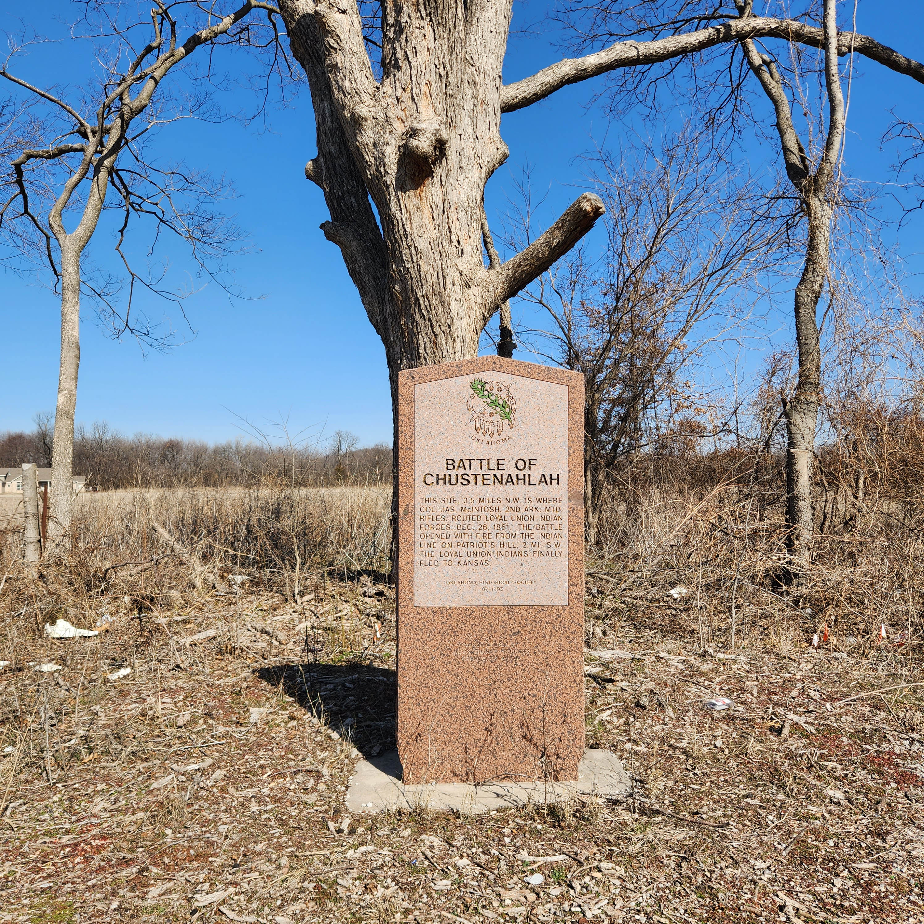
Location: on OK-99, approximately 4.5 miles north of Wynona
Coordinates: 36.610664, -96.304710
Material: Granite
Sponsor(s): Joe D. Haines
Topics: Folklife; Government; Social/Cultural; Territorial Period, 1861–1907
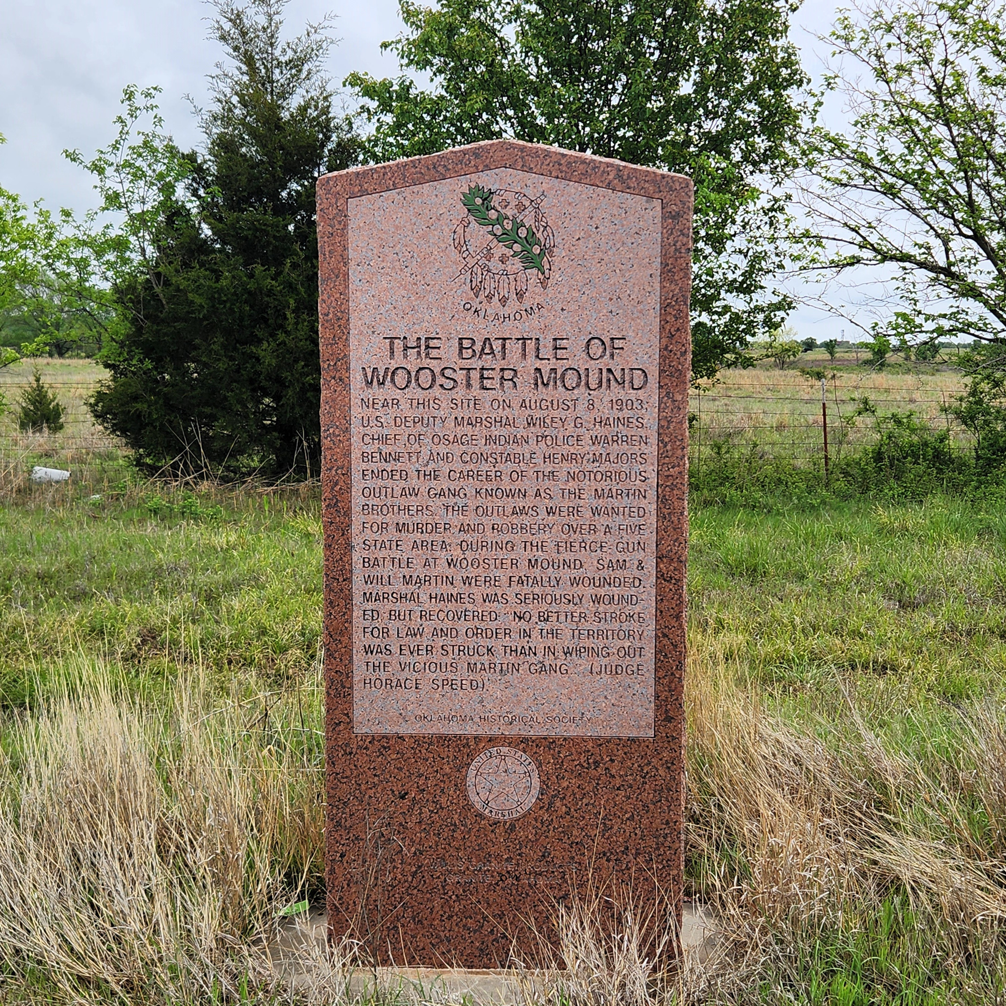
Near here in 1903, lawman Wiley G. Haines and a small posse killed Sam and Will Martin who were wanted for murder, robbery, and other crimes in five states. A third member of the Martin Gang, Clarence Simmons, escaped.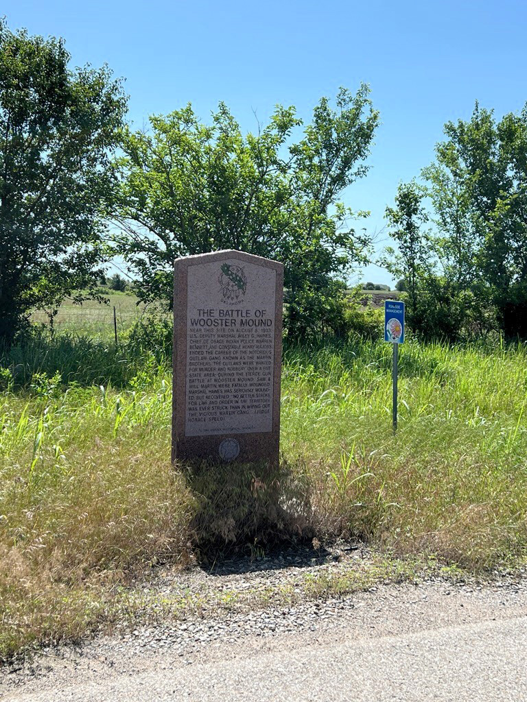
Location: in Osage Hills State Park
Topics: Early Statehood, 1907–1941; Government; Recreational/Service; Social/Cultural
Men of the Civilian Conservation Corps (CCC) built structures and roads in the park in the 1930s.
Location: at the Fred and Addie Drummond Home, 305 North Price in Hominy
Topics: American Indians; Ethnic Diversity; Family/Household; Natural Resources; Petroleum; Ranching; Retail
Frederick Drummond immigrated to the United States from Scotland in the 1880s. After moving to the Osage Reservation, he established the Hominy Trading Company in 1904 and expanded his operations into the cattle business and buying and leasing Indian lands, eventually building one of the state's largest ranches. Drummond and his wife, Addie, constructed this substantial Victorian home in 1905. Most of the original fine furnishings, as well as personal family records, photographs, and other items, are still in the house.
Location: north side of SH11, 1/2 mile east of the Bird Creek Bridge east of Barnsdall
Material: Aluminum
Topics: American Indians; Indian and Frontier Trade; Natural Resources; Territorial Period, 1861–1907
After the Civil War, Bigheart became chief of the Osage. He operated a trading post at Big Heart, now Barnsdall, and led his people to retain all mineral rights to their lands which brought great wealth to the Osage people.
Location: on grounds of Osage Nation campus in Pawhuska
Coordinates: 36.666224, -96.340294
Material: Stone with bronze plaque
Sponsor(s): Harry G. Benson and Family
Topics: American Indians; Early Statehood, 1907–1941; Folklife; Natural Resources; Petroleum; Social/Cultural; Territorial Period, 1861–1907
The Osage Nation held the first public auction sale for oil leases on reservation tracts on November 11, 1912. Early sales were held under this elm tree. Bidders sat on bleachers around the tree and the auctioneer, Colonel E. Walters, ‘cried’ the sales. A total of 16 160-acre tracts leased for a bonus of over $1 million. Thus, this tree under which these high bids were made became known as the “Million Dollar Elm.”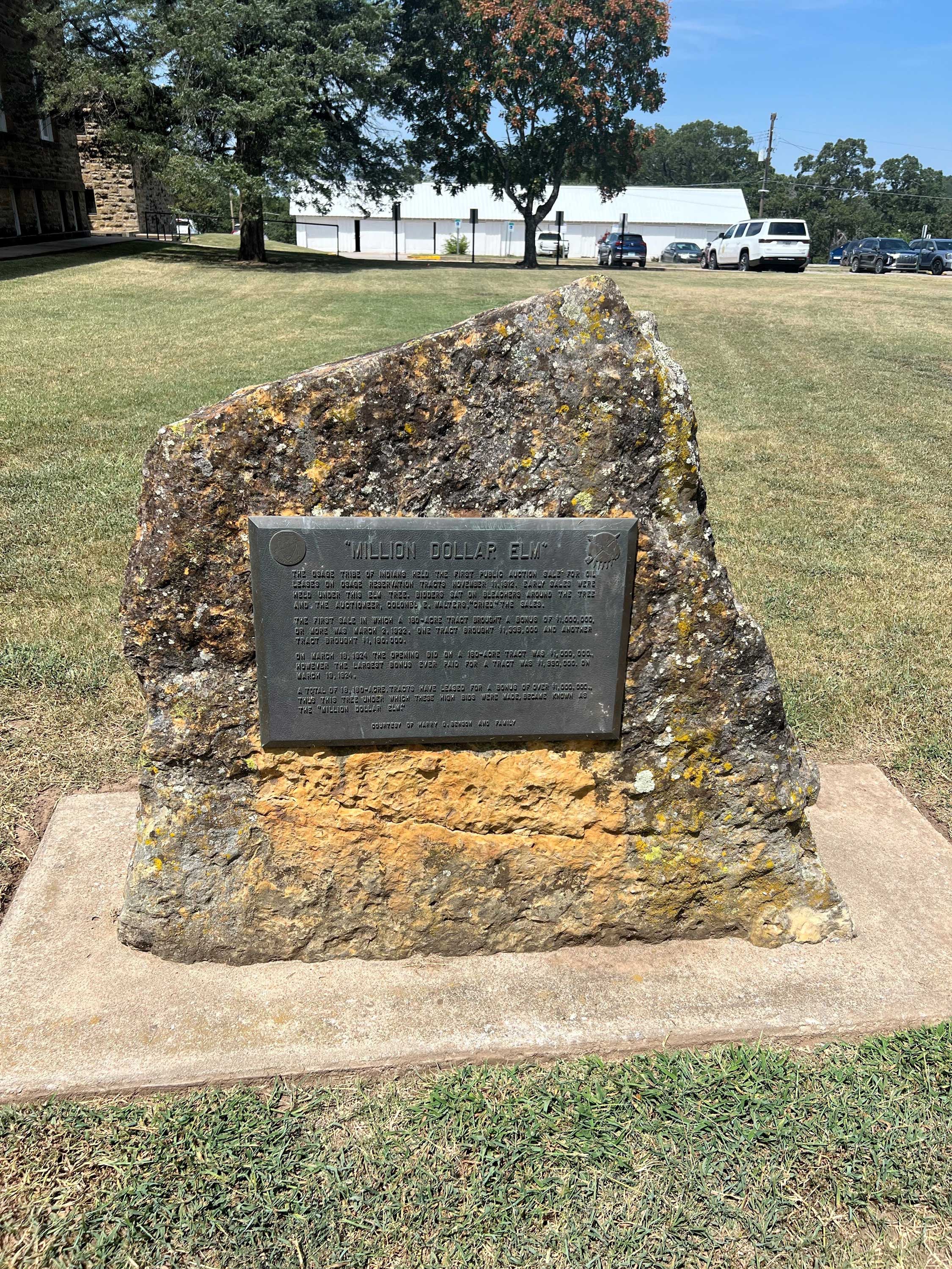
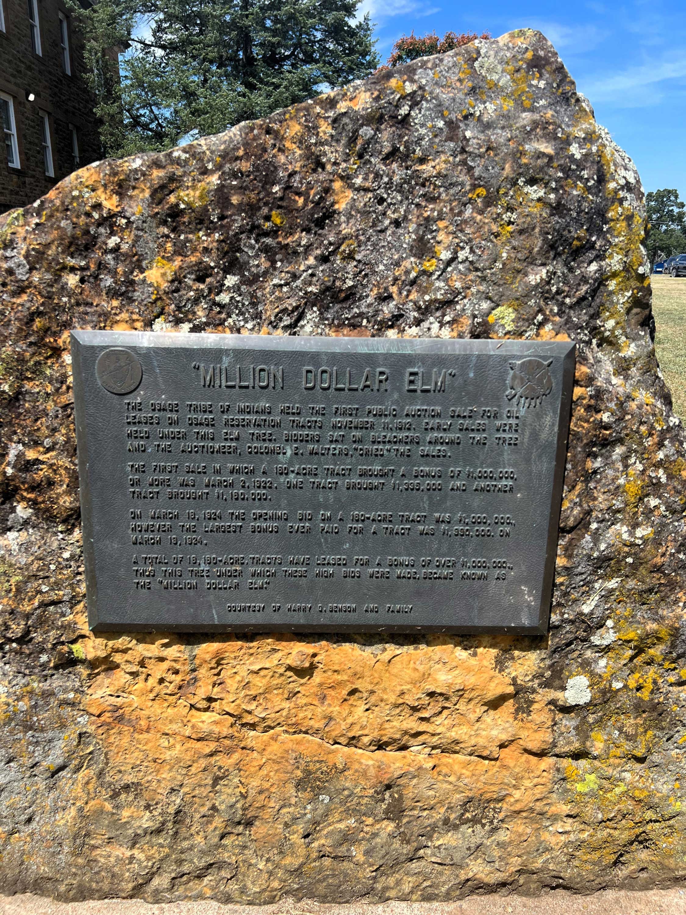
Location: on grounds of the Osage Nation Museum in Pawhuska
Coordinates: 36.667616, -96.339443
Material: Granite
Sponsor(s): Oklahoma Historical Society and Oklahoma Petroleum Council
Topics: American Indians; Early Statehood, 1907–1941; Folklife; Industrial, 1941–1982; Natural Resources; Petroleum; Social/Cultural; Territorial Period, 1861–1907
Symbolic of the impact oil had on the people of the Osage Indian Nation is the so-called “Million Dollar Elm.” It was given this name because in its shade millions of dollars worth of Osage oil leases were auctioned. It was planted at this site sometime during the latter part of the 19th century as an ornament and for shade. The name was not given by tribal leaders but by reporters and magazine writers who were dramatizing the events when important heads and founders of the world's greatest oil companies came in person to bid. The auctioneer himself, the histrionic Colonel Walters, became famous because of his success in getting top bids. The drilling of the first well in the Osage Nation occurred in 1897. The first tract to bring one million dollars or more was acquired in March 1922. On March 29, 1924, Midland Oil Company bid almost two million dollars for a tract. By November 1969, Osage lands had produced one billion barrels of oil.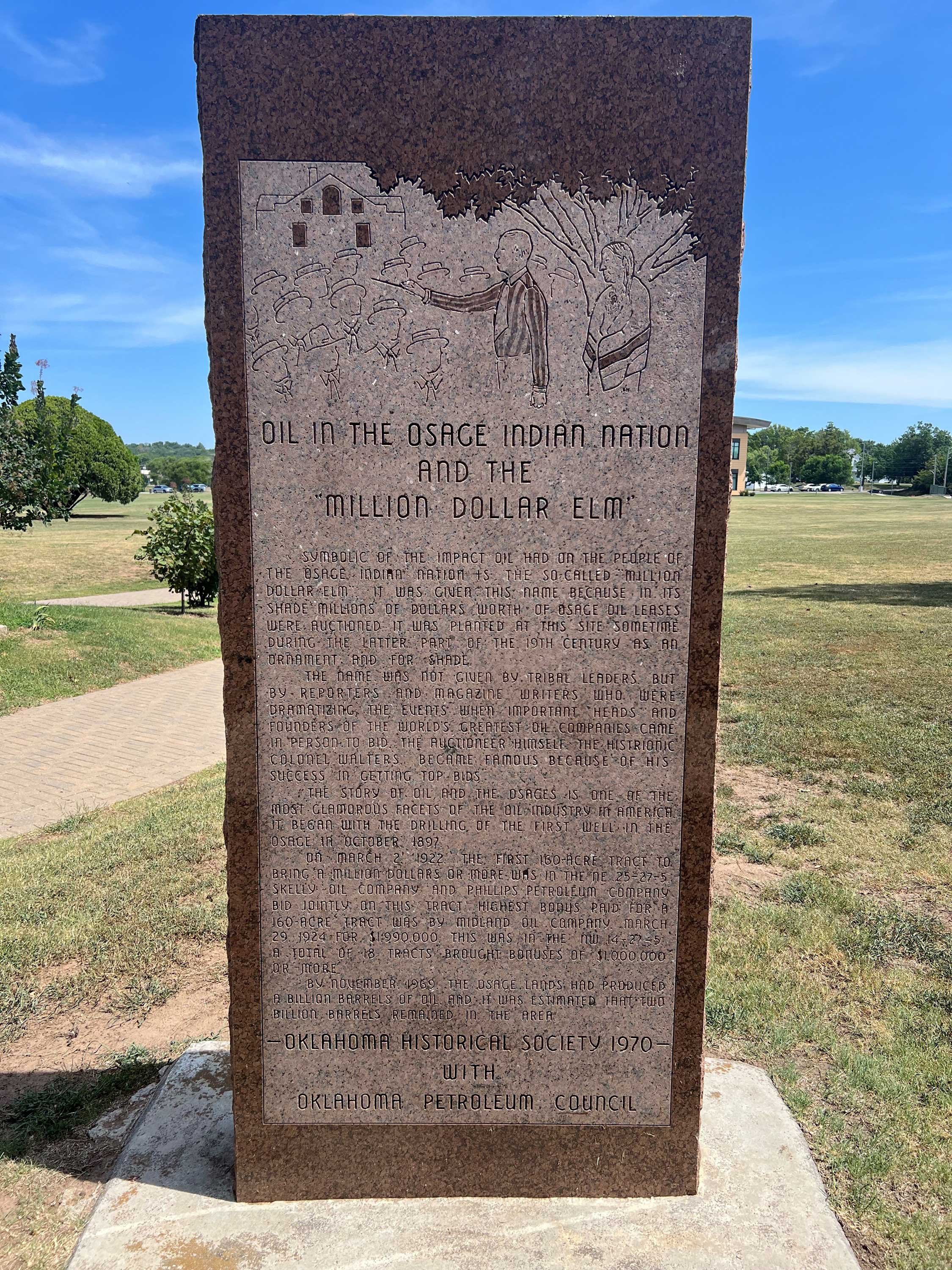
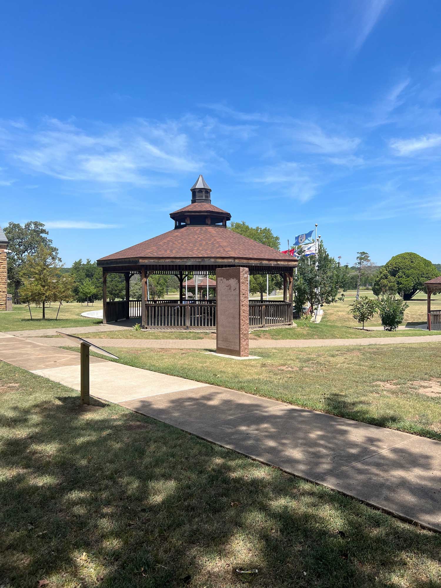
Location: on Lynn Avenue one mile north of OK-11/US-60 in Pawhuska
Coordinates: 36.676217, -96.331700
Material: Aluminum
Sponsor(s): Oklahoma Historical Society and the Oklahoma Department of Transportation
Topics: American Indians; Folklife; Government; Natural Resources; Petroleum; Social/Cultural; Territorial Period, 1861–1907
The Osage agency was established in 1872 to oversee the federal government's relationship with the Osage. Congress allowed the Osage to retain ownership of minerals in their reservation lands. When oil was discovered in the area, the allotted Osage became the richest Indian tribe in American history.
Note: This marker is missing.
Location: east of Pawhuska on Lookout Mountain
Topics: American Indians; Government; Industrial Period, 1841–1892; Territorial Period, 1861–1907
Fred Lookout was the last hereditary chief of the Osage. After being educated in the East, he returned to the Osage Nation in 1884. He served as the leader of his people longer than anyone. He died in 1949 at the age of ninety-eight. His wife, Julia, was a descendant of Chief Pawhuska.
Location: on US-60 between Pawhuska and Bartlesville
Topics: American Indians; Environmental/Cultural Ecology; Natural Resources; Ranching
First settled by the Osage Indians in 1796, the area is now part of the Tallgrass Prairie Preserve, a protected remnant of the original North American prairie, a 500-mile wide stretch of land in the central part of the United States that extended from Canada to the Gulf of Mexico. The tallgrass prairie exists today only in those areas which are not tillable or have soils not conducive to farming. Rich grasses in the prairie have sustained cattle-grazing operations since the 1880s.
Location: on US-60 northeast of Pawhuska
Topics: Early Statehood, 1907–1941; Government; Natural Resources; Recreational/Service; Social/Cultural
The Osage Hills State Park, built by Civilian Conservation Corps Company 895 from 1936 to 1939, is centrally located in the lush, rolling hills and a densely wooded canyon between Pawhuska and Bartlesville.
Location: in Barnsdall
Material: Granite
Topics: Manufacturing
Location: on OK-11 and OK-20 in Skiatook
Material: Granite
Topics: American Indians; Government; Indian and Frontier Trade; Mass Communication; Territorial Period, 1861–1907
W. C. Rogers, later a chief of the Cherokee Nation, established a trading post near here in 1872. A post office was opened in Rogers' store on March 12, 1880. The name comes from Skiatooka, a prominent Osage who traded in Rogers' store.
Location: at intersection of OK-20 and Blackburn Road, eleven miles west of Hominy
Material: Granite
Topics: American Indians; Education; Religion/Philosophy; Territorial Period, 1861–1907
The St. John's School for Osage boys was founded by the Bureau of Catholic Indian Missions in 1888 on the banks of Hominy Creek. A four-story stone building was erected in 1893 to replace the original log school. The school closed in 1913 but the buildings were maintained until the 1950s when they were torn down.
Note: This marker was reported missing on 12/20/2023.
Location: just off US-60 south and west of Clear Creek Bridge in Pawhuska
Topics: American Indians; Education; Religion/Philosophy; Social/Cultural
This Osage girls school was founded in 1887 by Mother Mary Katharine Drexel, a Philadelphia heiress who entered a convent as a young woman and used her fortune to support educational institutions across the southern United States, and the Bureau of Catholic Indian Missions. The school's original frame building burned in 1889 and was replaced by a four-story stone building. In 1942, the school became St. Louis Academy. Later, the buildings were razed and replaced with a low-income housing project. In 2000, Mother Katharine was named a saint by Pope John Paul II.
Location: on OK-99, eight miles south of Pawhuska
Topics: Government; Mass Communication; Territorial Period, 1861–1907
Post office was established in 1903 in Wynona, a Sioux word meaning “first-born daughter.”
(Page 1 of 1)
Historical Marker Program
Search Results
Your search returned 17 results.
96th Parallel
Osage CountyBattle of Chustenahlah
Osage CountyLocation: One half mile west of N 52nd W Avenue on OK-20, Skiatook vicinity.
Coordinates: 36.368646, -96.059451
Material: Granite
Topics: American Indians; Government; Military; Westward Expansion, 1803–1861
This site, 3.5 miles NW, is where Colonel James McIntosh, 2nd Arkansas Mounted Rifles, routed loyal Union Indian forces December 26, 1861. The battle opened with fire from the Indian line of Patriot's Hill, 2 miles southwest. The loyal Union Indians finally fled to Kansas.

The Battle of Wooster Mound
Osage CountyLocation: on OK-99, approximately 4.5 miles north of Wynona
Coordinates: 36.610664, -96.304710
Material: Granite
Sponsor(s): Joe D. Haines
Topics: Folklife; Government; Social/Cultural; Territorial Period, 1861–1907
Near here in 1903, lawman Wiley G. Haines and a small posse killed Sam and Will Martin who were wanted for murder, robbery, and other crimes in five states. A third member of the Martin Gang, Clarence Simmons, escaped.


CCC-Osage Mountain
Osage CountyLocation: in Osage Hills State Park
Topics: Early Statehood, 1907–1941; Government; Recreational/Service; Social/Cultural
Men of the Civilian Conservation Corps (CCC) built structures and roads in the park in the 1930s.
Drummond Home
Osage CountyLocation: at the Fred and Addie Drummond Home, 305 North Price in Hominy
Topics: American Indians; Ethnic Diversity; Family/Household; Natural Resources; Petroleum; Ranching; Retail
Frederick Drummond immigrated to the United States from Scotland in the 1880s. After moving to the Osage Reservation, he established the Hominy Trading Company in 1904 and expanded his operations into the cattle business and buying and leasing Indian lands, eventually building one of the state's largest ranches. Drummond and his wife, Addie, constructed this substantial Victorian home in 1905. Most of the original fine furnishings, as well as personal family records, photographs, and other items, are still in the house.
James Bigheart
Osage CountyLocation: north side of SH11, 1/2 mile east of the Bird Creek Bridge east of Barnsdall
Material: Aluminum
Topics: American Indians; Indian and Frontier Trade; Natural Resources; Territorial Period, 1861–1907
After the Civil War, Bigheart became chief of the Osage. He operated a trading post at Big Heart, now Barnsdall, and led his people to retain all mineral rights to their lands which brought great wealth to the Osage people.
Million Dollar Elm
Osage CountyLocation: on grounds of Osage Nation campus in Pawhuska
Coordinates: 36.666224, -96.340294
Material: Stone with bronze plaque
Sponsor(s): Harry G. Benson and Family
Topics: American Indians; Early Statehood, 1907–1941; Folklife; Natural Resources; Petroleum; Social/Cultural; Territorial Period, 1861–1907
The Osage Nation held the first public auction sale for oil leases on reservation tracts on November 11, 1912. Early sales were held under this elm tree. Bidders sat on bleachers around the tree and the auctioneer, Colonel E. Walters, ‘cried’ the sales. A total of 16 160-acre tracts leased for a bonus of over $1 million. Thus, this tree under which these high bids were made became known as the “Million Dollar Elm.”


Oil in the Osage Indian Nation and the “Million Dollar Elm”
Osage CountyLocation: on grounds of the Osage Nation Museum in Pawhuska
Coordinates: 36.667616, -96.339443
Material: Granite
Sponsor(s): Oklahoma Historical Society and Oklahoma Petroleum Council
Topics: American Indians; Early Statehood, 1907–1941; Folklife; Industrial, 1941–1982; Natural Resources; Petroleum; Social/Cultural; Territorial Period, 1861–1907
Symbolic of the impact oil had on the people of the Osage Indian Nation is the so-called “Million Dollar Elm.” It was given this name because in its shade millions of dollars worth of Osage oil leases were auctioned. It was planted at this site sometime during the latter part of the 19th century as an ornament and for shade. The name was not given by tribal leaders but by reporters and magazine writers who were dramatizing the events when important heads and founders of the world's greatest oil companies came in person to bid. The auctioneer himself, the histrionic Colonel Walters, became famous because of his success in getting top bids. The drilling of the first well in the Osage Nation occurred in 1897. The first tract to bring one million dollars or more was acquired in March 1922. On March 29, 1924, Midland Oil Company bid almost two million dollars for a tract. By November 1969, Osage lands had produced one billion barrels of oil.


Osage Agency
Osage CountyLocation: on Lynn Avenue one mile north of OK-11/US-60 in Pawhuska
Coordinates: 36.676217, -96.331700
Material: Aluminum
Sponsor(s): Oklahoma Historical Society and the Oklahoma Department of Transportation
Topics: American Indians; Folklife; Government; Natural Resources; Petroleum; Social/Cultural; Territorial Period, 1861–1907
The Osage agency was established in 1872 to oversee the federal government's relationship with the Osage. Congress allowed the Osage to retain ownership of minerals in their reservation lands. When oil was discovered in the area, the allotted Osage became the richest Indian tribe in American history.
Note: This marker is missing.

Osage Chief Fred Lookout
Osage CountyLocation: east of Pawhuska on Lookout Mountain
Topics: American Indians; Government; Industrial Period, 1841–1892; Territorial Period, 1861–1907
Fred Lookout was the last hereditary chief of the Osage. After being educated in the East, he returned to the Osage Nation in 1884. He served as the leader of his people longer than anyone. He died in 1949 at the age of ninety-eight. His wife, Julia, was a descendant of Chief Pawhuska.
Osage Hills
Osage CountyLocation: on US-60 between Pawhuska and Bartlesville
Topics: American Indians; Environmental/Cultural Ecology; Natural Resources; Ranching
First settled by the Osage Indians in 1796, the area is now part of the Tallgrass Prairie Preserve, a protected remnant of the original North American prairie, a 500-mile wide stretch of land in the central part of the United States that extended from Canada to the Gulf of Mexico. The tallgrass prairie exists today only in those areas which are not tillable or have soils not conducive to farming. Rich grasses in the prairie have sustained cattle-grazing operations since the 1880s.
Osage Hills State Park
Osage CountyLocation: on US-60 northeast of Pawhuska
Topics: Early Statehood, 1907–1941; Government; Natural Resources; Recreational/Service; Social/Cultural
The Osage Hills State Park, built by Civilian Conservation Corps Company 895 from 1936 to 1939, is centrally located in the lush, rolling hills and a densely wooded canyon between Pawhuska and Bartlesville.
Patriarch Petrochemical Plant of the Southwest
Osage CountyLocation: in Barnsdall
Material: Granite
Topics: Manufacturing

Skiatook
Osage CountyLocation: on OK-11 and OK-20 in Skiatook
Material: Granite
Topics: American Indians; Government; Indian and Frontier Trade; Mass Communication; Territorial Period, 1861–1907
W. C. Rogers, later a chief of the Cherokee Nation, established a trading post near here in 1872. A post office was opened in Rogers' store on March 12, 1880. The name comes from Skiatooka, a prominent Osage who traded in Rogers' store.
St. John’s School
Osage CountyLocation: at intersection of OK-20 and Blackburn Road, eleven miles west of Hominy
Material: Granite
Topics: American Indians; Education; Religion/Philosophy; Territorial Period, 1861–1907
The St. John's School for Osage boys was founded by the Bureau of Catholic Indian Missions in 1888 on the banks of Hominy Creek. A four-story stone building was erected in 1893 to replace the original log school. The school closed in 1913 but the buildings were maintained until the 1950s when they were torn down.
Note: This marker was reported missing on 12/20/2023.
St. Louis School
Osage CountyLocation: just off US-60 south and west of Clear Creek Bridge in Pawhuska
Topics: American Indians; Education; Religion/Philosophy; Social/Cultural
This Osage girls school was founded in 1887 by Mother Mary Katharine Drexel, a Philadelphia heiress who entered a convent as a young woman and used her fortune to support educational institutions across the southern United States, and the Bureau of Catholic Indian Missions. The school's original frame building burned in 1889 and was replaced by a four-story stone building. In 1942, the school became St. Louis Academy. Later, the buildings were razed and replaced with a low-income housing project. In 2000, Mother Katharine was named a saint by Pope John Paul II.
Wynona
Osage CountyLocation: on OK-99, eight miles south of Pawhuska
Topics: Government; Mass Communication; Territorial Period, 1861–1907
Post office was established in 1903 in Wynona, a Sioux word meaning “first-born daughter.”
(Page 1 of 1)
Marker Search
Browse by County
Adair County
Alfalfa County
Atoka County
Beaver County
Beckham County
Blaine County
Bryan County
Caddo County
Canadian County
Carter County
Cherokee County
Choctaw County
Cimarron County
Cleveland County
Comanche County
Cotton County
Craig County
Creek County
Custer County
Delaware County
Dewey County
Ellis County
Garfield County
Garvin County
Grady County
Grant County
Greer County
Harmon County
Harper County
Haskell County
Hughes County
Jackson County
Jefferson County
Johnston County
Kay County
Kingfisher County
Kiowa County
Latimer County
Le Flore County
Lincoln County
Logan County
Love County
Major County
Marshall County
Mayes County
McClain County
McCurtain County
McIntosh County
Murray County
Muskogee County
Noble County
Okfuskee County
Oklahoma County
Okmulgee County
Osage County
Ottawa County
Pawnee County
Payne County
Pittsburg County
Pontotoc County
Pottawatomie County
Pushmataha County
Roger Mills County
Rogers County
Seminole County
Sequoyah County
Stephens County
Texas County
Tillman County
Tulsa County
Wagoner County
Washington County
Washita County
Woods County
Woodward County
Contact Us
If you have questions, please contact:
Matthew Pearce
Oklahoma Historical Society
800 Nazih Zuhdi Drive
Oklahoma City, OK 73105
405-522-8659
matthew.pearce@history.ok.gov

